Day 4
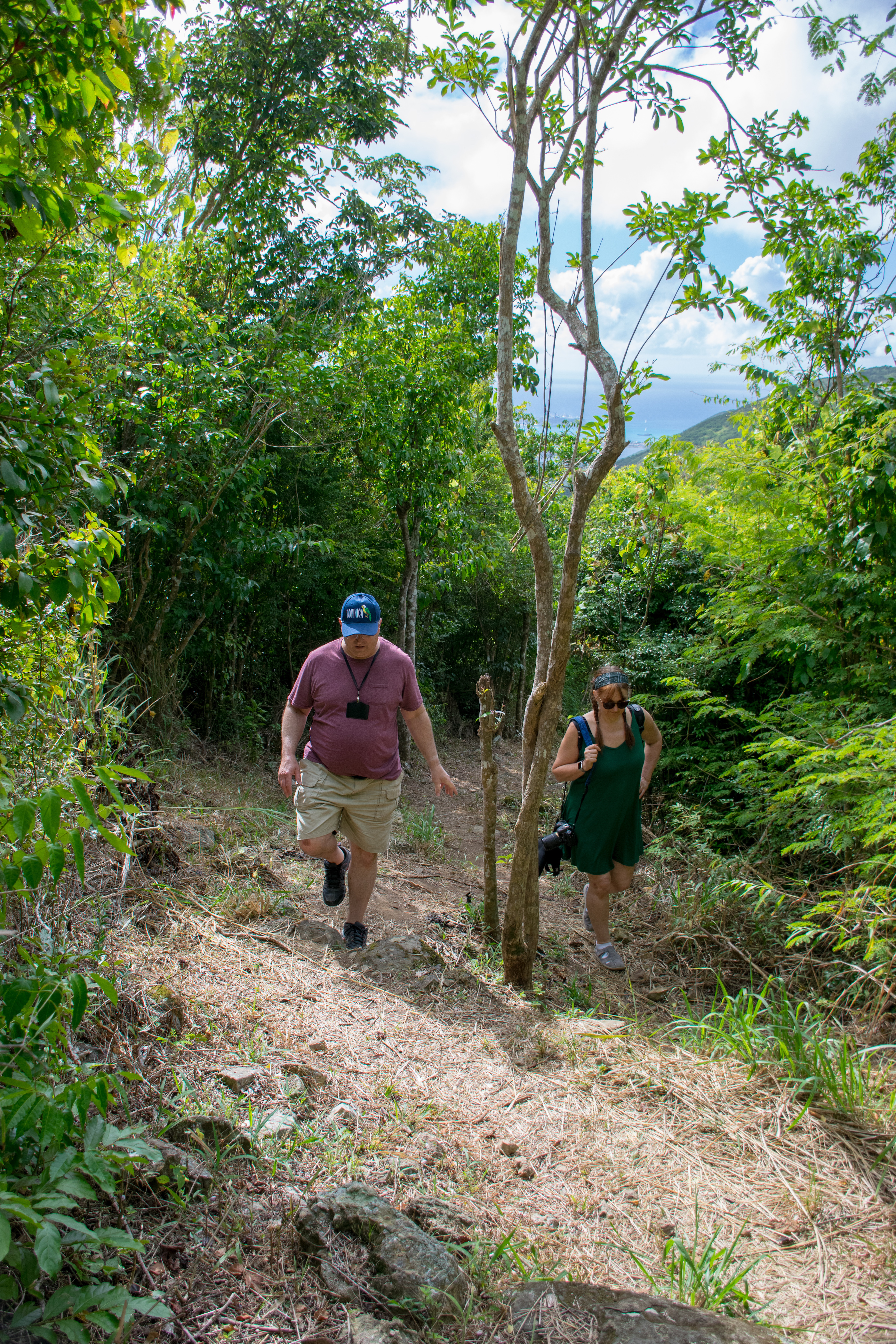
We woke up again at 6:00, ready to have breakfast at 6:30, and be off the ship promptly at 8:00am. The ship had other ideas in store so we were off the ship promptly at about 8:15am [when it finished docking] and when we did get off it was raining. But it was a ten-minute-the-sun-is-out type of thing, so we waited under the Celebrity canopies and admired the rainbow until it abated a little bit. Five minutes later (if that) we were walking into St. John’s. We picked up the scooters that we were renting from a local store and soon we were merrily on our way to the Devil’s Bridge.
My parents hadn’t ridden scooters in about 31 years but were excited to see if riding a scooter is like riding a bike (it more or less is) and I was excited they would get to see the island Aaron and my’s style.

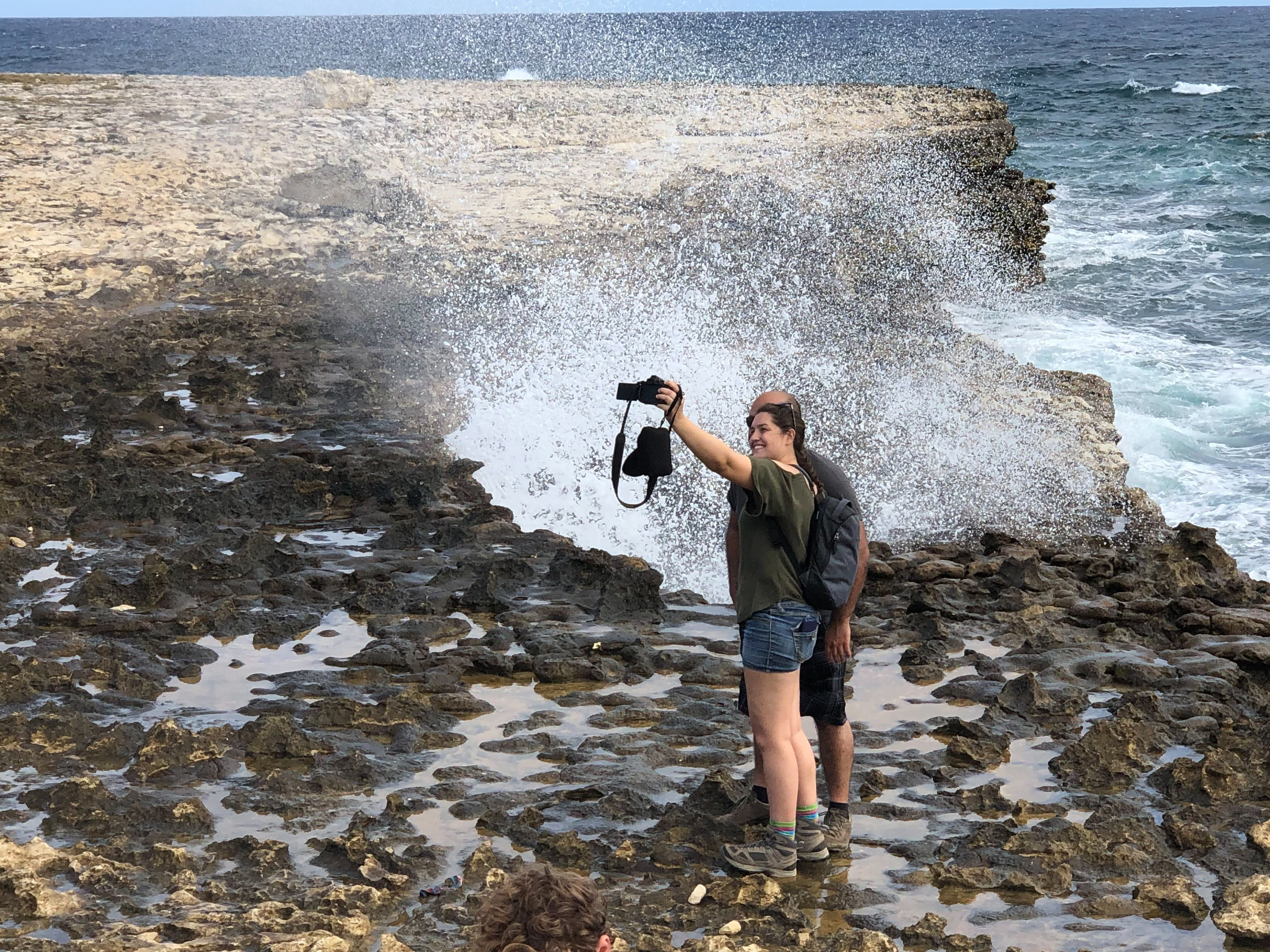
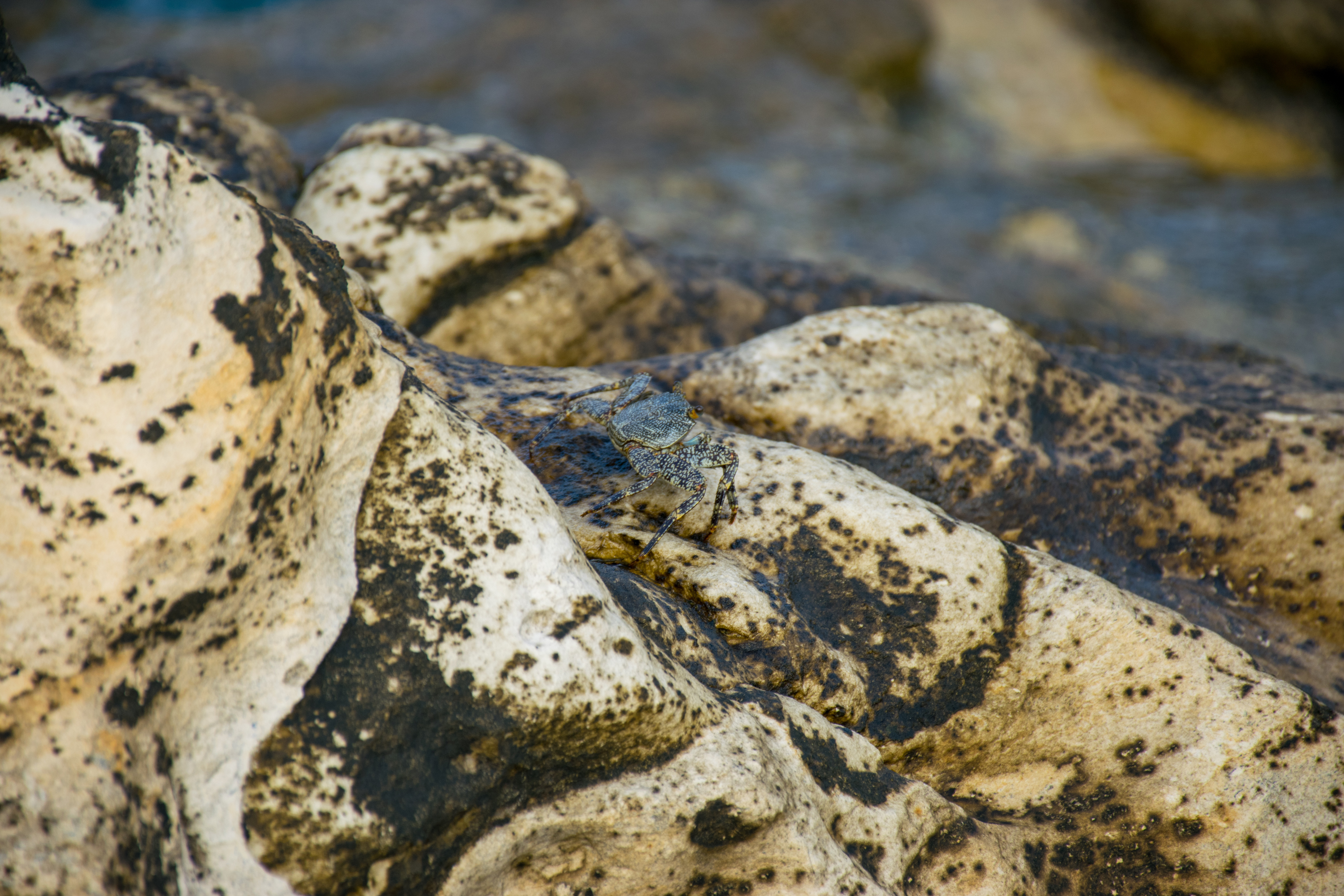
Before we even left town we noticed that the back tire on the scooter Aaron and I were riding was flat. We pulled into the nearest gas station, pumped it back up, mom and dad switched so dad was driving, and we were back on the road. 40 minutes later we pulled onto a bumpy dirt road and made our way the the “Devil’s Bridge” located on the farthest point on the island from St. John’s (are you sensing a theme yet?). Photographing Devil’s Bridge was no easy feat but Aaron and I gave it our best shot (and I saw a crab!).
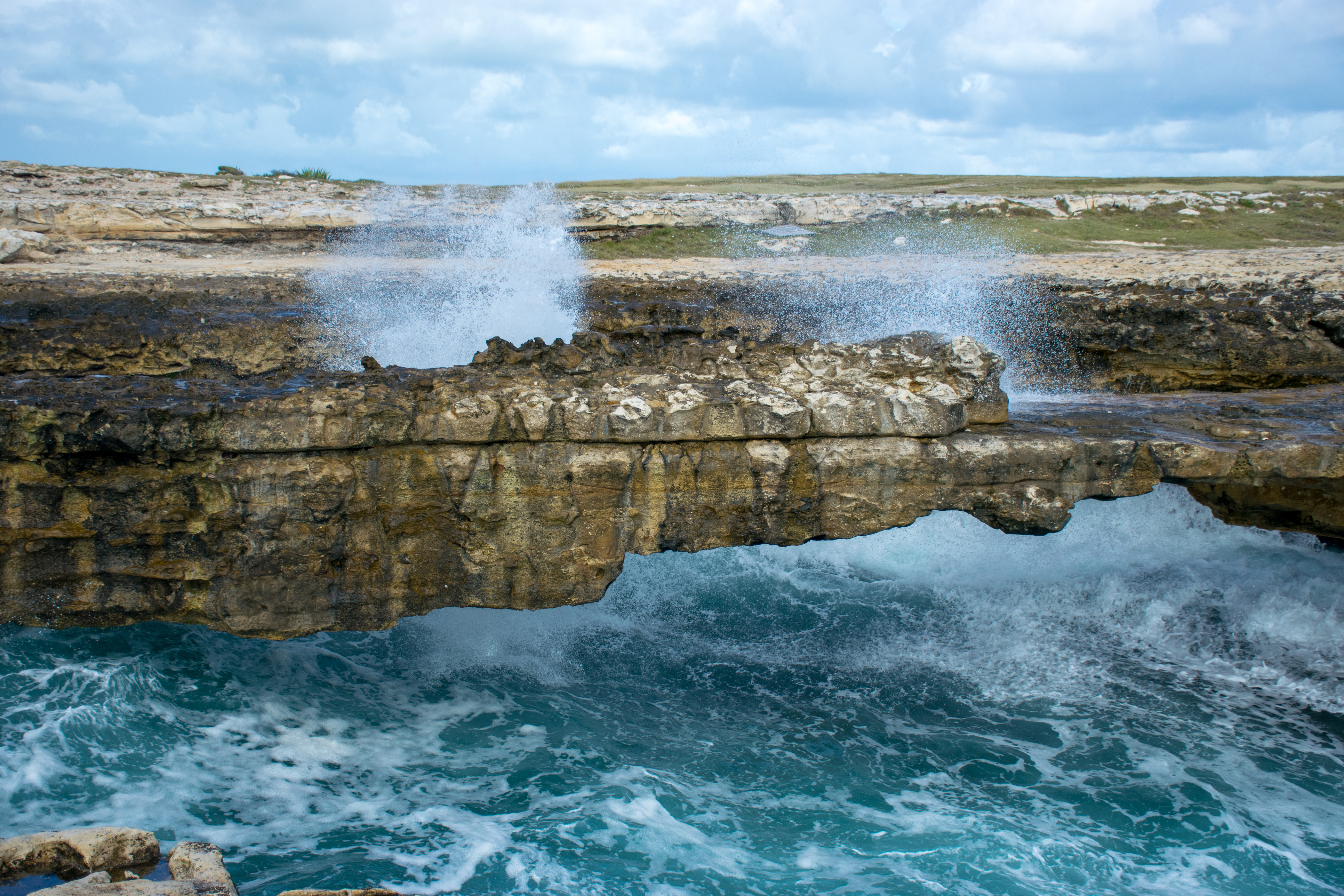

Retreating back to the kind Antiguan woman who had directed us to the bridge, who stood in the parking lot selling trinkets to tourists, we asked her a little more about the bridge’s history. She told us that it was made of limestone and had formed naturally (which is what we knew, but I had been hoping she might know how just that one section had fallen away but not the others). She continued on to tell us that the Devil’s Bridge was where slaves used to go to commit suicide. We were certainly grateful for her directions and her story and expressed that to her before we were back onto the scooters.
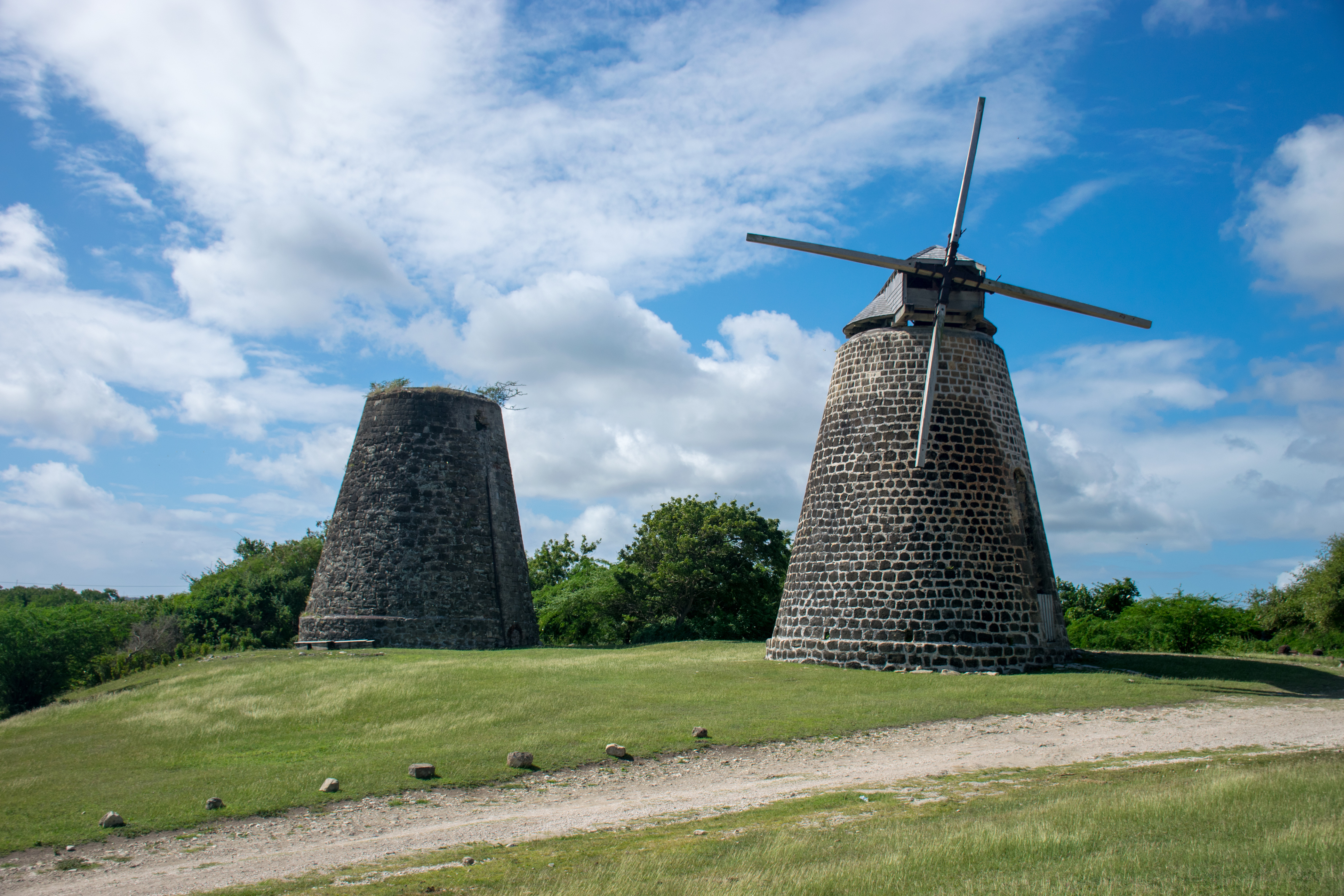
Our next stop was the Betty Hope Sugar Plantation. A recently discovered plantation from the 1700s, Betty Hope still had two windmills standing almost fully intact, though the other buildings had fallen into severe disrepair. Inside the renovated stables was a museum that told the history of the plantation and the slaves who lived there. In addition to detailing the type of work the slaves on the plantation had to do, the informational displays contained scans of posters for slave auctions and the text of a letter written from a slave on the Betty Hope Plantation to the master of the house, requesting permission “to buy himself” and begging pardon for asking the master this as he knew that the master needed to be able to bequeath the slaves onto his children. Despite spending years studying slavery growing up, that display shed a whole light on slavery and personified it in a way that my textbooks had not been able to cover.
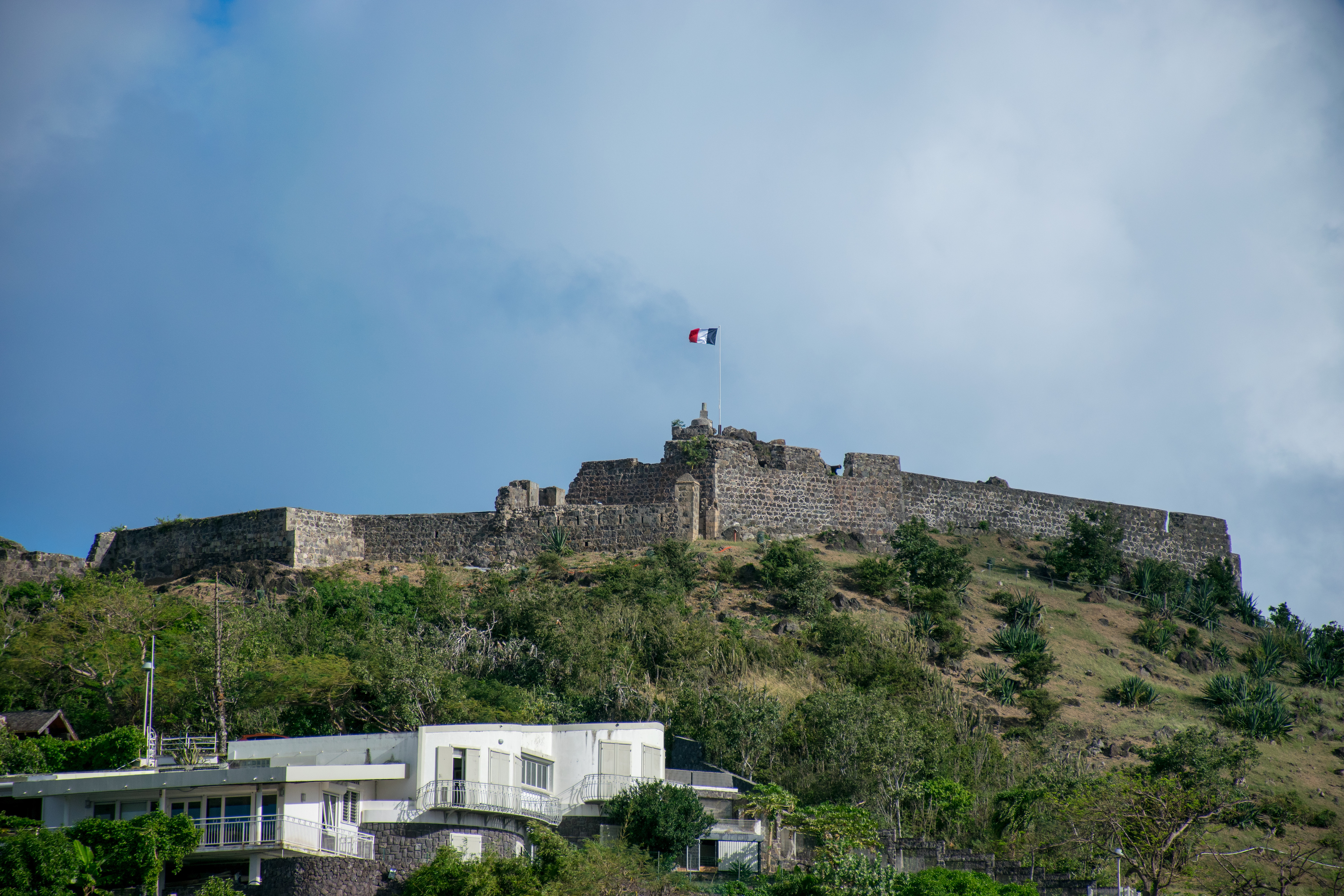
Back on the scooters, we aimed ourselves south towards the English port that was supposedly an important place to visit because of it’s historical significance to the island. This was the home of the mass graves that were recently uncovered by archaeologists who have been excavating it, trying to learn what caused all the death.
Antigua is a tough island to live on because it has no natural water source. No rivers, no lakes, just rainfall. Even the wells have started becoming contaminated by saltwater so the island works hard to capture rain and desalinate water. Back in the 1700s they had no sewage system and water was just dumped into the bay. Because the bay was surrounded on three sides the water didn’t really circulate, causing a huge public health problem every time storms brought the water onto land. This is one speculated cause for the deaths. The other is that the pipes that were used in the rum factories to make rum (which was drunk by everyone on the island) contained lead, and everyone on the island was constantly dying of lead poisoning.

The port was also important as a shipping route, as it was the main shipping route and naval base in the past. We stopped for lunch and a local place called Grace Before Meals and I had the local dish called “Roti.” A thick crepe/thin pita bread was filled with boiled potatoes, meat and curry sauce, and then wrapped like a burrito. What was not to love? This place had a special mango sauce that they put on top of the roti and it was SO good. After lunch we visited the naval base along with what seemed like every other tourist on the island. We went through the main building that housed the museum where we learned about the indigenous tribes who had originally inhabited the island before the Spanish arrived, as well as some of its history as a naval base and port in the 1700s and 1800s.

Back on our scooters we began our last leg of the trip, intending to head to Fort Barrington. Along the way, my parents accidentally hit a patch of gravel and the scooter slid out from under them rewarding each with some scrapes. This all happened right outside the house of an Antiguan family in a small community and the woman who was outside cleaning with her kids when it happened brought over hydrogen peroxicide and large bandaids, and insisted on helping get everyone cleaned up before we could even think of leaving. Everywhere we went in Antigua we were greeted by kind strangers who stopped to ask if we needed help, bid us to drive safe, or brought over bandaids at the exact right moment. Cleaned up and back on the bikes we continued on our way. Around the next bend we found ourselves descending a hillside surrounded by jungle and with Mt. Obama (renamed after the president) looming over us. I could only stare up in awe and take some photos on my phone as we whizzed down the hill.

Passing Mt. Obama and trading jungle for coastline we rode along the beautiful coast. At a nice lookout, I requested that we stop so I could get a photo, though trying to attempt to photograph the water was an impossible feat.
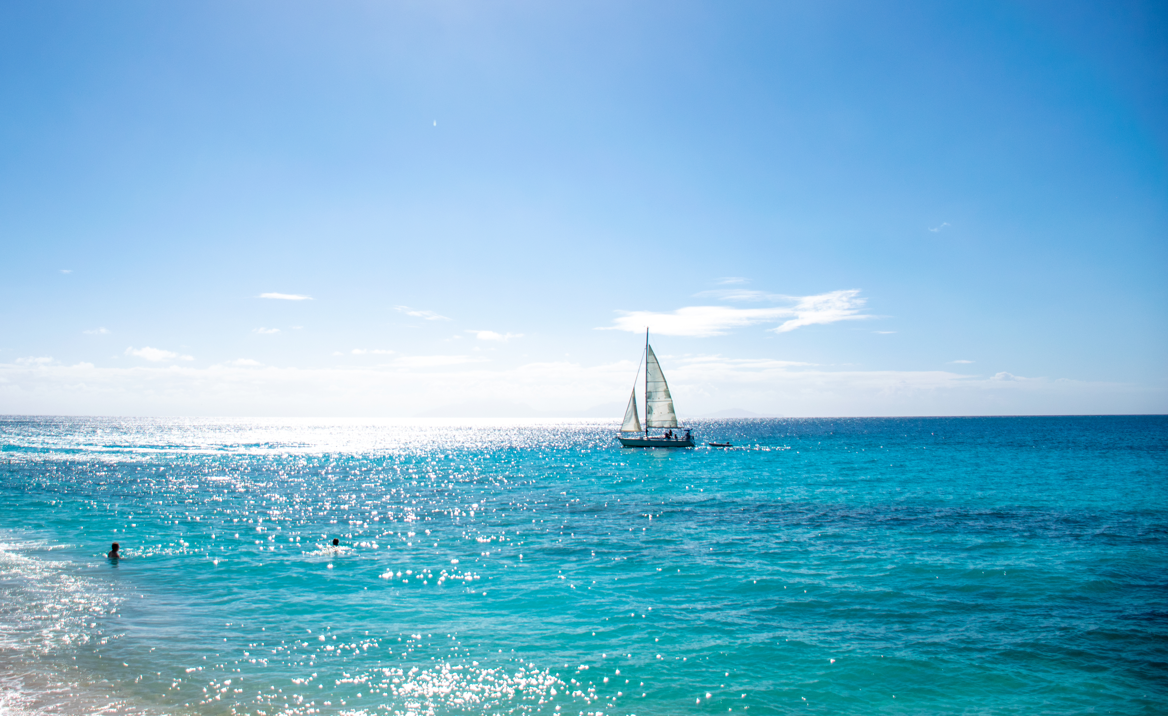
Continuing into the town we passed by the beach itself seeing that it was full of people and I felt that I had a good enough beach photo. But then I thought maybe my mom would want to take more photos so I told Aaron that if we saw another good stretch of ocean, we should stop and get pictures. Well the very next stretch of ocean happened to be on a secluded stretch of beach right at the end of town. There looked to be a reef just off shore and it was too good an opportunity to pass up! My dad and I grabbed swimsuits and jumped in the water, I grabbed my goggles and was relieved to find that the water was warmer and less salty than it had been in St. Croix. I happily ducked my head underwater and even spotted some fish, but I was too chicken to swim all the way out to the reef without someone to watch my back.
After about fifteen minutes we hopped out, dried off, took more photos of the beach, and hopped back on our scooters. This time we finished the journey back to town, with no time left to stop in Fort Barrington. (Unfortunately it would have required at least a half hours walk to and from Ft Barrington so we really would have needed more time to get over there too, but it looked spectacular!) Back in St. John’s we dropped off the scooters, wandered through the Christmas flea market that had been set up (there were no tourists there, just us and the locals, and it truly wasn’t aimed at tourists. None of the stalls had any sort of tourist trinkets that could be found close to the port), and then headed over to a roti shop that Aaron had picked out. He and I both wanted more roti. They had a selection of Shandy flavors that I had never seen so Aaron got a few so I could try them. I was most excited about the Sorrel Oseille flavor because Aaron had had it at lunch and the store owner had told us it was the Christmas drink and it truly tasted like Christmas in a bottle (aka cranberry juice with all spice and cinnamon). The wall in the back up the shop said “Happy Sorrel Oseille!”


Getting our food a little late, we headed into the main touristy area so I could pick up another key chain before we made it back to the boat. Utterly exhausted, we ate an early dinner in the buffet because it was formal night at our usual dining hall and then headed to the Celebrity Theater to watch the comedy-magic show that they had on board that evening. The show was aimed at kids, though we all found it reasonably amusing. He decided to pick on Aaron for one of his tricks, noticing that Aaron really didn’t want to be picked. We all laughed a bit and mostly enjoyed the show (despite a few off color jokes), and then took our tired and incredibly sunburned selves up to our rooms. Another full day in Dominica the next day, but this time we agreed to sleep in twenty minutes and get breakfast at 6:50am as we would be meeting inside the ship for our excursion the next day at 8:15am.
Day 5: Dominica
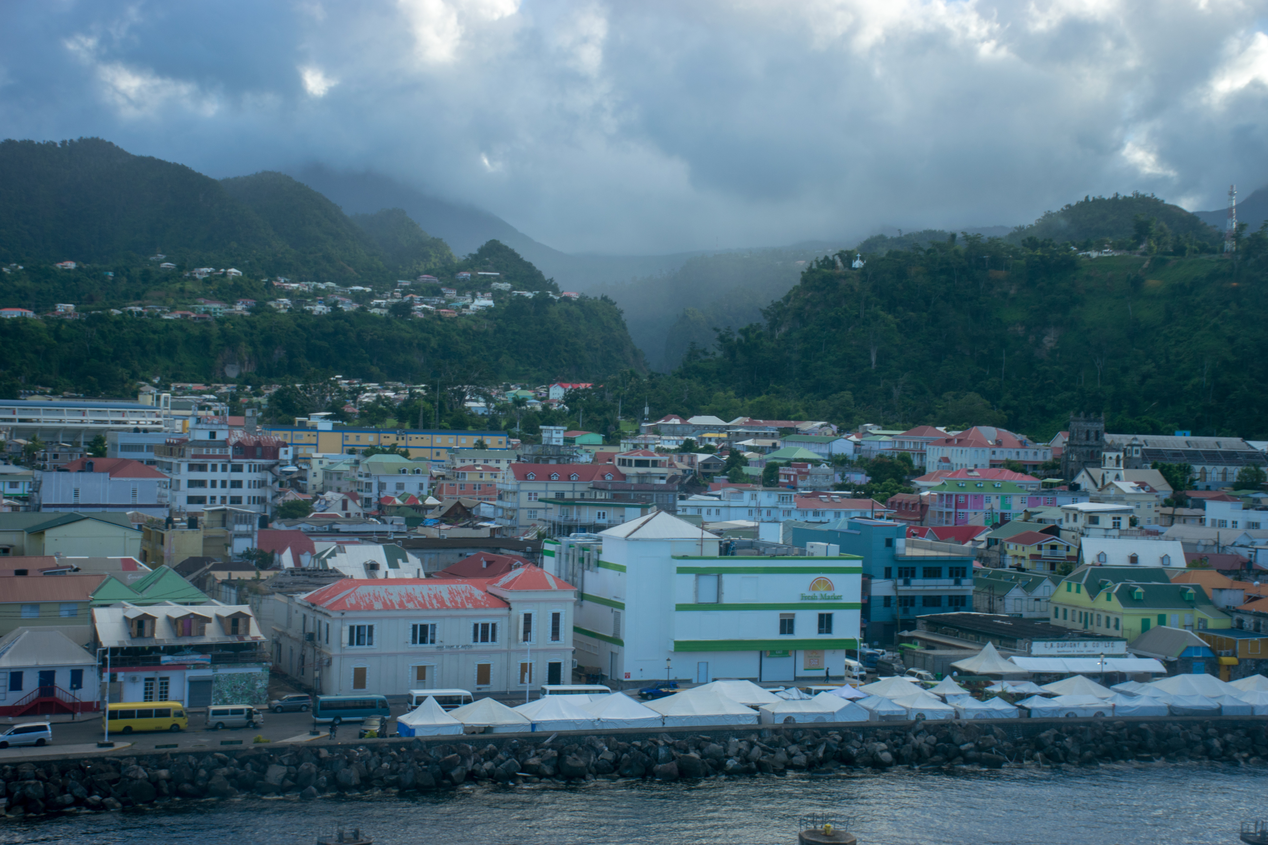
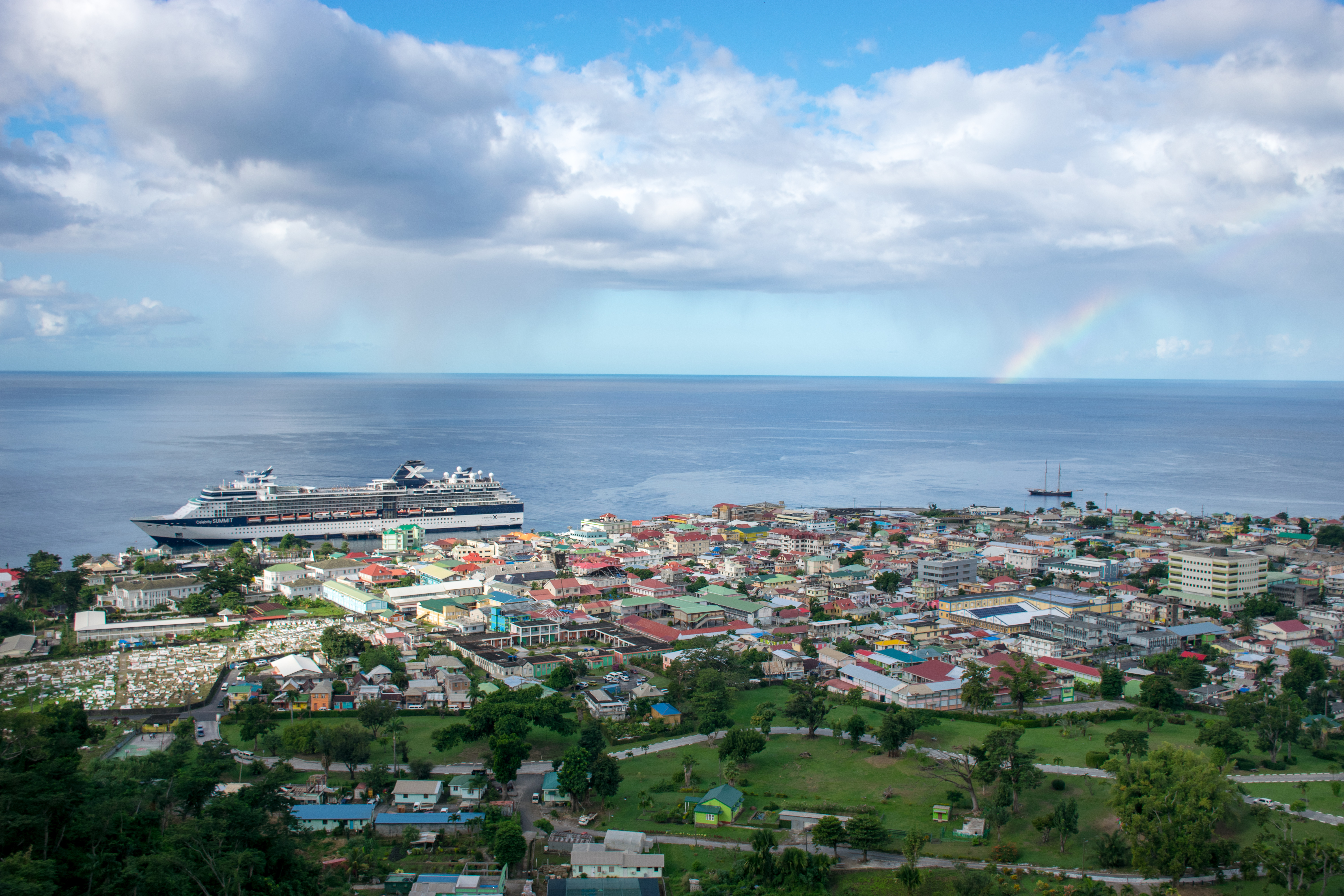
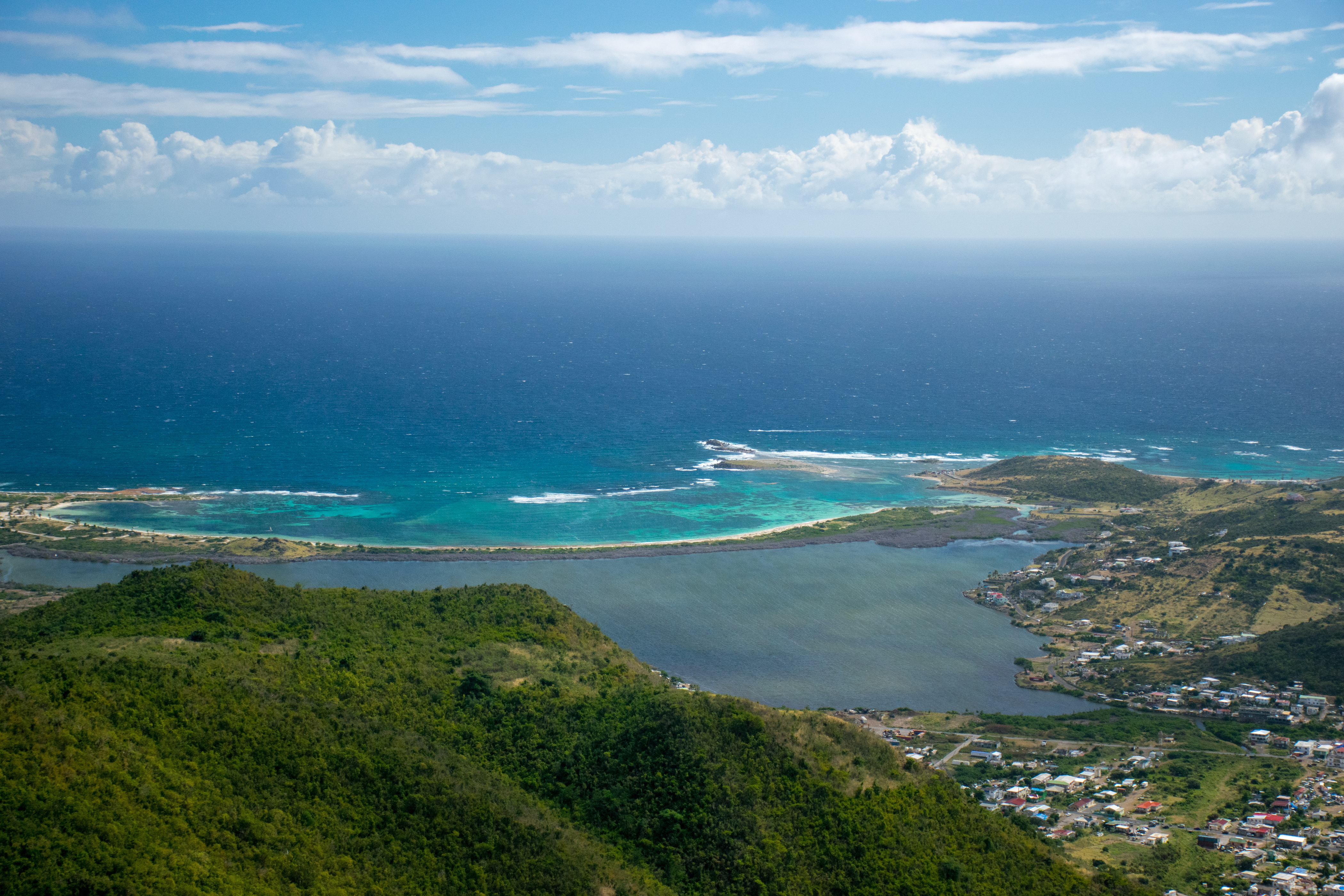
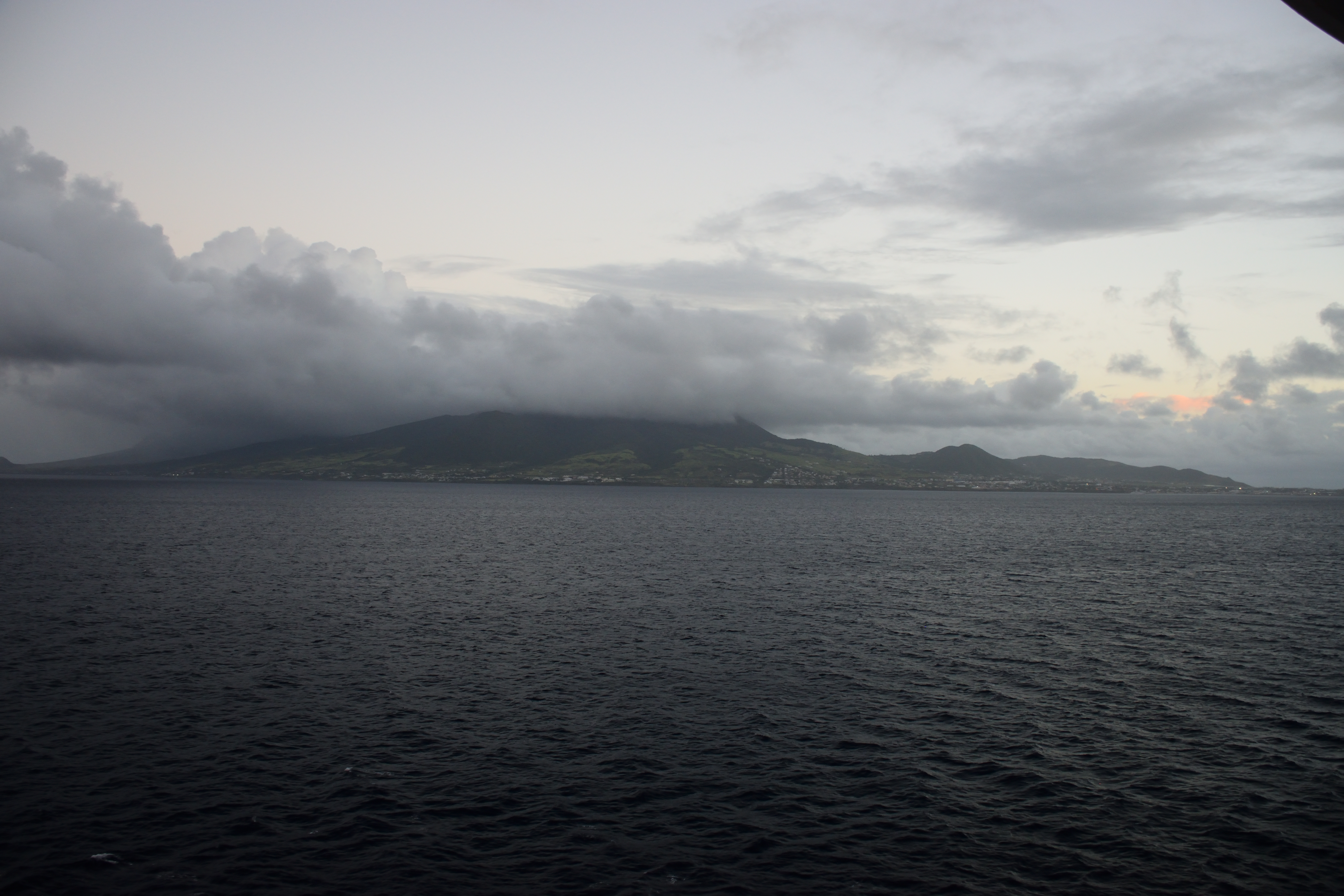
We ate breakfast with this view of Roseau and we pretty much knew it was going to be a good day.
As it was Christmas Day in a rather religious country, we didn’t expect anything to be open so we had booked a tour through the boat to ensure that we wouldn’t be stuck on the boat and we wouldn’t run into any closed parks/businesses/restaurants. The tour was “Dominica’s Favorites” and it was going to bring us to the top three spots to see in Dominica: a vista over Roseau, the Trafalgar Falls, and the Emerald Pool. We had a local young woman as our tour guide and she regaled us with tales about the island and its culture as we drove to our first stop.
Dominica is a very poor country economically, but very rich in its environment. It’s a mountainous rainforest with over three hundred inches of rain each year (meaning that we were sure to get rained on during the day). It’s a small island with a small population and it’s home to the only remaining Kalinagos tribe (formerly the Caribe Indians) in the Caribbean. When the Spaniards/British/French first arrived to the Caribbean, they wiped out this tribe on every island; if not by guns, by germs. Dominica was the last island to be colonized due to its mountainous terrain and the Kalinago tribes fighting back fiercely. When the French finally decided to settle the island, the Kalinagos were able to retreat into the depths of the rainforest and survive to this day.
The island was never clear cut as some of the other surrounding islands were and thus retains its lush rainforest habitat where almost every type of fruit will grow (the biggest exceptions being apples and pears). There are over 100 types of ferns alone and our guide was quick to point out moss that was actually little tiny individual fern plants.
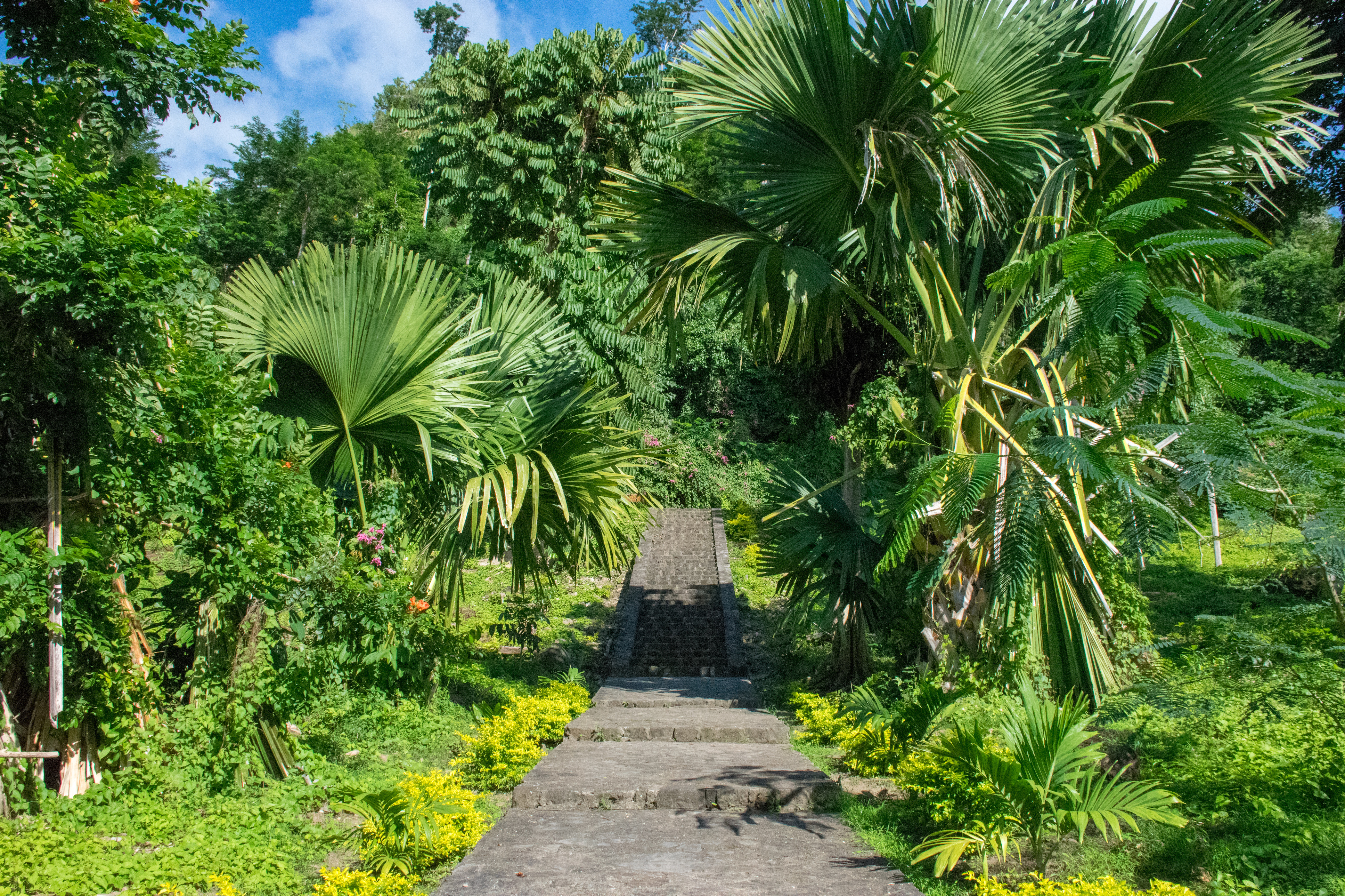
Our first stop of the day was a driving tour through the botanical garden (which we’ll return to later). Afterwards we drove up our first mountain to a look out over Roseau.
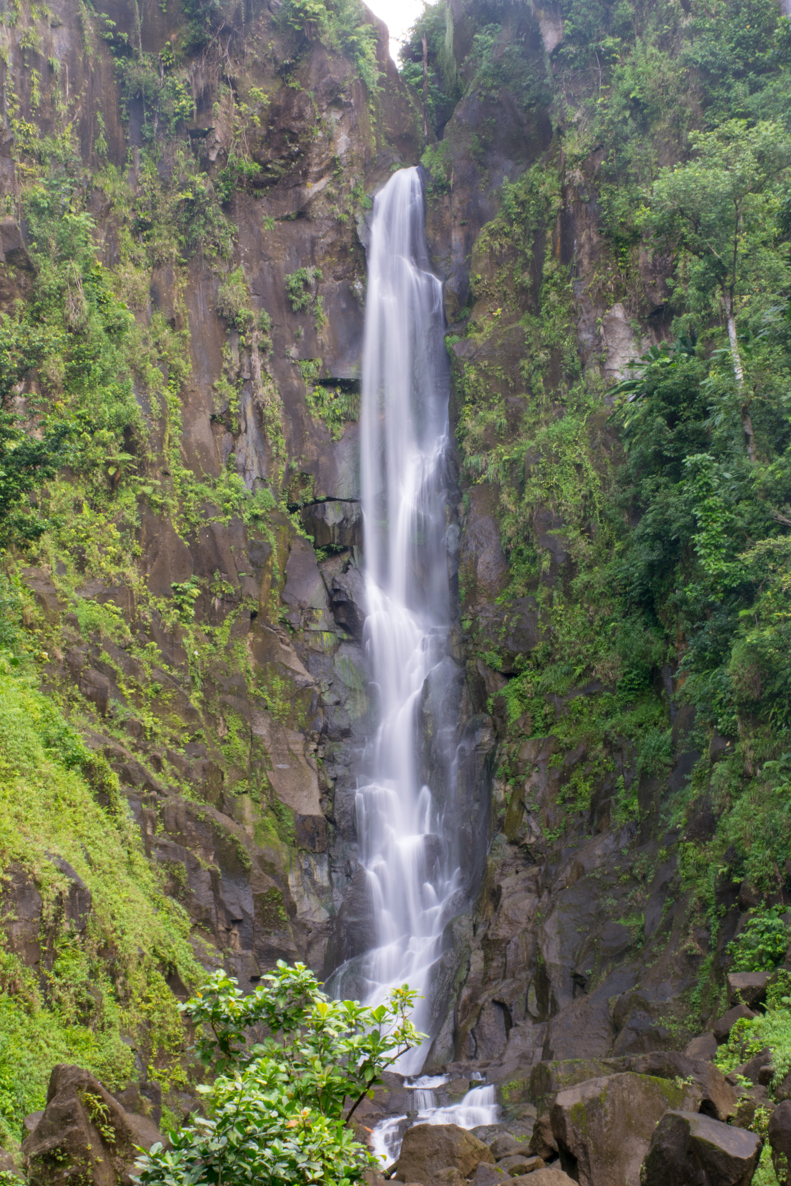
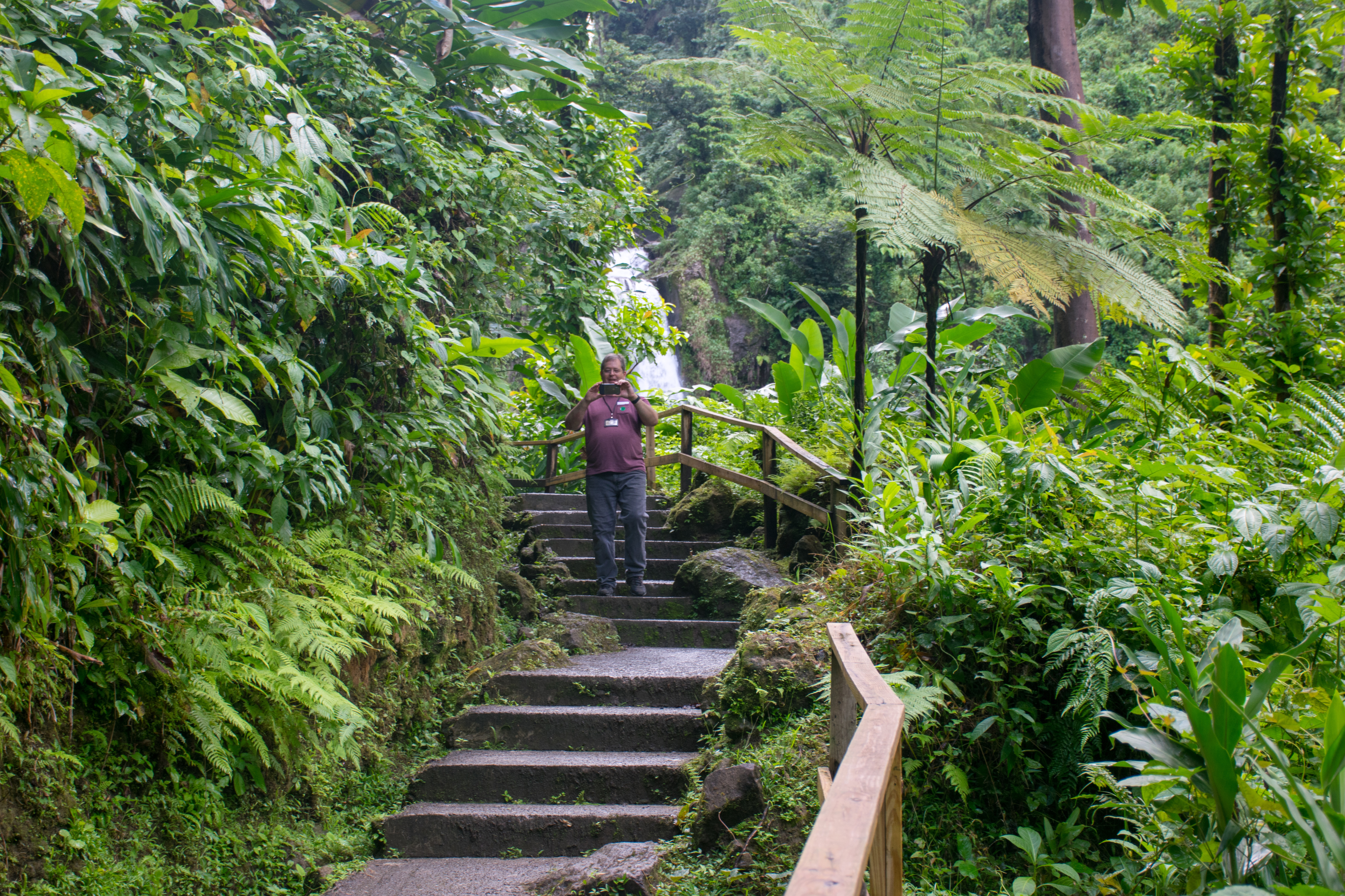
Leaving the lookout we drove deeper into the rainforest to enjoy a small hike up to the Trafalgar Falls (named “The Mother” and “The Father”). We were there with our tour bus as well as a few other busses so it was a crowded viewpoint, but we still managed to take a few nice photos.

It was around this point, after driving through neighborhoods full of steep cliffs and seeing rainbows around every corner, that we all promptly decided that Dominica was the best island in the Caribbean.
The next bit of driving was much longer than the rest and our guide regaled us with stories explaining why the economy was so bad and what life was like for the Dominicans who only have one small airport on the island with one airline owning a monopoly over flights, one electricity company, one telephone company (you get the picture). She also told us about the island’s close knit communities. There are few social programs on Dominica because every family takes care of its members. They often all live together, the grandparents provide childcare services, those who work share their wages with everyone, basic healthcare on the island is free, the adults all take care of their parents into old age and provide for them. She made it very clear that this was a place where everyone took care of each other without a question.
She also told us that the current prime minister, who had been working in the government for twenty years, was implementing many social programs for the elderly folk who often outlive their children. She said the oldest woman in the world, who had passed away a few years ago, was 128 and had lived here in Dominica. She also said that while their expected life span was 81 years, it wasn’t very uncommon for folks to become centenarians. Because of this, the prime minister was creating a security net for elderly folks who outlived their children. Their was a pension system for them to receive a monthly paycheck and he created a program whereby caregivers would live with and take care of them as they became unable to complete those tasks for themselves. Because of this, there is a ton of support for the prime minister in the older generations who won’t hear a word against him.
Our driver intimated that their politics weren’t as rosy as our tour guide made it seem so when we were back within a wifi zone, I took the opportunity to look up Dominican politics and found a very confusing situation. Despite having a parliamentary system, only 21 of their 30 representatives were elected. The other 9 were appointed by the Prime Minister. The president was appointed by the Prime Minister and the cabinet, and, if there’s a vacancy in the Prime Minister’s seat, the president appoints the new Prime Minister until the next regularly scheduled elections which happen every five years. This meant that the current Prime Minister had held seats in government for almost twenty years, but had only been elected once, which was during his second term as Prime Minister.
Appointing the cabinet members seems to be a leftover tradition from when slavery was outlawed in Dominica. Right after the slaves were freed, many were immediately elected into the government meaning that every seat in the government was held by a former slave. They were still attached to England at this point which did not like the idea of having a government run by former slaves so the English parliament created new laws stating that 21 of the cabinet officials would be appointed, and only 9 elected, very effectively reducing the power of the former slaves to nothing. While those ratios are now switched (21 elected, 9 appointed), it seems a strange system to have any representatives being appointed.
More recently, Dominca’s third political party vanished when it was combined with one of the other political parties which turned Dominica into a two party system with no obvious way of changing that. This has also concerned many Dominicans recently.
We stopped at a small restaurant near the Emerald pool for everyone to try some local juices. I had the passion fruit juice (which was excellent) while my mom tried out the Sorrel Christmas drink. While in Antigua the Sorrel OSeille was made with cinnamon and nutmeg, the Dominicans added ginger. This gave the sorrel a wildly different taste that I didn’t like. I was glad I’d stuck with the passionfruit option.
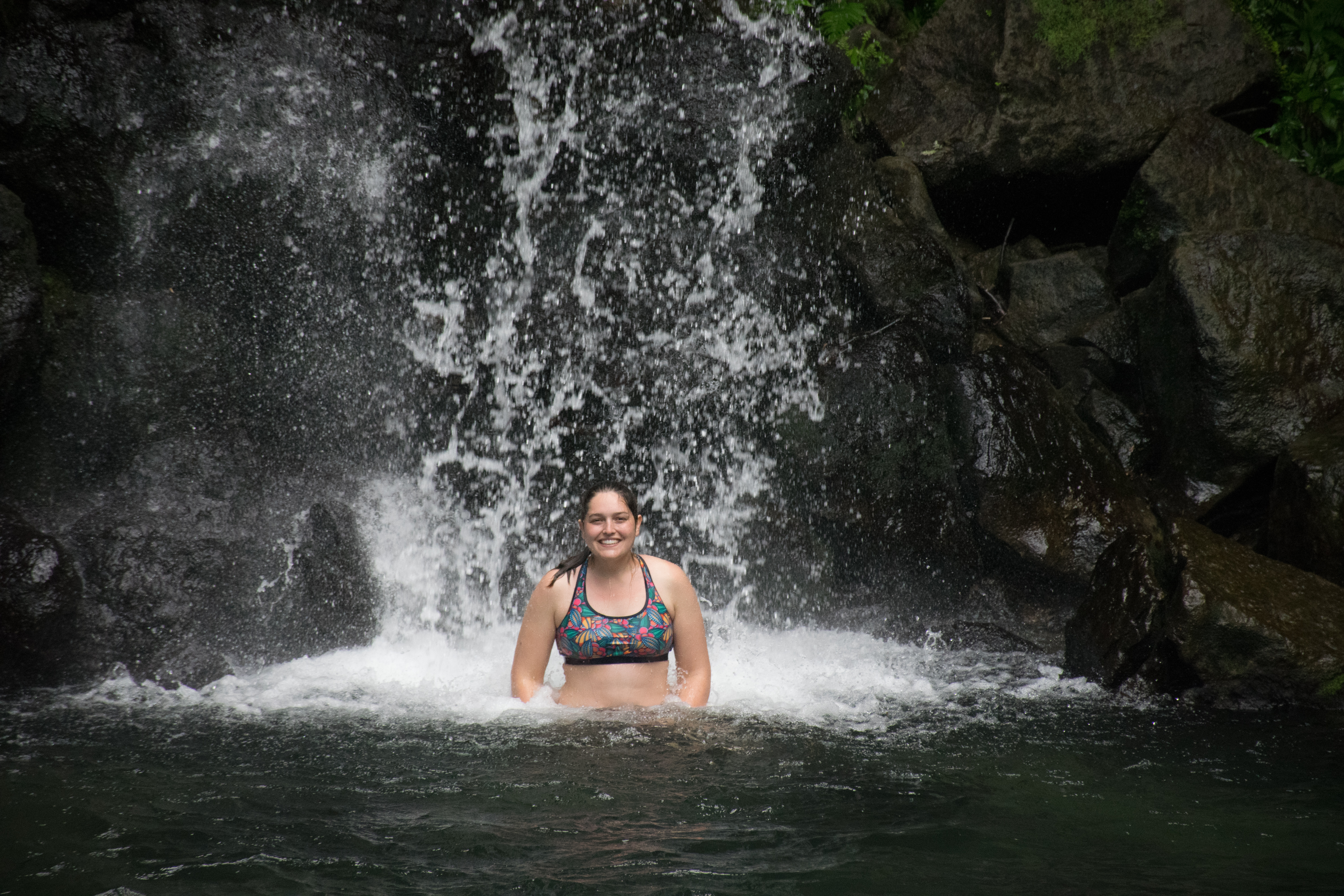
I picked up a keychain from the little tourist stand and then we were back in the bus for the five minute drive over to the Emerald Pool. The Emerald Pool is a little pond at the base of a waterfall. Compared to the Trafalgar falls, it was hardly a waterfall, our guide called it a “drop of water” and let us know that while we might think the temperature of the water was “refreshing,” the Dominicans just call it “cold.” After taking my own dip in it, on a rainy day like that one, I agreed that the water was definitely cold.
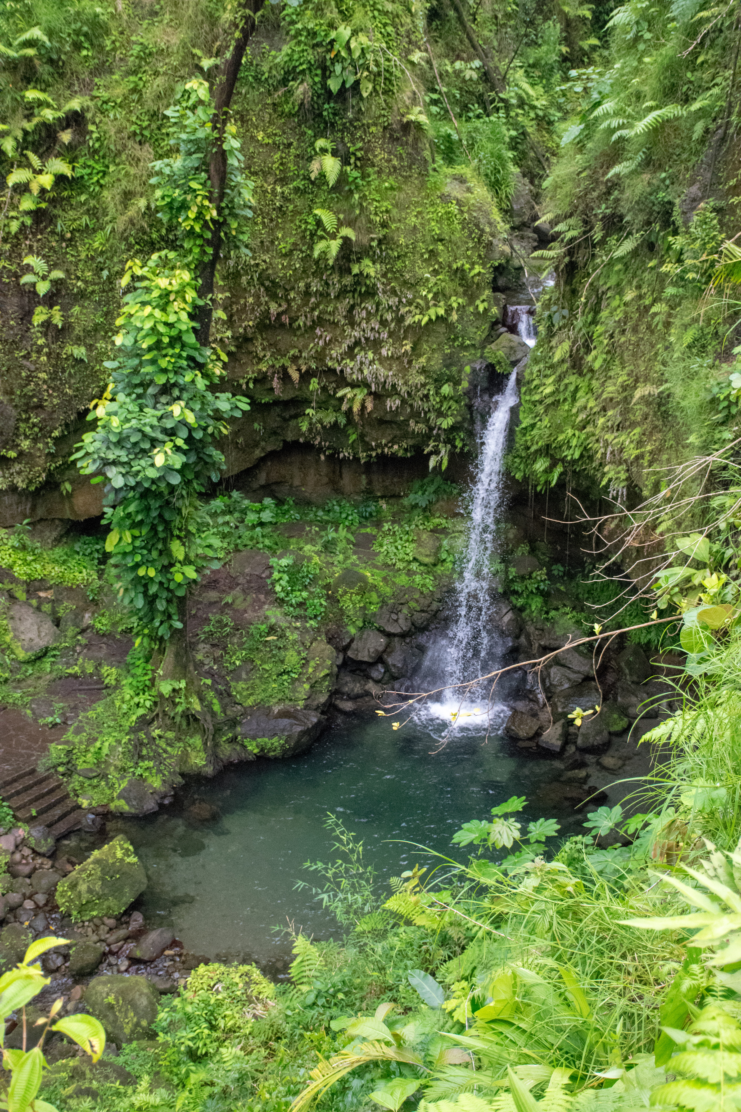
The pool itself was far from emerald on the day we visited, mostly because it was cloudy so the pool wasn’t really reflecting all of the greenery that surrounded it.

Leaving the pool we visited more touristy shops as we waited for the van to be ready to go. We ended up chatting quite awhile with one shopkeeper after I grabbed a keychain with a little pocket knife on it. Aaron was shocked that I’d dream of taking it on a plane despite the fact that the rules were relaxed about pocket knives years ago. The woman selling the keychain commented that “it was a beautiful thing to be white” letting us know that the Caribbean island has seen (perhaps more than) its fair share of racism and social structures benefitting its white minority despite leaving slavery behind so long ago.
Back in Roseau we had a few hours before the ship was due to leave port so, after a quick lunch, we decided to walk up to the botanical garden to more fully appreciate it after our whirlwind bus tour. It was about a fifteen minute walk up to the garden past some of the elementary schools that were still shuttered due to damage from Hurricane Maria. The entire island still showed an immense amount of damage from the hurricane. Our tour guide told us that most islanders didn’t have insurance and/or couldn’t afford it, though that might change in the near future because of Hurricane Maria. The island, which was already quite poor, has had a lot of trouble recovering from the hurricane. Many very cool geothermal and hydroelectric projects which had been started before the hurricane were now indefinitely paused. This was also true of a new, state-of-the-art hospital that was being built on the island (as currently islanders have to be airlifted out for any operations that they need).
Much of the botanical garden was destroyed in the hurricane so we were well warned that it would not look as it normally did as many of the plants and trees were destroyed in the hurricane. Most of the indoor and informational areas were also closed because it was Christmas. We nonetheless enjoyed the walk around the outside grounds seeing large lizards, lots of plants, and this giant tree:

The botanical garden is also famous for its baobab tree which was blown over and onto a bus in 1979 (the bus was empty), the tree was never moved and so it just continued growing and it still lies there today.

Back on the ship we ate dinner and fell asleep, excited for the opportunity to sleep in (all the way until 7:30!) on our day at sea the next day.
Day 6: Day at Sea
Somewhat scarred from our previous experiences at the on-ship entertainment, we were hesitant to go to more programming. Despite ourselves, my parents wandered onto the ship’s galley tour after breakfast in order to get a behind-the-scenes tour of the kitchens while Aaron and I went to a Port Destinations Talk by our shore excursions specialist. My parents abandoned their tour early and Aaron and I sat through an hour of back to back advertising for shore excursions that we could buy at each of the upcoming ports. She ended the talk by telling us that the main tourist attractions in San Juan (the San Cristobol and El Moro forts) were both closed due to the government shutdown (they weren’t) and then raffled off six prizes and gave them all to the first number that was pulled (that’s not how that works).
We then visited the “Concierge” on our deck to get access to his internet and figure out how to spend our time in Sint Maarten the next day.
I think we all spent the rest of the day alternately napping and washing our clothes, trying to catch up on sleep.
Day 7: Sint Maarten/St. Marten
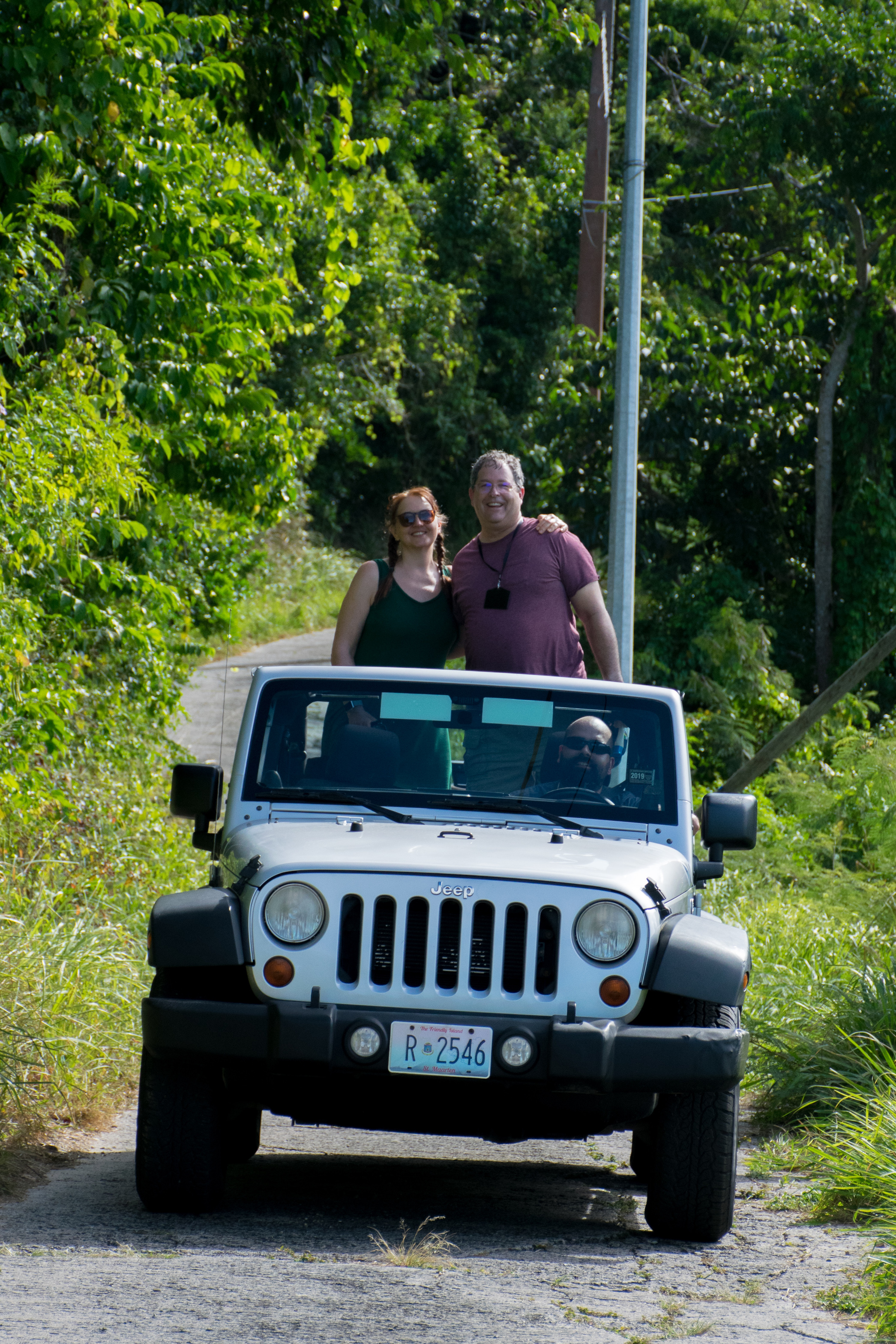
We hadn’t really planned ahead for Sint Maarten/St. Maarten which is an island divided between the country of Sint Maarten (formerly a Dutch colony) and St. Martens, a territory belonging to France. They are divided in the same way that the EU is divided, that is to say, not at all and there’s free movement between the two sides of the island. Our chat with the concierge had been incredibly helpful and our first stop was the car rental place right outside of where the boat docked. We were first off the boat once again which meant that we were right on time to book their only remaining vehicle: a cute little two door jeep.
Map in hand, my parents jumped in the back and we all drove to our first stop: Marigot, the capital of the French side. Marigot is famous for its little market in the main square. Much reduced due to the holidays or the hurricanes (we weren’t sure which) it was a small market and we enjoyed the ten minute rain storm under the cover of one of the booths with a St. Maarten lady who was used to tourists without umbrellas. She laughed with us about the frequency of these onsets on storms and after it ended we were back on our way again.
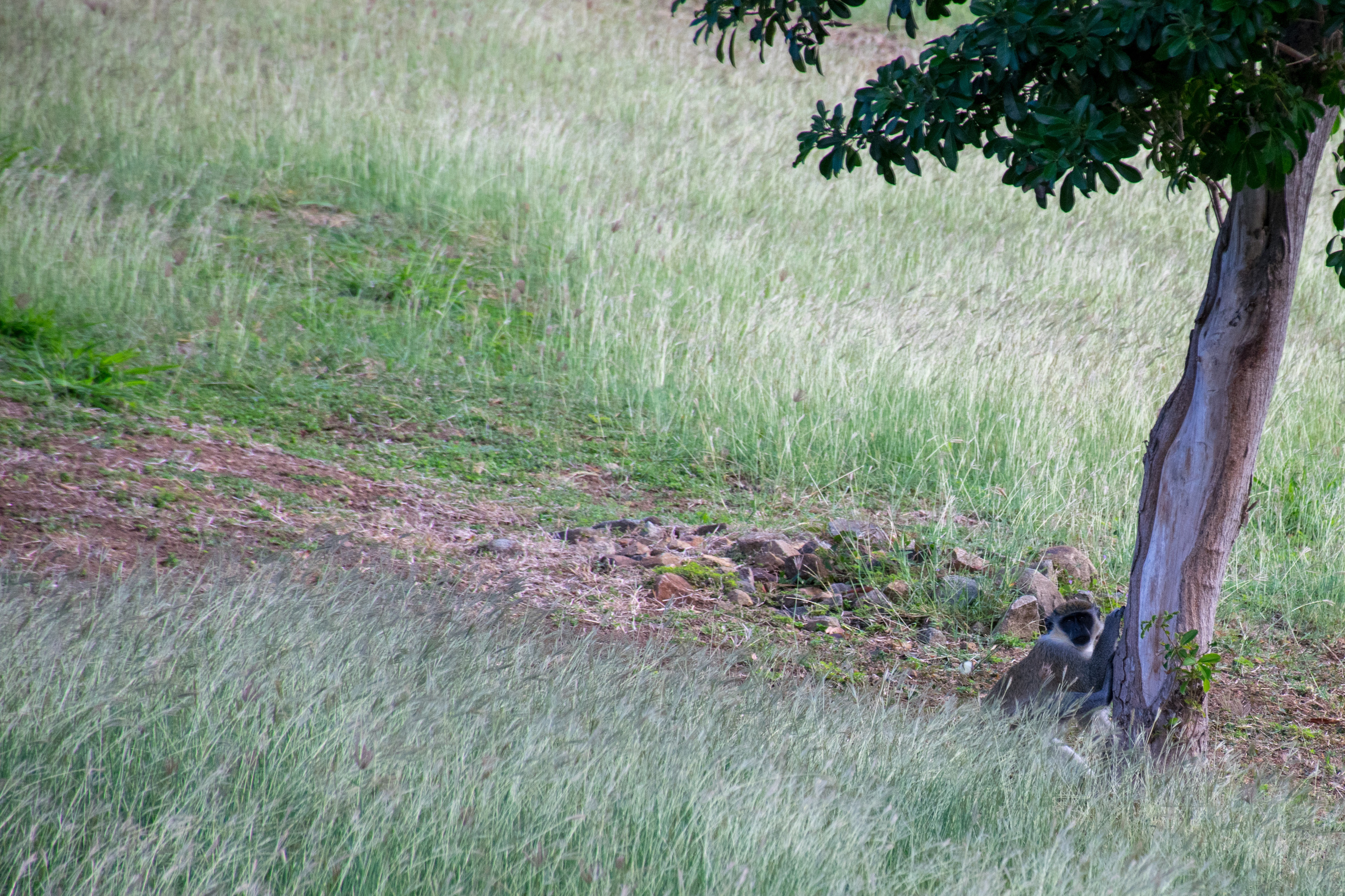
After the market we headed up to a place called Loteria Farm. Supposedly an old plantation, we found a resort without obvious signs of where to go or what to do. We did, however, find a colony of monkeys playing on the hill and I wished they were less skittish so we could get closer.
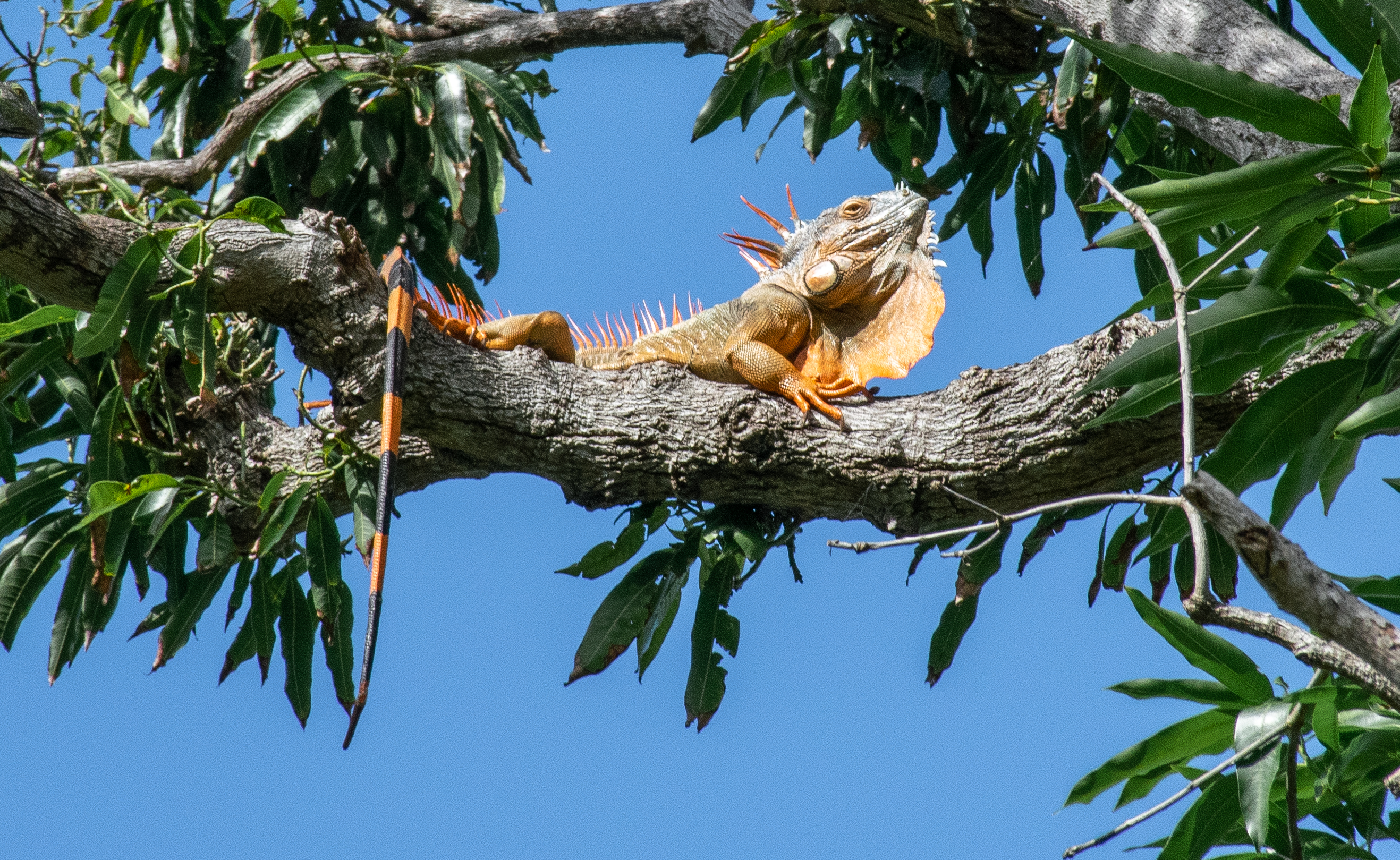
Turning away from the monkeys, we found that the trees were filled with iguanas.
After taking our fill of photos, we hopped back on the road and continued upwards towards Pic Paradise (Peak Paradise) a short hike to the top of the mountain that had a great view. It wasn’t a long hike, but it was incredibly steep. Once at the top we were almost blown away by the wind, the view was incredible.
Heading down the mountain, we all realized we were reasonably starving so we went over to Grand Case where the locals had told us was their favorite restaurant to eat at. Coincidentally, it also happened to be where Aaron had researched and wanted to eat at. Lolo’s (also known as “Talk of the Town”) was an outdoor restaurant located right on the beach with a slightly different menu depending on that day’s catch. There was a giant grill next to all the tables where they spend the day barbecuing the meat and it smelled SO good!
Aaron made sure we ate Johnnycakes, a local donut like appetizer, and I tried the homemade punch which was super colorful and tasted great.
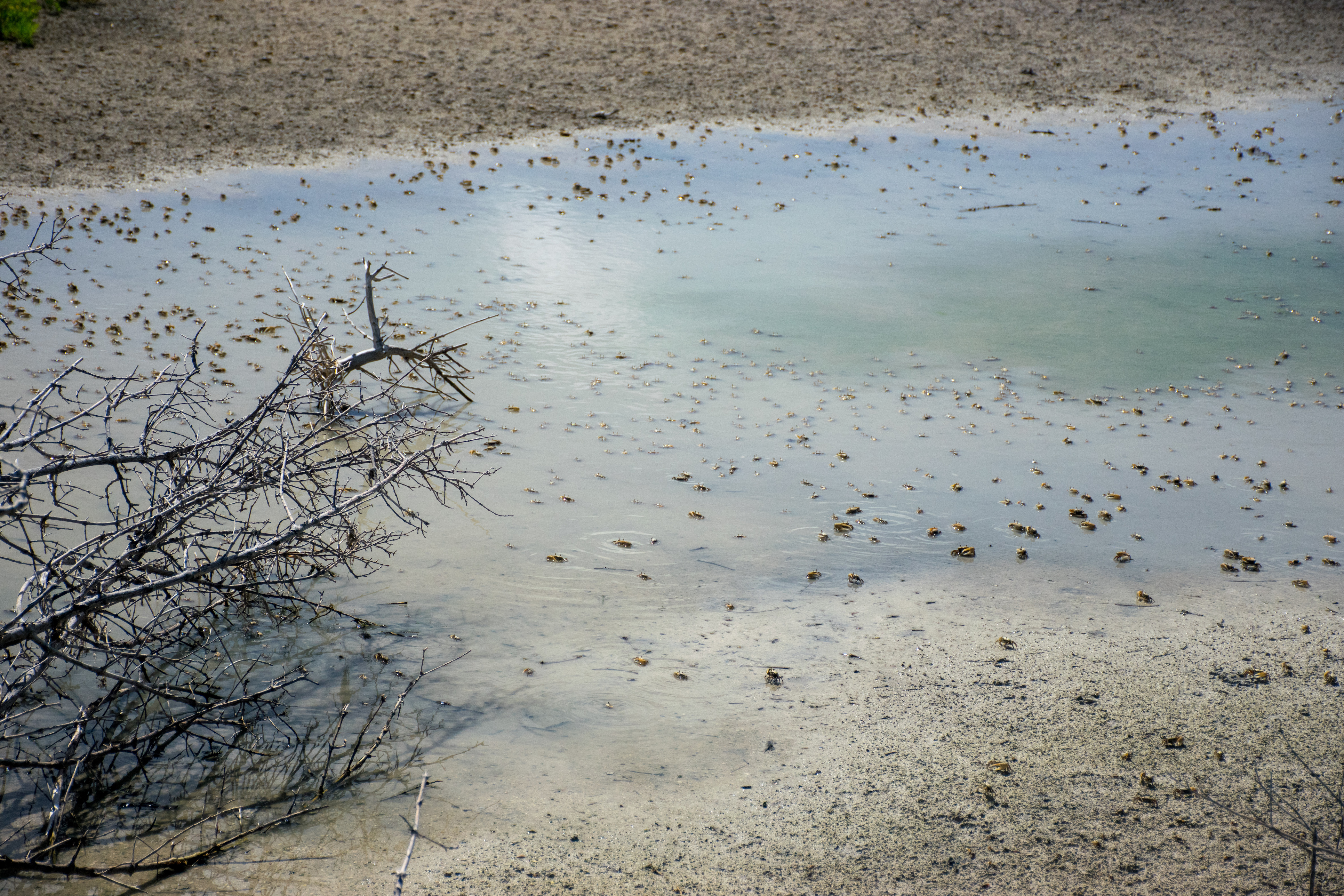
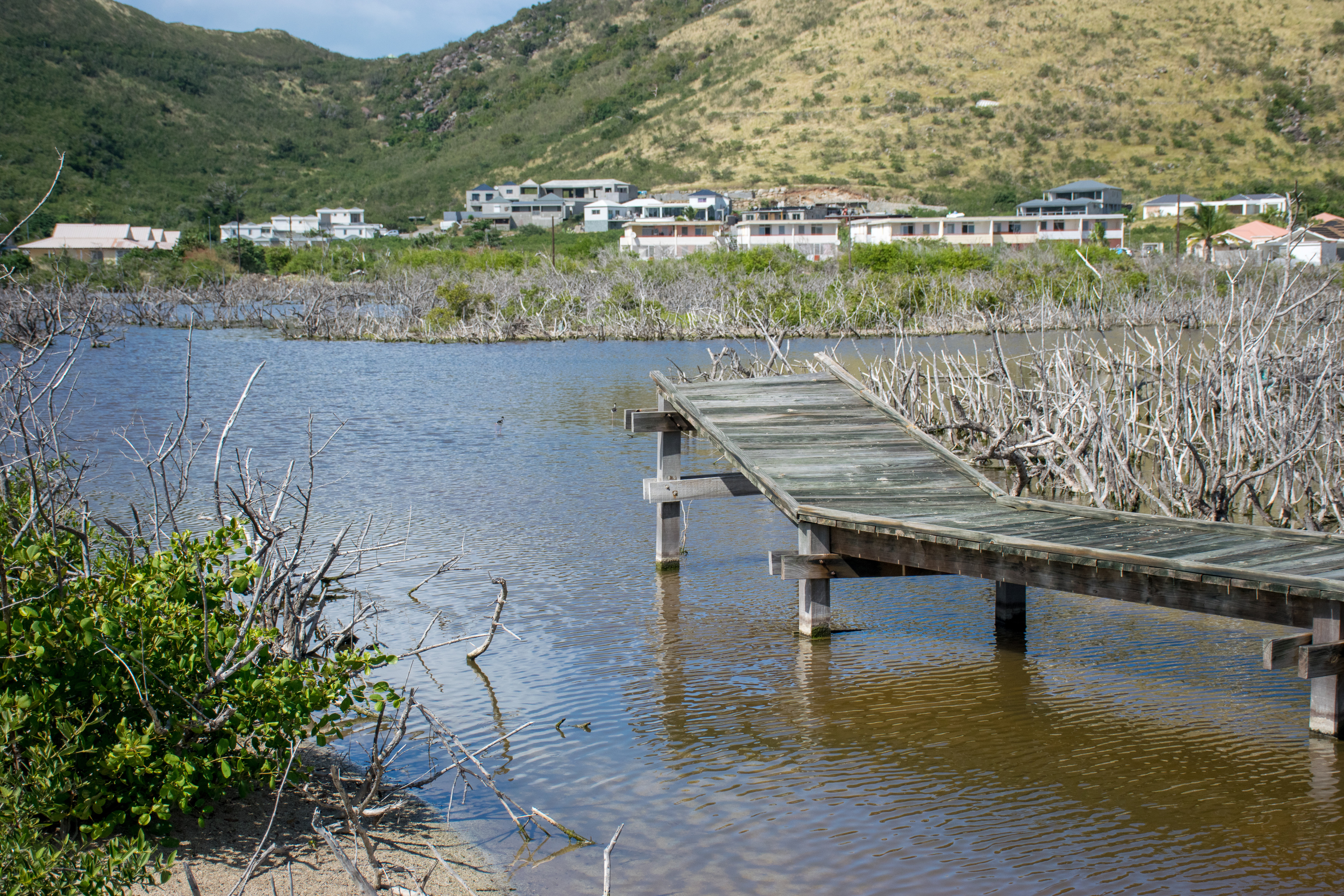
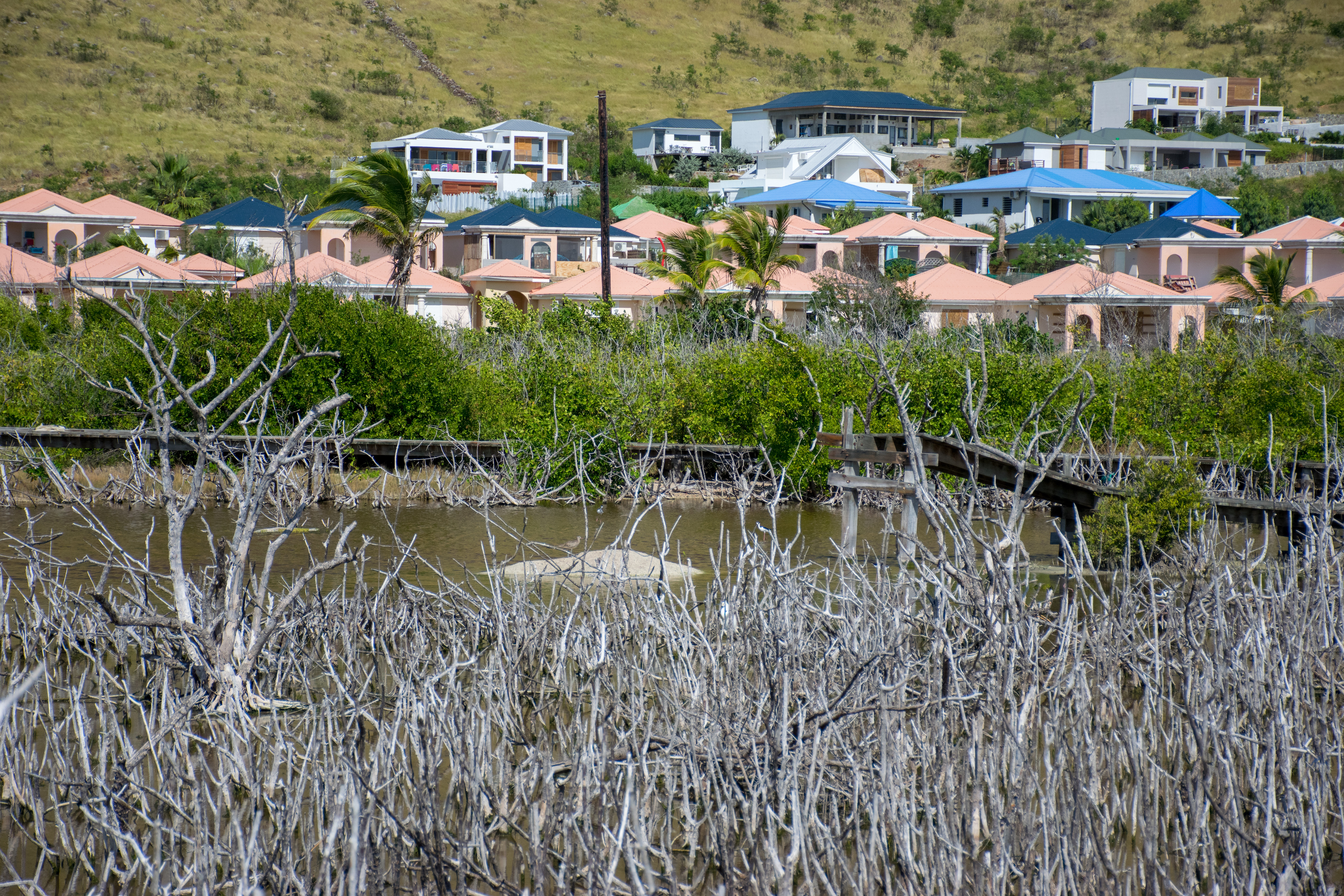
Well fed, we headed back into the jeep to continue our tour. I’d found a nearby beach that looked like it had some walking trails that might be interesting to see. We drove over to find a raised platform walkway that led out over the swampy lagoon area next to the beach. At high tide the whole thing must be connected to the ocean. There were egrets and lots of other small birds, and as we walked along the path we found ourselves walking over crab colonies with dozens of crabs all clustered together.

And then our walk came to an abrupt halt when the walkway ended. About thirty feet away we could see where the walkway picked up again and beyond that we saw the informational signs that presumably told us more information about the little lagoon. Unfortunately none of that was accessibility without getting wet due to the hurricane.
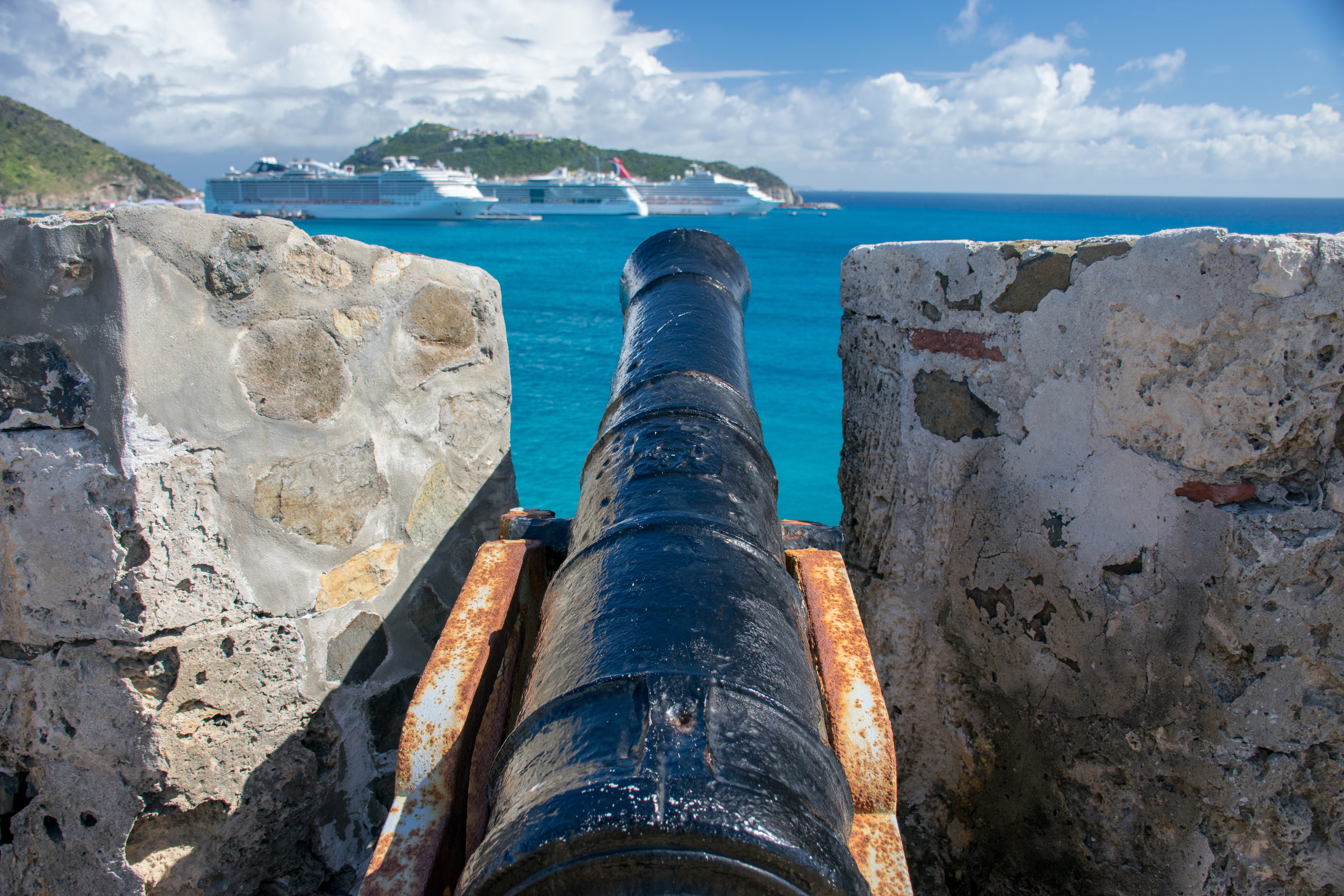
We retraced our steps back to the jeep and headed to our next stop: Fort Amsterdam. At this point we crossed back over to the Dutch side of the island without any sort of fanfare (other than three flags waving at the border). Fort Amsterdam was created to protect St. Maarten but was incredibly broken down. Obviously some of this was hurricane damage, but lots of it was also just age. We had to hike through a resort to get up to the ruins, but once we arrived we enjoyed taking pictures. My favorite part was the succinct timeline that recorded the dates the St. Maarten changed hands until it became independent in 2010.

Leaving Fort Amsterdam behind we decided it was finally time to head to Maho Beach. Maho Beach is famous for this type of photo:
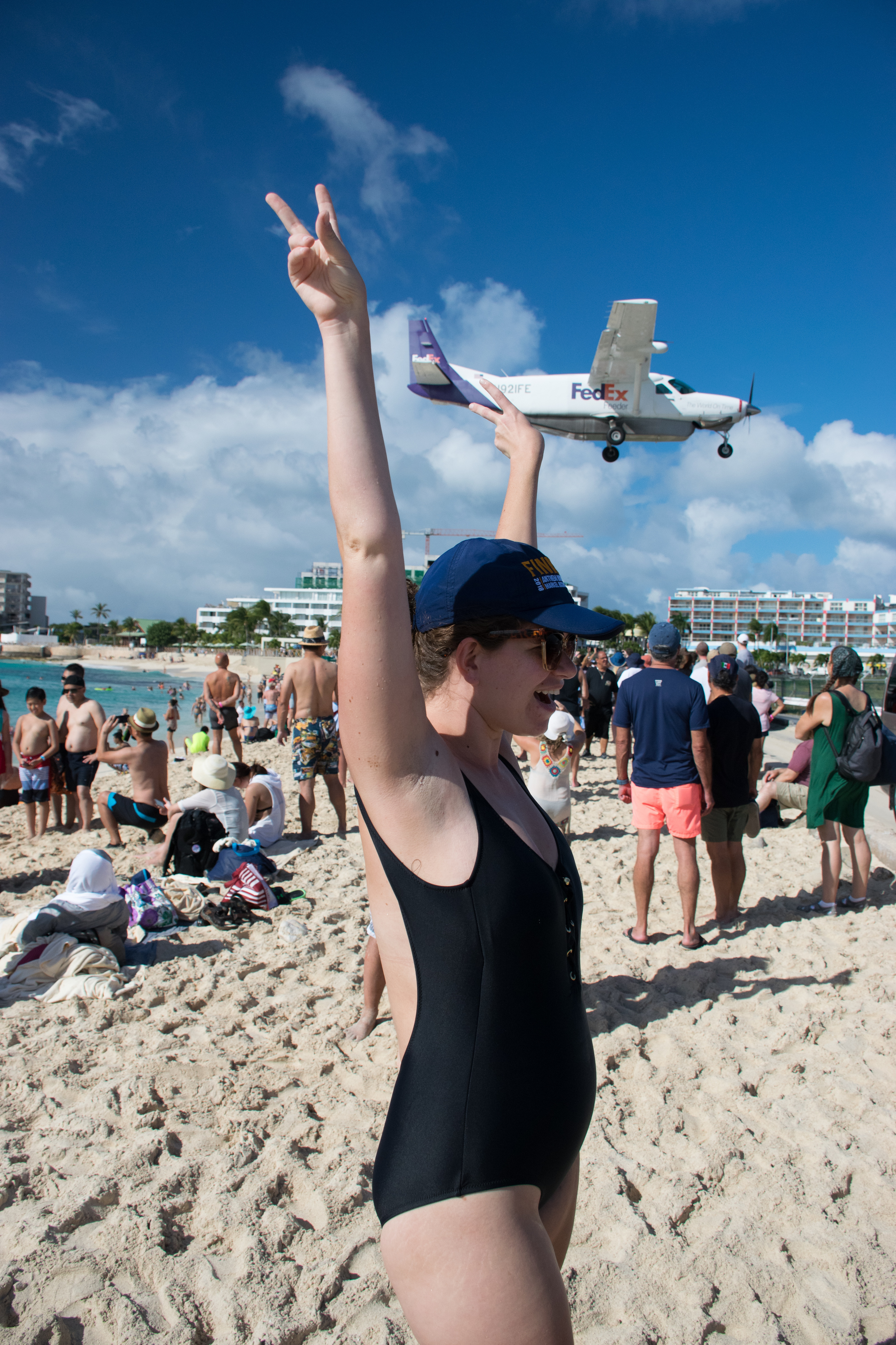
There are also plenty of tourists who have posted YouTube videos of their hats, clothes, or, in some cases, themselves, flying down the beach as planes take off the runway. We had been carefully watching the planes scheduled to arrive that day and made it to the beach at about 2:10, a good 40 minutes before the largest plane of the day (nonstop AirFrance flight from Paris) was due to land. We all gathered our cameras and staked out our spots on the beach to take photos of the planes landing.
I headed into the water with my waterproof camera, Aaron headed towards the side of the beach with the good camera, and my parents hung out on the beach, people watching, and refreshing the flight aware webpage that would tell my dad which planes were landing.
The view from the water was great! I had my ear plugs in to avoid getting swimmer’s ear (or hurting my ear some other way) so I was relatively safe from the sound of the jets landing but some of them were still very loud!
Eventually a very large plane dropped in and I thought that must be the AirFrance flight so I waved at my parents, and tapped my invisible watch, and I shrugged; and they didn’t even glance over at me. I gave up on trying to signal them and just hung out in the water. Eventually my mom joined me to let me know that it had been a Delta flight and it was the second largest plane that was landing here today. Apparently the AirFrance flight had been delayed and we didn’t know when it would land.
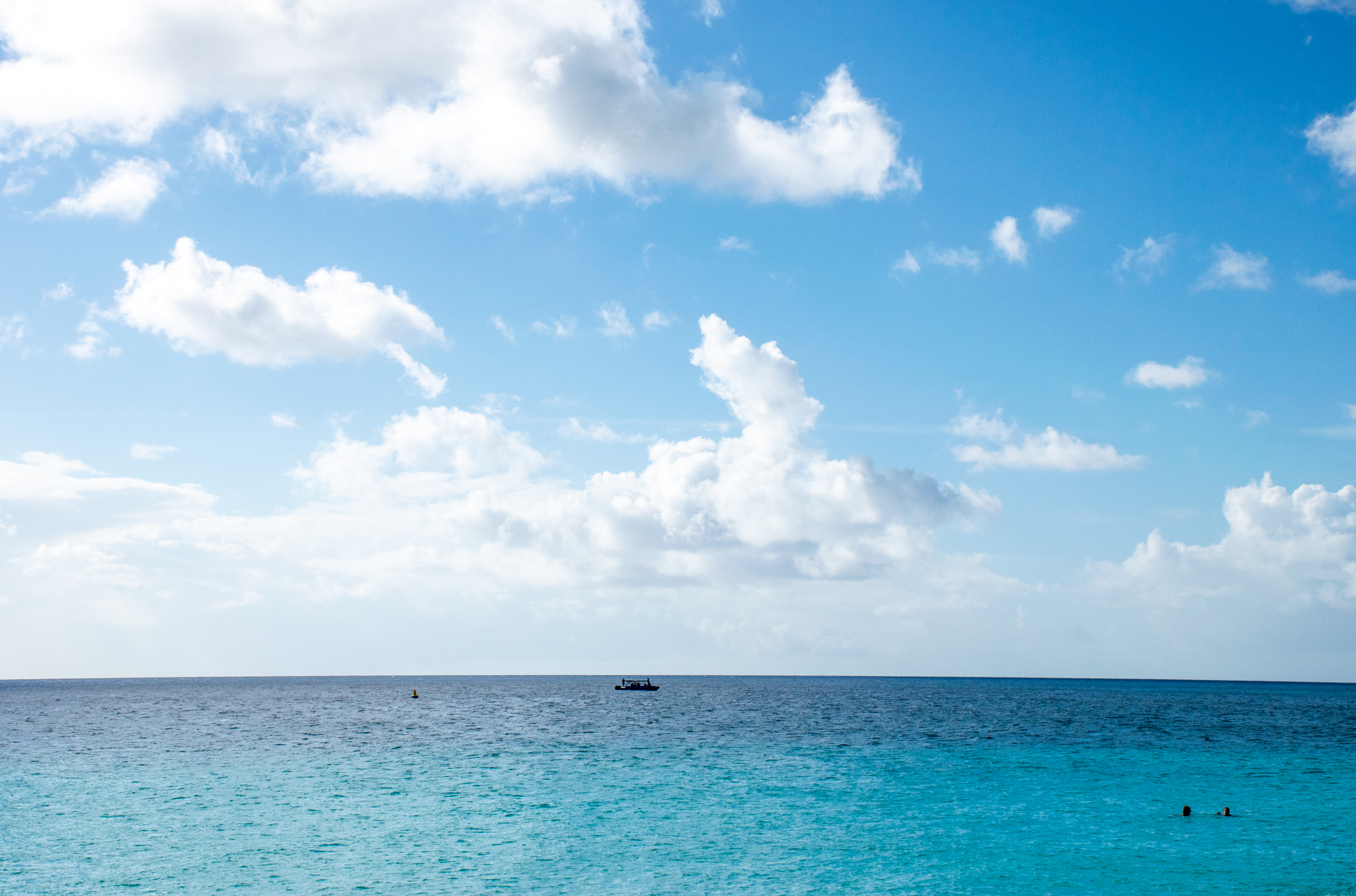
As well as photos of me swimming around in the salty water and other planes landing.
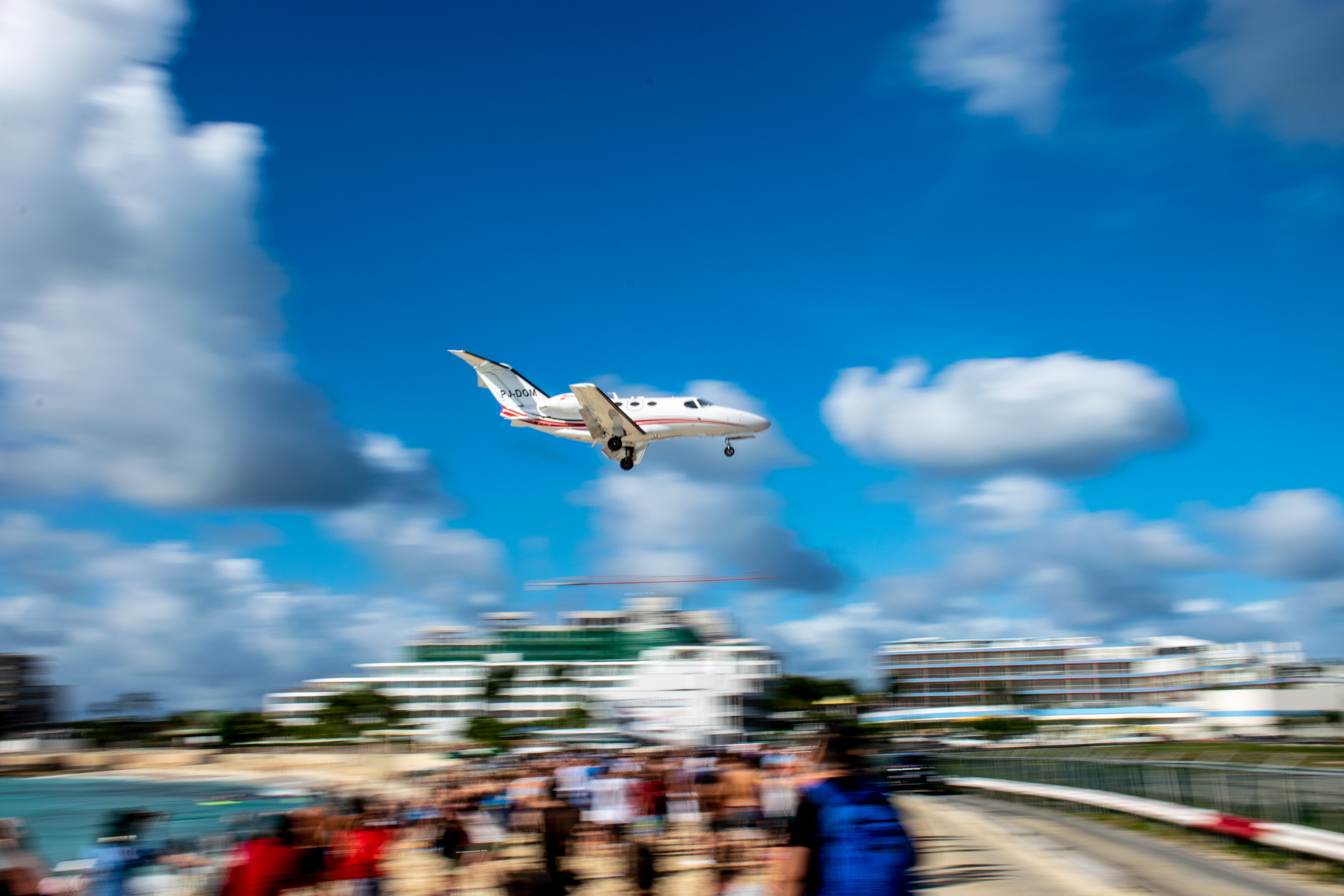
Eventually we all converged on the beach, thinking that it was getting late and the AirFrance flight was never going to show up. As we turned to leave, the AirFrance flight showed up so we all got to enjoy the show as it flew incredibly low over the tourists to land safely on the runway.

Leaving Maho Beach behind, we went to our last scheduled stop of the day in Fort Louis. Fort Louis is on the French side of the island and sits at the top of a hill overlooking Marigot. The fort was created because Marigot was such an amazing little bay for shipping that if Marigot could only defend itself and stop changing hands (the British and the French spent a lot of time trading the city back and forth) it would be able to grow into a much bigger city. The fort was in a similar condition to Fort Amsterdam, but we nonetheless enjoyed the climb up and the views from the top.


Dropping my parents off on the boat, Aaron and I took the jeep for one last spin around the island, determined to drive a few more roads and get dinner in town (not that we didn’t like the food on the boat, but we were hoping for more island food). At the end of the day, our trek across the island in the jeep covered almost every road on the island.
Day 8: St. Kitts
St. Kitts and Nevis are two small islands located right next to each other and the main things to do on the islands are snorkel, go on a catamaran tour, ride the scenic railroad around the island, or go climb the volcano mountain in the middle of the island.
I’ll give you three guesses as to which we chose.
Online the hike was labeled as moderately strenuous, on our tickets it was labeled extremely strenuous. The weather forecast for the day was rain all day long, what could go wrong?
In the morning we met at our excursion location (it’s almost necessary to hike the mountain with a guide, I’m not even sure it’s legal to hike without one) where we were met with waivers for us to sign saying we wouldn’t hold anyone liable if we got hurt. One cruiser looked at the waivers, confirmed that the hike would, in fact, be muddy, and then left. Apparently it was too dangerous for her. We all signed and then were ushered into a van by our tour guide who told that we were all signed up to do the volcano mountain hike, that the trail was incredibly muddy because of the rain, it was going to be raining all day so we should expect to get wet, and that the clouds would likely stay at the top so we wouldn’t be able to see down into the caldera.
Nobody moved.

So off we went! On the 45 minute drive to the base of the mountain our tour guide told us a little bit of the history of St. Kitts but mostly just played music for us. When we arrived they told us that there were no restrooms, but we were welcome to use the “Bush Facilities” if we needed to. As in Australia, the Kittians referred to the wilderness of the island as “the Bush.” When everyone was present, they told us that those of us who were more fit should head up first and let the slower folks set their own pace near the back. For some reason, Aaron and I decided that we belonged up front. I figured, we’ll give it fifteen or twenty minutes to see if this is the right speed for us, we can always hang back. We didn’t know that we had elected to hike with the lead guide whose primary goal was to get us to the top as fast as possible. We set off at a fast walking pace (which shall hereafter be referred to us running up the mountain), and we didn’t slow down. About five minutes in at that pace, one woman stepped to the side, never to be seen again as we continued our run up the mountain. About fifteen minutes in I realized that this pace was probably too fast for me (Aaron meanwhile was having no problems at all keeping up). As soon as I made that decision, I immediately challenged myself to keep up with the group anyways. So we kept running. Our guide did everything he could to get us in front of other groups, we were bypassing other guides as quickly and as often as he could, he would even take us off the path so we could pass them more easily. Whenever we got behind a slower group I had the glorious opportunity to catch my breath, I think that’s the only reason I managed to stay with the group.

After about 40 minutes of this, our guide pulled over and told us we’d get a five minute break. He counted our group so that he”d know how many were with us, and then showed off by swinging on some vines while we all took a video.
After that we were back to running. After about an hour and fifteen minutes we got stuck behind another group that we could not pass. At this point the path had deteriorated to the point that we were climbing ladders made of tree roots, walking up streams and climbing little two foot waterfalls. There was no passing here, we followed this group all the way to the top. About 30 minutes from the top we stopped and the guide gave us a passionfruit juice (mixed with pineapple juice and orange juice) and some raisin bread. It was some much needed relief before we finished the hike to the top.
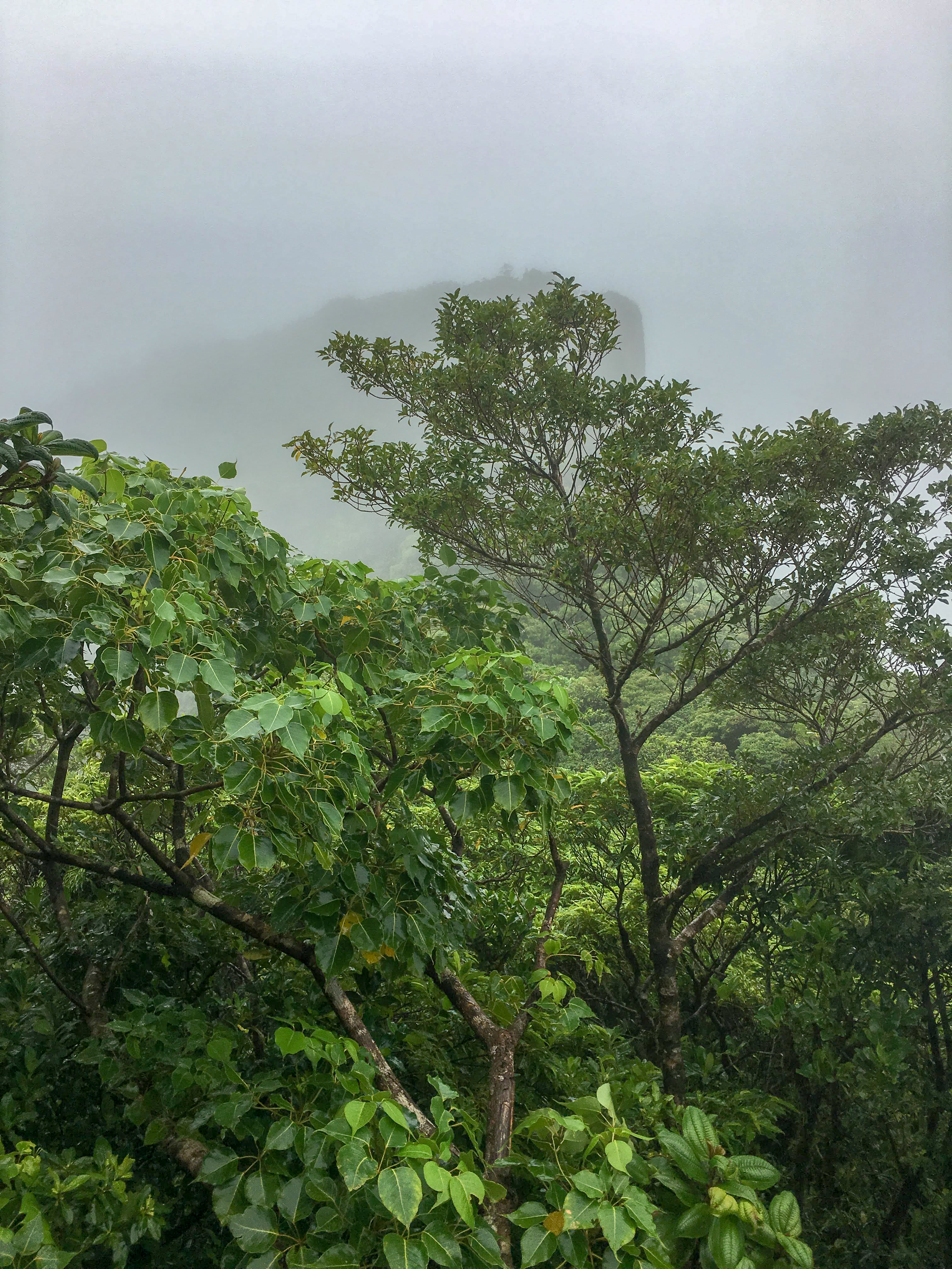
If it had been a clear day here’s what the view might have been:
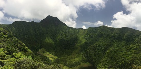
But instead this is what we got:
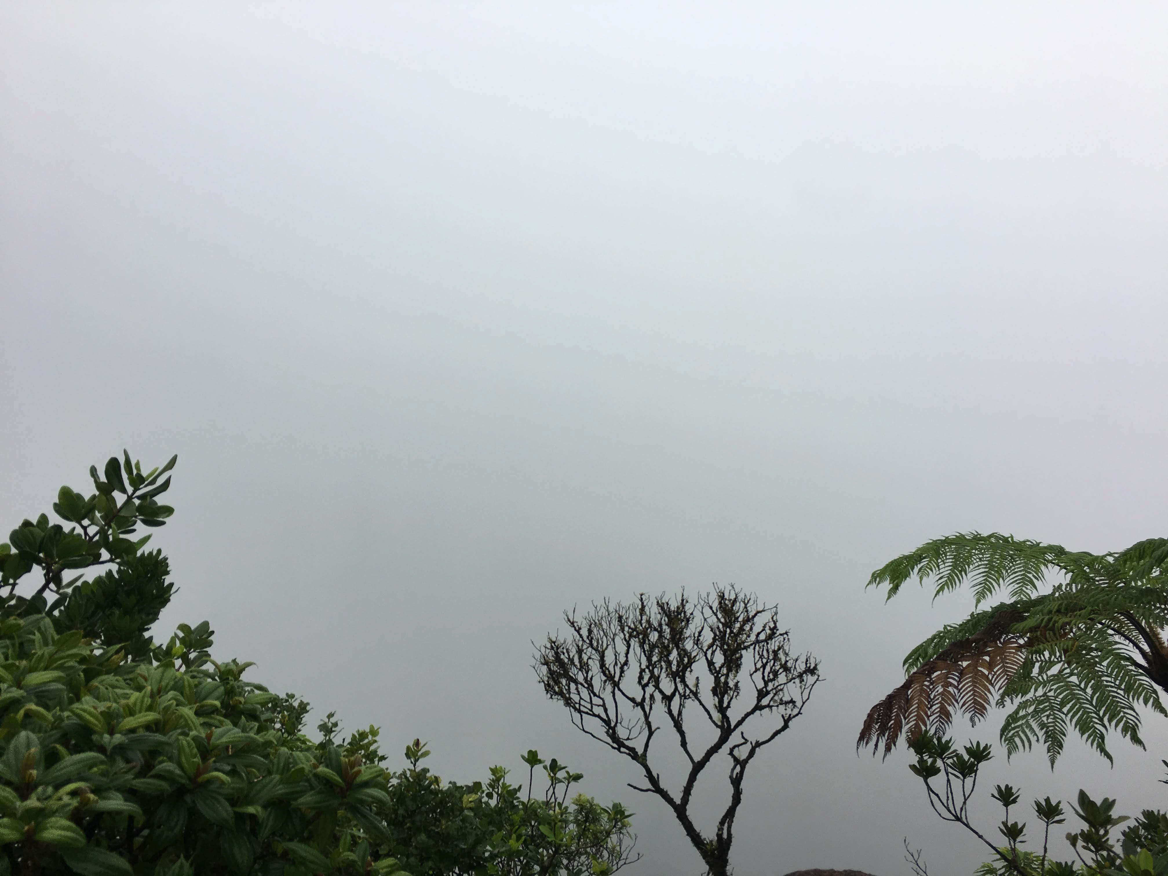
We did get to enjoy the smell of sulphur coming up from the sulphuric lake though!
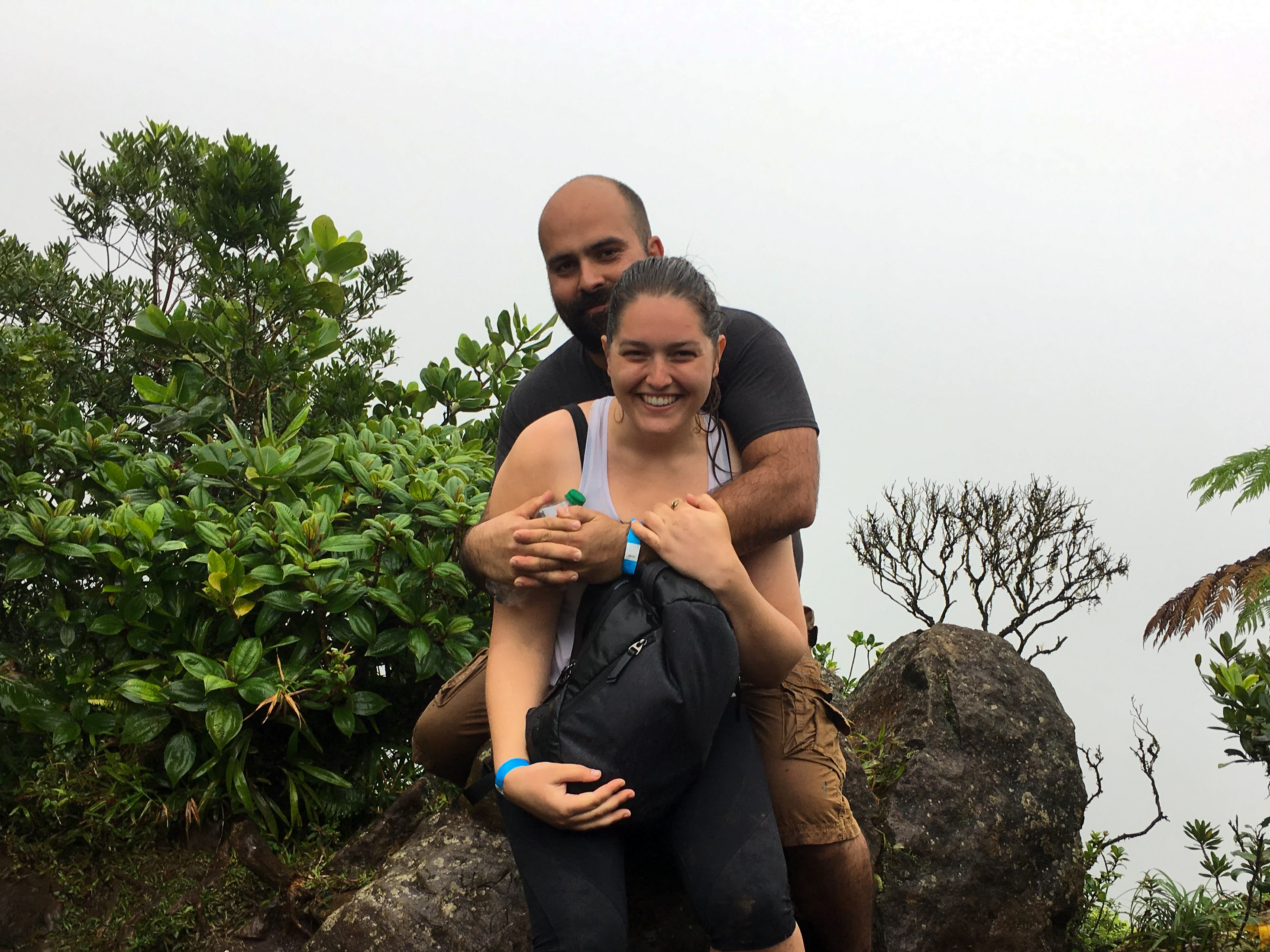
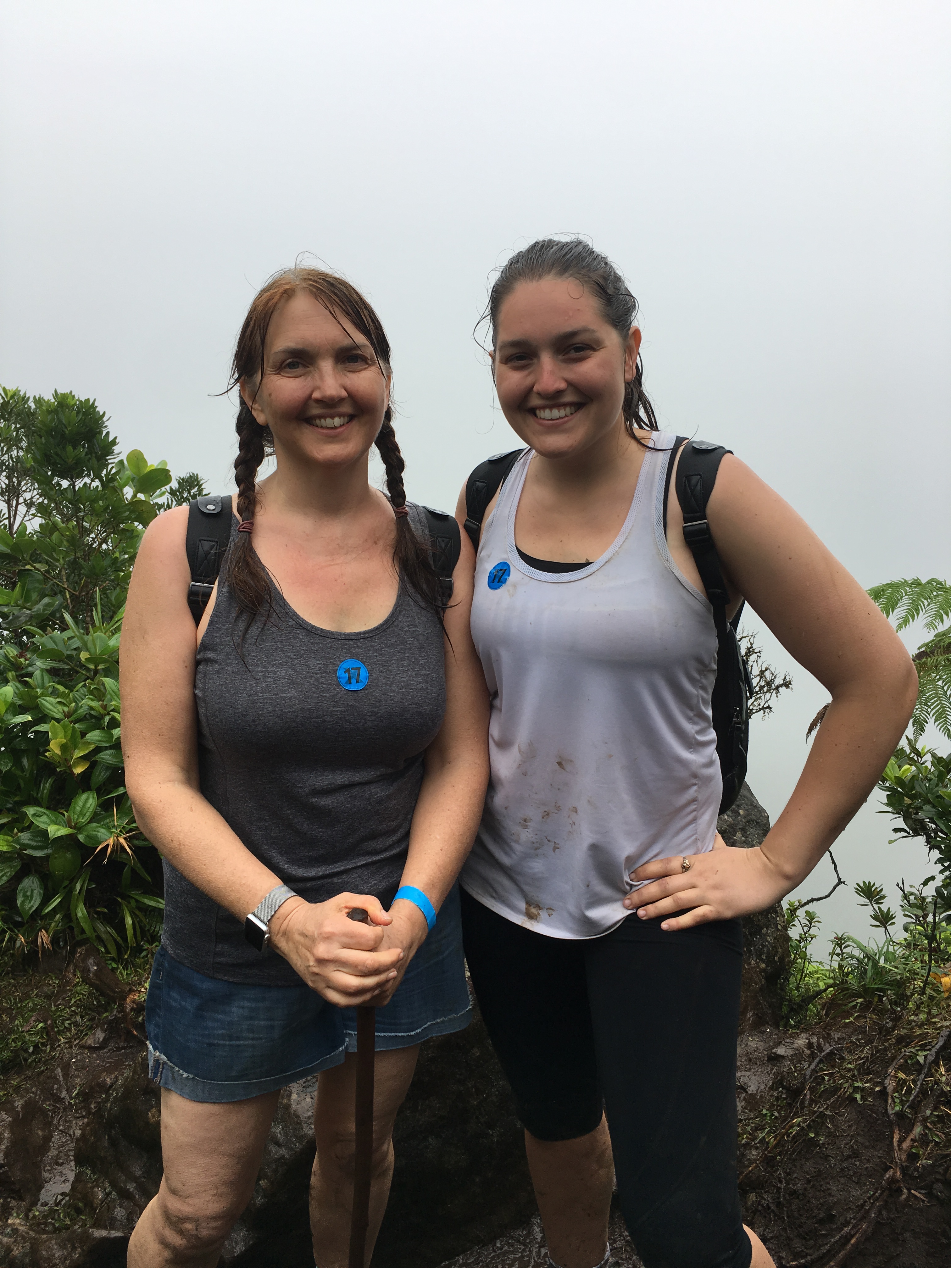
As we started to head back down, my mom caught my attention. She had made it to the top in the group behind us! Our guide had been making noises and saying things like “We’ll get to the summit” leaving us very suspicious about whether the other groups would make it at all. We were told that the turn around time was 12:15pm, but we didn’t turn around then. We made it to the top at about 12:45pm, and we found my mom at 1:00pm. We returned to the top so I could get a picture with her at the top as well.
Then we all hiked down the mountain together at a much slower pace. In the end, the total hike, according to my GPS, was 4.5 miles with an altitude gain of 2,115 feet (each way). To say we were pooped at the end of it was an understatement. My dad had hiked up to “Break 1” which my mom, who took breaks, knew where that was but we did not, suffice to say, he climbed about 1.25 miles at my best guess.


It took us about 2.5 hours to climb down which made our arrival time back at the base camp at 3:40pm. Now our ship was supposed to have everyone on board at 4:30pm, which meant that if we left within five minutes, we’d probably get back just on time. But we weren’t the last ones down, there was another group behind us and they didn’t arrive down until 4:10pm. By the time our driver came down and everyone was loaded into the van it was 4:20 and as we pulled away from the mountain, the guides were receiving phone calls from all of the cruise lines asking where their passengers were. Our guide responded that we were on our way and that we’d be there in twenty minutes. We made it there in 30 minutes and were hastily being shoved through security at 4:50pm.
Somehow we managed to stay awake just long enough to pack before collapsing asleep in bed.
