
Day 14: Costa Rica
We left decently early in the morning thinking we might make it onto the 9:00am ferry. With some rushing and a carefully timed breakfast we walked into the ferry area at 8:45am and bought our return tickets at the window (again 100 cordobas). Our tardiness to the launch area meant that we weren’t the first on the ferry and by the time we got up to the third deck, all of the seats around the edge were taken and I sat on the ground and read while Aaron leaned against the railing. The ferry ride felt much smoother until we got close to Rivas when the boat started rocking so much that water splashed onto the car deck.
Upon landing we grabbed a taxi to take us to the bus stop. With Aaron sick, the bus guaranteed to be full, and the price only about $12 more, we told our cab driver to just go ahead and drive us to the border and save ourselves some hassle. The border was badly signed and it took us a few tries to find the area where we could get our exit stamps. We had to pay a $1 municipal tax and a $2 exit fee and then we had our stamps and walked over the border. From there we had about an hour long wait in line to get in to Costa Rica with lots of other tourists. When we finally made it to the front, I expertly answered the agent’s question (“Where are you going?”) and then we had our stamps and were through. We walked back to the Alamo car rental that was located between the two customs buildings, picked up the little Suzuki we’d be traveling around Costa Rica in, and then drove down to Nuevo Arenal, stopping once to get food at a roadside restaurant.
As we relaxed that evening in the hostel, I received a message from Marcos saying that unfortunately we’d have to cancel our stay at la finca because he’d gotten booked for a last minute tour during the days we were supposed to come to la finca and couldn’t turn it down. Super disappointed I asked if we could still visit the farm and he said yes and Aaron and I started brainstorming what we might do instead.
Day 15: Volcano Tenorio
I had read online that the Tenorio Volcano National Park allows only 500 visitors in the park at once and a total of 1000 visitors per day, because of this Aaron and I thought it would be better to get there early. We went to a local German bakery/restaurant for breakfast because Aaron was excited about discovering it and using it as an opportunity to speak German. The food was fantastic and the owner (we presume) was linguistically baffled by us and spent the entire meal addressing us in a mix of German, English, and Spanish, and sometimes repeated himself in all three.
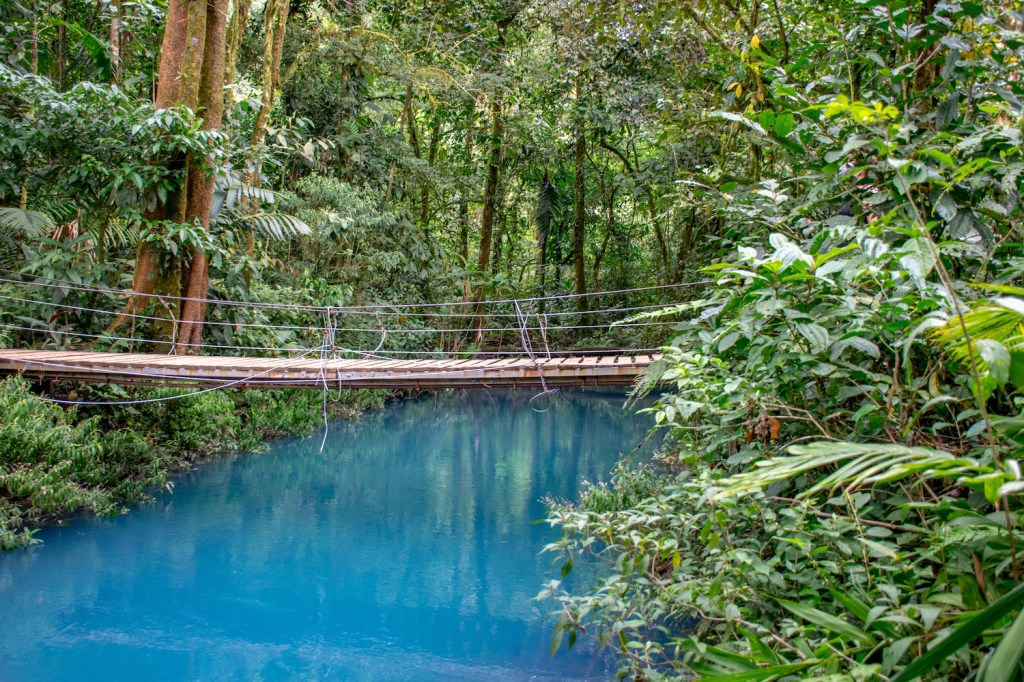
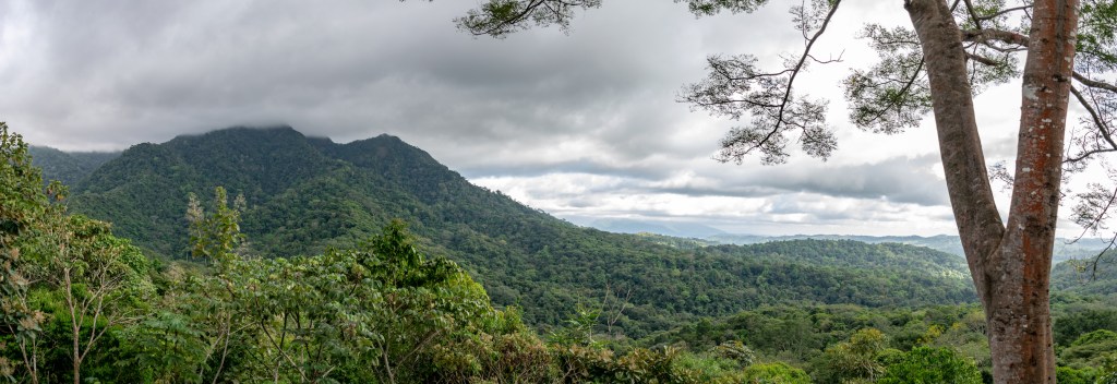
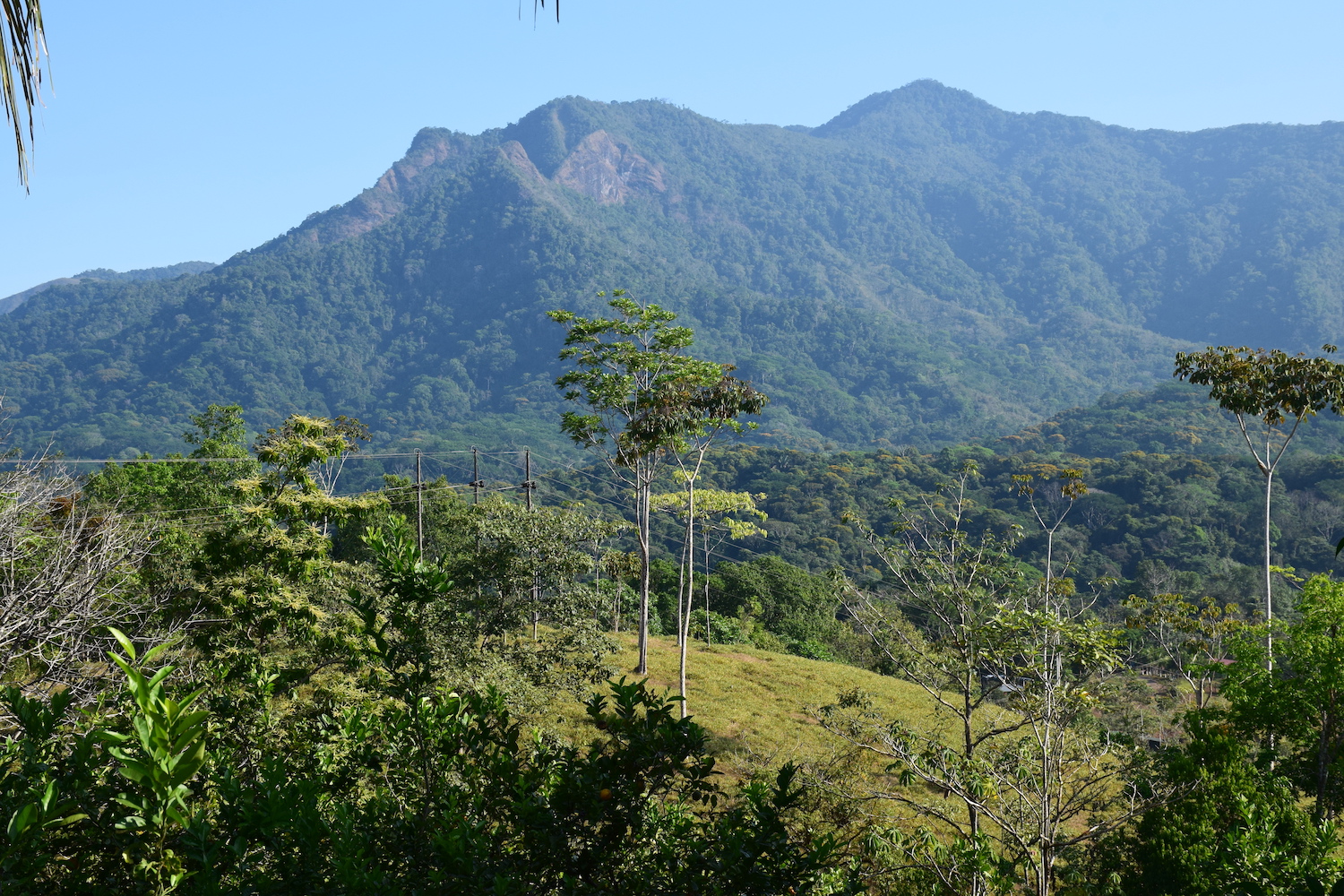
We finally got on the road around 9:00am and ascended up into the hills over Arenal for a gorgeous drive past many lots for sale before descending back down to the base of Tenorio. The volcano itself is mostly dormant, no lava or anything, but the exciting part of visiting Tenorio is the waterfall and bright blue river that runs through the park. As we stood in line to buy our tickets with other tourists from around the world, a park ranger came along to tell the line that there were currently five hundred people in the park so we might have to wait a few minutes before we could enter. By the time we got our tickets we didn’t have to wait, presumably enough people had left that Aaron and I were able to walk right in.

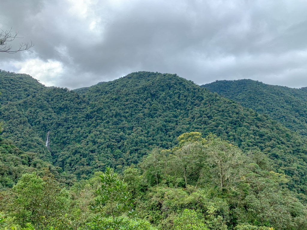
The hike begins with a 1.5 kilometer walk that is mostly up, to a staircase down to the the waterfall. We decided to do the waterfall on our way back and instead enjoyed the vista before descending down to walk along the river stopping at a viewpoint to see it’s gorgeous colored water.
Walking a little further we passed some sulfurous geothermal vents that we could smell long before we could see them.
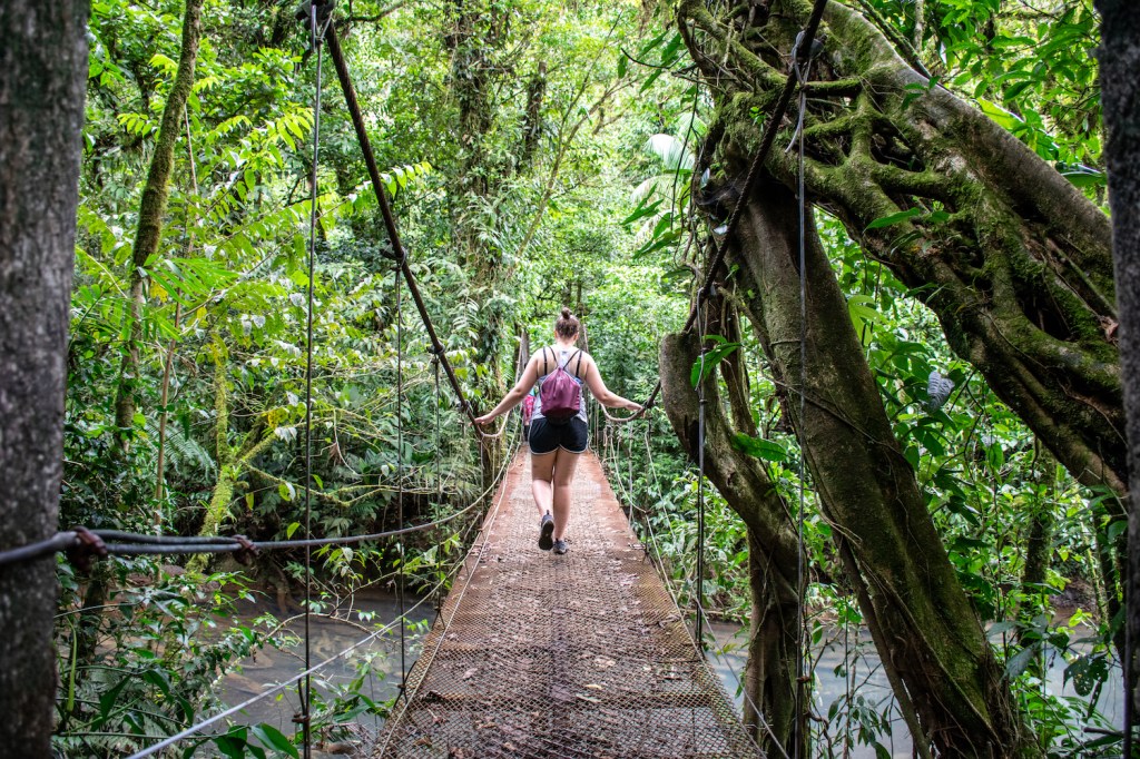
After that, we crossed two bridges that could only accommodate one person crossing at a time. Some volunteers form the University of Costa Rica were monitoring the first bridge to ensure that traffics didn’t get too backed up. The smiled patiently as some tourists stopped in the middle of the bridge while their travel companions took their picture. The other tourists waiting in line on either side of the bridge silently gnashed their teeth at having to wait.
At the end of the trail we found where the color started, a fascinating natural occurrence that I probably could have stared at all day.

A groups of tourists was also sitting around a stump where a pizote was happily posing for pictures in exchange for being fed whatever chips or apples the tourists had on them. Aaron and I watched this occurring in horror. On our way back out the park we mentioned to the volunteers that people were feeding it and they indicated that they already knew and thanked me for letting them know, but they said it in such a way that I knew there was nothing that was going to be done about it.
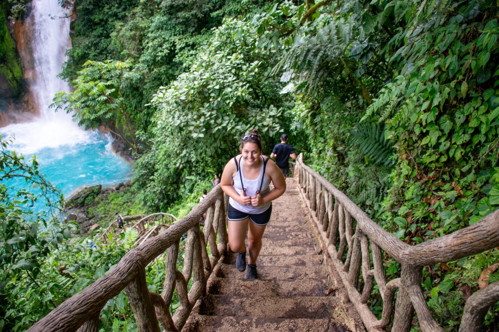
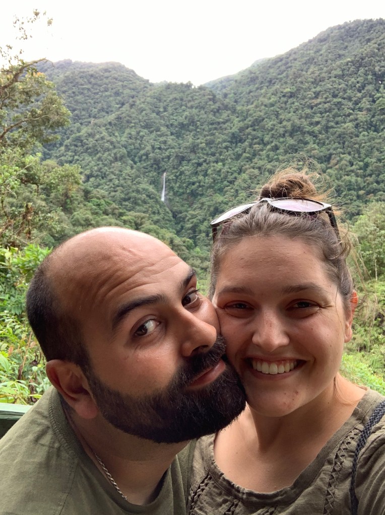
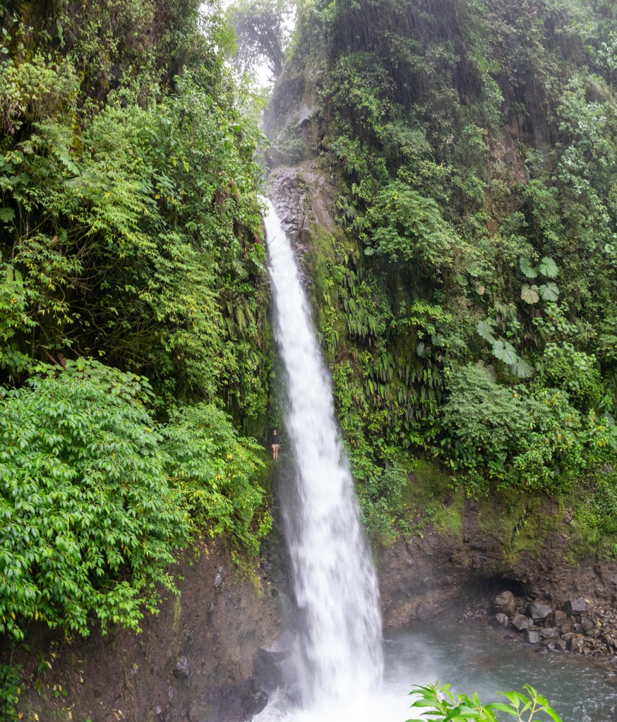
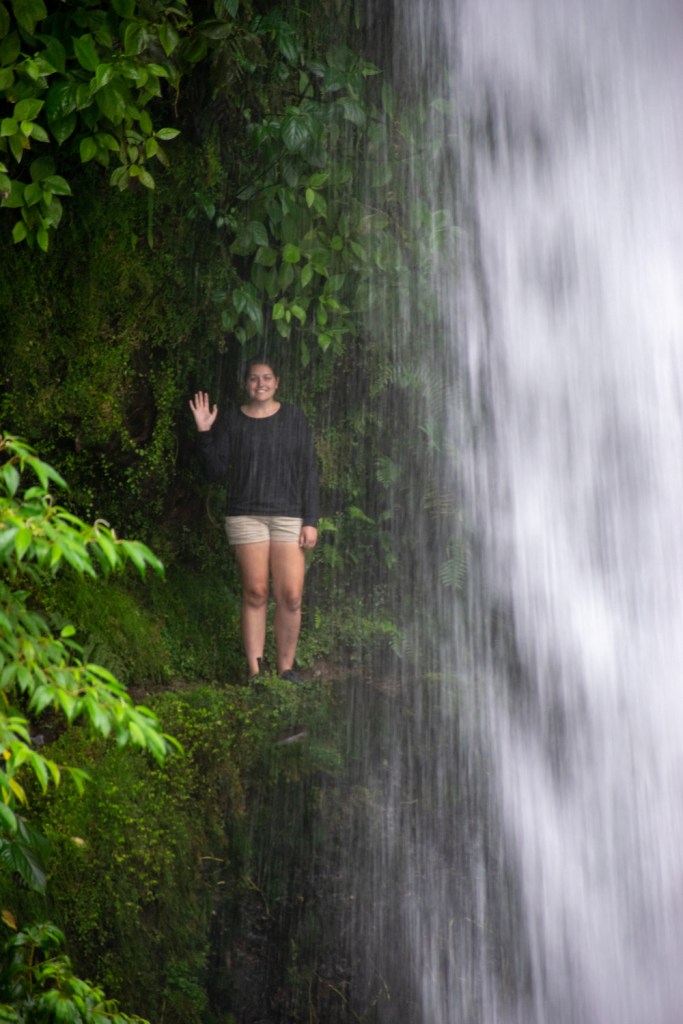
Back at the fork for the waterfall, we made our way down the endless staircase to be rewarded by a fantastic waterfall at the base that was falling into a pool the same beautiful blue color that we had been seeing throughout the park.

Curious how many tourists had entered the park by the time we had left, we asked the ranger guarding the entrance and she told us that something like 863 people had been in the park already, from this Aaron and I realized that if we had been more willing to risk not getting into the park, there theoretically was value in coming later as there would, by design, be fewer people in the park. We also suspected that another good strategy might be to come early in the morning, buy the tickets for your group, and then return later in the day. Both of us appreciated the Costa Rican government’s insistence on limiting the number of visitors in the park. Even during the dry season with this many people in the park, some of the lower sections of the trail were mud pits and I could see why the entrance to the park had two different vendors renting muck boots to tourists to visit the park. In the rainy season the whole trail would have most likely been a mud pit.
Finished with Tenorio, we lazily drove back to Nuevo Arenal taking the long route to see if there happened to be another national park on the way that we could visit. Costa Rica has a habit of creating national parks and then not letting people visit them except for scientific purposes because, no really, they created the park for the animals not the humans. 🤷♀️ So we often see parks marked on Google Maps but when we go looking for them, they have no entrance and no signs telling you how to get there.
We ended out the evening getting dinner at the small heladeria/soda near our AirBnB where we discovered a fantastic chocolate-milk-kind-of-drink and a vanilla creme drink that were so good we returned for them the following night.
Day 16: Arenal National Park
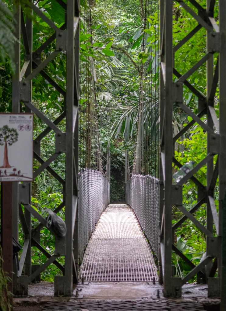
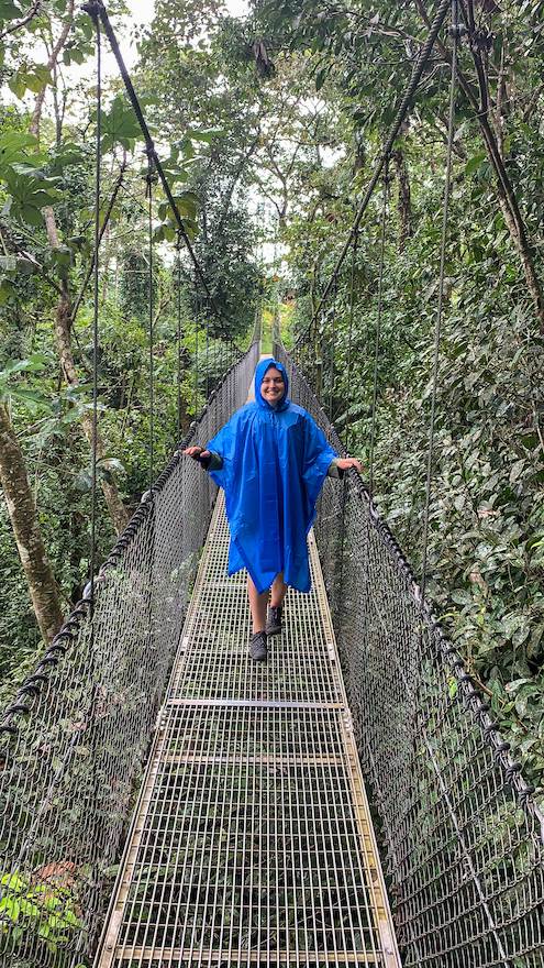
We started the day by driving to the Mistico Hanging Bridges Park, a park outside Arenal where you can walk along 2 miles of paths and cross five different hanging suspension bridges with a metal grate that you walk along where you can admire exactly how high above the jungle floor you are (usually like 50+ feet). Because it’s a suspension bridge for humans, and only supports fifteen humans at a time, the whole bridge sways more with every person who is on it no matter how softly you try to tread, you always end up sort of stumbling across the bridge, attempting to keep your balance and admire the view at the same time. It’s a good laugh.
When we arrived it was pouring rain and we were worried about getting soaking wet, getting the camera wet, and not seeing any animals. So we waited it out in the lobby area to see if the rain would let up (since it does have a tendency to stop). Luckily for us, it cleared up after about 15 minutes and we decided that since the weather wasn’t predicted to be better tomorrow, we’d go ahead and go for it and just assume that if it rained again we could always find a large leaf to shelter under.
We eagerly scanned the treetops for signs of sloths, but managed to go the whole 2 mile walk without seeing one. It was some consolation that for the last little bit we were following a tour and they didn’t see any sloths either. We did manage to find a variety of birds, a lizard, and a gigantic grasshopper.
And of course we crossed all of the bridges and didn’t drop anything off any of them which felt like something worth celebrating in itself.

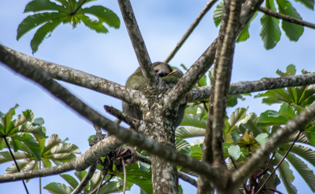
After leaving Mistico we were headed to La Fortuna to check in with Alamo on the logistics of driving to Panama, deciding that it wasn’t worth doubling the cost of the rental to cross the border we decided to figure out a different plan, grabbed lunch, and then started driving towards Arenal National Park. On the way, we joined a group of tourist vans that had pulled over to admire a sloth hanging out in the top of a tree. It turns out that while we had failed to see a sloth in Mistico, where the habitat was perfect for sloths, we could see one just driving around because they are happy to hang out in trees by the roadside.
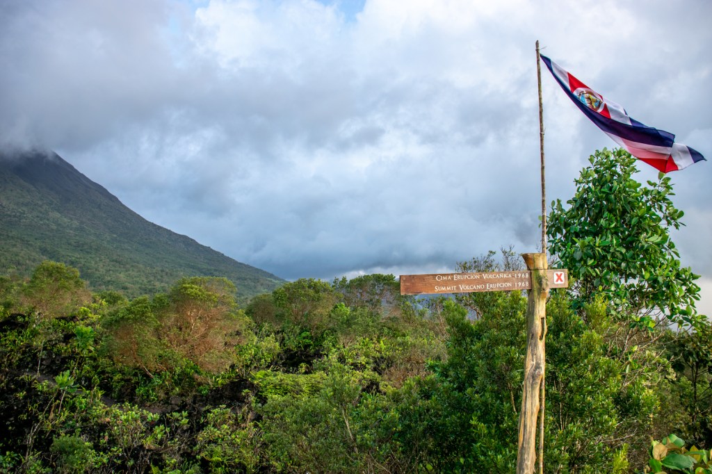
That particular goal achieved, we finished the drive to Arenal National Park where we discovered that the last entrance to the park was at 2:30pm and it was 2:45pm, missed it by that much! Luckily, just outside the main park is Arenal 1968, a smaller park with a couple hikes that lead you around the site of the 1968 eruption. The last entrance for them was at 3:30pm, so we had plenty of time to do their hike.
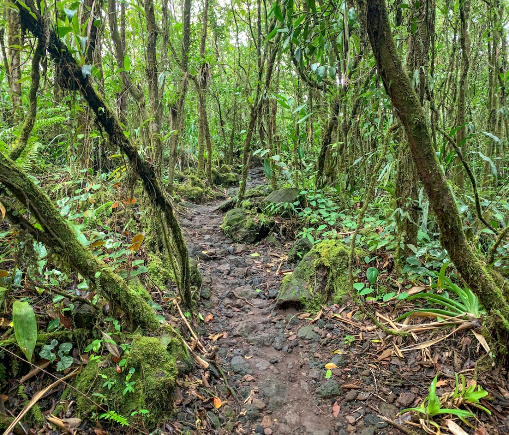
Arenal 1968 has two different hikes, a 6km hike and a 4 km hike. The 4km hike takes you in a large circle up to the lava fields and the highest point of the lava field and then back around for panoramic views. The 6km hike takes you through the jungle and then meets back up with the other trail to climb up the lava field. Aaron and I opted for the jungle hike with the hopes of seeing a cayman in the little lake that the path went around.

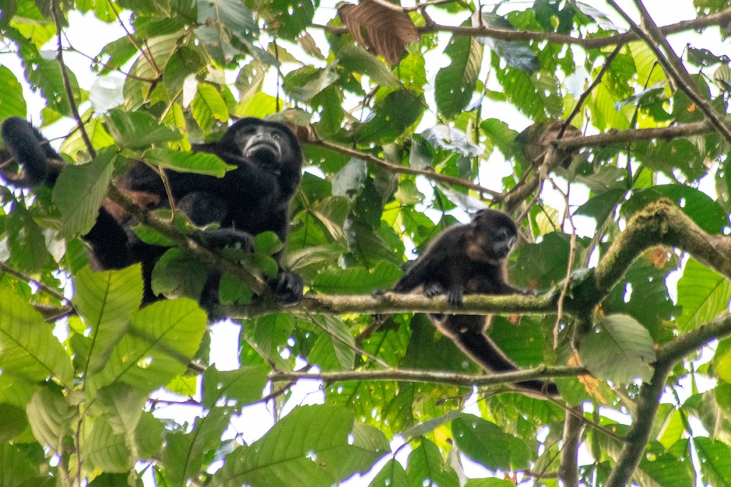
We crept very quietly through the jungle and were well rewarded with our efforts. We spotted a few birdies that stuck around to get their pictures taken, howler monkeys (including a baby) that didn’t start screaming at us, and a snapping turtle in the little pond. I thought it was cayman but the more we watched the less the head shape looked correct.
The best part of the hike for me was looking out onto the pond and seeing visual evidence that it was raining, but not feeling a drop of it because we were so well shielded by the dense canopy. Unfortunately, our dry trek ended with the canopy thinning and we hid the camera until we reached the summit, though the rain died off quickly.
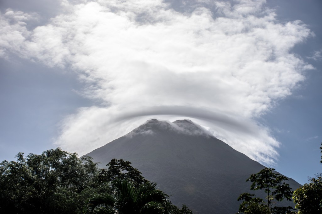
We hung out at the summit for twenty or so minutes, hoping that the clouds might lift enough for us to get a clear view of the volcano but no such luck. Running a little short on time, we headed back to the entrance, making it out just 15 minutes shy of their closing time. We headed back to Nuevo Arenal to plan out our last few days and get the chocolate malt shake things that we’d had the night before.
Day 17: Mastatal
The drive to Mastatal was a four hour drive that we cut in half with a visit to the crocodile bridge that I visited five and a half years ago when we also were on our way to Mastatal with the Costa Rica program.
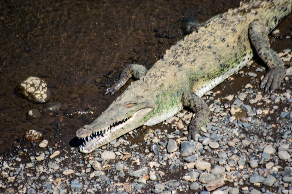
The bridge was much as I remembered it from all those years ago, with maybe a few more tourists and a few more stores clustered around one side of the bridge. The crocodiles were exactly the same, gigantic, still, and very unnerving. Continuing our drive for another two hours the roads got much worse as we got closer to Mastatal.

Eventually we made it back to La Finca Siempre Verde and hopped out. We were greeted by Marcos’s dad and his wife who told us that we were a little early and that Marcos wouldn’t be back until five, oops! Already I could see that the whole place looked completely different and I was positive that one of the buildings didn’t use to exist….We decided to take the extra time to drive over to La Cangreja National Park and check into Villas Mastatal where we’d be staying. The trip to the park was very bumpy as the roads in Mastatal are just as bad as I remembered. Once we arrived we looked around and took some pictures, knowing that we didn’t have enough time to do any of the hikes (the national parks all close around four and it was well after three when we arrived).

We then drove back to Villas Mastatal which had a similar set up to La Finca Siempre Verde with volunteers and dorms, except that when I had visited it hadn’t been finished. I recognized most of it the moment we arrived and I was happy to remember the spots where I knew we had pictures of a younger me enjoying the hammocks. We also admired the finished dorm building and hang out area down below.
When five o’clock rolled around, I got on the WiFi and found a message from Marcos letting me know he was at the soccer field downtown, we jumped in the car to meet him. We caught up and I asked Marcos if he knew why UCI was taking a year off, he told me he didn’t know, that it had to do with wanting to think about re-structuring the program and I guessed it probably had something to do with sorting out staffing for the program. Marcos also told us about the changes in Mastatal. With the growing eco-tourism industry in Costa Rica, the Costa Rican government had gotten wind of all of the little self-started eco-tourism businesses in Mastatal and came through demanding to see permits for buildings and businesses, which, of course, no one could produce as they were unaccustomed to dealing with the government to grow their businesses. So they were given a year to get their permits and update their buildings or shut down. This meant that they also had to comply with building codes and create buildings that were bat-proof in order to keep the tourists safe from rabid bats.
This meant that Marcos’ open air buildings were no longer acceptable, water toilets had to be installed, and they had to make an attempt at accessibility. At this point Marcos brought us to the finca itself explaining that most of what I had seen and experienced had been torn down two weeks ago (if only we had started in Costa Rica! We could have seen it and then helped remove it!). The showers that i had loved so dearly were gone, the composting toilet was kept but currently out of order, and the two story dorm building with the yoga deck had been removed entirely (all but the floors which were kept with their pretty mosaics).
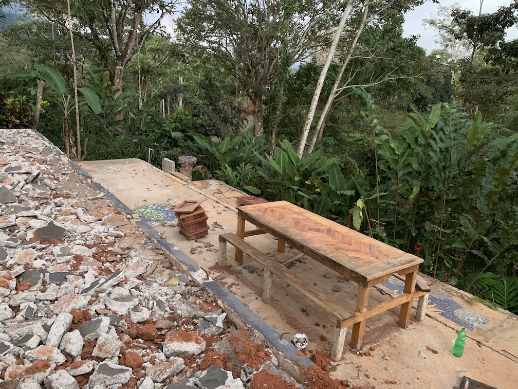

[On the right, me from 2013 displaying a glass bottle I turned into a cup while sitting at the picnic table in the photo on the left.]
The kitchen where we had made homemade jam and bread had grown into a two story building with space for Marcos and Jennifer upstairs and a much large dining area. As he brought us upstairs, I once again saw the view that had made La Finca Siempre Verde so beloved to all of us and had been the desktop wallpaper on my laptop for years.
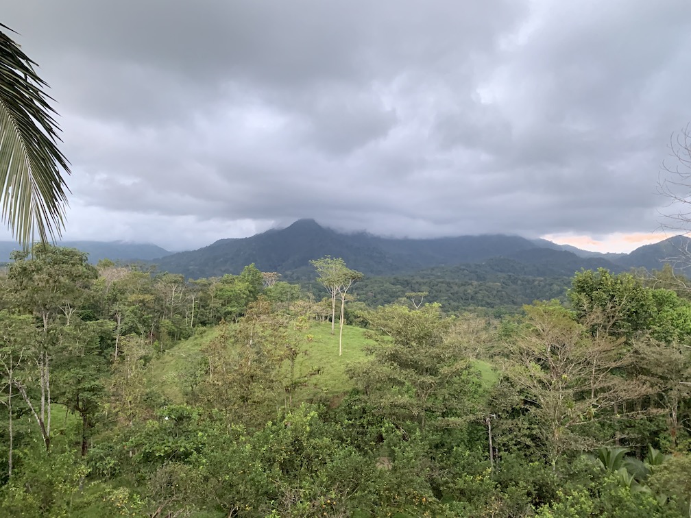
On the left: the view from la finca on that cloudy January day in 2020. On the right: the view from la finca on a beautiful day in March 6.5 years earlier.
And then Marcos began explaining his plans for the future (which needed to all be completed in the next three months because he had a group scheduled to visit). The dorm would be re-built as a one story building with chicken wire around it to keep the bats out. This way it would comply but still be a mostly open air building. He said he wanted to re-create the yoga deck but that the wind has gotten so bad recently that he’s afraid of putting a second story on it. There would be a new entrance to the farm that would have a long concrete driveway for cars to drive up and would be lined with both ornamental flowers and flowers that would attract butterflies and hummingbirds. About halfway up the driveway he’d started construction on a small building that would become a plant nursery (there was a moment of confusion here as I thought he meant kid nursery for his new daughter and I wondered why the kid would be kept so far away). The upstairs area where he and Jenny lived would have a second bedroom added for the professors and staff accompanying groups to sleep in as well as a little souvenir shop. He was also planning on building some little cabañas for couples and AirBnB guests to stay in. He also showed us his wood shop which had been completed and Aaron admired the bamboo construction.
With the tour completed Marcos had to get back to the group he was guiding so we took a quick picture together and I promised him that I’d let him know next time we were in Costa Rica to come back and help out and see the farm finished. Then we went back downtown and got dinner at La Soda which I recognized immediately when we walked in. The woman served us the best Casado that we’d had yet and we ate dinner in the company of a kitten who spent the entire meal in my lap attempting to get past my guard and climb onto the table to eat our casado.

Marcos and me, 6.5 years later
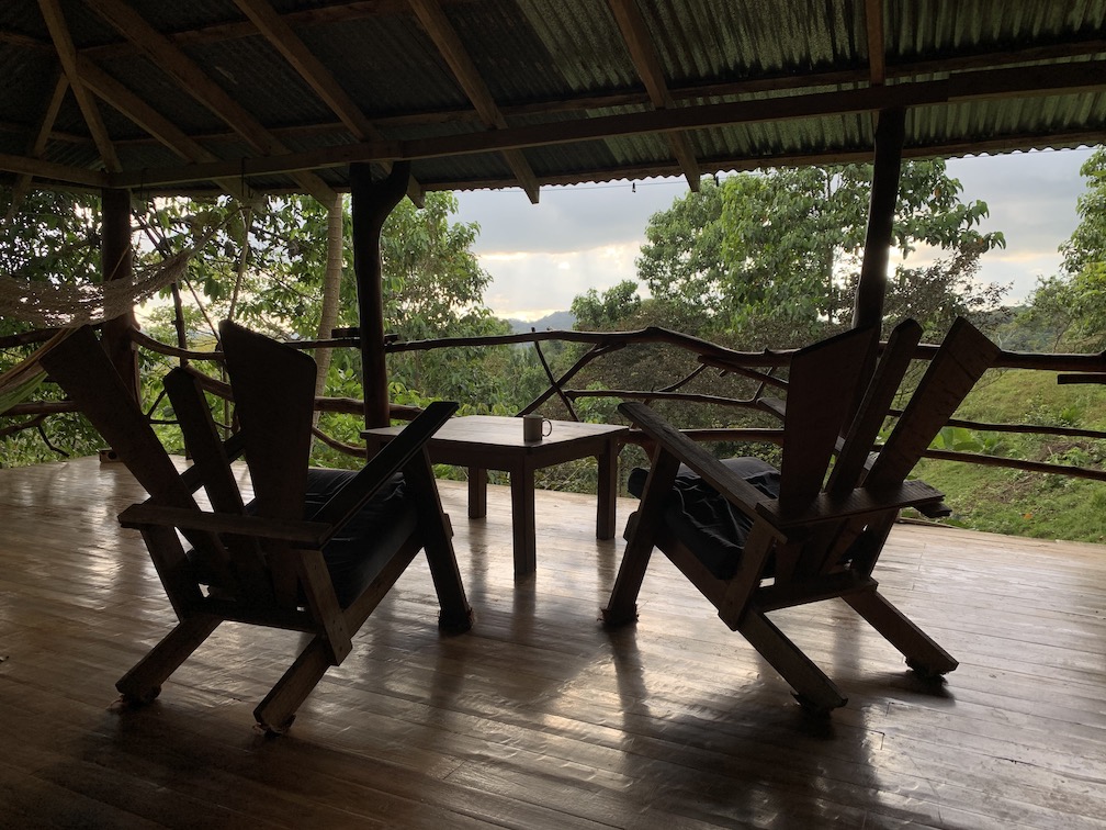
Back at Villas Mastatal we introduced ourselves to Raquel and Javier and I mentioned that I’d visited years ago and Javier recognized Irvine from my shirt and greeted me as an old friend, welcoming me back to Villas Mastatal. Then he led us, not down to the rooms built into the dorm as I expected, but up to some studio apartments that had been newly built up the hill (I assume these were built after the government demanded permits). They felt like we had walked into a Hilton hotel room and left the jungle far behind, it was a spacious room with a giant, comfortable bed, a little kitchenette, gigantic bathroom, hot water; even the decorations felt like a hotel room in the US down to the stock painting over the bed of a mountain range that was clearly not located in Costa Rica. Aaron and I reflected on how the changes required by the government and by trying to cater to different customers meant that Villas Mastatal had somewhat let go of the experience of living in the jungle on a sustainable farm. While I knew Villas Mastatal also had a composting toilet, it wasn’t even mentioned to us as an option.
Day 18: Tapantí National Park
We woke up early and jumped in the car to drive the two and a half hours to our next stop to the east of San Jose. The drive became much longer as the terrible roads added time, we took a detour to attempt to visit the University of Peace because I’ve always wanted to see it and were politely denied since we didn’t have an appointment, we went to the nearby Peace Park to see the monument before getting back on the road.
A lunch stop later we finally found ourselves in Tapantí National Park. The ranger at the front gave us a map and explained to me that there were three hikes of varying lengths and a mirador at the end. We decided to start with the mirador and climbed up the steps to the little hut that had been erected at the top.

We enjoyed the view of the waterfall for awhile before heading back down and chatting with the group of Canadians at the base of the mirador. We all joked about fleeing winter in the north and then we headed off to the waterfall hike. This was one of the wettest trails we’ve hiked on with lots of mud and everything being wet despite it not having rained there today. Signs warned us against swimming in the river as we hiked. It was a 1.5 km hike and not too strenuous and once we reached the river we enjoyed hanging out and watching the water. Unlike other waterfall hikes, this one didn’t ended at a pool beneath the waterfall so in the end, the view of the waterfall had actually been much more impressive at the mirador.


We decided to head back to our AirBnB after this and call it an early day. At our AirBnB we were impressed with how well outfitted it was and grateful that they had a washer and dryer we could use. Despite being close to the end of the trip, we did a rather large load of laundry to try to get the mildew-y smell out of the clothes that we had washed previously that clearly hadn’t worked. I also emailed the University of Peace to see if, by chance, they could give us a tour on Thursday before we left.
Day 19: Volcán Irazu/Volcán Turrialba/Monumento Nacional Guayabo
Day 19 and the mosquitoes are still after me. I had gotten a break from the mosquitoes while we were in Guatemala City and Nicaragua (except on the Concepcion hike) but they returned with a vengeance in Costa Rica and my legs became even more eaten when we stayed next to Lake Arenal. Mostly the bites are small and I can’t see them, but I can certainly feel them itch all night long….
We woke up early to an email from the University of Peace saying that they’d be happy to give us a tour on Thursday morning. After emailing back to clarify the logistics we set out to Volcán Irazu, dressed for a hike in shorts and tee shirts. While we ate breakfast I looked over the national park’s website one more time, ignoring the note that said that the temperature at Irazu year-round was 9 to 15 degrees Celsius. Surely that couldn’t be true when it was so hot. As we drove up the volcano Aaron noticed the temperature start to drop. As it kept dropping we both became concerned about how we had decided to dress for the day. We finally reached the top and realized that we were able to drive literally to the top of the volcano, rendering our hiking clothing somewhat useless, the final temperature was about 12 degree Celsius. Everyone else was dressed in parkas and long pants. The tourists all had wind breakers, and I had my little gym shorts and a long sleeve tee shirt that was super thin. Aaron and I jumped out of the car and took lots of shivering photos from the vista at the top.


We climbed back into the car and drove down to the lower parking lot where you could walk the volcano rim. As we drove we both realized that we were quite short of breath and I pulled out the phone to find out our altitude. The top of the volcano was at an altitude of about 11,200 feet, we were well above the clouds and clearly running low on oxygen. At the lower parking lot we took some more photos before jumping back into the car and descending to a warmer climate that had more oxygen.

Our next stop was the Guayabo National Monument, we weren’t convinced Turrialba was open because it had been recently active (in 2014) and the residents had all evacuated. The Guayabo National Monument was created to protect some indigenous ruins that were found in the very late 1800s. The archaeologist who uncovered them took the artifacts that he found and created the National Museum of Costa Rica with them as the ruins were found on his farm. What was left were cobblestone streets leading through a reasonably large town. Large circular mounds delineated where huts used to be that would have (maybe?) been residential buildings while the middle of the town held a grass plaza and the largest mound of them all.


He’d also uncovered some tombs and the entrance to the city was a long cobblestone road with checkpoints on either side of it to control who was able to enter the city.
My favorite part of the ruins was the natural spring on one end of town that was directed into a stone basin and from there, by way of an underground aqueduct, sent to a second stone basin to create a little well on the edge of town.

We also spent the whole walk scanning the trees for any sloths who might have felt like hanging out there and were quite disappointed to not find any.

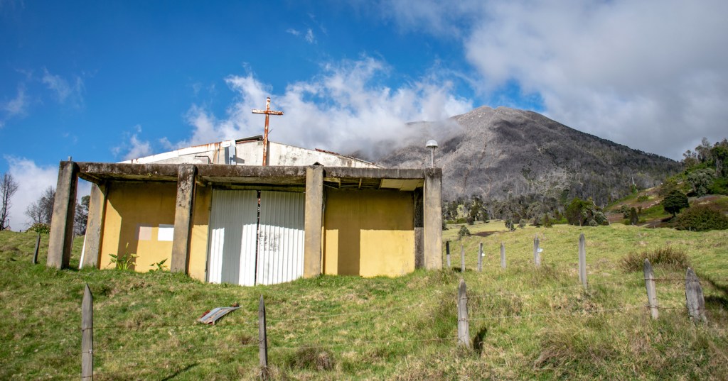
Finished with Guayabo, we headed back to the car and drove up to Volcán Turrialba. Once again we started climbing up the mountainside, drawing even with the clouds, and then climbing above the lower clouds. This volcano wasn’t as high as Irazu because the top of it was covered in clouds but it was surely close in height. At 8000 feet we passed a sign that said “Volcanic Activity Do Not Enter” right next to another sign that said you would need four wheel drive from here on out.
We continued onward in our little two wheel drive Suzuki, confident that they would stop us when we got too close. At 8800 feet we came across the almost ghost town that had been evacuated in 2014. While most of the buildings were empty, one little general store was open downtown to collect payments for folks who wanted to park or camp across from it and the farm next to the parking lot still had cows in it. A sign pointed us toward the volcano, letting us know that we had 6 kilometers left to drive, but a chain across the road told us that we weren’t allowed to drive it.
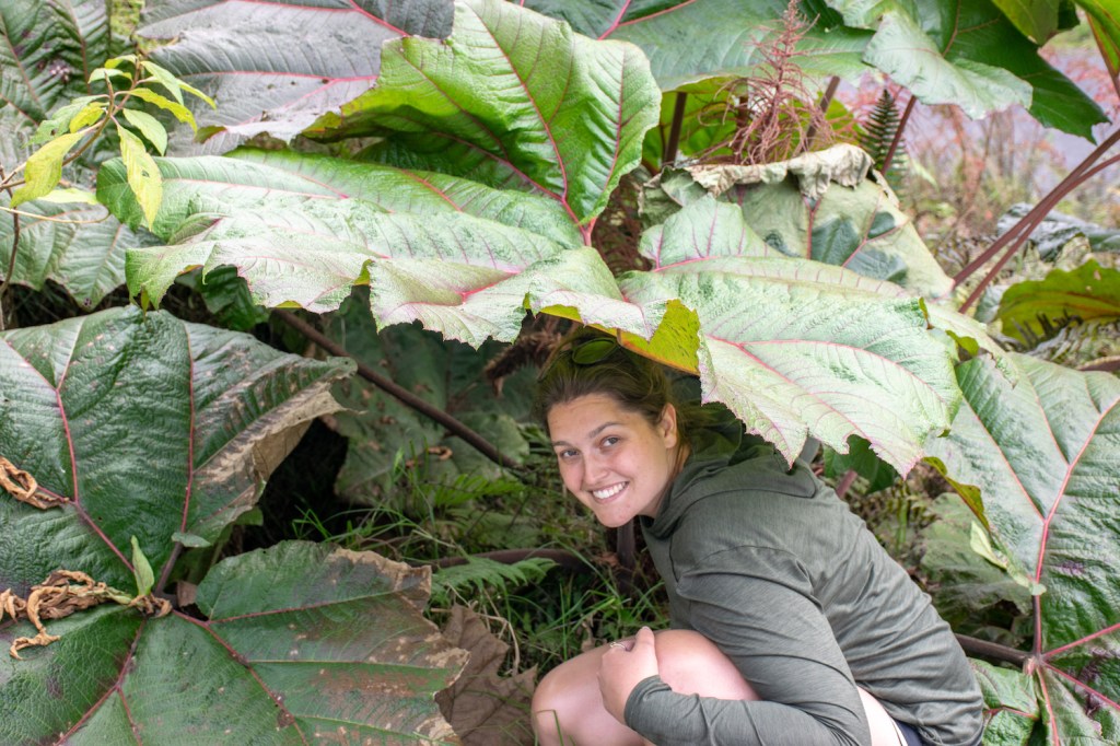
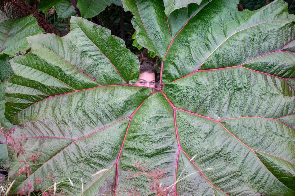
Content with ending our journey there — I wasn’t planning on hiking up 6 kilometers at an altitude of 8800 feet — we took some pictures of the top and I was mesmerized by watching the clouds swirling around the top of the volcano. We then drove slowly back down, stopping just once to take photos with the gigantic leaves that we had seen throughout the trip but had yet to take a good photo with.
Back in town, just at dark, we turned in early and I stayed curled up in bed with a bad stomachache.
Day 20: Braulio Carrillo National Park
With our first two choices for breakfast closed, we ended up eating at a Denny’s. The waiter there complimented us on our Spanish and then started suggesting other places for us to visit in the area. He began with suggesting the itinerary that we had completed the day before. Once we told him we’d done that, he paused for a moment and then started mentioning some very off the path places to visit that we hadn’t heard of but wouldn’t have time to visit as we are finally nearing the end of our journey.
Once we had finished eating we headed back into Costa Rican traffic to make our way to where google maps said the entrance to the Braulio Carrillo National Park was. Google maps was wrong about where the entrance to the park was, apparently the entrance was actually on the other side of the volcano near Poas. At the point we realized that we were in the wrong place, we were two and a half hours from the correct entrance and from Poas so we continued forward and got to admire the mist in the rainforest and a river that we drove over which was entirely orange, presumably with iron and not with pollution.

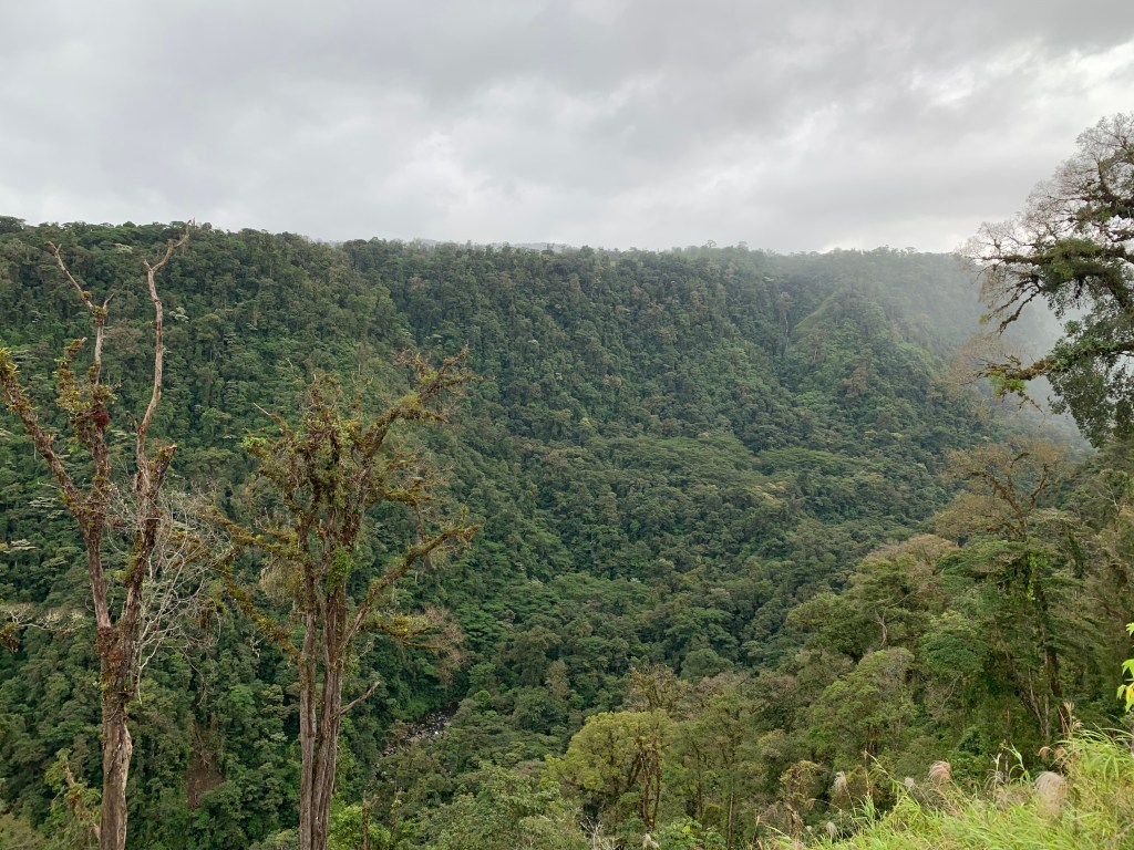
We finally made our way around the north end of the park and then began heading south towards the park entrance, winding our way along the edge of a valley with national parks on each side of us (Poás on one side, Braulio Cabrillo on the other). My nose was buried in a book to deal with the long car ride, so when Aaron pulled over I looked up to find us surrounded by rainforest on both sides with waterfalls visible across the canyon every hundred feet or so. The mist gave the whole scene a somewhat surreal feeling as we hopped out of the car and stood to admire the unmarked vista.
As we neared the parks we came across the Peace Waterfall, a waterfall that our waiter at Denny’s had mentioned that morning. It snuck up on us so suddenly that we turned a corner and were faced with this huge waterfall. It was amazing to watch and we parked, took pictures, and I walked along the wet trail overlooking the pool at the base of the waterfall so that I could admire the backside of water.
At this point we were finally close to the national parks so we decided to drive up Poás because Aaron had really wanted to see it and Braulio Cabrillo didn’t have anything nearly as exciting as an active volcano in it. As we neared the top we passed signs that said that tickets must be purchased online and the rain picked up and came down harder. It also started getting more windy. Once we reached the ticket booth we were informed that the ticket booth had WiFi that we could use to purchase tickets if we wanted to go in, but the ranger gave us a word of warning that with this thick mist and dumping rain, there would be nothing to see if we decided to buy the tickets.
Plans foiled by the weather we decided to go back down the road a ways to warm up in a restaurant where the gales of wind rocked the restaurant to the point that all of the other tourists huddling inside looked at the walls with concern.
Eventually we’d had our fill and I’d had my agua dulce so we decided to go to our AirBnB early and just call it a day, the weather won this time around. Our AirBnB host was the nicest woman you could ever imagine with three dogs, one of which was a big dog who liked to take himself for walks around the neighborhood, the other two were dachshunds who clearly had practiced wagging their tails in sync and begged pets from Aaron and I and we were more than happy to oblige. We hung around the house for awhile, I grabbed a blanket and sat on the couch and read and then we went to a nearby restaurant that Aaron had found. It was an open air restaurant with a museum of old stuff attached with a fantastic view of the city below. We were a little cold with the rain, but I ordered hot chocolate and we had a nice little date night and watched the planes land at SJO off in the distance.
Day 21: University of Peace
We woke up super early expecting there to be traffic on our drive to the University For Peace (UPeace) and encountered none, leaving us at their doorstep at approximately 8:07am instead of 9:00am. Clearly they weren’t ready to give us a tour that early so we were shown to the little cafe where we hung out until our tour. About twenty minutes later we were picked up for the tour where our guide explained the mission of UPeace and showed us the signatory countries to the UPeace charter (countries with large trade in arms and weapons deals were conspicuously absent from the list of signatory countries including the US, many European countries, and many countries from the Middle East). As we walked around the small campus she explained that, despite having a mandate from the UN to exist, the UN doesn’t provide the university with any funding. Because of this, they have many partners who either co-program with UPeace or help provide scholarships for the students attending. Each graduating class (it’s a one year program) has about 150 students spread across 11 different M.A. degrees. They also offer a three year doctoral program, but that looks like you have to be interested in doing research that is closely tied to the professor that you are working with and they didn’t have a lot of information about the doctoral program for me.

We found the visit to be super interesting and informative. They run on a block semester system with all of the students taking one class at a time for three weeks and then switching classes. It has always been a kind of semester that I think is really interesting but that I don’t think that I would like, whereas Aaron thought it was awesome and would totally fit him. Having this style of scheduling allows them to operate using a staff of almost 100% visiting professors from around the world who are invited to come teach a class somewhere between 1-3 weeks long. The MA students all also have to complete either a thesis or an internship which, they told us, students often complete back in their home country. At one point they showed us a map of where all of the students from this year were from and we were amazed by the spread. Students were pretty evenly distributed from each continent with South America and Africa having the lowest number of attendees but still two students from each continent. The largest group of students were from Southeast Asia and China and our guide told us that this was the first year they had students coming from China after a deal was made between the China Student Commission (or something like that) that had agreed to sponsor 30 Chinese students to come to UPeace.
We also chatted with their housing person and he explained that they had a huge database of landlords that they make available to all incoming students that worked similar to AirBnB, so students had no trouble finding housing. In addition, UPeace provides a shuttle four – five times a day to the central hubs where the students live so that students don’t have transportation issues getting to campus either. All in all it was a very small university that was doing some pretty cool things! We were both impressed and glad that we had gotten the opportunity to squeeze in a tour.
Afterwards we took the car back to the rental place, and had them drop us off at the airport, and then we did that thing where we look at google maps and say “Oh it’s only 2 miles to the hostel, we’ll just walk it with our giant backpacks, it’ll be fine” and then it’s not fine. Although this time was better than the other times and we were a little overheated, but not totally exhausted and I didn’t even get a blister. The hostel wasn’t ready for us to check in but let us drop off our bags. Then we went to go explore and get lunch because I was hungry.
After spending the afternoon napping and recovering from our hike, we got dinner at a little restaurant that had Tortilla de Queso, which Aaron had wanted to try. Essentially it was a tortilla with cheese baked into it, like a quesadilla, but only one tortilla and the cheese is encased inside of it. I also got a tortilla dish which was essentially Casado on a tortilla but instead of meat there was just more cheese. The whole meal was way too heavy for me to I ended up getting full off of a couple bites of Aaron’s tortilla, my plátanos, and the batido de crema that I ordered that once again tasted like the best vanilla shake-thing that I’ve ever had. After walking around a little longer we headed back to the hostel, called it a night, and went to sleep early since we had to be up at 4:15am or so to get to the airport by five, for a seven am flight back to the states.
