After me being home for approximately three weeks this summer, Aaron suggested that I join him for the Australia leg of his Eastern Hemisphere trip that would include Shanghai, Australia, and Singapore, among other countries. Neither of us had been to Australia and it was the only continent neither of us had yet been too, and when it comes to continents, you gotta hit them all. So we started planning and researching, and looking at the weather. Eventually we came to the conclusion that we should head to Western Australia and, in an attempt to get off the beaten track and leave the tourists behind, rent a car and head into the Outback and see if we could survive for a week bush camping.
Overall pros about Australia:
- Clean public toilets in every town
- Free wifi was abundant
- Everyone had a happy, carefree attitude towards everything
- Excellent attempt to share aboriginal history in tourist areas
- They have cool marsupials such as kangaroos and quokkas
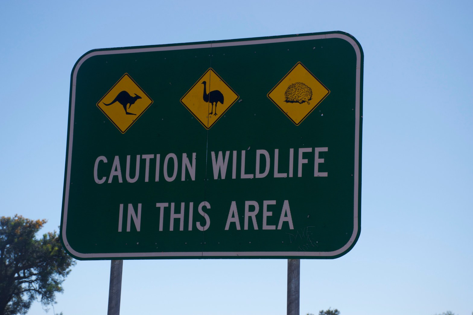
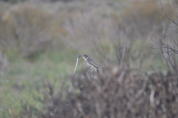
- One day hiking in SoCo = 3 snakes, 7 days camping in the bush in Australia = 0 snakes
The funny thing about traveling in a country where they drive on the left is that you realize how many other societal rules also have to do with traveling on a certain side of the road. For instance, that doesn’t just apply to roads, but also to sidewalks. And I bet you didn’t know that escalators have a side either, I certainly didn’t realize that until I walked towards the right hand escalator and then realized that the one I wanted was on the left. Even more exciting is driving on the left side of the road and realizing that not only is a left turn associated with turning left, but also with crossing traffic. I can’t tell you the number of times that I told Aaron to turn left, when I meant right, because I had comprehended in the directions that we were crossing traffic rather than that we were turning to left. It was a similar feeling to what I experienced in the Middle East where suddenly the first day of the work week is Sunday, not Monday, and that throws off the rest of the week. During our entire trip Aaron and I would constantly find the little things we did habitually when we stopped paying attention. We each tried to get into the car on the wrong side at least once, I reached to my left to unbuckle my seat belt, he kept wanting to toss things at his feet because he was on the right hand side of the car which we’re accustomed to belonging to the passenger. In the end, the best way to deal with the switch was by not associating it at all to driving on the right side of the road. As soon as I started thinking oh it’s different from how I do it at home, I would get confused. It was easiest just to say we drive on the left side and go from there.
In order to provide the best reading experience, this probably should be divided into a few different blog posts; but for my own sake of keeping my photos all in one blog post I’ve given you large headings and I hope that’s enough organization that you can leave and rest your eyes without losing your place.
As a bonus, starting on Day 2, you can put the locations at the top of the section into google maps and see our route for that day.
Day 1: Sydney
It’s hard to fly into Australia, because it’s not near enough to the rest of the world that there are any large hubs there. This is doubly true of Perth, the (small) capital city of Western Australia; so my journey began with a 15 hour flight from LAX to Sydney. Taking advantage of the necessary layover, I gave myself a twelve hours, leaving a good eight hours for me to toss my bags in a luggage locker and go see Sydney.
It’s hard to see Sydney on January 1st, they also celebrate New Year’s Day (surprise!) so the majority of businesses were closed. Luckily, I was able to find a small bakery that was open and I bought myself my first mince beef meat pie with the “tomato sauce.” I took my find to a nearby park that supposedly had spectacular views over the Sydney Harbor Bridge and enjoyed breakfast there. The sauce was labeled tomato sauce, and upon trying it, I realized that it was, in fact, ketchup! After that first meat pie, I believe I averaged about 1 meat pie a day. View of the harbor below.
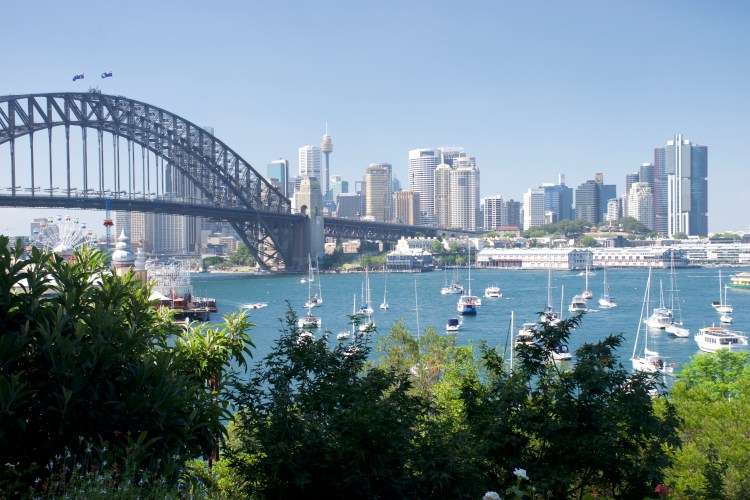
It’s a pretty good looking city.
After finishing breakfast I walked along the beach and found my way up and onto the Sydney Harbor Bridge where I walked south into Sydney enjoying the view of the bridge and the surrounding area.

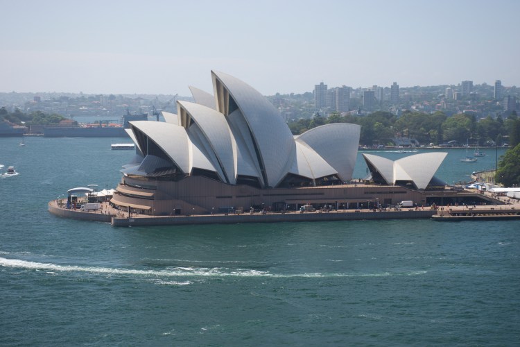
Once over the bridge I headed up to the observatory and then back down along the boardwalk where I found Ferry McFerry Face and silence. I should note that it wasn’t silent for lack of people, there was just no music playing. A whole line of restaurants and shops, ferry terminals, and no music, no loud cars, no one yelling loudly. It was amazing, and it kept up! That was the best part, it stayed just as quiet throughout most of the city. Not that all of the city was devoid of cars but they weren’t as loud somehow, and there was no honking. Aaron and I drove thousands of miles and we never heard a car horn and we only heard a loud stereo once. I definitely could get used to that kind of quiet.


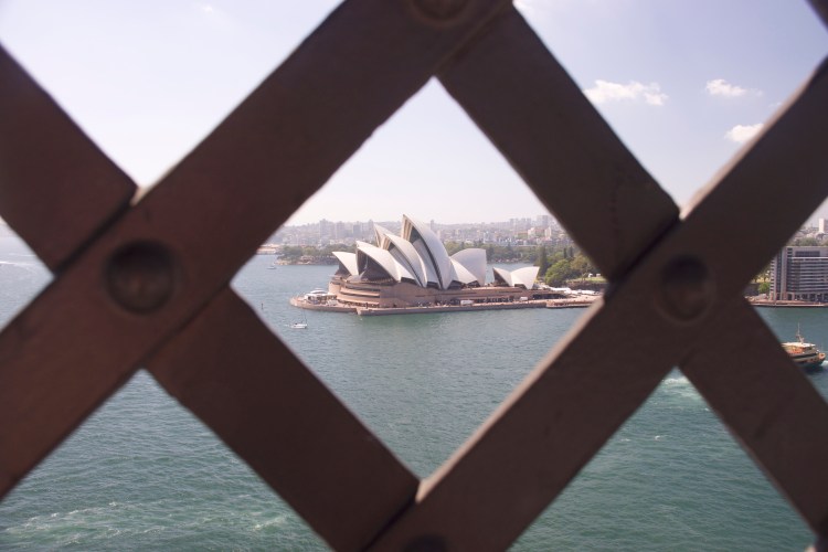
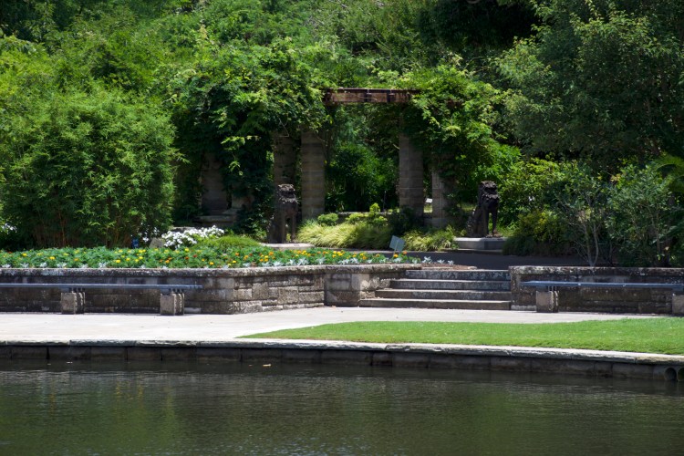
I headed along the wharf and then circled back up through the city to see the public parks and the botanical garden on the edge of the city where I once again had great views of the Sydney Opera House. Due to the New Year’s festivities parts of the botanical garden were still closed so I had to make due with an altered course which my aching feet appreciated. Even my hiking boots couldn’t stop my feet from hurting after 25,000 steps.
Deciding to forego walking up to the base of the Sydney Opera House, I headed back into Sydney toward the markets and “The Rocks” museum where I was promised some air conditioning and a little bit about the history of Sydney. Turns out I needed seating even more than air conditioning and I happily planted myself on the upper level of the museum on a couch and watched the informational videos. It took almost an hour to watch all of them and I think I had almost fully cooled off by the end of them. As a whole Australia seems to work very hard to show the aboriginal history and acknowledge their presence on the continent. There are acknowledgements to the aboriginal historical claim over the land for all of their national parks pages online. The Rocks museum was dedicated to the history of that neighborhood, including providing as much information as was known about the aboriginal community that originally lived there. In addition, most of the popular tourist areas that Aaron and I visited had plaques talking about the aboriginal tribes and provided copies of their myths about the mountains or rivers that were nearby. I appreciated the amount of information that was provided on the aboriginal tribes and the Australians history of colonization. Whether or not judging their attempt to represent aboriginal history and culture was successful, I leave up to those who are better suited to making that judgement.
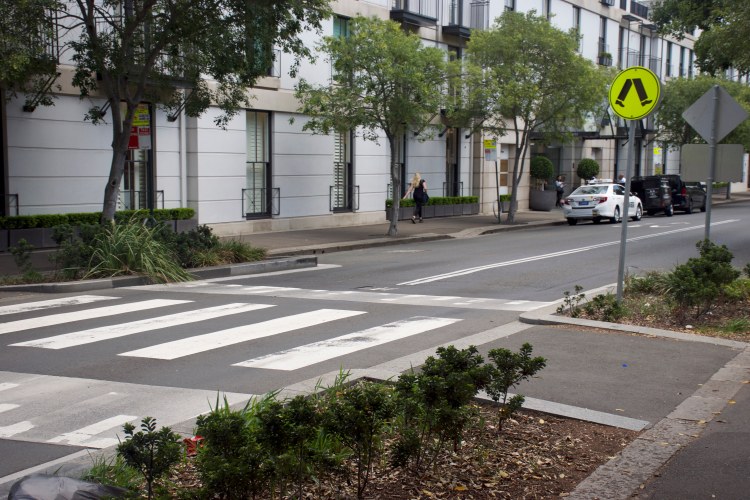
The city is easily walkable and I laughed at the pedestrian crossing signs all over Australia. Perhaps this is where Dr. Seuss got his idea for What Was I Scared Of? (aka Pale Green Pants).
I finally admitted to defeat, letting my exhaustion, aching feet, and sunburn get the better of me and I found myself on the train back to the airport an hour earlier than I had originally planned. Though, in my own defense, I had accomplished everything that I could do on a national holiday on my list.
Back at the airport I re-checked the cooler, headed through security and passed out on my five hour flight to Perth….
Bright and early the next morning I woke up, packed my bags and waited anxiously outside the hostel for Aaron to pick me up in the rental car so we could begin our road trip. His flight landed at 5:30am and he made it to my hostel around 7:00am and off we went!
Day 2: Perth – Mandurah – Pinjarra – Charlie’s Flats
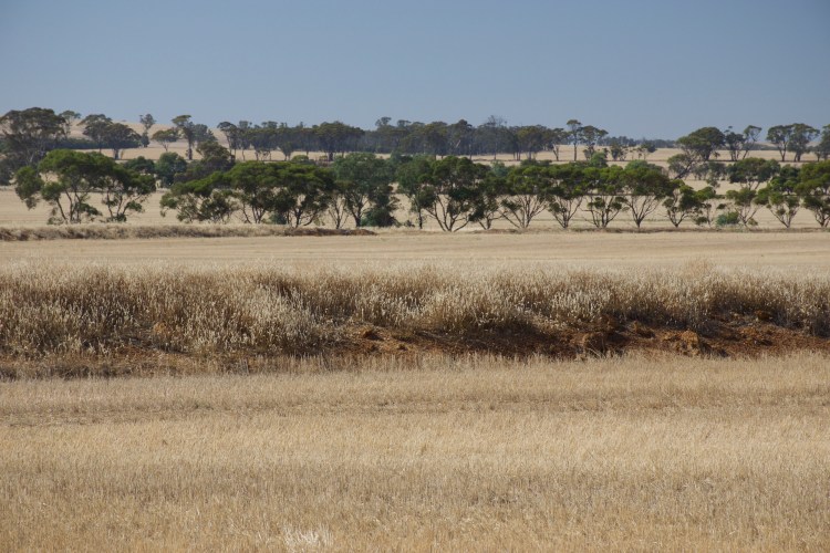
Due to our combined lack of sleep, we planned for the first day to be a quick and easy drive down to Lane Poole Reserve with stops on the way at camping stores, a target, and a grocery store to get supplies. We didn’t expect much from Lane Poole Reserve, in fact, we discussed skipping it. In the end, I decided that exhaustion couldn’t ignored and we already had our original reservation so we headed to Charlie’s Flats and I am SO glad we did. It was incredibly hot in Western Australia, it’s like being in Sonoma County during the summer. Everything is dead, the weather is hot, and you just want to be swimming except the ocean is probably too cold. Luckily, Charlie’s Flats was located on a river so once we made it over there we set up camp and hopped in the river and cooled off. We pretty much stayed there, splashing around until the heat finally broke.


One of the fun parts about that campsite was that we were surrounded by birds. Black cockatoos hung out in the canopy above us and Aaron and I spent a good amount of time trying to take pictures of them as they ate leaves in the trees above us. We also could hear an elusive kookaburra laughing, which almost sounded like it was echoing around us. We fell asleep almost as soon as it got dark and we woke up bright and early the next morning. When sunset is 7:15pm and sunrise is 5:00am we tended to sleep each night from 9:00pm-5:00am. The jet lag was almost non-existent and I suspect that’s largely due to the huge time difference (16 hours) between Perth and Los Angeles.
Day 3: Charlie’s Flats – Hyden – SOMETHING – Newdegate – Fitzgerald National Park – Mason Bay Campground (by way of 4 Mile Campground)
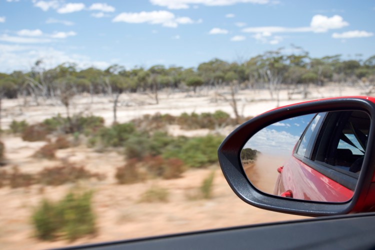
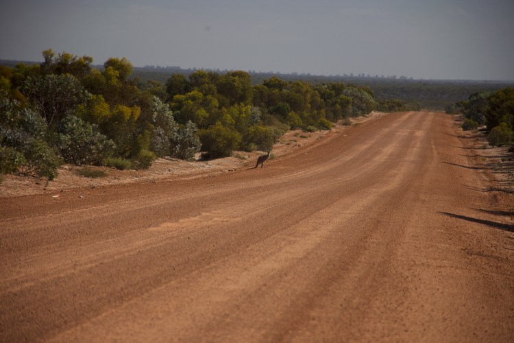
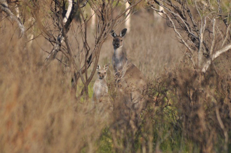
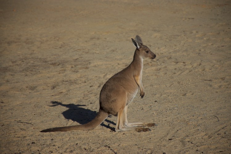
Because we woke up so early, I’ll admit that we didn’t sleep very well, we hit the road at what we would start calling Kangaroo Hour. Charlie’s Flats is located off a dirt road within the Dwellingup State Forest, as we left we kept a sharp eye out for any wildlife, but especially kangaroos. I had almost given up on seeing one when Aaron slammed on the breaks and hissed at me to look in the mirrors. And as the dust cleared from the road behind us, a familiar shape appeared….
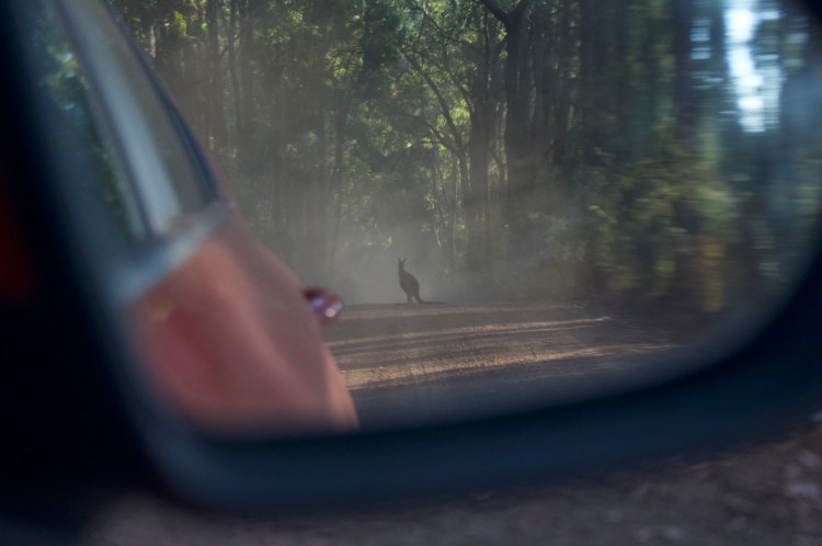
Awwww yeah! A kangaroo! And after our first sighting, we began to see them everywhere for the next half hour or so of our drive as we left the park. Most had roos with them, which I thought were probably the cutest thing until I saw my first joey sticking her cute little head out of her mom’s pouch.
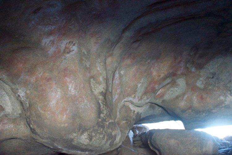
Eventually we left the park and it was hot enough that the kangaroos had all vanished into the bush for the day. Our trip now took us straight into the Outback to Hyden, a tourist trap in the middle of the desert. We had read the reviews of the tourist attractions and everyone complained that they were “crawling with tourists” but it seemed worth the effort to go and see Wave Rock anyways since it was a pretty cool rock formation, and north of Wave Rock was Mulka’s Cave which has one of the largest collections of aboriginal cave paintings in Australia. It seemed worth stopping even if it was crawling with tourists.
By any American’s standards Wave Rock was /not/ covered in tourists. There were more tourists there than most of the other places we went, enough that it was hard to get photos without other folks in it, but really it was like being on a NorCal beach in the summer. There are other people there but it’s no Eiffel Tower. So we took a few pictures and headed up to Mulka’s Cave.

Unfortunately for us, that day it was a good 108 or so degrees in Hyden. The heat meant that we weren’t eager to hang out and fully explore the area. We were boiling, so we headed straight up to Mulka’s Cave and enjoyed the comparative cool inside the cave, photographed some cave paintings and hopped back into the car.
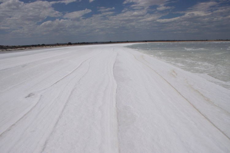
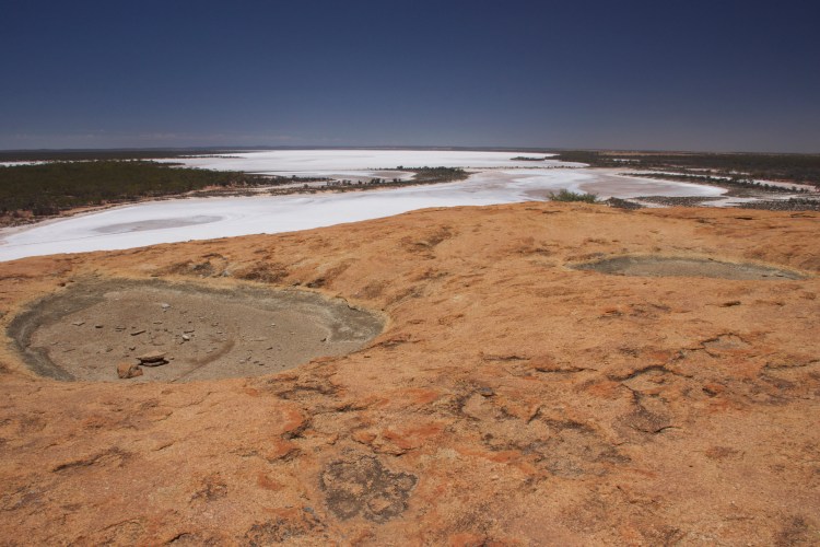
Our route was then supposed to take us straight south to our next campground but it was so early in the day that we took a detour to go through a Nature Reserve with a giant salt lake in the middle of it. The lake still had some water in it so the sky was reflected across its white surface and near the edges the salt sparkled like snow. I was glad for my waterproof boots and both of us had fun hopping out and photographing the area.

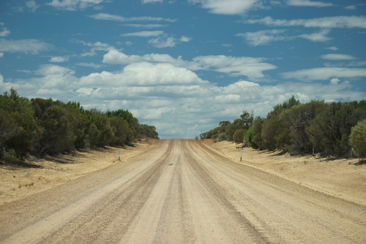

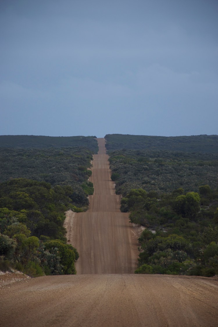
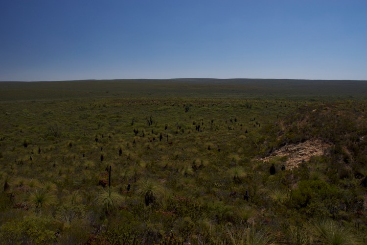
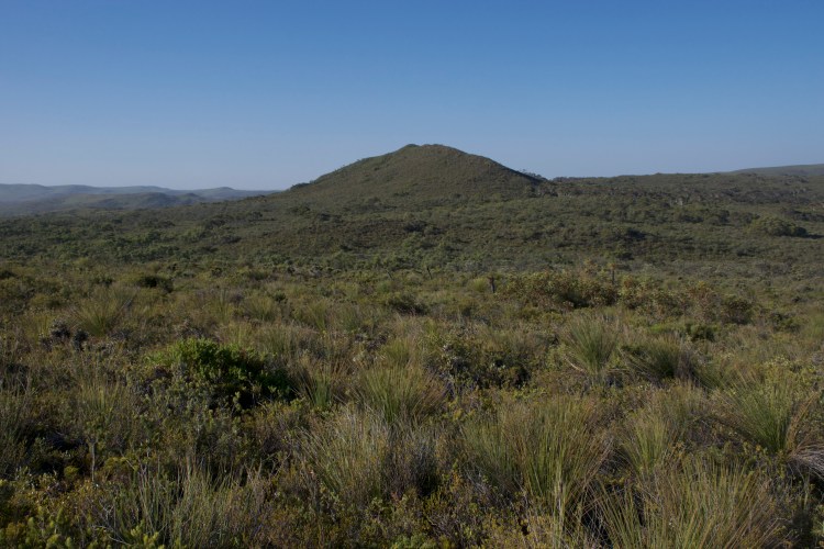
From the salt lake we headed south and drove through the Fitzgerald National Park. While in Mandurah the first day we had bought a holiday national parks pass that would let us go to any national park in Western Australia during a four week period. I knew our route would take us through a few national parks so it seemed worthwhile to get the pass and not have to worry about parking. Once we had the pass it became a personal challenge to see how many national parks we could visit. The national parks in Australia are very different from ours, they range in size from small to large and for the most part they aren’t open to humans. Each one we went to usually had one or two hiking paths, a couple four wheel drive paths and then one road through the park connecting everything. Unlike Yosemite, per say, that is covered with enough hiking paths to last you a week, Australia’s national parks didn’t take long for us to cover because there usually wasn’t a lot of ground that was open for us to cover. Because of this it was easy to add them as stops to our drive and take in the views as we drove through the park, keeping a sharp eye out for kangaroos.
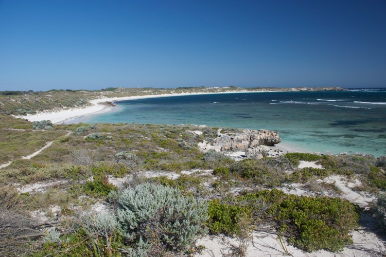
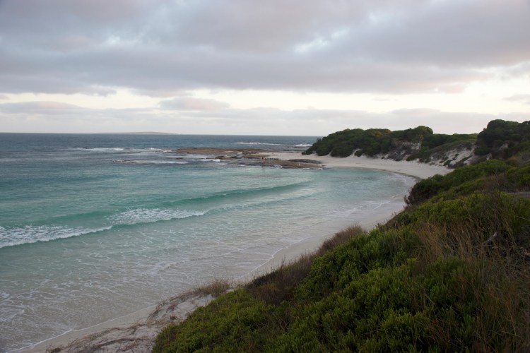
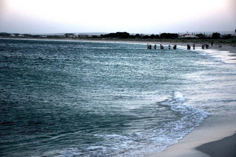
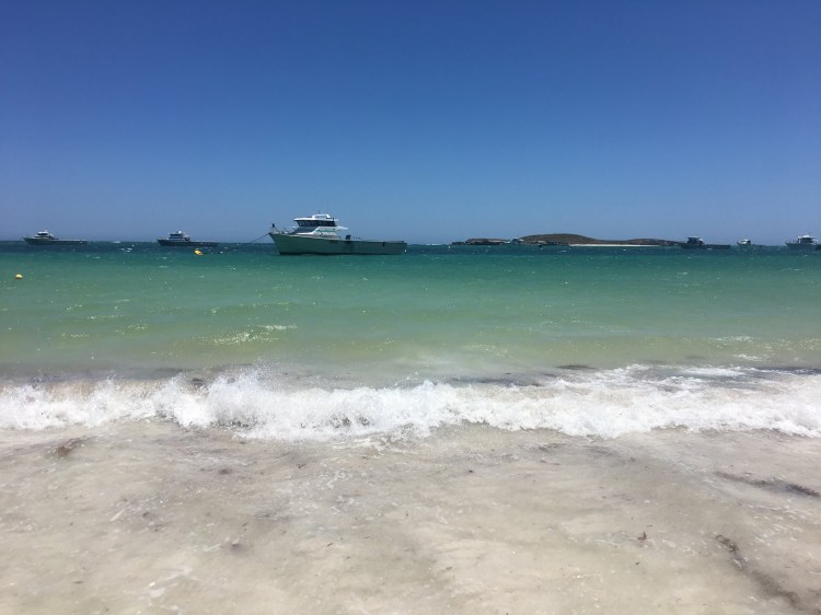
Because of our long detour during the day, we rolled into our beach campsite for that night just as the sun was setting. We lucked out and snagged a spot that was quite literally ten feet from the beach.


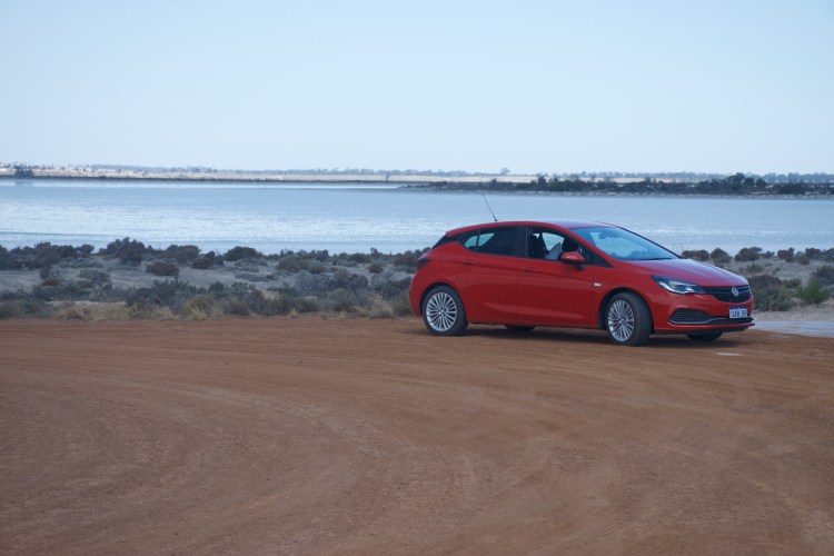
No one else was able to use that spot because they all had large RVs or trailers or camping rigs that didn’t fit back there. We just had our tent and little four door astra so we grabbed the spot, set up camp and made ourselves dinner before collapsing asleep listening to the sound of the waves.
Day 4: Mason Bay Campground – Esperance – Cape LeGrande – Quagi Beach – Stokes National Park – Quagi Beach
Esperance is a nice beach town right next to Cape LeGrande, a national park in the south known for it’s beautiful white beaches; although I really think all of the southern coast in Western Australia should be known for its beautiful white beaches. After waking up early we drove into Esperance where we stopped for coffee, groceries, and gas before heading out to Cape LeGrande. It was a touristy enough town that it had kangaroo meat pies on the menu in the cafe that we stopped in. So, of course, we tried the kangaroo meat pie; though we had already had kangaroo burgers, having bought the patties at the grocery store in Pinjarra.
Kangaroo meat tasted just like a lean ground beef/steak.
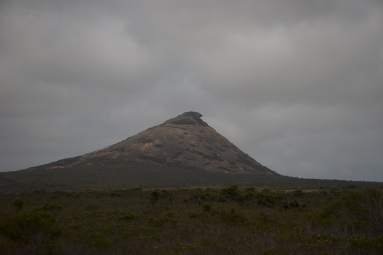
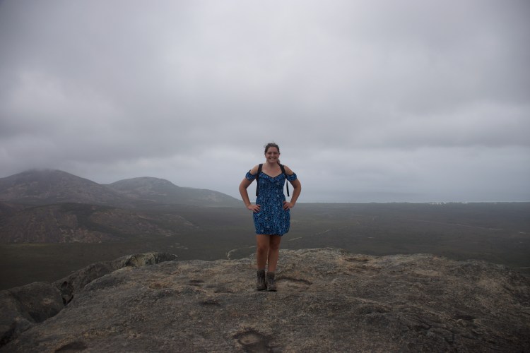
It was a cloudy morning which we appreciated once we arrived in the national park. There was really only one main hiking trail in Cape LeGrande that could be done in one day. The other trail was 17 kilometers long and would have to be done in spurts so we weren’t planning on doing that track. The hike up Frenchman’s Peak was a very difficult walk as it essentially had you climb directly up the side of the granite hill. At the top we found a spectacular cave as well as great views.


After hiking back down Frenchman’s Peak we drove over to the beach to dip our toes in the Southern Ocean and enjoy the white sand before returning to Esperance.

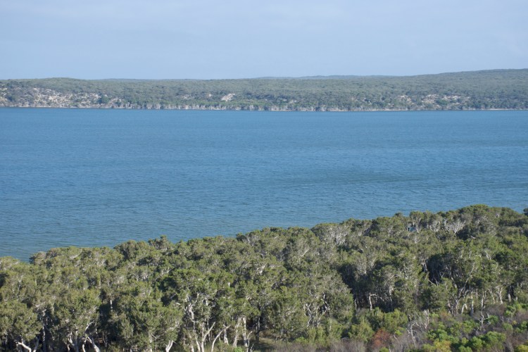
After Cape LeGrande we swung by Quagi Beach to secure our campsite (sites are often first come first served) and then headed back out immediately into the neighboring Stokes National Park. We drove around Stokes and wandered down a walking path towards Stokes Inlet, learning about the geography and aboriginal myths along the way. The view was incredible and we were the only ones there.

At this point we were approaching the evening Kangaroo Hour so we hopped back in our car and slowly drove out of the national park, our eyes peeled for kangaroos. And our efforts were well rewarded!
They were everywhere!
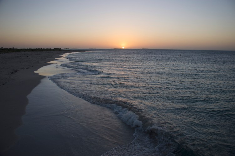
Back at Quagi Beach we strolled down to the beach just as the sun set for a nice view and then returned to our site and cooked dinner. I pointed out the Southern Cross constellation before we passed out for the night. This was our last night by the Southern Ocean, the next day we were heading north into the Outback.

Day 5: Quagi Beach – Norseman – Dundas – Coolgardie – Boondi Rock – Goldfields National Park – Boondi Rock
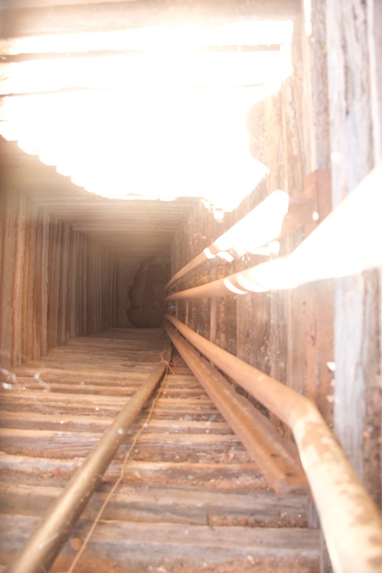
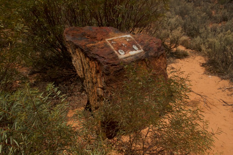
We were up early so by the time we reached Norseman it was late-ish morning and we began the Old Heritage Trail which was 50 kilometer round trip tour of the old carriage route that ran between Esperance and Norseman back during the gold rush. The section of the route we went on ran from Norseman to Dundas, an old ghost town that died almost as soon as it was settled due to larger gold finds to the north of it. We were alone in driving on the trail which allowed us to take our time but it was heating up fast so we didn’t want to spend too much time out of the car. The trail took us both to sites that gave us an idea of what life was like (Old cricket fields, an old race track) as well as old mining sites (An open shaft as well as the entrance to a gold mine).

Cricket track from the 1800s
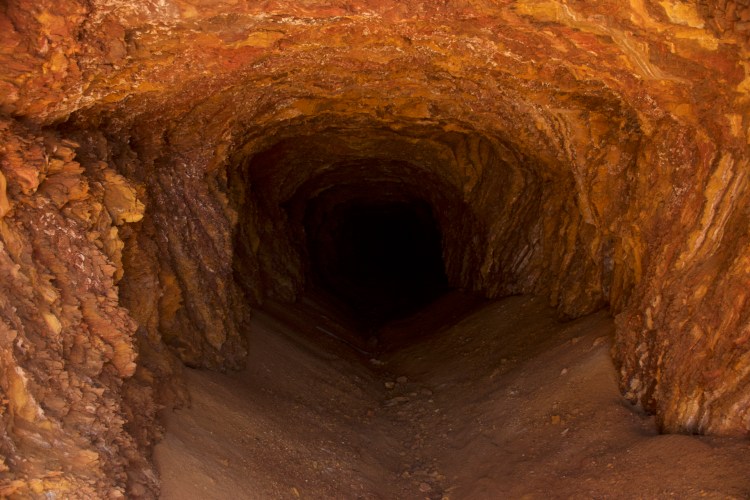
By the time we reached Dundas, the temperature had risen to 111 degrees and we were loath to actually walk around in the heat. Nonetheless we hopped out of the car to inspect the old ghost town of Dundas. When it became a ghost town there was only one semi-permanent building in the town – the hotel. Because of this, the ghost town mostly just consists of old roads. Pictures on some of the information signs showed gold miners hanging out in front of tents wearing too many layers for how hot it gets. We then decided to drive out to Dundas Lake to see if we could find the Lone Grave, an old grave site that no one knows anything about. Because it’s not a super popular tourist attraction it’s not well signed so we did quite a bit of driving before we reached a road unfit for our car and we hiked about 500 meters trying to find the lone grave before admitting defeat to the heat and heading back to the car.
We then continued our drive north up to Coolgardie, watching in amazement and shock as the temperature rose to 114 degrees. By the time we reached Coolgardie it was the hottest part of the day and we did not want to head to our campsite because we’d get there too early and overheat (not to mention get eaten by flies). We went to the tourism office so I could get maps and hopefully figure out if the two nearby national parks had hiking trails (Spoiler Alert: they really don’t). The woman working in there told me that the rec center had free wifi and air conditioning if we were looking for somewhere to beat the heat. Since we had extra time we decided to take advantage of the wifi and check in/cool down before heading out to our campsite.
After about an hour the rec center was closing and we were all set to face the heat once again. Once back in the car we saw that the temperature had finally broken while we were inside and it was only 111 degrees. We headed out to our campsite to quickly set up camp and claim our spot before driving around the nearby national park. Just because it didn’t have hiking trails didn’t mean we could drive around it a little.
Day 6: Boondi Rock – Karalee Rocks – Baladje Rocks – Mukinbudin – Elachbutting Rock – Beringbooding Rock – Talgomine Rocks
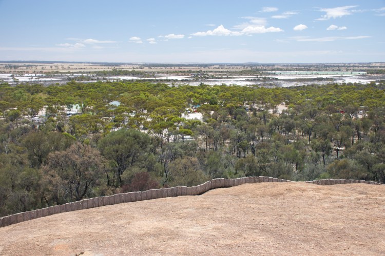
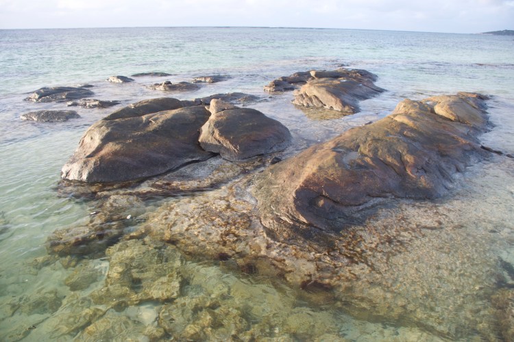
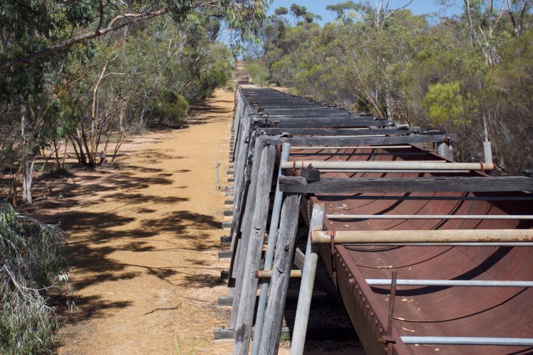
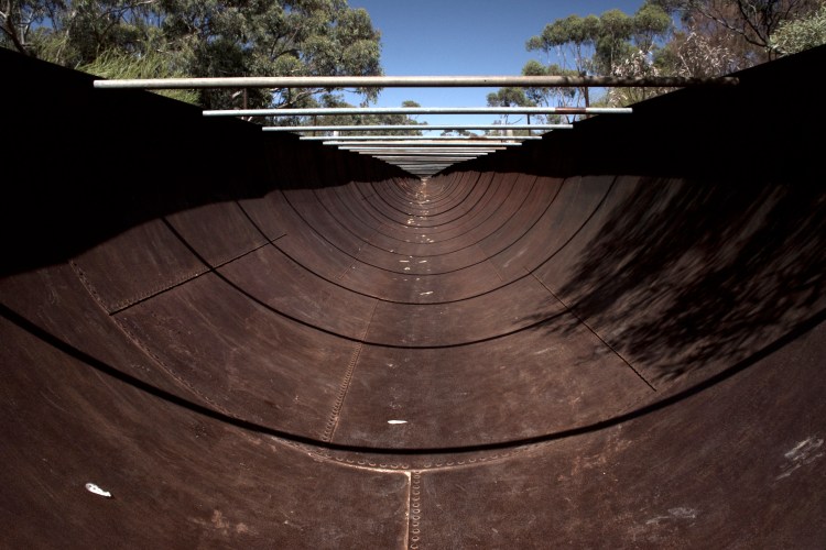
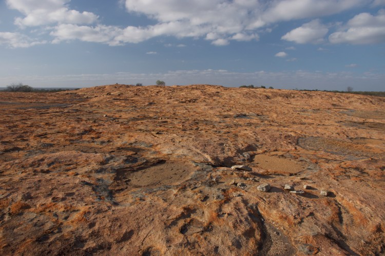
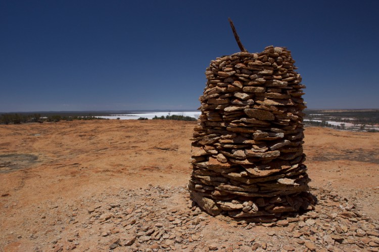
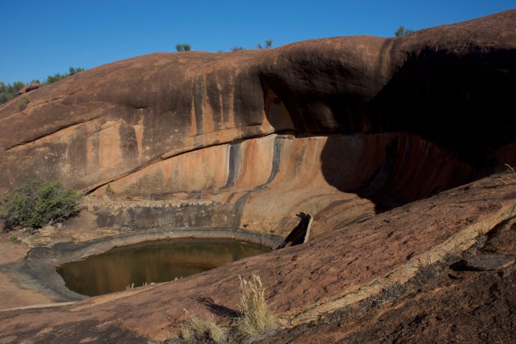
A note on rocks, since we visited so many of them this day: All of these rocks, as well as Wave Rock in Hyden, are not boulders. They’re giant rain catchment systems that were used by the aboriginals and early gold miners (and by folks today) to capture rain water and store it for future use. The area only gets an inch or so of rain per year so it’s important to store what little water comes down. Essentially the “rocks” are giant hills made of, or covered by, sold granite. The water would then collect in little “gnamma holes” in the rocks (natural pools, essentially) and the aboriginal tribes would cover them with sticks and leaves so the water wouldn’t evaporate out. When the gold miners came along and the steam engine was built, water was needed in even greater quantities so the early settlers would build low walls around the entire edge of the hill, using granite quarried from the hill, that directed the water to a manmade dam or catchment site for long term storage. Boondi Rock, where we camped was one such catchment site and we hiked over the rock early in the morning before heading out to our next stop.
From Boondi Rock we headed west, and stopped awhile later at the Karalee Rocks and Dam on the edge of the Boorabbin National Park. This was a somewhat popular tourist site (meaning no one was there but us, but it was well signed and there were walk trails marked with information along the trail) so we walked the trail learning about catchment systems and viewing a “soak,” also known as a well, that was built there. Apparently a man had created a daisy chain of these wells across our route that had supplied water to the various towns and Coolgardie before CY O’Connor designed the pipeline that would connect Perth to Coolgardie.

Leaving Karalee Rocks we headed out and stopped at the Baladje Rocks, a new find from my time with the tourism folks in Coolgardie. This rock catchment system was totally in the bush and had never been adapted for use by the gold miners. This means it was a giant rock that didn’t have the stone walls built around the edge to direct the water. It only collected water in its gnamma holes. There also weren’t any marked hiking trails so we climbed up the side and explored the caves and top on our own. We found all sorts of cool lizards up there but no snakes.
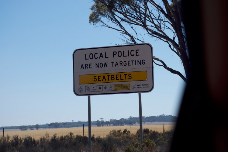
After that, we stopped in the small town of Cooper’s Crossing near Mukinbudin. We stopped in the only open store to replenish the ice in our cooler (even the best coolers can’t handle 114 degree weather) and learned that out in the Wheatbelt, businesses closed on the weekends — including gas stations. We weren’t done with our rocks and were supposed to be driving through the northern edge of the Wheatbelt for both Saturday and Sunday and I hadn’t expected the gas stations to close. Based on that information we re-routed ourselves so that we’d return to the main highway in the south the next morning where we’d be assured of 24 hour gas stations. As an added bonus, the new route would send us through two more national parks.
With that settled, we continued on our way north to Elachbutting Rock, a water catchment system in the bush that is not at all well known. It was mostly a tourist attraction because it has a somewhat impressive Wave Rock (like the one in Hyden but with fewer tourists) and a tunnel cave called Monty’s Pass. We were the only ones out there and enjoyed making our way through the tunnel, and getting away from the heat. We decided not to walk to the top of this rock, instead electing to drive the one-way five kilometer circuit around the outside of it where we were lucky enough to see more kangaroos! (Or a wallaby, we weren’t sure about this one).


Although we were scheduled to camp at Elachbutting Rock, we still had plenty of time and there were campsites at Beringbooding Rock as well so we continued on, electing to camp at Beringbooding Rock instead.
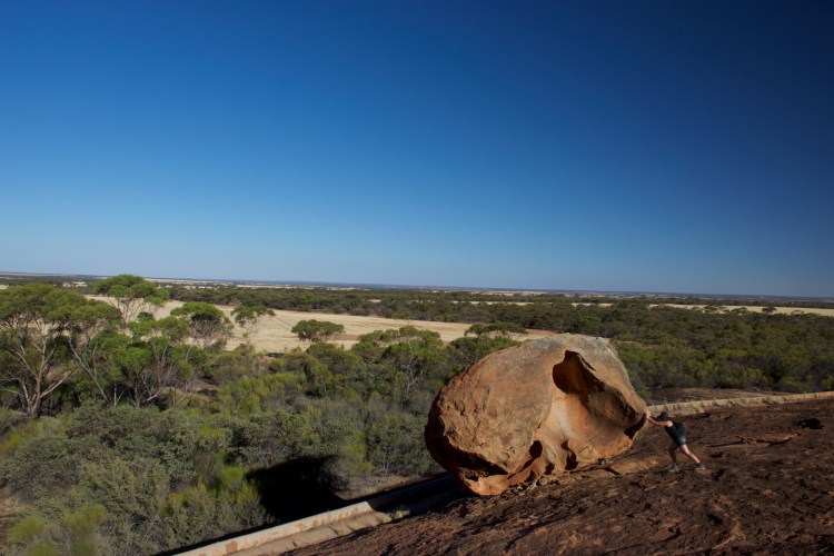
Beringbooding Rock is the largest water catchment system in Western Australia and it’s still in use today. Aaron and I arrived at the park just as a huge semi truck had finished filling up its tank from the storage tank. We parked and then used the map to hike around Beringbooding Rock visiting the storage tank, kangaroo pond, cave drawings, the balancing rock, and a large gnamma hole. All were very cool sites and I did my best to push the balanced rock down the hill but it didn’t budge.

The problem with the Outback is not that it contains scary wildlife. We didn’t see any snakes and only a few spiders and none were the giant bird-eating spider my coworkers and friends had warned me about. The heat is problematic but not totally unbearable (except when it’s 114 degrees). No, the true problem with the Outback is the sheer number of flies that are constantly buzzing around everywhere. Being on top of the rocks provided a good wind shield that kept the flies away but as soon as we returned to the car we’d be inundated by flies once again and the only remedy was to drive away. In the evening they go to sleep and everything is okay but it’s unbearable during the day so you can imagine how frustrated we were when we’d finished up at Beringbooding Rock and we still had two hours left of sunlight and flies. Instead of sitting there and getting annoyed we hopped back in the car and I hunted down a new campsite for us that would be on the way to our new route. This meant we ended up driving back down to Talgomine Rocks, another water catchment system within a nature reserve. There was a campsite at the base of the rocks and we arrived there and set up camp fly-free. Unfortunately, we weren’t out of the woods yet. Aaron made dinner while I set up the tent and we ate happily, enjoying that we weren’t surrounded by flies. We did some laundry and as we were cleaning up after dinner, all set to pass out in our tent, Aaron noticed a thousand tiny spiders all emerging from underneath my toiletries bag on the picnic table. Apparently we’d disturbed an egg sack and it hatched all over all of the clothes we’d washed and all of our supplies on the picnic table.
We quickly relocated to the other side of the campground and began washing all of our things and throwing out anything that couldn’t be washed.
But hey — at least there weren’t any flies.
Note: No photos were taken at Talgomine due to exhaustion and a spider attack.
Day 7: Talgomine Rocks – Nungarin – Merredin – Moore River National Park – Badgingarra National Park – Loveland Kangaroo Sanctuary – Leseuer National Park – Jurien Bay – Loveland Kangaroo Sanctuary
We left Talgomine Rocks just as early as other days, eager to get away from the lingering feeling that there were spiders everywhere, which meant that we arrived in Nungarin way too early for their Sunday market to have begun. Instead of waiting for it, we continued onward to Merredin where we finally were able to fill up on gas at the 24 hour gas station.
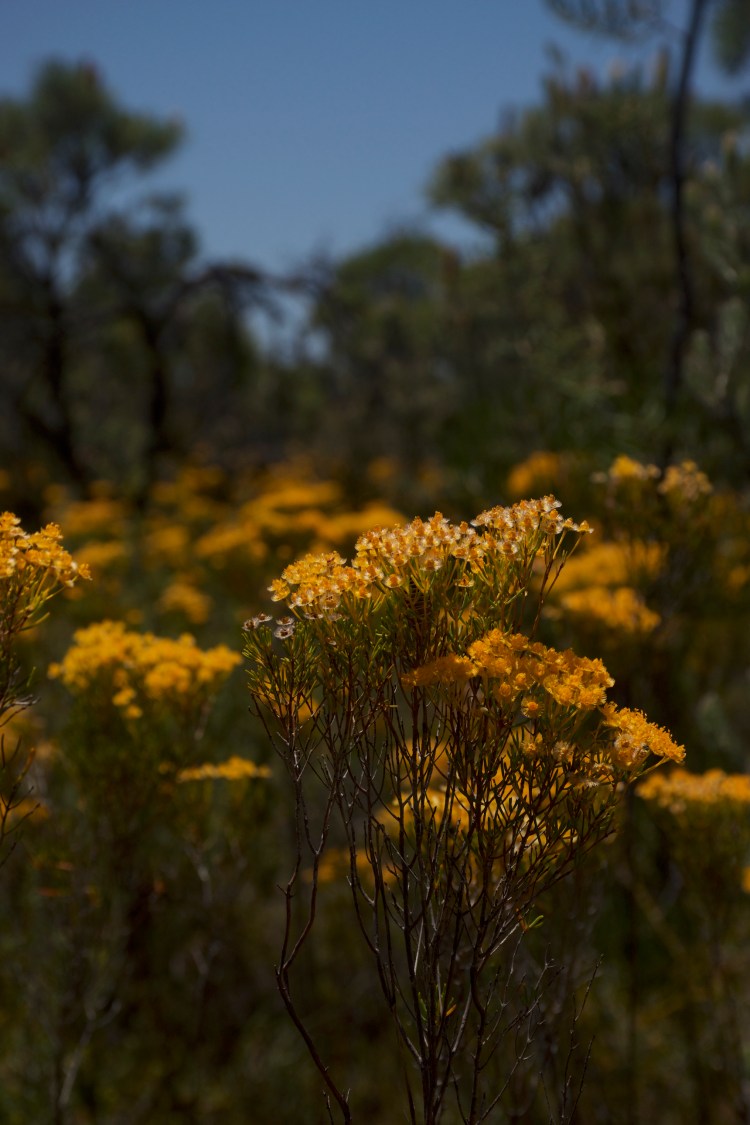
From there we continued west intending to go to the two national parks along the way before checking in to our AirBnB at a kangaroo sanctuary and then taking a quick trip up to Leseuer National Park before settling down for the evening. The Moore River National Park had some lovely wildflowers but was a national park that was really for people with four wheel drive rigs, which we didn’t have but everyone else in Australia did (See pictures of wildflowers from two days ago). We drove along one path as far as we could before returning to the highway and continuing up to Badgingarra. That national park had a 3 kilometer round trip hiking trail which we hiked despite the 95 degree weather. There were some great views from the end of the trail and on the way back we saw a kangaroo and her roo bouncing around among the bushes.
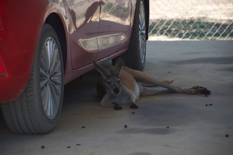
As we drove to Loveland Kangaroo Sanctuary, we tried to let our hosts know that we were on the way and failed. As they put it once we arrived: We’re in the bush! There’s no signal. We passed the sanctuary on the first attempt but caught it almost immediately and backed up and rolled through their front gate. Signs warned us that kangaroos were around so Aaron drove incredibly slowly, both of us hoping that we’d see kangaroos and we wouldn’t scare them away. We saw them almost immediately and started snapping photos.
When we got to the top of the driveway, our host came out to meet us along with about 6 kangaroos who were interested in greeting us. Because they were orphans raised on the sanctuary they didn’t have the usual fear of humans that other kangaroos have and they were quite happy to come over and sniff us and let me take photos with them.
I eventually pulled myself away from playing with the kangaroos so we could get settled into the apartment we were staying in for the night and head back out to the national park. I was hoping to hike the trails at sunset for some nice views. We did hike the trails, and we saw a kangaroo, though we were a little early for sunset.
Since we had extra time and we were near civilization, we decided to drive out to Jurien Bay and see the sunset over the Atlantic Ocean and see if we could find dinner there. We eventually stopped at a fish ‘n’ chips restaurant where Aaron got shark ‘n’ chips. I chose the safe route and made myself a ham and cheese toastie (toasted sandwich) and promised to try the shark. It tasted like chicken.
Day 8: Loveland Kangaroo Sanctuary – Nambung National Park – Lancelin Sand Dunes – Yanchep National Park – Emperor’s Crown Hostel
We woke up early despite not sleeping in a tent and spent the morning re-packing all of our camp gear and feeding the kangaroos and taking pictures of them. Now that we were no longer camping, we wouldn’t need it to be out.


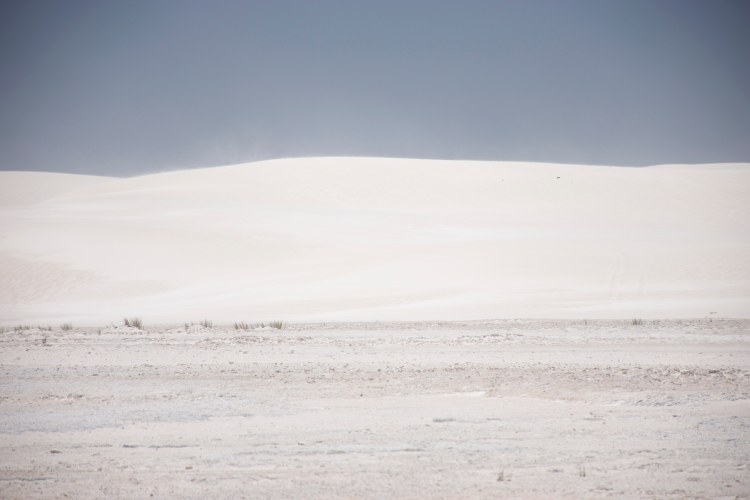
We left the sanctuary just before 10am heading to Nambung National Park, our first stop of the day. The Pinnacles Desert in Nambung is a famous tourist attraction in Western Australia and we had been warned that it’s best to get there around sunset when there were fewer tourists. We got there early in the morning instead and still managed to beat the tourist rush, though it was still more tourists than we’d seen for most of the trip. The Pinnacles were incredibly cool and one highlight was definitely seeing an emu grazing around in the background of one of the patches of rock.


Did you find the picture with the emu in the background?
According to the internet the Pinnacles were formed thousands of years ago when the base layer of limestone was covered by a layer of dirt and then sand. Plants grew in the dirt and their roots eventually split apart the limestone underneath. Then gradually all the dirt and sand was blown away until only the limestone columns that hadn’t been touch by plant roots remained. We enjoyed our drive through Pinnacles and then headed south to Lancelin Sand Dunes.

I had a feeling Lancelin was going to be more for folks with four wheel drive cars and dune buggies so it wasn’t a huge surprise to us when we arrived and found that that was indeed the case. We didn’t spend long there opting instead to stop by the Indian Ocean and dip our toes in before continuing to Yancheng National Forest where I had high expectations for a koala bear sighting.
On the way to Yanchep National Park some 4×4 camping rigs pulled out from the bush onto the highway in front of us and Aaron recognized them as part of Ronny Dahl’s caravan, a somewhat famous youtuber who was a big part of the reason Aaron was interested in Western Australia in the first place.
Needless to say, we followed them until they pulled over at a rest stop so Aaron could say hello.
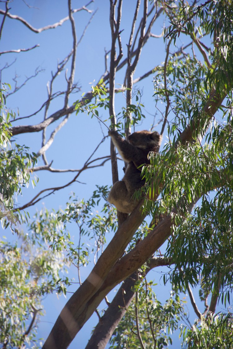
Sometime in the first half of the 20th Century the Perth Zoo gifted Yanchep National Park a few koala bears. Yanchep created a nice koala bear habitat and the koalas have been there ever since, chilling in the trees above a boardwalk that you can walk along and spot them from. For the most part it looks like the koalas are there by choice, it’s possible it would be difficult for them to leave because they aren’t exactly in a eucalyptus forest so they’d need to either walk on the ground or go in other types of trees and maybe not find other eucalyptus nearby but they do seem like happy koalas. We took some cute photos of them circling the area a few times to get the best shots of them.
We also walked over to the Loch McNess lake which was a beautiful marshy lake full of birds and toads that were croaking loudly. Unfortunately I didn’t see the Loch McNess monster.

Finishing up at Yanchep we headed down to Perth to settle in to our hostel and find dinner in the city.
Day 9: Emperor’s Crown Hostel – South Fremantle – Port Coogee – Rottnest Island – Emperor’s Crown Hostel
Perth’s main attraction for tourists is Rottnest Island, a small island about 35 minutes off its western coast that is inhabited predominantly by small marsupials called quokkas. Having done my research I was well aware of the quokka infestation and I wanted to see them. So despite it being quite overpriced, Aaron and I grabbed tickets to take us to the island so I could get my quokka fix. Because we bought our tickets late we ended up on an afternoon ferry leaving us the morning to explore Perth.
But Perth has bad parking options so we headed over to Fremantle (which was where our ferry was leaving from anyways) and began the day at a laundromat so we could wash our clothes. While waiting for the load to finish we found a hairdresser for Aaron and she told him about a shipwreck just off the coast five minutes away that was cool to see. After finishing out laundry I mapped us to Port Coogee where we found free parking, free wifi, a lovely beach for kids to play on, a boardwalk along the new housing development, and the shipwreck. The water was calm so we hung out and read about the Omeo Shipwreck.
We wanted to get lunch down there but the restaurants nearby were closed for some reason. Foiled, we headed up to Fremantle to park near the ferry and ended up getting lunch in a gourmet hot dog store. My favorite part of that place, other than the excellent hot dogs, was that their special of the day was a “vegan” hot dog which was essentially a veggie dog covered in other veggies and melted cheese. Maybe Australians have a different definition of vegan?
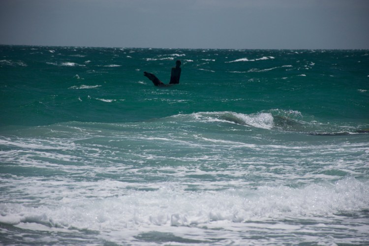
After lunch it was time for us to head to Fremantle. The boat ride over was incredibly rocky and we both ended up feeling seasick and were thankful to grab our bikes upon arriving at the island and begin biking rather than staying on that boat any longer.
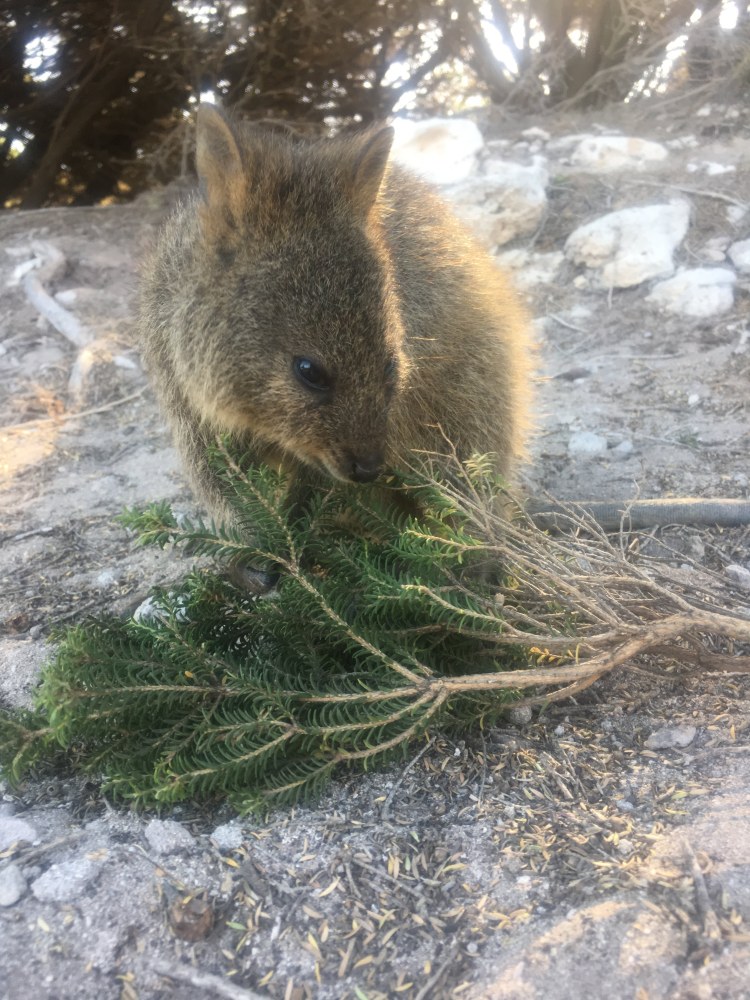
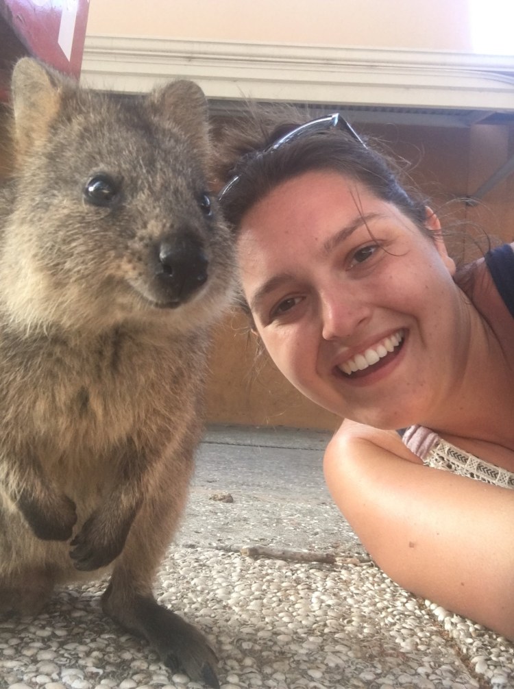
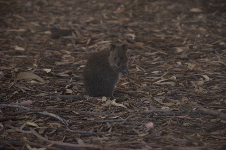
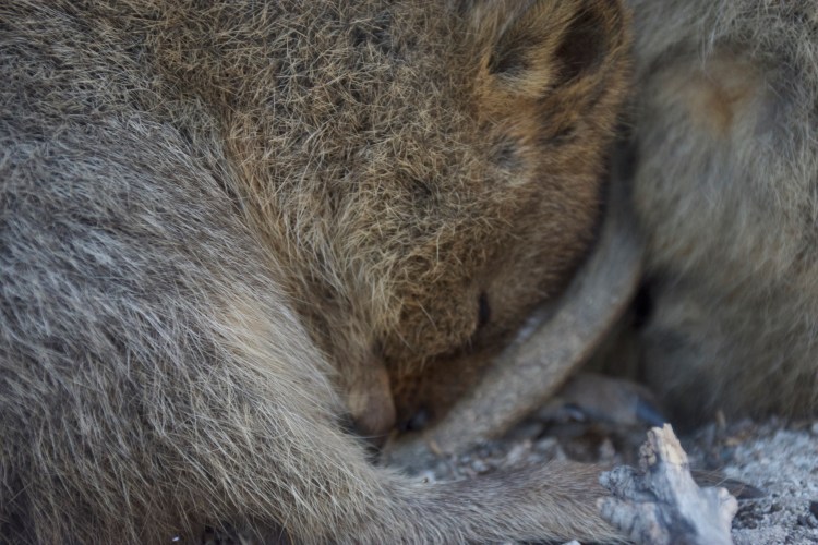
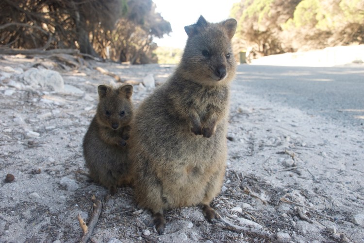
The ferry company had maps available that had marked out four different areas that were good locations for spotting quokkas. They need to re-do their map and just cover the entire thing with quokkas because they are everywhere! They don’t like the sun but as long as you look around in shady areas you will find quokkas. Quokkas are little marsupials that are internet famous for taking nice selfies. If you don’t follow cute animals on IG or if you haven’t been researching everything to do in Perth then you’ve probably never heard of them. No worries, I went to Australia and did some first hand research for you.
The first time we saw quokkas I was so happy that I was like ANY SELFIE WILL DO. I was so worried they’d run away or be afraid of me that I snapped up a million pictures even though the lighting was terrible. Then we realized that quokkas actually kinda of like humans so I slowed down and started taking better pictures.

They really only exist on two islands in Australia, Rottnest Island and Bald Island. They were hunted to mostly extinction on the mainland but their predators don’t exist on those islands and humans think they’re cute, so instead of stunting the growth of these “rats,” they’ve let them live happily. Rottnest was actually discovered by a Dutch man way back when and he saw it was full of quokkas and rightly named the island “Rat Nest.”

But they’re such cute rats.
LOOK HOW HAPPY THIS ONE IS.


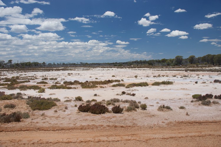
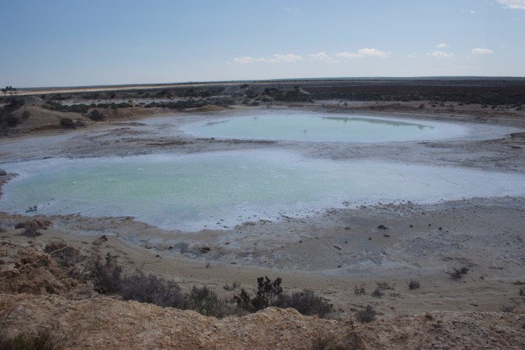
Esperance is a famous city in Australia because it is home to the oh-so-famous Pink Lake. What the photos don’t tell you is that the lake is only a lake for part of the year, and that the pink color is from algae that grow in the lake so it’s only pink during the correct weather and lighting conditions.
Which is a very long way of saying it wasn’t pink when we drove by, nor was it a lake. It was more of a salt flat, which we saw plenty of. Because of this, we felt slightly vindicated when we found a different “Pink Lake” on Rottnest as we biked by.

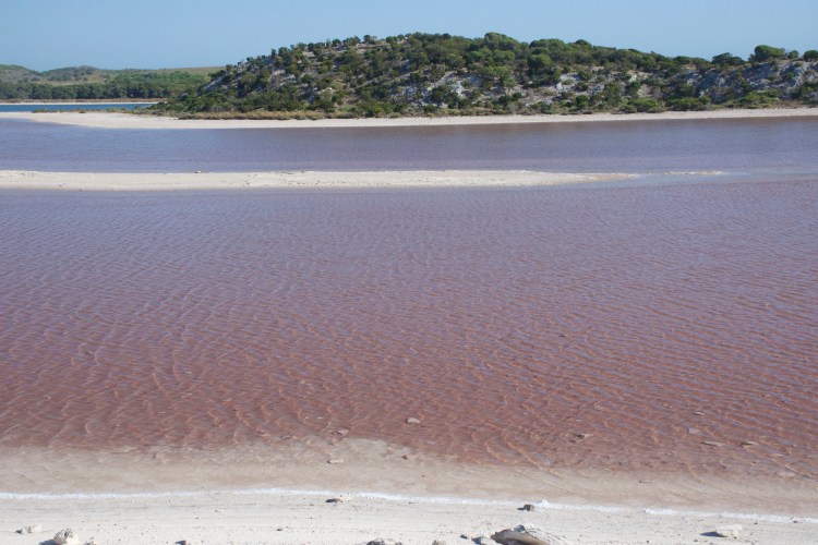
This lake is pink due to the angle of the sun and the color of the dirt at the bottom of the lake. So I can still say I went to Australia and saw a pink lake.

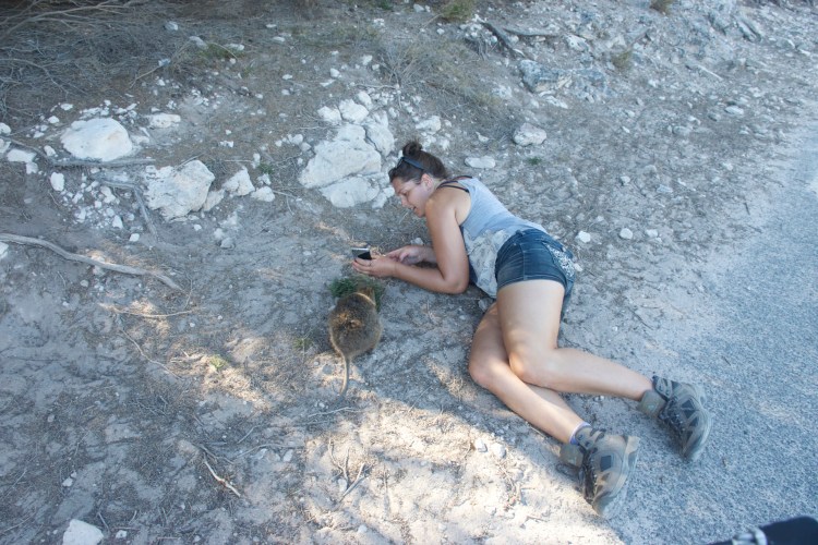
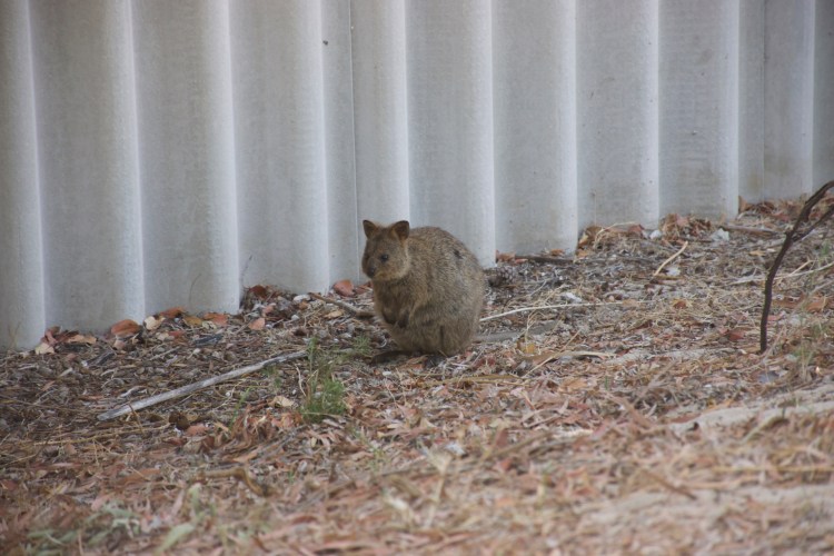
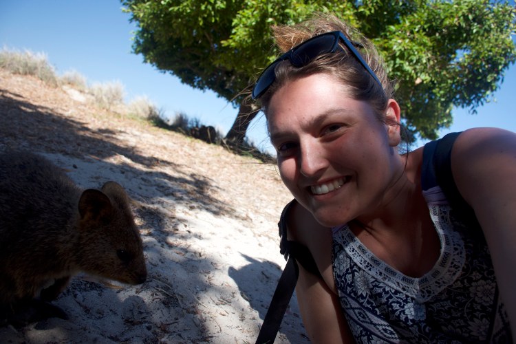
It is actually illegal to touch or feed the quokkas, and I expected that to be not a problem. I assumed the quokkas wouldn’t want me to touch them. Instead I had to fend them off! They tried to climb into my purse, they tried to climb into Aaron’s lap, one tried to sniff my cheek causing me to blur the selfie as I jerked away from it.
Our day ended at Rottnest and we returned to the mainland as the sun was setting, trying to avoid getting seasick and not really succeeding.
Day 10: Emperor’s Crown Hostel – Beelu National Park – Port Coogee – CY O’Connor Beach – Nando’s – Fremantle Prison – Perth Airport
Our final day in Australia was cut short by our evening flights out, and I was exhausted. So we drove through one last national park, going to the very beginning of CY O’Connor’s pipeline before heading back out to Coogee to swim in the Indian Ocean near the Omeo ruins and find the CY O’Connor statue on CY O’Connor beach.

A few notes:
These photos all were taken during the trip, but I don’t feeling like going back through my thousand plus photos to figure out the timeline so I’ve dropped them off here instead.