President’s Day weekend was a long weekend off work for me, and Aaron’s schedule is somewhat flexible so we decided to take some time to drive down and explore Death Valley and get the most out of our jeep.
We did our research beforehand, and headed down to the park armed with the National Geographic Topographic map, a printout of the park map from the National Park website, the Moon travel guide to Death Valley, Google Maps, and a super handy app called “TopoMaps.” Between the five different types of maps we were able to successfully navigate Death Valley despite not having any cell service.
I will say that the maps rank in order of usefulness (from most useful to least useful) like this: TopoMaps, the National Geographic Map, Google Maps, Moon Guide, printout from the Death Valley website.
TopoMaps (once I found the GPS feature) became the most useful of the maps despite its age. The TopoMaps app lets you download old USGS topographical maps and then uses your phone’s gps to position you within the map. The only downfall is that the maps for DeathValley were last updated in 1985, which meant that we occasionally passed routes that were no longer routes. This was any easy problem to fix by cross referencing with the National Geographic topographical map which was very up to date, though it was a little inconvenient to use for navigation in the windy jeep. Google maps was helpful to an extent, though it often didn’t have the 4W trails that we were traveling on. The print out from the website was a nice overview, but we didn’t use it at all for navigation.
The moon guide was an alright addition. We mostly used it to provide ourselves with background information on the places we were visiting. While most of our locations were in the guide and it was very informative, we did go on a few trails that were not mentioned at all in the guide.
So next time you visit Death Valley don’t forget to take TopoMaps and the National Geographic topographic map with you. Between the two of them, it’s hard to get lost.
It’s a long drive to Death Valley so we stayed at a friend’s place overnight and checked out the Blues scene in Reno before making it to our entrance point into the park.
Day 1:
Just outside Beatty, Nevada there’s an old ghost town that died almost before it began (a story we found to be true of most of the ghost towns we passed in and just outside of Death Valley). In its place they created an outdoor art museum, taking advantage of the sparse rainfall. The most famous piece of artwork there is a collection of 14 plaster shrouds (essentially if you took paper mâché, and laid it over a human standing up, and then the human walked away, that’s what it looked like) arranged in a line. It’s called the Last Supper and if you google Goldwell’s Open Air museum the first few pictures will be of those figures. But if you’re me, then the most interesting piece in the exhibition was the couch in the photo below.

The statues were cool too though.
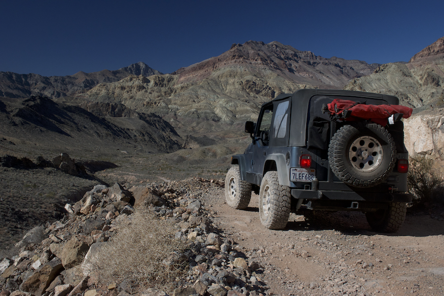
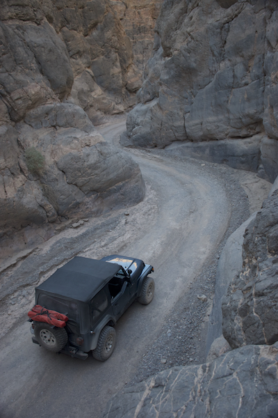
We entered Death Valley through Titus Canyon, a one-way 27 mile long track that wound through a couple mountains, passed Leadfield ghost town, then crept through a final, narrow passageway before letting out into Death Valley. The beautiful trek is for four wheel drive vehicles and generally takes about three hours.

My favorite part of the drive came when we arrived at the last couple of miles. Not only did we drive through medium sized puddles that splashed all over the jeep, but we got to wind our way through tight quarters feeling like we were on the Indiana Jones ride at Disneyland.
After exiting Titus Canyon we headed to the northern part of Death Valley (rather than turning southward towards Badwater Basin, perhaps the most famous area of the park) for a quick stop at Ubehebe Crater. At the crater we expected a bit of a hike but then we got out of the car and realized we were parked quite literally at the edge of the crater. The freezing cold wind drove us back into jeep to continue onto the Teakettle Junction, the Racetrack, and our campsite for the evening just south of the Racetrack.
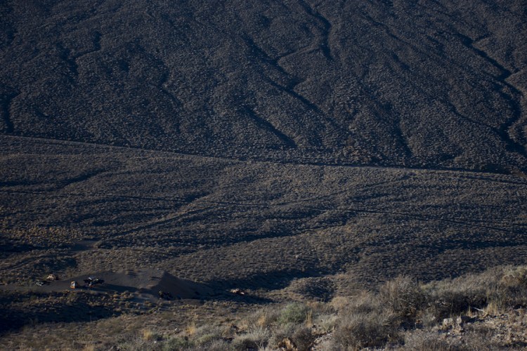
The Racetrack is one of the more famous landmarks in Death Valley, but it does require a ten mile drive down a very bumpy dirt road that requires high clearance (though 4 wheel drive isn’t necessary). The Racetrack is a giant, flat, dry lakebed that very occasionally fills with water. For most of the year it is completely dry, cracked earth (as shown below).

In the middle-ish of the lake is a large cluster of rocks (like you could climb them and re-enact the Lion King type large) that is nicknamed the Grandstand. Located all around the lake are the rocks that give The Racetrack its name. While there are no cars racing in circles around “The Racetrack,” there are rocks scattered around the lake with tails behind them, as though the rocks moved to get there.

Up until a few years ago, scientists could only conjecture at the mystery these rocks provided. There are no footprints or paw-prints or prints of any type to explain the movement of the rocks by someone coming along and pushing or dragging the rocks to their new location; nor is it possible that the rocks managed to drag themselves across the lakebed. You ponder that mystery for a little while, we’ll revisit the Racetrack in the morning.
At that point, it was growing rather cold and we still had to set up camp, so we hopped back in the jeep and drove a few more miles south of the Racetrack to the Homestead Dry Camp, a camp that hadn’t been marked on the majority of our maps.When we arrived, we found that we weren’t alone, many other people had already set up camp for the night in the various outcroppings in the campsite. We worried we would have neighbors when we noticed that the campsite continued back towards the hills. We followed the roads a little ways and realized that no one had ventured out this far because it required four wheel drive to cross the wash and get to the other campsites.
We crossed it easily in our jeep and set up camp for the evening away from all of the other people who had also found their way to this little campsite in a deserted part of the park.

Day 2:
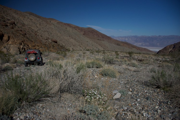
We decided to skip Lippincott Mine Road, in favor of crossing to the Panamint Valley by way of Hunter Mountains. This route promised to be somewhat easier than the Lippincott Mine Road shortcut, and included a stop at Jackass Springs, which had been recommended to Aaron by a friend. It also meant that we once again passed by The Racetrack, this time at dawn. We stopped at a different area and took advantage of the much better lighting.
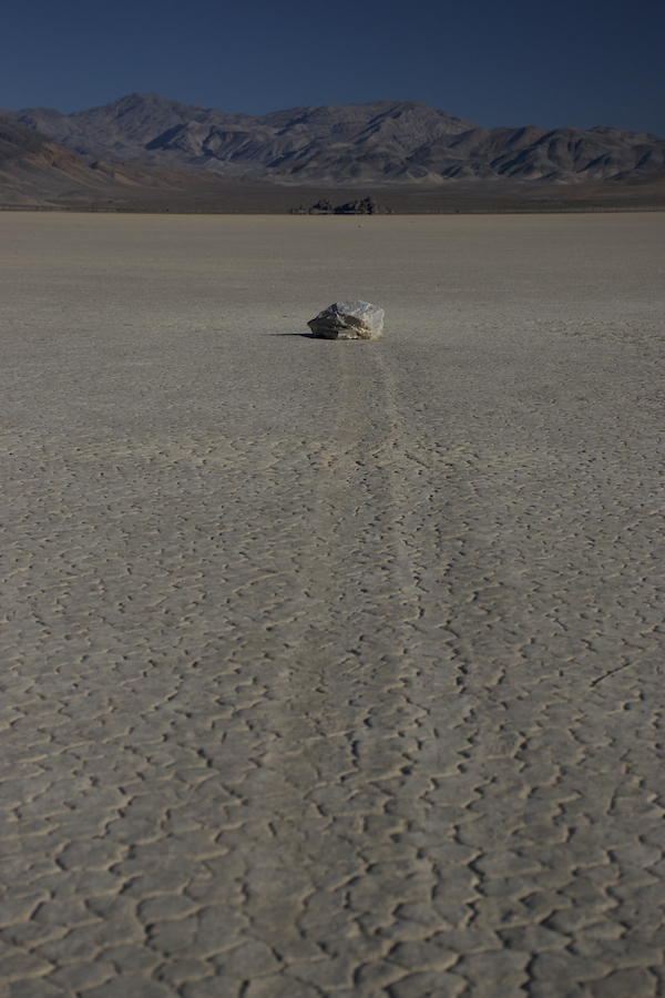
Even five years ago scientists had no proof as to how the rocks were managing to move themselves around the lakebed, though they did have lost of good theories. Just recently, a team of scientists (no doubt wearing the warmest jackets they could find) camped out and witnessed the rocks racing around The Race Track.
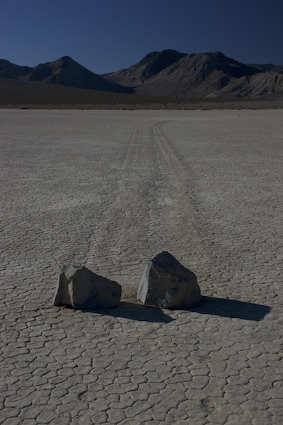
Every once in awhile, in a very specific set of conditions, the rocks will move across the lakebed leaving long tracks in their wake. Because the conditions that changed the patterns in the lake bed are so rare, there’s signage everywhere warning people to keep their cars off of The Racetrack (because the tracks will take years to vanish).
So here are the specific conditions: When it rains, it will flood the lake bed filling it with just a tiny bit of water. If that is followed by a hard freeze, the surface of the lake will turn to ice. If this happens right when there are incredibly strong winds in the valley, the rocks will be pushed along the ice, leaving these mysterious tracks in their wake. Now you see why the scientists who watched the phenomenon needed such big jackets.
North of The Racetrack, and the last bit of our back track before we headed into Joshua tree land, is Teakettle Junction. This three way junction is famous for its collection of teakettles left by tourists passing through.
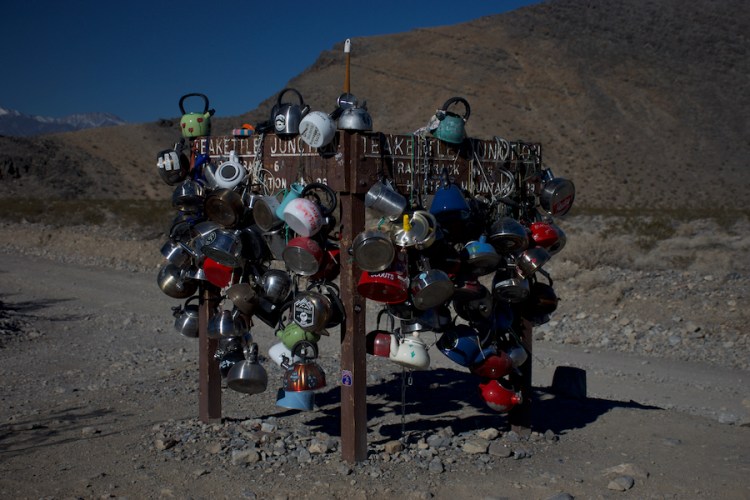
While we forgot to bring our own teakettle to leave behind (much to our horror, we’ll have to come back) we enjoyed seeing the teakettles that were left behind with notes written on them or kids drawings. We stopped for a quick selfie before hopping back into the jeep and driving towards Hunter Mountain.

The Topomaps app was indispensable in marking out different points of interest along or just off of our routes. It marked all the different locations of various prospects and even old mines. Way more old mines than were marked on any of the other maps we were carrying, it was because of this that we knew to take a turn that led us to this abandoned mine.

This mine had no information whatsoever about it in any of our guidebooks so we could examine and make guesses as to what they were mining. Luckily, google will always come to the rescue here. Calmet mine is sitting on a huge deposit of “Wollastonite” Ore which is apparently used to make porcelain. If you look in front of the mine in the picture above you can see a pile of the ore out front. Despite the size of the deposit, this was the only area ever worked.
It was boarded up far more securely than the mines we had seen in Australia and it was at this point that I realized that I went from 23 years reading about ghost towns and old mines but never seeing one; to seeing a huge amount of them in just the first two months of 2018. It turns out mining in the US and in Australia have very similar types of ruins left behind; with townships based on mining hardly ever lasting long enough for many permanent structures to have been created.
At the top of Hunter Mountain we were rewarded with patches of snow as well as this lovely view:

We tried to find Jackass Springs but were foiled. It looks like the spring had dried up, we didn’t even see any burros. The views as we drove through Hunter Mountain made the entire drive totally worth it, even without any burro spotting.
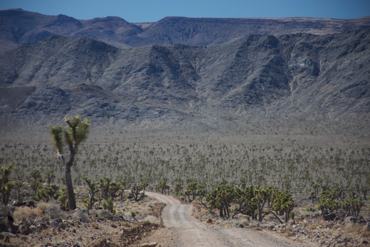
As we headed down Hunter Mountain, we descended into a Joshua tree valley with some of the largest Joshua trees I’ve ever seen.
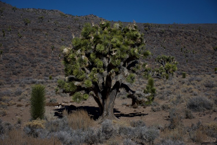
It was Joshua trees as far as we could see which was a great ending to Hunter Mountain, the whole of which ended up being far cooler than we expected. That is definitely a trail that requires a 4WD vehicle, but it’s certainly worth the extra time to enjoy the pass.
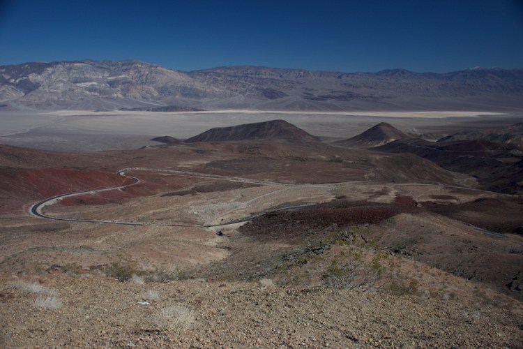
Once we made it to the end of the dirt road we aired our tires back up and hit the pavement for the next leg of our trip. As we headed into Panamint Valley we stopped at Father Crowley’s Overlook and admired to somewhat colorful landscape that was laid out in front of us.
Death Valley (at its lower altitudes), like many hyper arid deserts, has an ecosystem that is based on decomposers, therefore it’s heavy on small rodents, bugs, lizards, and snakes; and very light on any type of larger animal because there isn’t enough flora or fauna to sustain it. We saw a few hawks and some small birds, but mostly we didn’t see any animals. The higher altitudes have far more water due to the melting snowpack and can sustain larger animals like wild burros. Ironically, we didn’t see any wild burros up in Hunter Mountains, but we did have a pack of them wandering along the roadside as we entered Death Valley from Nevada.

Passing through Panamint Springs, stopping only to gas up, we continued on to one of the other more popular tourists stops: The Charcoal Kilns. Ideally we would have loved to camp up here and hike up to the summit of Telescope Peak, the highest point in the park. Unfortunately, we’ll have to return for that as the road past Charcoal Kilns was closed for the winter.
The Charcoal Kilns themselves are a cool bit of architecture that were used to create charcoal and assist with smelting the metals that were mined up in these mountains. They are positioned in a straight line and all of them are the shape of beehives.
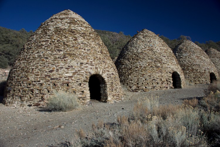
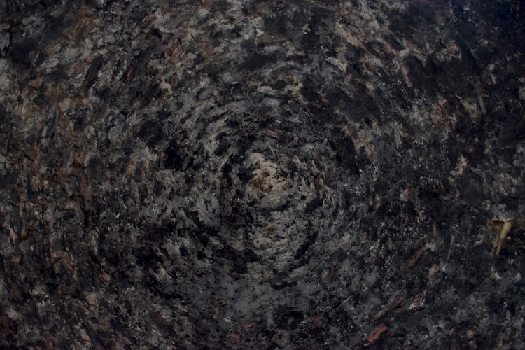
They are so perfectly round that the moment you walking into them, the walls that were originally designed to reflect heat, reflect sound waves, creating millions of echoes. If you stand right in the center the effect is greatest, though it’s still pretty impressive to walk around the edges and hear your footsteps reverberating throughout the room. If you stand in the center and look straight up, you’ll this lovely sight:
The day was beginning to end and we didn’t have a concrete plan for this evening’s campsite. There was a tourist campsite with facilities and such located along our path, but we also knew that we could just drive up any canyon we wanted and as long as we were two miles from the road, we could legally pull over and camp there.
So we drove along and, using Topomaps and our National Geographic maps, we scouted out promising looking canyons. One of our later (as in farther along our route) options was a canyon called Wood Canyon and seemed particularly promising as Topomaps had an old mine marked at the end of the canyon. How cool would it be to camp at an old mine for the night?! We found the turnoff for Wood Canyon and were surprised to find that it lead to a dead end. Signs at the end of the road blocked the hiking trails saying that they were NOT the “Wood Canyon Road.” Aaron and I took this to mean that there was something around here the WAS the Wood Canyon Road. It took a couple of passes but we finally found the turn off onto a dirt road that was partially overgrown and ran parallel to the turnoff we found originally.
At the end of the canyon we found exactly what we were looking for (and perhaps a little bit more). This was an interesting enough campsite that I went and looked up the history of it to tell you all.
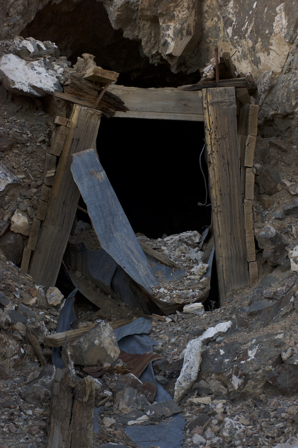
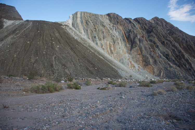
The Argenta Mine is an old mine that was not nearly as well closed off as the Calmet mine that we saw earlier on our way through Hunter Mountain. Apparently not many people make their way out to this mine as the rangers haven’t decided it’s necessary to go in and fully close it off. Despite the strong temptation to explore, we limited ourselves to the first five feet of the mine for photography purposes.
The historical portion of the Death Valley website claims that the earliest reference to the Argenta Mine can be found in an 1875 notice of a new mine that was owned by the Parker company; though it seems unlikely that the mine was worked that early. They suspect that the mine was first located in 1924 and operated by the Rainbow Mine Company in 1925, and then by a different company in 1927-1928. The mine then changed hands after a suit was filed against the company in 1933. The mine changed hands again in 1943 and by 1950 the mine was starting to decline. As its name portrays, the Argenta Mine did yield silver, but also zinc, lead, and a little bit of gold.
The end of the piece goes on to say that the mine never yielded a profitable output nor are the remaining structures historically significant. The page claims that at one point there were twenty structures in the area, Aaron and I were able to easily distinguish the footprint of two buildings.

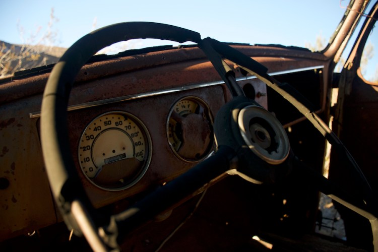
After the mine stopped being used for mining, it became a dump site for broken vehicles and the area is surrounded by junk cars haphazardly placed around the mine and the leftover buildings.
As far as camping goes, the best part of this area was a fifty foot diameter clearing that was slightly raised above all of the ruins at the mouth of the mine. We parked the jeep on that clearing, pulled out our camping stuff and proceeded to explore the area, speculating about what things were and what types of cars had been drug up this canyon.

The “upper mining level” referred to in the caption of the above photo is where we camped.
Day 3: The next morning we decided it was a great morning for a hike to the very top of the hill that we had camped at the base of. What a way to start the morning!
In the bottom left hand corner you can see the clearing where we camped, and, if you look closely enough, the little itty bitty jeep. This was my favorite campsite of the trip, Wood Canyon is definitely a hidden gem in the park.
After making our way back down to our campsite we quickly packed up and headed out, our final day in Death Valley would be spent in Badwater Basin and also required the most driving so we wanted to get an early start.
Before passing through Stovepipe Wells we stopped at the Mosaic Canyon, a pretty, mile and a half hike that advertised itself as a slot canyon hike that would show off marble canyon walls and mosaic stones. Which it sort of was. The first bit of the hike was a slot canyon hike and the stone was polished to a smooth marble finish from the passing rains.


After that it opened into a wide wash with direct sunlight. I was still dressed for the cold desert mornings and overheated almost immediately. After walking for another quarter mile up the wash we turned around and returned through the slot canyon to the parking lot. The “mosaics” weren’t quite what I was expecting, though I’m not really sure what I was expecting, but the marble was definitely worth seeing. We managed to beat the tourists on the way up the canyon to get those two tourist-free shots, but were surrounded by them as we made our way back down the canyon. I suppose that confirms the guidebook’s statement that mosaic canyon is one of the most popular hikes in Death Valley.
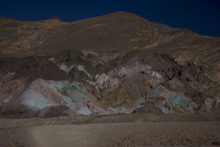
We passed through Furnace Creek after leaving mosaic canyon stopping long enough for gas and a snack before continuing on to Artist’s Drive. This 9 mile, one way, paved road differed from Titus Canyon in almost every way possible but was a very cool drive to see the colorful hillsides showing off all the metals at the “Artist’s Palette.”
Shortly after leaving the Artist’s Drive we turned off onto a dirt road, heading down the Devil’s Speedway at speeds that weren’t nearly fast enough to justify that name. It’s hard to feel like you’re on a speedway when the speed limit is 25 mph…

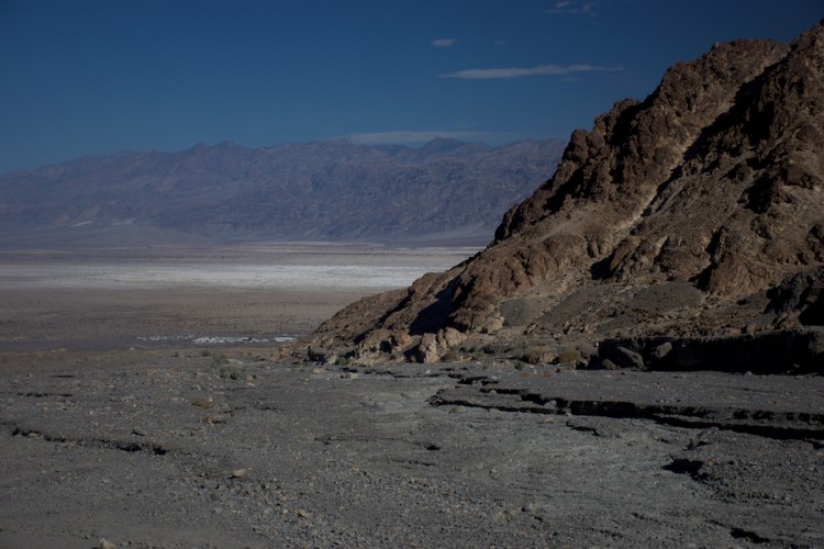
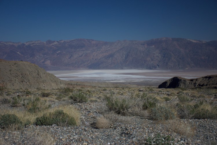
But the view on either side of us as we sped towards the lowest point in North America (282 feet below sea level) made up for the slow speed limit. No reason to speed when you’ve got a great view!
We decided that we should really duck off into a side canyon for lunch and see what the view was from some of these hills. We drove until we couldn’t drive anymore and then pulled out our kitchen camping gear and cooked up hot dogs in the shade of a tall canyon, enjoying the peace and quiet. On our way down to the basin we were treated with a great view of Badwater Basin the whole drive back.
The canyon we headed up was called Hanapaugh Canyon, and while the guide books we brought with us had no information to spare about Hanapaugh Canyon, the internet will shed a little more light on the area. The canyon was once home to two different silver claims that were shared by “Shorty” a man whose well is well-marked in Badwater Basin and a couple. Edna Caulkins Price and her husband apparently worked with Shorty and, at one point lived in Hanapaugh Canyon, trying to find some silver. Her writings tell a little about life in Death Valley in the 50’s and her, her husband’s, and Shorty’s attempts to find silver up that canyon. According to one article she wrote, the road that we drove up to get into the canyon was created single handedly by Shorty who agreed to build the road because he believed the mines would be prosperous.

After our foray into the hills we continued back to the road. At this point it looked like we would make it to tonight’s campsite right at sunset, something we were used to from Australia, though we still didn’t want to delay too much.
We traded seats at this point and Aaron walked me through the finer points of driving stick, and soon I had us flying down the west side road of Badwater Basin. The wind started picking up and Aaron and I switched back, in the distance we saw a sandstorm covering the mountains on the horizon.
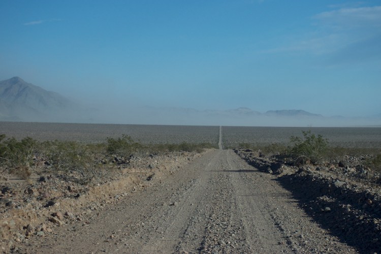
And we stopped and took pictures thinking how cool it was to see a sandstorm in Death Valley. It’s not often that we see sandstorms. The last time I was in a sandstorm it lasted three days and I ran from building to building on the kibbutz in Israel trying to stay out of it. So this one was rather pretty to see and then we got back in the car, expecting it to end suddenly, and kept driving.
And the sandstorm got bigger. And it got closer. And it didn’t die suddenly.

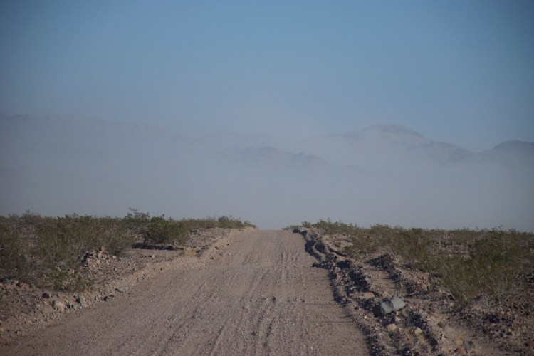
And then it was right in front of us, and we sat there thinking how cool! We get to drive through a sandstorm! And then the sand started getting thicker…

It was at this point that I realized that the broken zipper on the passenger side jeep window was about to become quite problematic. I grabbed a shirt and tried to plug the hole. I was about half successful, on the one hand, the sand wasn’t flying into the jeep anymore, on the other hand I did seem to be turning the passenger side door into a little sandbox. And we kept driving…

And visibility got down to about five feet. What an adventure! We kept driving and eventually ended up on the other side of the sandstorm, the air cleared up enough for us to pull the windows back off and we hoped that we’d still make it to our campsite on time. Fortunately the sand had stopped blowing, but the wind hadn’t, and it was at this point in the journey that I said goodbye to my beloved visor as I turned to look out my window and the visor was torn off my head by the wind and out Aaron’s window in the space of a second. We looked for it but it was totally gone.
When we finally made it to the turn off for our campsite at Saratoga Springs we realized that the sandstorm was still directly over Saratoga Springs. There was no way we could camp there tonight, in fact, looking around, everywhere to the north of us was covered with sand. After trying a few different areas off the road and searching for a suitable campsite, we finally ended up heading down Sheep Creek Springs Road, hoping to find some relative calm up the canyon, and if it was windy, hopefully it wouldn’t be sandy. At this point it was dark enough that we were using the jeeps high beams to navigate the canyon and ended up stopping as soon as we found a reasonable place to camp.
We set up the tent, which took both of us working together to stop the tent from blowing away and then weighed it down with rocks on three sides and placed rocks around each of the tent pole bases. It was windy enough that we were both half convinced the wind would blow our tent away with us in it! Luckily our handiwork did the trick and the tent stayed put all night and somehow it didn’t even tear! (Alright, fine, there’s one tiny hole in the floor of the tent, but none of the seams ripped) I guess I have to give our cheap Walmart tent some credit, it’s been sitting in our garage for about ten years so the fact that it survived that storm was quite impressive.
The next morning, we woke up and started our long drive back up to the north. It’s a shame we didn’t spend more time exploring Sheep Creek Springs, apparently it was once upon a time an old mine and, much like Argenta mine, the footprint of the homestead that was built there is still very visible.

Too many hours later we rolled back into town, ready for a long shower and a good night’s sleep. Next time I’ll have to remember to bring some knitting with me for the long drives in the jeep.
