Sunny Yuma, Arizona was the starting place for our next adventure! Located on the border between Mexico, Arizona, and California, Aaron and I found ourselves in Yuma to visit his family over his birthday weekend. While in the area, we decided to take advantage of the Camino del Diablo, a 4×4 trail which started practically in his mom’s backyard.
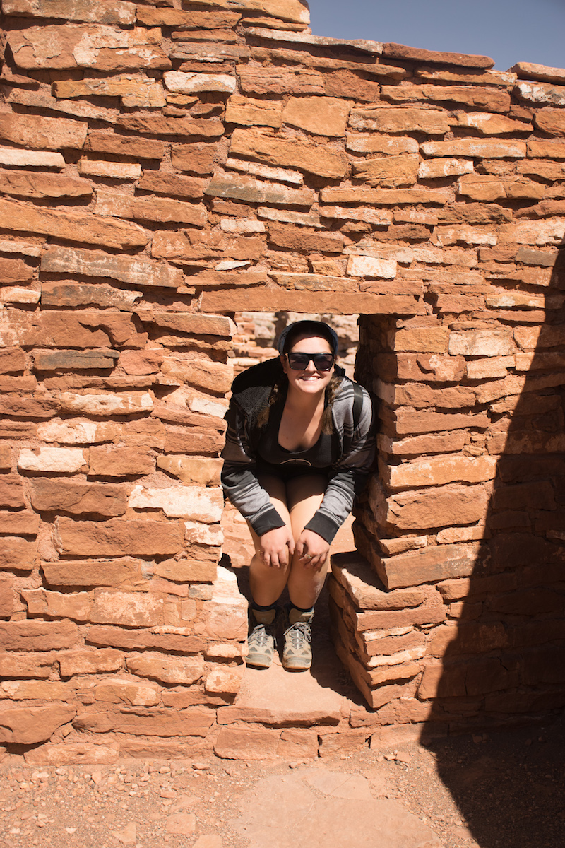
Before heading out there we went out with Aaron’s mom and sister to visit Skull Rock, a giant rock formation that looked like a skull that was off on an unmarked trail. The weather was, of course, beautiful, and so was the surrounding desert. It was a great introduction to the area!
After lots of exploring, a couple wrong turns, and lots of chatting over the walkie talkies about this rock, we finally found it just as we were about to give up.
For the Camino del Diablo, we had done our research ahead of time: we knew that most Youtubers had done the trail in three days, we expected it to take us 2-3 days, and we’d stop by the Organ Pipe National Monument and the Sonoran Desert National Monument on the other side with any extra time we had. Then I’d be dropped off at the airport in order to fly home and get to work, while Aaron drove the jeep back home.
The best laid plans, eh? We made it through the Camino del Diablo on the first day. With all that extra time we decided to have an adventure…
———————————————–
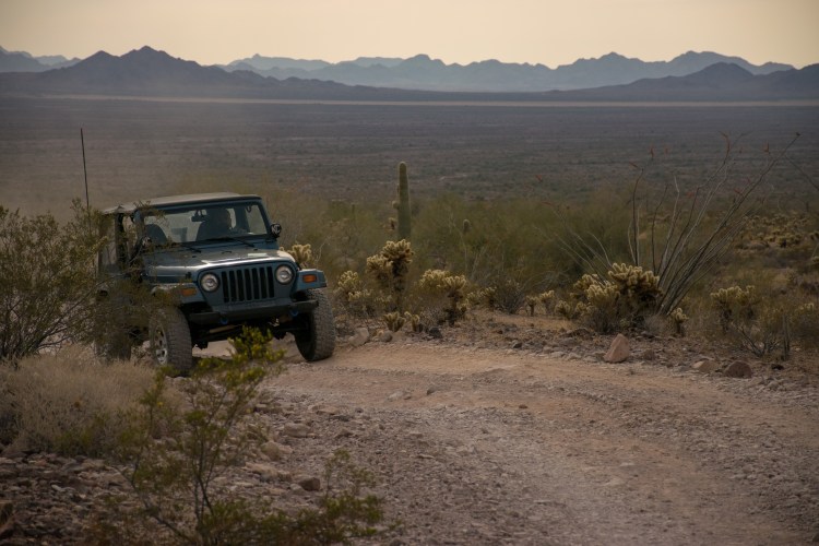
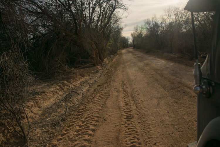
Before embarking on this trip, we made sure to apply for our permits from the Barry Goldwater Range Management Department. The range is also home to an Air Force base and has a bombing range and a laser practice range? Because it’s so close to the border, it also has many undocumented immigrants attempting to cross through into the U.S. Because of that, a permit is necessary to enter the area to let the Air Force know not to do any target practice that day, and to let the Customs and Border Patrol folks know that you’ve been cleared to be in the area. We also called the day we entered the range to remind them that we would be in the area that weekend. We loaded up the jeep with a rather excessive amount of water (better safe than sorry), drove until the pavement ended, aired down our tires, and kept driving.
We once again were using Gaia GPS for the majority of the trip to keep us on track and find all of the cool sites along the way. Here is an overview of our trip down the Camino del Diablo:
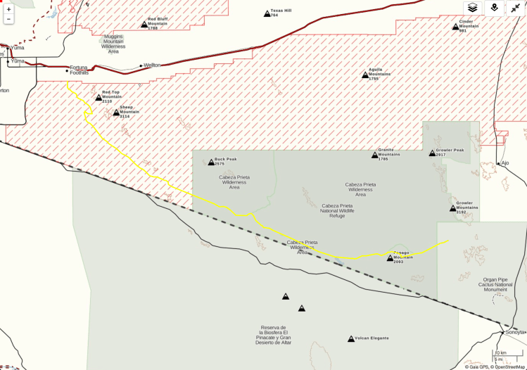
Any trail called “The Devil’s Highway” probably is a trail that you shouldn’t go down. The name almost screams “This probably isn’t a good idea.” Historically, the trail is famous for its history of different communities including the Native American Indians and the colonial explorers using it to cross through the desert (and dying from lack of water). You can imagine why we wanted to bring too much water.
You can also see how close the trail takes you to Mexico, at it’s closest, we were about two miles away from the border.

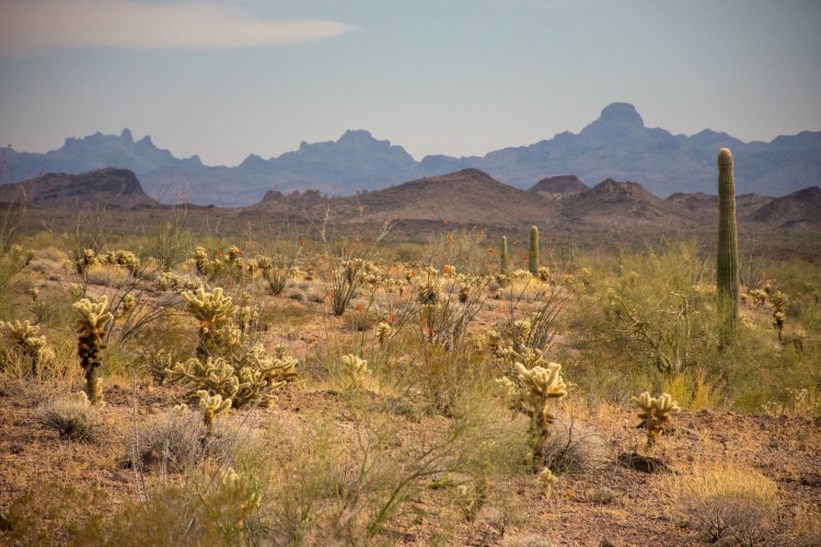
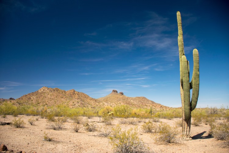
The saguaro cactuses grew to rather astonishing heights out in the wilderness where they were allowed to grow unchecked. They featured often throughout our first day as we alternated driving through fields of cholla cacti and forests of saguaro cacti.
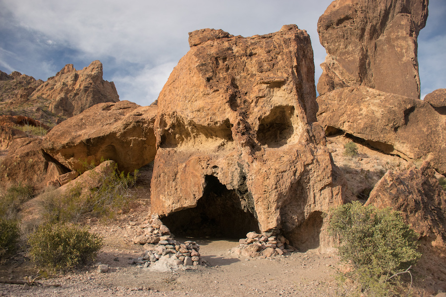
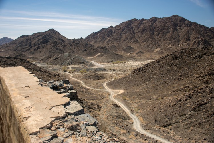
Our first stop was Fortuna Mine, another old abandoned mine. It’s a popular spot for folks day tripping around the area so we ran into a few people who were hanging out there. This is the view from the overlook, the mine shaft itself was difficult to photograph because of the huge fence surrounding it to make sure you didn’t fall in (which I guess makes sense since it was a vertical shaft, unlike others we’ve seen).
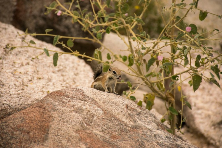
And then we continued onwards! Our plan was to make it over the Tinajas Pass by the afternoon and either camp at the area called the “Two Tanks” or push on until Tule Well and camp there, it all depended on the timing. The Two Tanks turned out to be natural ponds that formed in between rock crevices. While I’m certain that there were two tanks at the top of the hill if we had dared to climb all the way, it was a steep hike and we were there at the hottest part of the day.
So we enjoyed the tank that was nestled partway up the hill and took shots of this small little chipmunk who was posing for my camera.
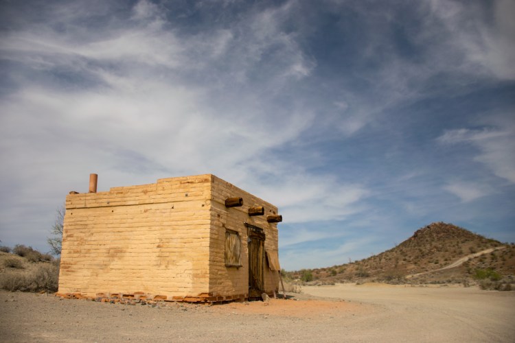
We continued on, excited that we would make it to Tule Well before the sun set. When we finally arrived at Tule Well it was easily four hours before sunset. Tule Well was mostly a rest stop where a well had been built awhile ago for folks to grab water. It’s still possible to use it today, though you would probably want to put the water through a filter before you drank it. There’s also a little house built by an Air Force group where people have stopped by and signed the guest book. We added our names before continuing on the trail.
It was at this point that the terrain began changing. We were entering the Cabeza Prieta Wildlife Refuge and now, instead of barren desert full of cacti, we ended up driving in a wash with scrub bushes on both sides. This proved to be an added challenge as we were now driving on sand (albeit shallow sand) and if we went too slow we’d end up getting stuck (our jeep doesn’t have lockers). So we kept up a steady pace as we whizzed along the wash, I kept my eyes out for any sort of antelope or deer as we were approaching kangaroo hour and I was hoping they’d be a little more active.
We eventually made it all the way through the Cabeza Prieta Wildlife Refuge and into Organ Pipe Cactus National Monument. We cut through the northwestern side of the park admiring the organ pipe cacti and the giant saguaros.

We made a quick stop at Bates Well, the only touristy site in that side of the park and learned about the rancher who lived on the monument even after it had become a monument, letting his cattle graze in the area. He had been grandfathered in when the area was turned into a monument and the Bates family held onto the land into the late 1900s when finally the last Bates who was willing to care for the land passed away and it was turned over to the National Parks folks.
We headed north just out of the park and found ourselves a campsite and an old abandoned mine, surrounded by huge organ pipe cactus such as the one below.
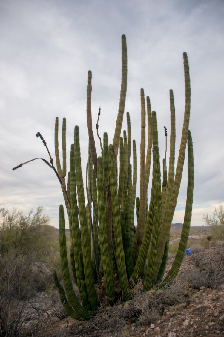
Behind the organ pipe cactus and just to the right, you can see a bright blue object on the ground. This was a container filled with water, duct tape holding the opening shut. Down in the dry riverbed near the campsite were the remains of a fire pit, which led me to suspect that this little alcove had once upon a time been used by immigrants crossing the border.
The next day we continued heading North in order to make it to the Sonoran Desert National Monument.

As can be seen in the above map, we first headed south to visit Farley’s Cabin, a little cabin tucked away in the saguaro filled hills. Along the way we passed by Squaw Tits mountain, so named for its resemblance to breasts. At least according to Wikipedia.
When we finally made it to the cabin, we stopped and took a selfie. Aaron poked his head inside and quickly retreated once he heard the sounds of bees humming around the cabin. I decided to stay well away from the place.

After leaving the cabin we looped up and around then further south into the National Monument, eventually leaving the monument and entering Sand Tank Mountains (another area where our permits were necessary). The landscape was gorgeous.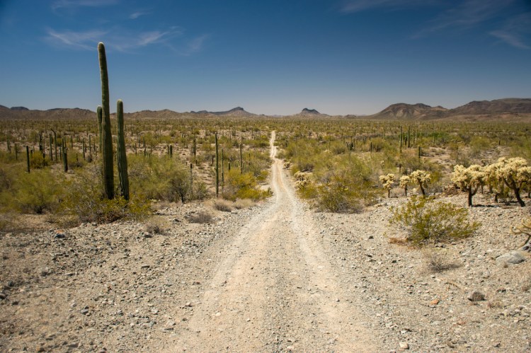
Fun anecdote about cacti: While driving through the Sand Tank Mountains we chanced upon a pair of pronghorn antelope. Unfortunately they saw us before we saw them, so we really only saw their backsides as they fled. We stopped the jeep and hopped out, hoping to follow them on foot and get a better glimpse of them. As we crested the top of the hillside (only to find that they had vanished) we were both simultaneously attacked by cacti! Aaron had accidentally stepped on a cholla cactus while I was unlucky enough to have been stabbed in the calf (above my hiking boots) by a head of thorns that had fallen off a saguaro cactus and (apparently) attached itself to me. Saguaro cactus spines, much like bee stingers, are barbed which meant that pulling each of the 5 spines out of my leg was incredibly painful. One of them had poked far enough into my leg to leave behind a massive bruise :(. The things I do for wildlife.
Luckily for Aaron, he had stepped directly on the cholla spines. He had to sacrifice his shoe but his foot survived intact. He waited patiently at the top of the hill while I fetched a different pair of shoes from him at the jeep, triple checking every step as I went.
Continuing on our journey we started heading back towards the highway following the main paths marked on the map. Eventually we turned onto a path located in a wash. And we found ourselves in a sea of soft sand. Our jeep doesn’t have a locker which means that if we got stuck it would require a lot of work to dig ourselves back out again. We couldn’t get stuck, which means that we couldn’t stop. Aaron kept us at a steady speed and I kept up a steady litany of directions and guidance based on the map or my own observations of the surroundings. Eventually, after lots of palm sweating, cursing, and some pretty epic drifting around corners, the path returned us to solid ground and we both got out of the jeep to walk it off.
When we finally made it out of the Sonoran Desert we decided to drive north to see Montezuma’s castle, it’s located right near Sedona, so we thought we’d visit the tourist trap – sorry, castle, and then camp in the hills above Sedona.
Along the way, windows off, I was reading or something, a bug was thrown into the cabin of the jeep and it landed on my leg. Thinking it was a stick or a beetle I immediately moved to swipe it off my thigh. Unluckily for me it was actually a bee and it didn’t appreciate being swiped away, enough so that it left behind its stinger in my thigh. Once again, I was forced to pull a sharp, barbed object from my leg. It was a rough day.
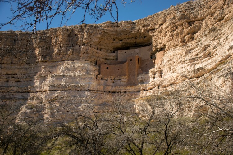
Montezuma’s castle (pictured above) was neither a castle nor was it ever inhabited by Montezuma. The “castle” is an old apartment complex built by the Pueblo Indians around 1200CE that is located high up in the mountain side. We managed to visit many pueblo ruins on this trip and they certainly had an affinity for being on top of things (a feeling I can relate with). Their houses, castles, and apartment complexes were most commonly built at the top edges of canyons, on top of hills, or built into the sides of mountains like Montezuma’s castle.
Fortunately this means that the ruins are very well preserved. Archaeologists and anthropologists guess that building on the high ground provided quite a few benefits for the Pueblo Indians. From such a high vantage point it was easy for them to see any invaders coming. Location’s such as Montezuma’s castle were nearly impenetrable because they could only be entered by ladders that the Pueblo Indians would raise when attackers arrived. It also meant that their habitations were in no danger from the flash floods that come through in the winter; this is another reason the ruins are so well preserved. Finally, the higher locations, especially on hilltops, provide a steady wind flow that, even in the boiling summer months, would help keep the building cooler.
The only reason I call Montezuma’s Castle a tourist trap is because really all it provides is the view provided above of Montezuma’s castle and some information about it. Next to the castle are ruins of a second housing complex, five stories tall, that burned down at some point in the past. While both of these are very impressive, visiting the site takes all of about fifteen minutes and the National Monument folks insist on charging you $10 per person to see that. The entry also gets you into another nearby monument that sounds equally disappointing and still a rather steep price at $10 a head. Nonetheless, it was an interesting introduction to the Pueblo Indians and a cool castle to see from afar. On to Sedona!
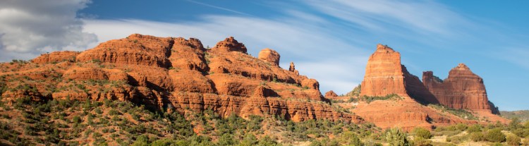
It took us about twenty minutes to drive from Montezuma’s Castle to downtown Sedona, which was bustling with tourists. Going from the low desert along the border of Mexico to the high desert and beautiful red rocks of Sedona was quite a change, especially as we had been expecting to stay in the desert all three days. Finally managing to shake some of the tourists we started driving up Schnebly Hill towards the Schnebly Hill Vista. At this point there were only a few other tourists in their own car traversing the trail; apparently all the tourists without four wheel drive vehicles had elected to take the Pink Jeep Tours! Needless to say, we were surrounded by tricked out jeeps filled with 12-15 tourists hanging on to handle bars for dear life as their jeeps crawled over the rocky 4×4 trail up to the vista.

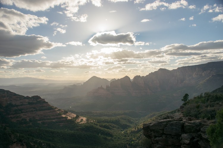
The finale to the incredibly rocky trail was a huge incline with a steep drop to one side, at the top of which was the view below. Being there at sunset meant that the sun more or less turned everything into dark silhouettes, but my camera was able to pull out some faded colors nonetheless.
Leaving the last of the tourists behind, we continued up into the hills to look for a campsite. We passed plenty of other people who were camping at the top of the hill and elected to keep driving until we found a site that had no one anywhere near it. Eventually we turned down a side road that dead-ended at a giant field and a small pond. The turnoff was lined with empty campsites and we took the one that was furthest from the main road.

We had come prepared to camp in the desert for three nights and weren’t expecting to spend a night camping in the forest with a low temperature of 45-55 degrees. Aaron very kindly made me some hot chocolate and a bonfire while I set up the tent so I could stay somewhat warm in my short shorts. It was quite a shock to spend one night camping in the almost silent desert to spending the night on top of a mountain, 7500 feet above sea level, in a forest with branches playing with the wind all night, and the sound of turkeys gobbling into the night. Yes, turkeys. No, I don’t know why. It was a relief to not have to worry about scorpions with every step.
I don’t have a map of the next day, I’m not sure why so you’ll just have to imagine the route. We began by seeing if we could make it all the way to the Walnut Canyon National Monument without using real roads. We made it almost there but we did have to get on a real road once. At one point we managed to surprise a pair of desert elk and both of use were shocked by how big they were. We once again jumped out of the jeep and crept through the trees in an attempt to see more than just their backsides. In our silence, we did manage to see the backside of an incredibly fluffy coyote as we accidentally stumbled upon his den and he fled. We didn’t find the desert elk and eventually walked back to the jeep empty handed continuing our trip up to Walnut Canyon National monument. We ended up coming up to the monument along the backside of the monument and, after a closer look at the map, decided to forgo entering the monument for fear of another Montezuma’s Castle-like experience. Circling around the edge of the monument, and calling it good for having seen the back edge of the monument, we headed north up to Sunset Crater: our next stop of the day.
As we drove, the roads quite suddenly turned from dirt to volcanic rock with the consistency of sand. Not too bad, we thought, we’ve driven in sand before, we just won’t slow down, and then our route led us into an ATV fun park, which, while fun for us, was not fun for the jeep, and after five minutes of bouncing, was less fun for us, and then the navigating became more difficult as there were trails crossing everywhere, and the sand got deeper and Aaron really couldn’t stop and then it was the split second decisions from me with my eyes glued to the map shouting out directions and Aaron keeping the jeep in motion and every second we’re worried we’ll sink into sand or drift or spin out….and then we made it onto hard ground again, gave a sigh of relief, and decided that maybe we didn’t need to go through any more ATV fun parks in the jeep. Despite the difficulties, the route threaded us in between two giant craters which was an incredibly epic drive.

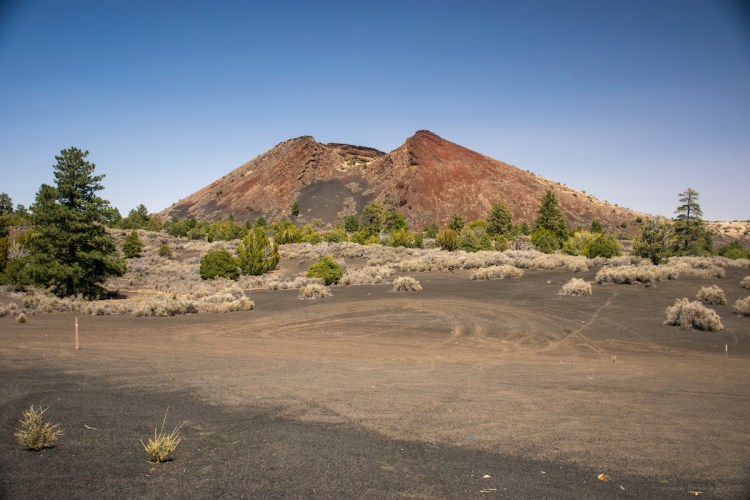
We made it safely out of the ATV park and saw Sunset Crater from behind, and, looking at the time and the map, decided that was probably exactly the same as what we’d see if we entered the park. We crossed it off our list and continued our trek north to the Wupatki National Monument which was located an hour south of the Grand Canyon and promised lots of Pueblo Indian ruins.
Along the way we passed by Strawberry Crater, named such from it’s red appearance (I think).
If we had had more time we would have stopped and hiked the trail and peered down into the crater, but we had a tight schedule based on that evening’s camp site.
As we passed the crater the landscape changed again and we were suddenly in a scrubland. Imagine the picture below with fewer trees and that’s pretty much what it looked like (the picture was taken at the end of the trail in the Wupatki National Monument where the landscape became more populated by trees). It was an eerie feeling flying through the colorless landscape, it definitely felt like a great place to film a movie located on a different planet. In the background of the photo below are the San Francisco peaks.

The Wupatki National Monument was much larger and more spread out than the two previous monuments. We stopped at two different sites that had the locations of Pueblo Indian ruins dating to 1200 or so CE. These were not large apartments, but rather small dwellings. The amazing thing to me about these dwellings was that they had not been reconstructed at all. According to the information sign, the ruins we saw were all the originals. It stands testament to the dryness of the area, the construction skills of the Pueblo Indians, and the remoteness of the area that they are still standing. These ruins were far more accessible than those at Montezuma’s Castle and we enjoyed walking in and around the ruins, crouching through the doorways between rooms.

As I mentioned, we were on a tight schedule because of our campsite for the evening. We had read online that it was possible to camp at the bottom of the Grand Canyon if you drove to the unpopular end of it (you know, the side that people don’t go to), obtained a special permit (we were all about special permits this trip), and then traversed a four wheel drive trail and forded the areas where the water crossed over the trail. The whole process is worth a different blog post because there’s a lot of outdated information on the internet, and I will get that in a approximately a week after I’m certain that the people who matter have read this blog so they won’t spoil the ending for themselves.
So we were in a huge rush. We knew we had to get the permit from the local hotel and I had read online that they stopped selling permits at either 4pm or 5pm. So we raced over to Peach Springs, rolled into town, screeched to a stop outside the local Hualapai (pronounced wall-uh-pie) Lodge Hotel, raced inside, and asked the front desk reception if we could buy permits to go down Diamond Creek Road.
The young woman working there looked at us, and then looked down at a binder in front of her, and informed us that the there had been a change in the procedure for giving out permits and that the Hualapai Department of Fish and Game had taken over selling the permits and that they had closed that day at 3:00pm. We had arrived at 4:47pm.
I was so sad. All hope of driving down to the base of the Grand Canyon gone, and we had no backup plan. But Aaron insisted, he drove us one block down to the Hualapai Department of Fish and Game, “to check, maybe someone is still there,” he insisted. So we arrived and walked up to the door, we read the closed sign, we tugged the doorknob hopelessly, and then we sat down outside the door and I started opening the map to find the local BLM land for a different campsite.
After about thirty seconds the door opened and a young man stuck his head out and asked if we needed anything. We told him that we were hoping to get a permit to go down Diamond Creek Road and he welcomed us inside and said they would be able to help us with that.
We practically fell over in shock. We headed inside and the other young man inside filled out the paperwork, we paid the fee, which was cheaper than we expected, and I signed the papers. Aaron went and got gas at the station around the corner and I walked over five minutes later with our brand new permit to trespass!

We both were impressed by the wording of the permit, a constant reminder that the land we were going on did not belong on the United States and we were only going because they were allowing us to be there. I appreciated the Hualapai taking what agency they could to make a political statement.
With our permit in hand we eagerly hit the road, wanting to set up camp and enjoy our time at the base of the Grand Canyon while we still had daylight.
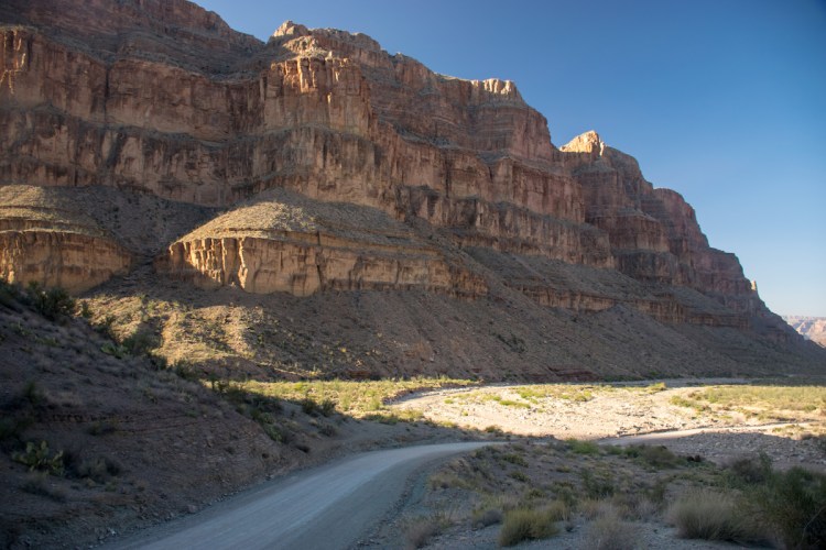
And what a great drive down it was! I had spent the two hour drive over from the Wupatki National Monument reading about the drive down and what to expect and how to get the permit (the most recent post had been from 2015, hence the need for separate blog post with updated information) so I was quite aware that we would be dropping quite a bit in elevation and that we should expect a huge temperature increase.
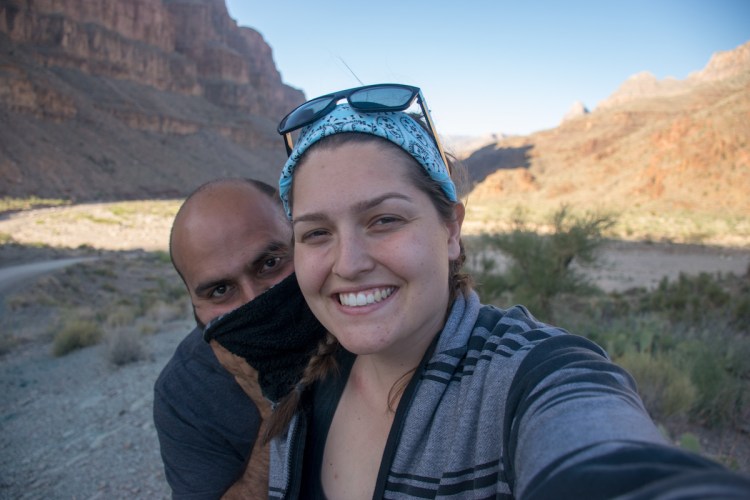
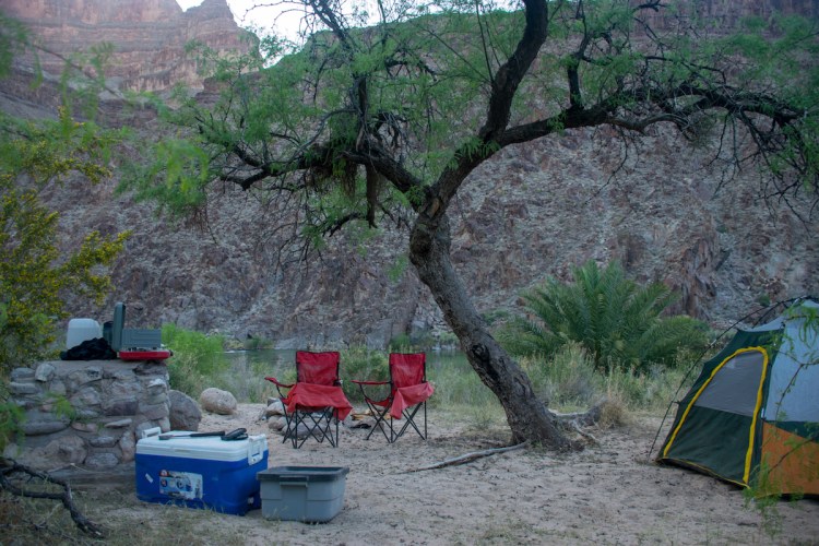
Seeing the numbers on the map made it even more real as we dropped from 4000 feet above sea level to just 1500 feet above sea level. While I had been freezing in Peach Springs, the base of the canyon was incredibly warm and humid. It felt like I was back in Cuba, enjoying an almost-too-warm summer’s day. Aaron and I picked the best campsite (overlooking the Colorado River) as no one else was down there, and enjoyed the best facilities we’d had at a campsite yet: portapotties. And I must say, they were some of the nicest portapotties I have ever used. The whole picnic area was beautifully kept up with wooden shade awnings over all of the picnic tables and no litter anywhere.
After setting up camp we headed down to the river to dive in, rinse off, and cool down. I had been warned, again, by the internet that the water would be cold. It was SO cold. Aaron dove right in, I poked a toe in, shivered, and slowly tried to force myself in.
But that wasn’t going to do it, I made it to my knees and made it no further. Eventually, after getting out, drying off, calling myself a wuss, and watching Aaron hop back in a second time, I pulled off my towel, took a running start and flung myself into the river as though it were a beach in NorCal, I was much more successful with the second attempt and managed to not shiver for a whole ten seconds after dunking myself.
Eventually we returned to the campsite, cooked dinner, lit a campfire to deal with the mosquitos, I used our camp shower to wash my hair, and we relaxed. After the sun finally went down I took a few photos of the stars framed by the canyon walls.

