
Our trip started with a frantic drive out to Durango, Colorado. Our end goal of Mesa Verde National Park was filled to the brim with largely intact Pueblo Indian ruins that are only directly accessible to the public if they are guided in by a park ranger. The many overlooks and self-guided driving tours of the park can be enjoyed without the guidance of a ranger but we wanted to have the opportunity to walk in the ruins as we had in the past. But to get a ranger to take you on a tour you have to buy tickets ahead of time, they can only be bought in person, and you can only buy them up to two days in advance. And they can only be bought in the park itself or at the Visitor Center in Durango, hence our frantic drive to Durango.
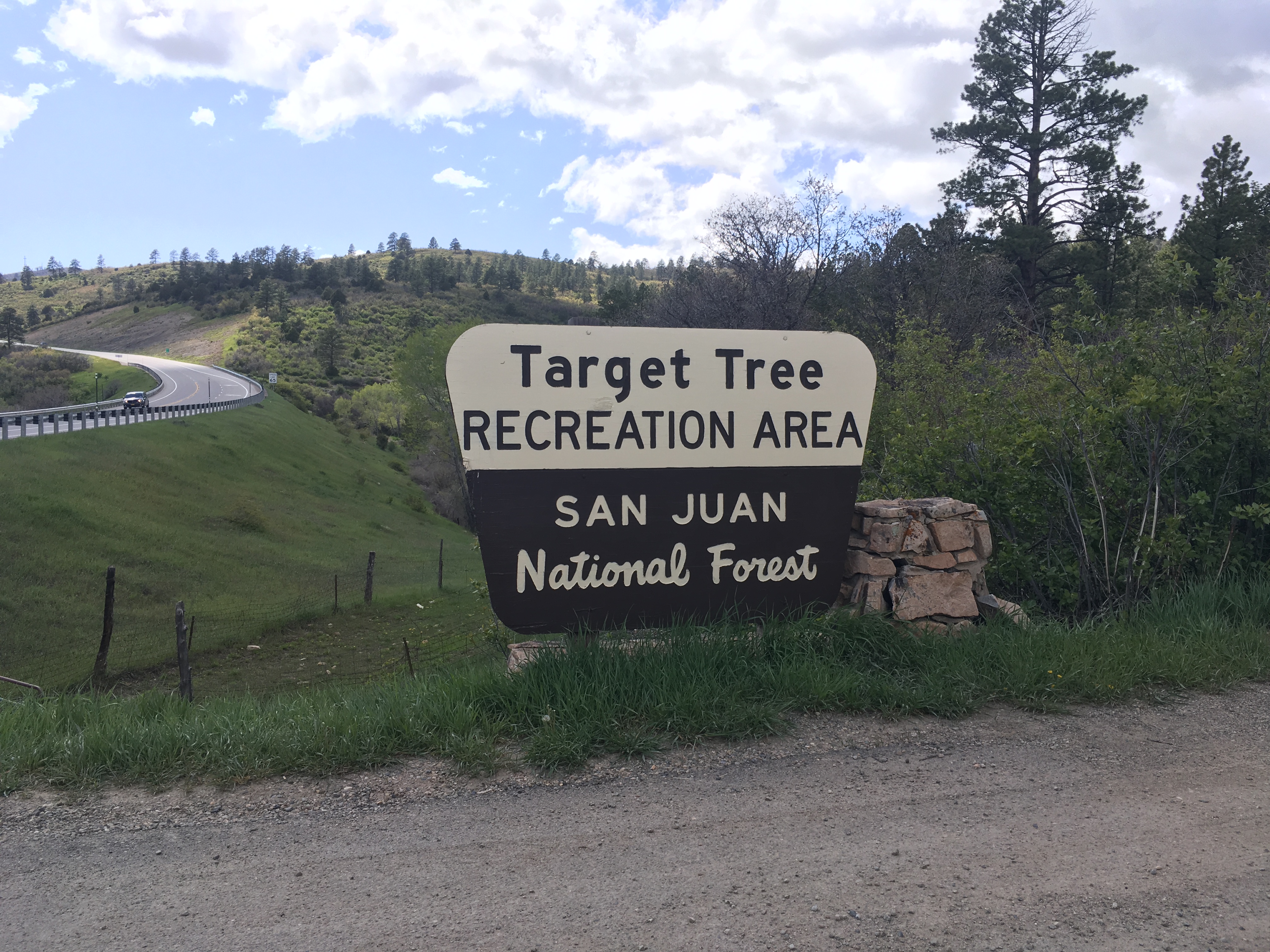
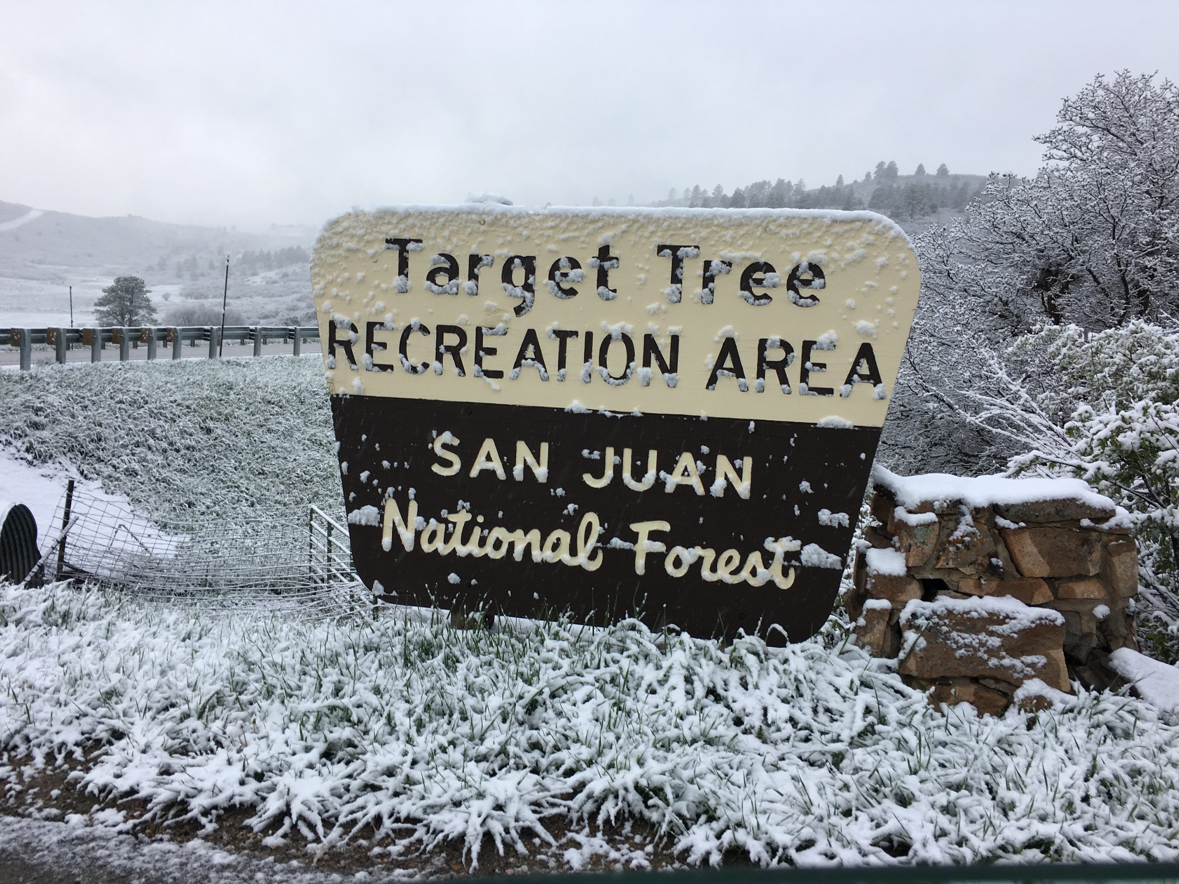
Luckily we made it with time to spare and were able to secure tickets for early the next day to see the Cliff Palace Ruins and the Balcony House ruins. With those tickets safely in hand, we sought out food and settled into an artisanal pizzeria where we looked at the weather forecast for our campsite outside of Durango, named Target Tree campsite (named after a tree that the Native Americans used for target practice so often that it still bears the marks).
Our phones were pleased to let us know that there was a Winter Storm Advisory in place for the evening directly over our campsite, despite the weather currently being quite nice. We decided to go up and, if needed we could always come back down and shelter in Durango, given the expected proximity to snow, I ducked into an outdoor outfitters store (that were littering the downtown area as though it were Starbucks on the UC Irvine campus) and bought myself some nice Patagonia long underwear pants. Feeling reasonably equipped for cold weather, we drove up to our campsite.
We arrived to beautiful weather, the sunlight spilling through the trees, all was quiet. Feeling like old hats we set up our tent, lay out the mattress, tucked in all of the blankets, brought our food totes to the picnic table and then, instead of walking to the Target Tree, we collapsed in exhaustion in the tent for a mid-afternoon nap.
When we woke up the clouds had covered the sun turning our afternoon into a far more ominous early evening. Aaron began cooking dinner while I watched the drama continue to unfold in my telenovela. First it started to very lightly rain, and then, as Aaron was finishing cooking, it started to hail. I rushed to take the chairs into the van so they wouldn’t soak through. Just as Aaron was serving dinner, the hail let up and I rushed to take the chairs back out so we’d have somewhere to sit while we ate. As we finished eating, the hail picked back up and we rushed to clean everything up. While Aaron had been cooking, the camp host stopped by to confirm our reservation and tell us that it was going to be a “cold one.” Her strong midwestern accent gave away her origins as clearly being from slightly further East than Colorado. She also left us with a couple pieces of firewood which Aaron tried to light into a very small fire.
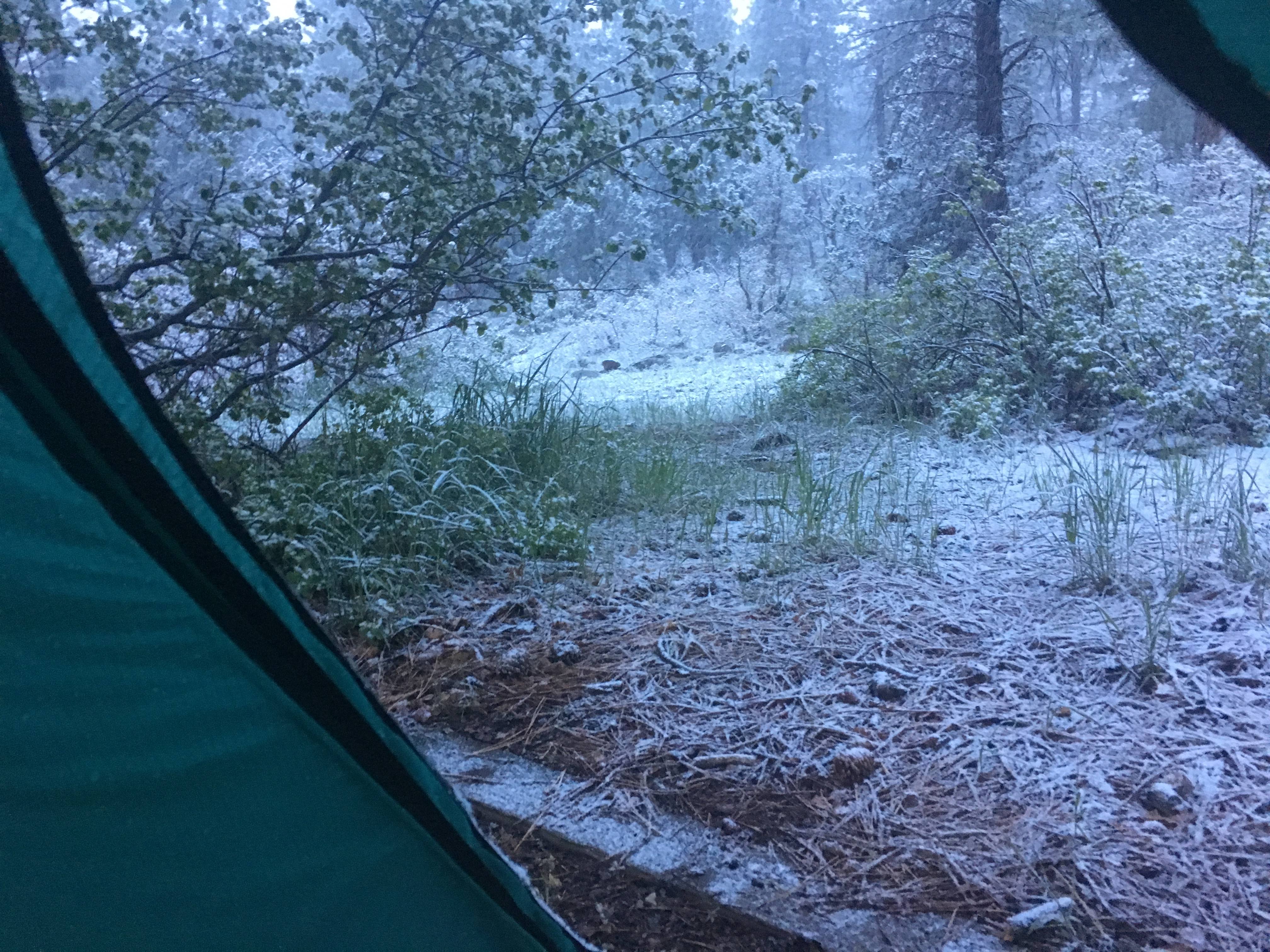
Just as the fire was catching and we were finishing dinner and the hail was picking up again we decided it would be best if we hid out in the van for awhile. We took refuge in the front seats with the heat blasting and mourned our little fire, where we could see flames leaping up, impervious to the rain. Eventually the hail abated and we decided it was now or never so we left the safety of the van, got ready for bed, and fled into the tent just as it started hailing again. And there we stayed until roughly six o’clock in the morning after having slept reasonably well. We stayed quite warm — I strongly recommend REI’s Half Dome 2 Plus Tent + a shit load of comforters) — until my bladder alerted me to the fact that it was now time to get up. I opened the tent flap to find a winter wonderland of sorts awaited us outside the green walls of our tent. While I’d heard the hail on and off all night, it was clear that snow had won out eventually and it was still snowing as I watched. I pulled my shoes on, flipped my hood up, and raced over to the bathroom, shivering the entire way and cursing myself for not putting my hair up. I watched miserably as snow collected in the hair spilling out of my zip up hoodie.
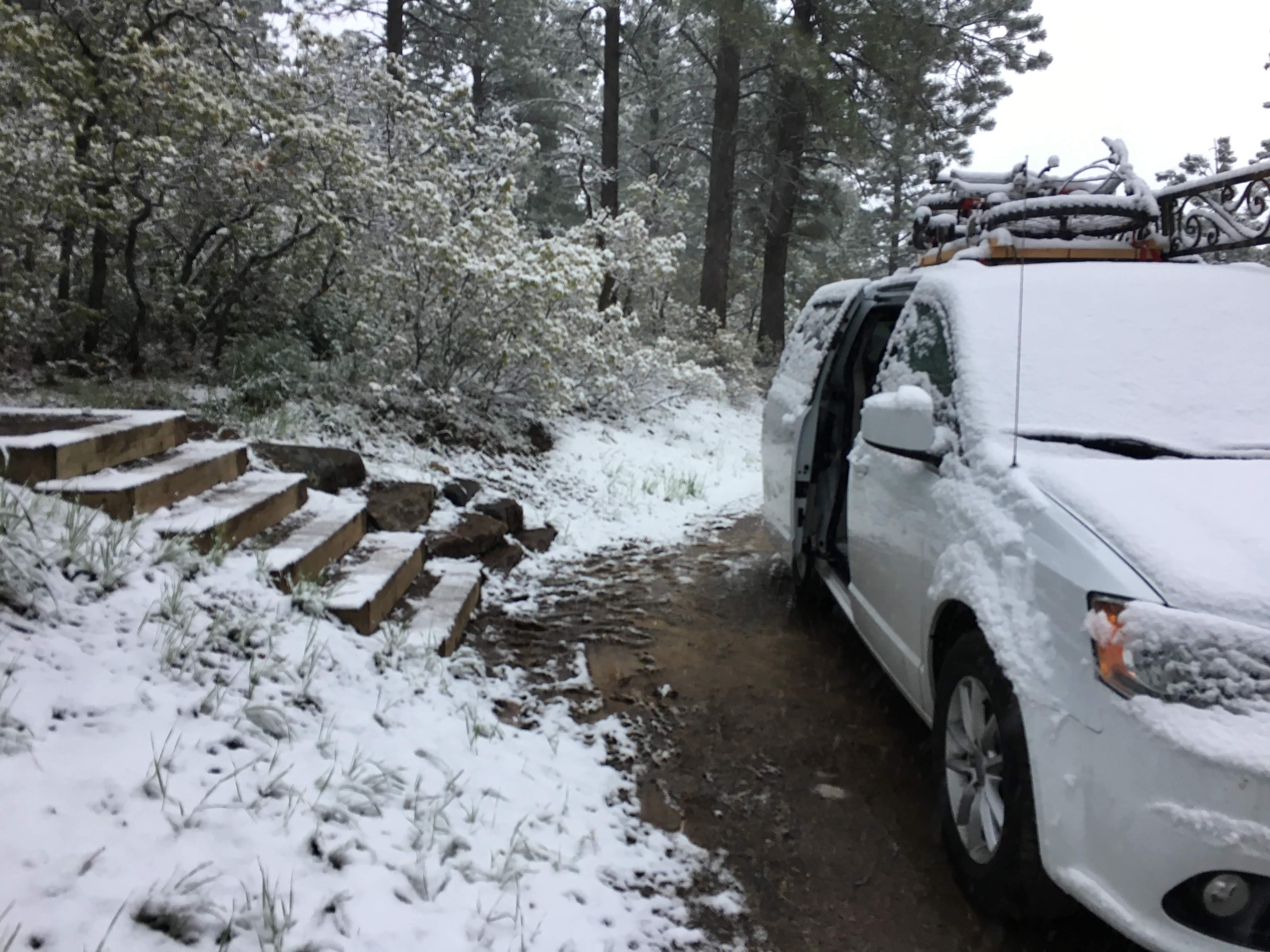
Safely back in the tent, I whipped my hair up into a bun and tucked ALL of it under the hoodie, before breaking down the tent. Aaron started wiping snow off of the lids of each of the bins (which promptly began to fill with snow afterwards) before we began tossing camp gear into the van. Sans gloves, Aaron soon found the his fingers were quite numb and painful, realizing that my gloves were in the front seat, I pulled them on while Aaron turned on the car and held his hands over the heater until they defrosted or something. It was at this point that we both realized that, frozen hands excluded, we weren’t actually cold. So we hung out for an extra second, brushed our teeth, pulled breakfast out of the cooler (yogurt for me), and took photos of the van covered in snow.
We pulled out of the campsite at about seven am and realized that we were going to be waaaay too early to Mesa Verde at this rate. Given the weather we decided to stop by Walmart where we could hunt down ponchos, a first aid kit, and more hand lotion. Not that this was an easy feat. Apparently in Colorado most people don’t need ponchos, they need emergency blankets, and lighters, and more emergency blankets, they don’t need ponchos. They assume you have snow jackets that are more than capable of handling some rain.
Nonetheless I managed to find the only rain ponchos in the entire store, in their tiny little 2 inch by 2 inch boxes. As I carried my finds up to the register (Aaron had previously succumbed to the altitude and was fending off a nose bleed in the bathroom), I realized I was feeling a little light headed. I stopped by the bakery section to get muffins, and forced my brain to function long enough to get water from one of the little refrigerators next to the cash registers. To my dismay, they only had self-check out machines available and I almost went to the Walmart employee guarding the machines to ask him to help me with my purchase as I really was getting close to the point where I would faint. Deciding that would take too long, I used sheer will power to get me through the transaction and over to the comfy chairs by the mobile order pick up station where I collapsed onto a chair and started drinking water and eating my muffin. I realized that I probably shouldn’t have rushed so much to clean up camp as that was the likely cause of my current state. I texted Aaron that I had succumbed to the altitude myself and would wait in my comfy chair from him, he responded that his nose was still bleeding and expected he would be anemic if this kept up. I mused lightly on the ironic possibility of either or both of us fainting in this Walmart in Cortez, Colorado.
Luckily, we both know how to take care of ourselves and my dizziness went away with enough water and the rest of the muffin and he emerged without a hint of blood and (hopefully) no anemia. With our time leftover we found a Starbucks, because I wanted hot chocolate and he wanted coffee, and then we drove out to Mesa Verde.
Mesa Verde is a huge national park with only one road that takes you from the entrance to the other side of the park where it forks down two separate canyons. One canyon is home to the famous Cliff Palace and Balcony House, the other canyon is home to Long House. It takes about an hour to get between one canyon and the other so we opted to only do Balcony House and Cliff Palace in order to still leave time in the evening to explore Hovenweep National Monument. Due to our early morning, we arrived at the canyon with the Cliff Palace with an hour or so to spare before our tour started. Taking advantage of the extra time, we took ourselves on a fast paced driving tour of the Mesa Loop. Here we were able to see a variety of cliff dwellings and we learned about the history of the Ancestral Puebloans and the differences in the architecture of the buildings as they moved out and then returned with the changing climate conditions and availability of animals to hunt.

The most interesting fact that I learned about the Ancestral Puebloans was that they had been expert basketmakers before they discovered pottery, then after they discovered pottery, they stopped making baskets. Archaeologists were able to find baskets that were made before and after they discovered pottery and they found that the later baskets were made with much less finesse than the early baskets. The skill had seemingly been forgotten over time.
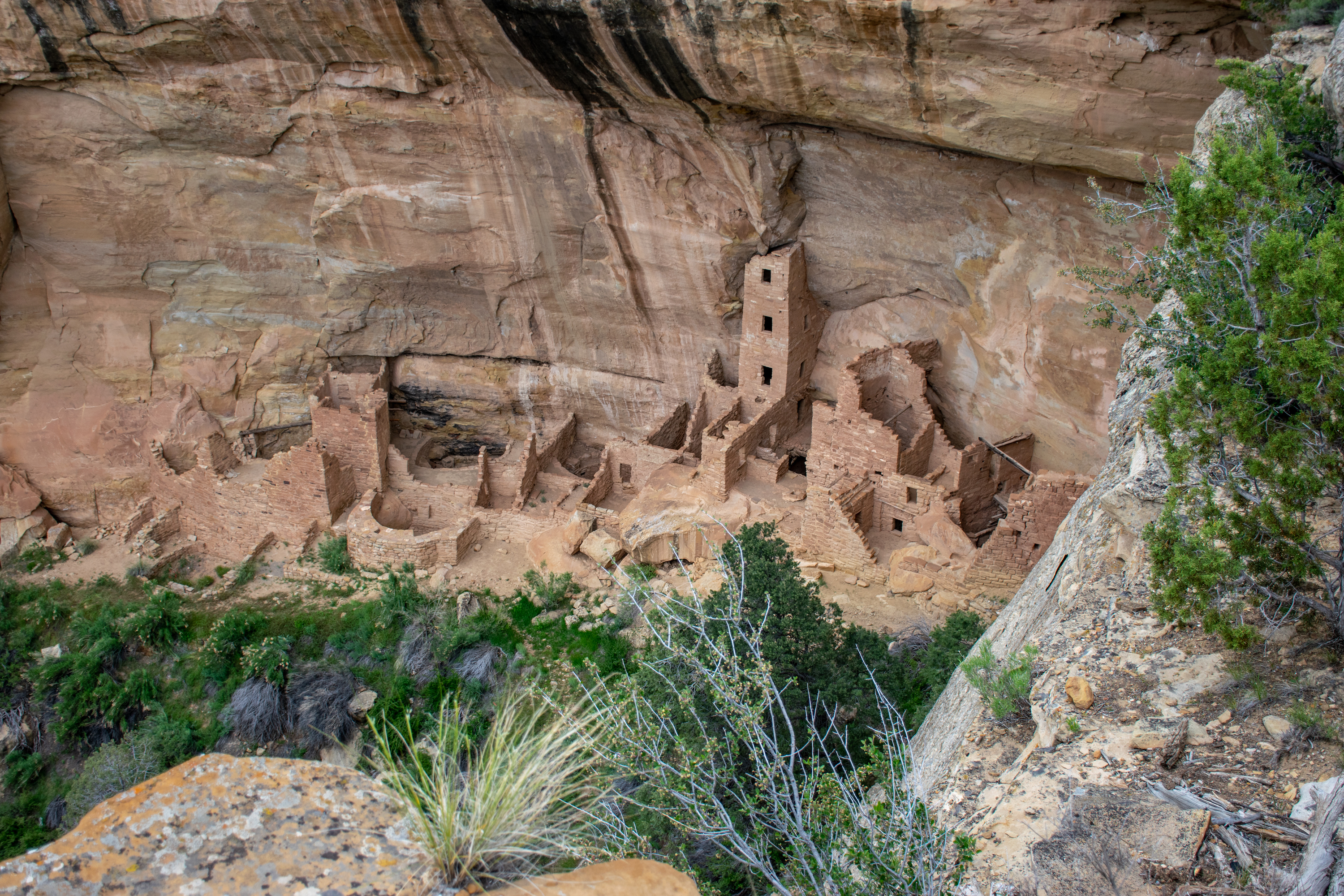
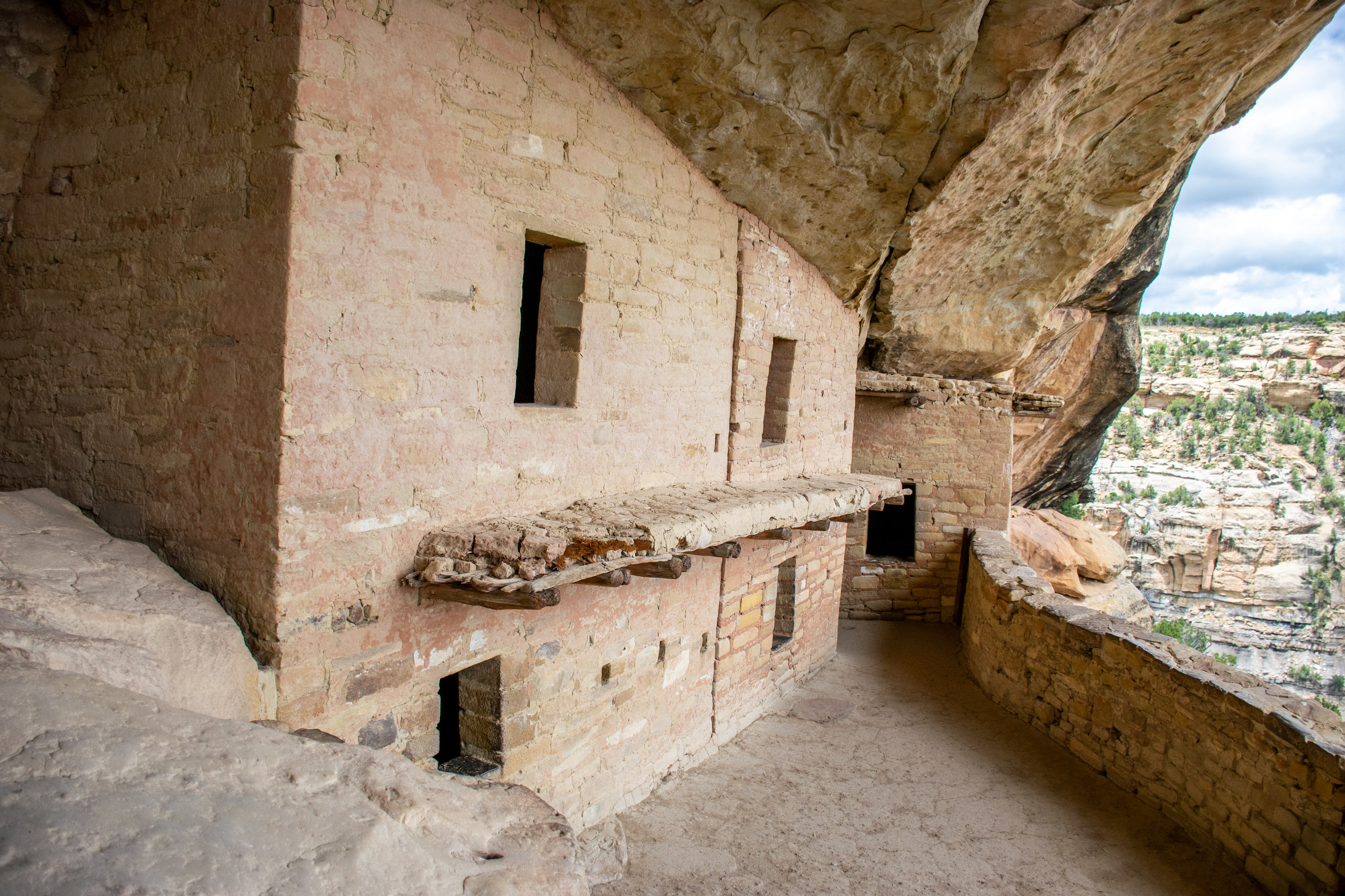
After completing our trip around the self-guided driving tour, we pulled into the Cliff Palace parking lots to join a huge group of tourists who would all be going with us on our little journey. The ranger began with a safety talk that mostly consisted of “if you have bad knees or a bad heart, this might not be the tour for you, don’t faint because you locked your knees because it’s a huge hassle to rescue people down there, and think twice if you’re from sea level because the 60 foot climb back out feels like six miles.” Forgetting our earlier trauma with the altitude, we both declared ourselves fully capable of climbing in and out of the cliff dwellings and headed down the steps with the rest of the group. At the base of the stairs was a little overhang where we all found seats while our guide told us what was known about Cliff Palace and some of the theories as for why it was built. He told us that the wooden poles we saw in the structures were all original from the 1200s, that there were [number of rooms in Cliff Palace], and that based on the number of Ancestral Pueblo structures in the Southwest, there had been more Ancestral Puebloans living there in the past than there are people living in the area today. He also gave us a lecture on lunar phases which I mostly didn’t understand but involved lots of arm movements and gestures. This was to explain not only the importance of lunar phases to the Ancestral Puebloans but also to explain the most common theory as to why there were paintings inside one of the dwellings we were about to see. The lines and squiggles corresponded to the patterns of the lunar phases.

Having said all of this, our ranger then walked us along the front of Cliff Palace, pointing out different mortars and styles of building. He also explained some of the tools that they used for building including levels, which explained why all of the buildings were built with 90 degree angles and straight up and down. We ended up standing over some kivas while our ranger gave an impassioned speech about the importance of kivas as cultural centers and gathering spaces, and while most anthropologists call them religious buildings, our ranger made the argument that all religious spaces are just community spaces that provide people with hope, and an opportunity to come together as a community. He ended with an impassioned plea that we all remember that humans are essentially the same and not to let our differences divide us, with a not-so-subtle jab at school shootings.
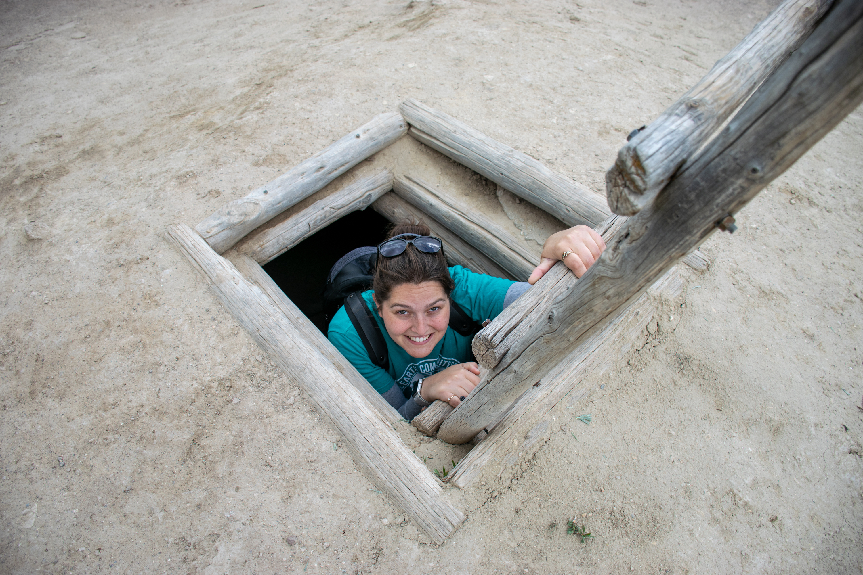
After we had all poked our heads inside the window of one of the buildings and admired the paintings on the wall, we began the climb out of Cliff Palace. Two ladders later, and after admiring many of the original toe and hand holds that were used to access Cliff Palace, we emerged back up top in the parking lot. It didn’t feel exactly like six miles, but I was winded.

Back in the van, we headed to a few look outs that were on the way to Balcony House.
Making it to Balcony House with time to spare, we made ourselves lunch before heading to the beginning of our next tour.
Our new tour guide was actually the tour guide supervisor filling in for a sick park ranger. Her safety speech was much less winded, but Balcony House is also a much easier climb (except for the 32 foot ladder). Her tour was much more tourist-guided and she encouraged lots of questions, and asked us questions that made us figure out the answers for why some things might look a certain way. Clearly she was meant to be a teacher and that’s what she was doing. She approached the tour from a far more introspective view than our previous guide. She wanted us to think about why we were visiting Balcony House and why studying past cultures is so important.
We did have one small hiccup on the trip through balcony house when a little four year old saw the 32 foot double-wide ladder and panicked. Lots of sympathetic looks were given to the kid and his dad tried very hard to convince him that no one would ever let him fall off the ladder and that he was great at climbing ladders and that he had done so well on the Cliff Palace ladder that surely he could conquer this ladder as well; but in the end the poor kid and his dad backed out the way they had come while the rest of us continued onward into Balcony House.

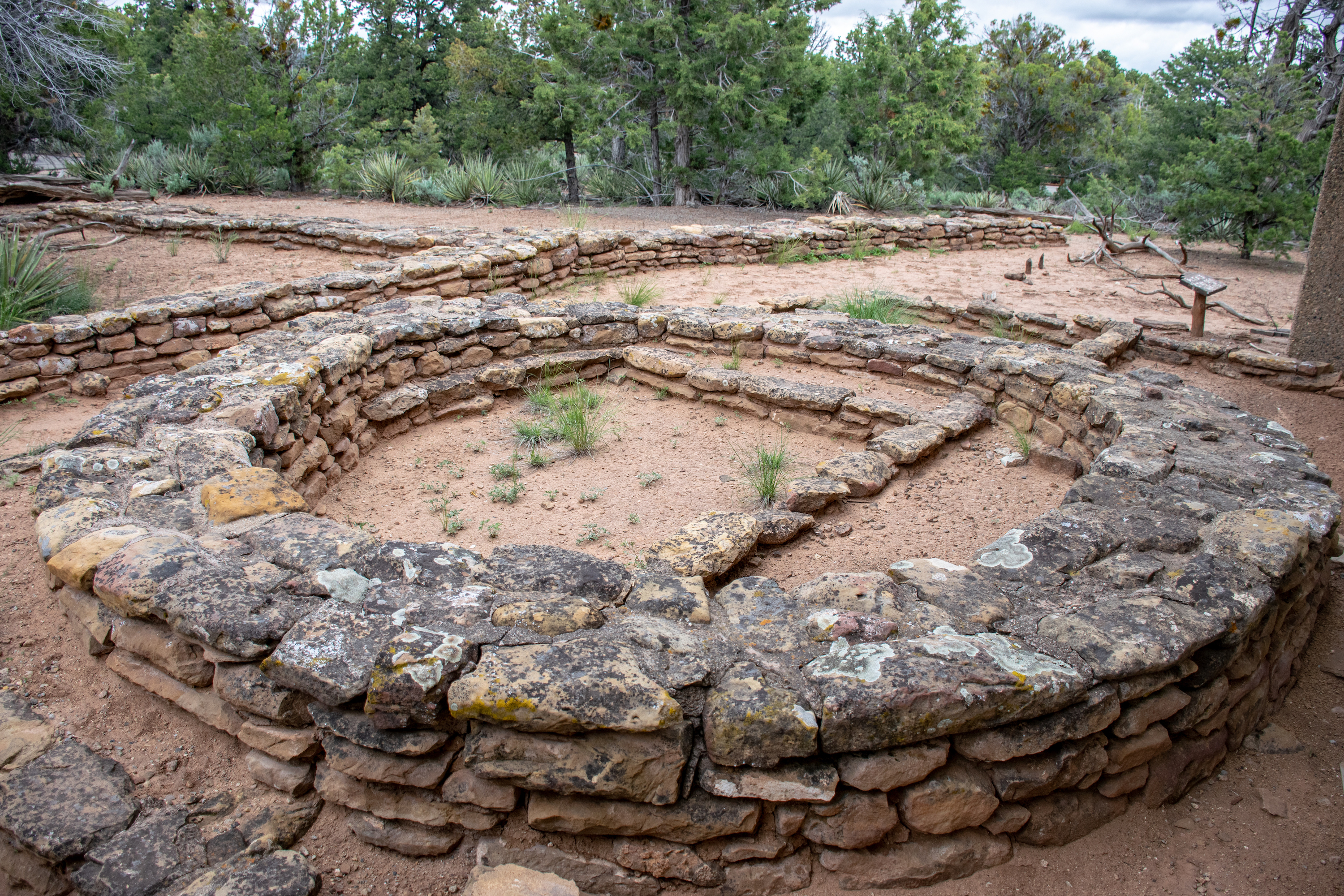
After finishing up in Mesa Verde we drove out to Hovenweep National Monument as Aaron tried to resist taking dirt roads in our overly loaded van. Upon arrival, we stopped at the visitor center and picked up a map of the area. I entered just behind Aaron as I had been finishing a paragraph of this blog and he approached me with a huge pack of what looked like postcards, each one designed with the front in the graphic artist drawn version of each national park’s main feature. I laughed and told him to be careful because buying that meant that we would now have a to-do list. The helpful ranger working behind the desk told us about the ruins walk and that it was accessible from the campground. We then headed to the campground, picked out our spot, set up the tent so that it would dry, and headed out to see the ruins peppered along the canyon.
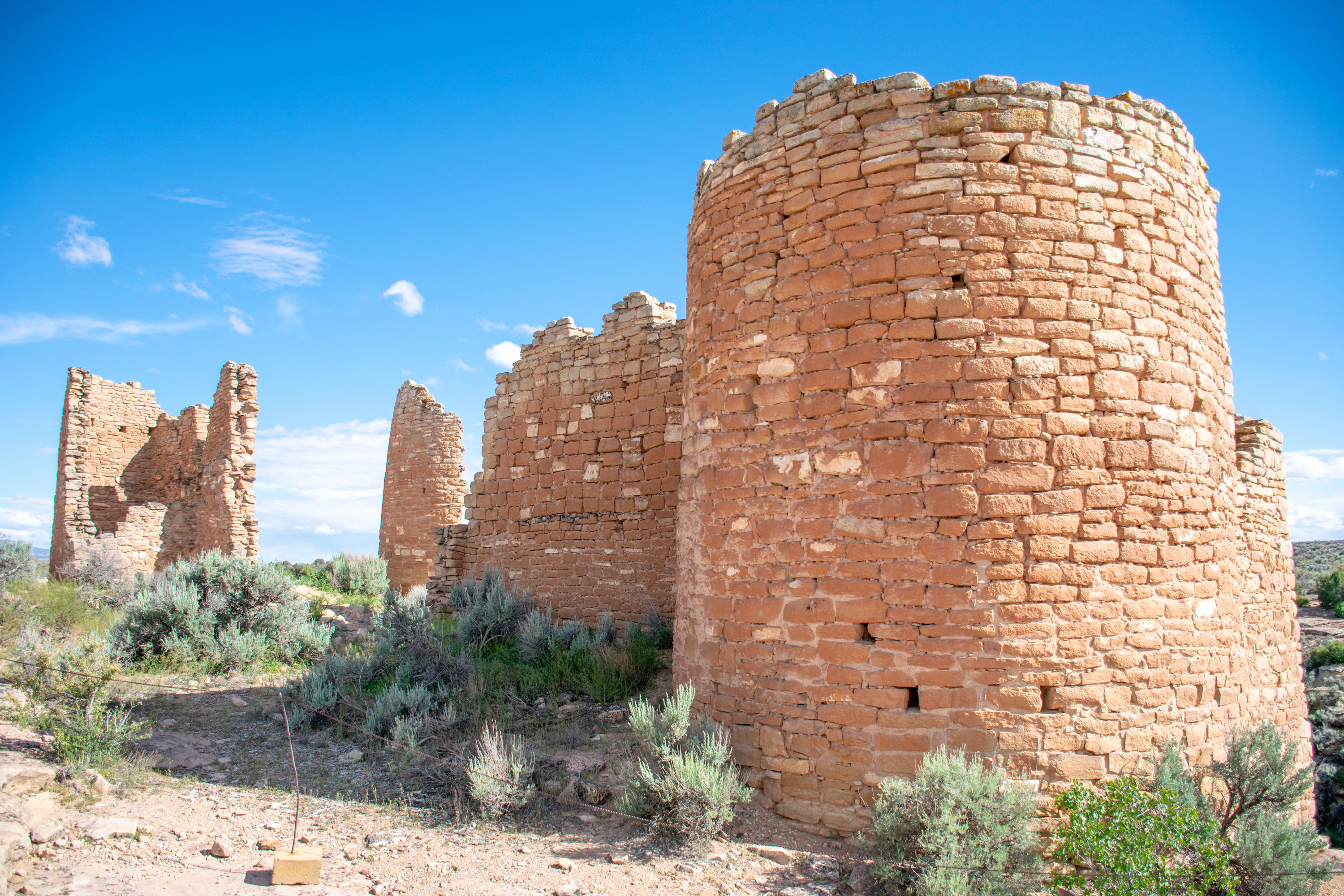


Just after finishing the last ruin and turning our footsteps towards camp, Aaron was accosted by another altitude induced nose bleed. We, unfortunately, didn’t have any paper towels and the desert doesn’t have any good spongey moss. Luckily it stopped quickly, almost at the exact moment we made it back to camp. Greatly in need of showers after the hour and a half hike, we set up our shower tent (for the very first time) and took quick camp showers using our water bottle as a shower head.
We spent the evening scarfing down food, after which Aaron worked on planning out his other trips and I watched my telenovela devolve into senselessness as it reached its ninth season in front of a nice fire overlooking the desert.
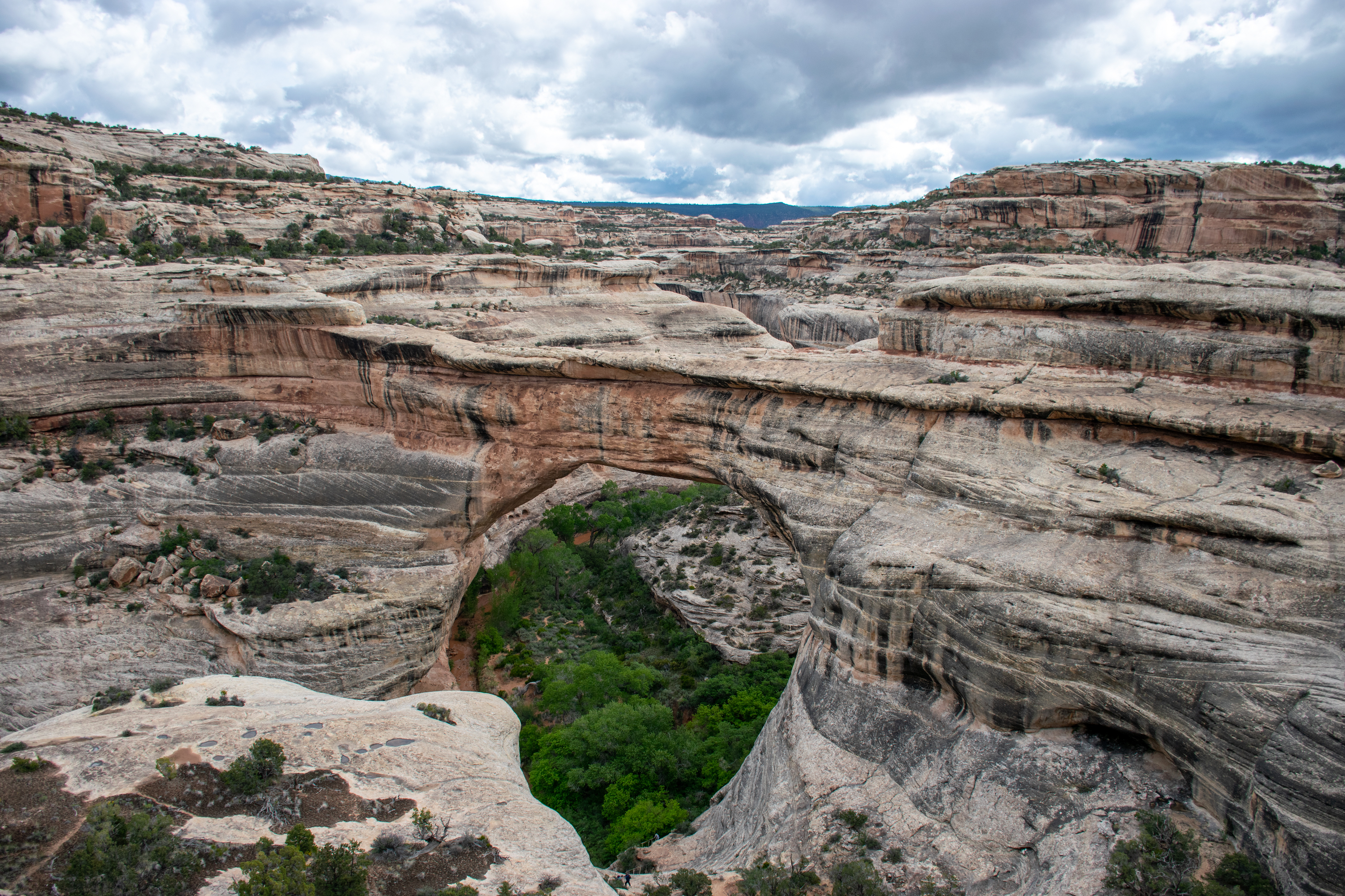
We woke up to bright sunlight warming up the tent (which was covered with dew). Packing up camp and eating a quick breakfast we hit the road, our only plan to drive until we reached Goblin Valley and then on to the Fremont Indian State Park that evening where we would be staying in a teepee. I spent the morning part of the drive sending urgent work emails and working on this blog. A couple hours in, after we were decidedly in the middle of nowhere, we started passing signs for the local national monuments and parks which could be the only explanation for this road that had no towns on it, no gas stations, and very few reasons to exist. Eventually Aaron mentioned that the upcoming park was for the Natural Bridges National Monument. My response, “I like natural bridges” was enough for him to decide to turn off so we could get a break from the car.
While I stood in line waiting to flash our National Parks Agency Access Pass to the ranger, Aaron hunted down the usual sticker with the art from the park. He returned just as it was my turn with not a sticker, but rather two packs of national monument cards, similar to the national parks cards. I rolled my eyes and purchased both, our to-do list grew quite a bit this trip. Map in hand we headed back to the van to drive through the monument to see the bridges that it boasted all within a 5ish mile radius of one another.
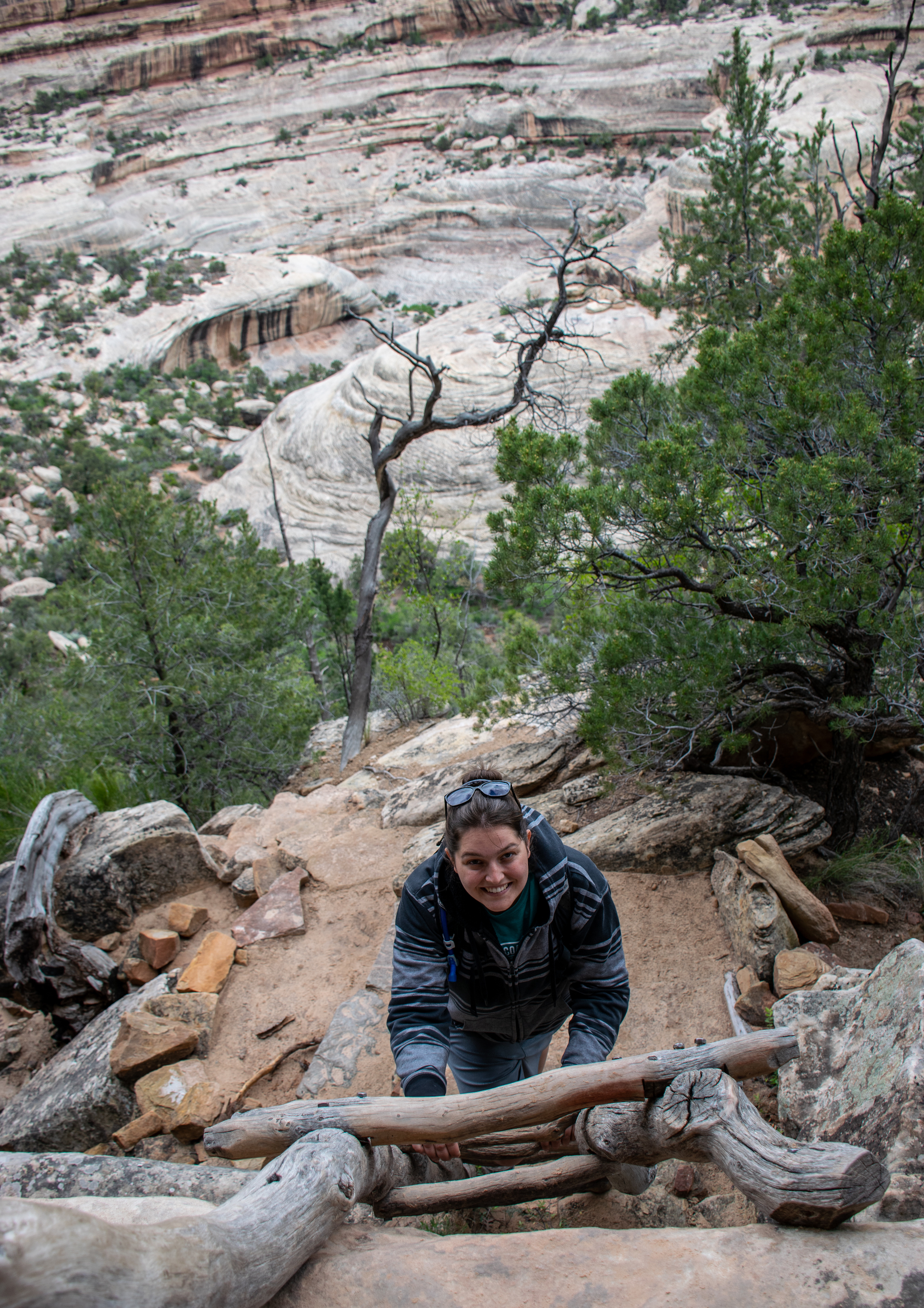
For those intrepid hikers who had all day, there was a one way path that followed the river bottom to see all three arches and then climbed to the top of the mesa and returned to the parking lots by walking over the top of the mesa. For those who don’t have much time, or that much stamina, you can park at each arch and climb down on a trail that ranges from .2 miles one way to .75 miles one way. If you have even less time than that, you can just go to the look out for each bridge. We decided that we were somewhere in the middle and walked halfway to the Sipapu Arch where we found a nice vista from halfway down, went to just the vista at Kachina Arch as that had the longest hike, and went all .2 miles of the way to Owachomo Arch, the oldest arch in the park.

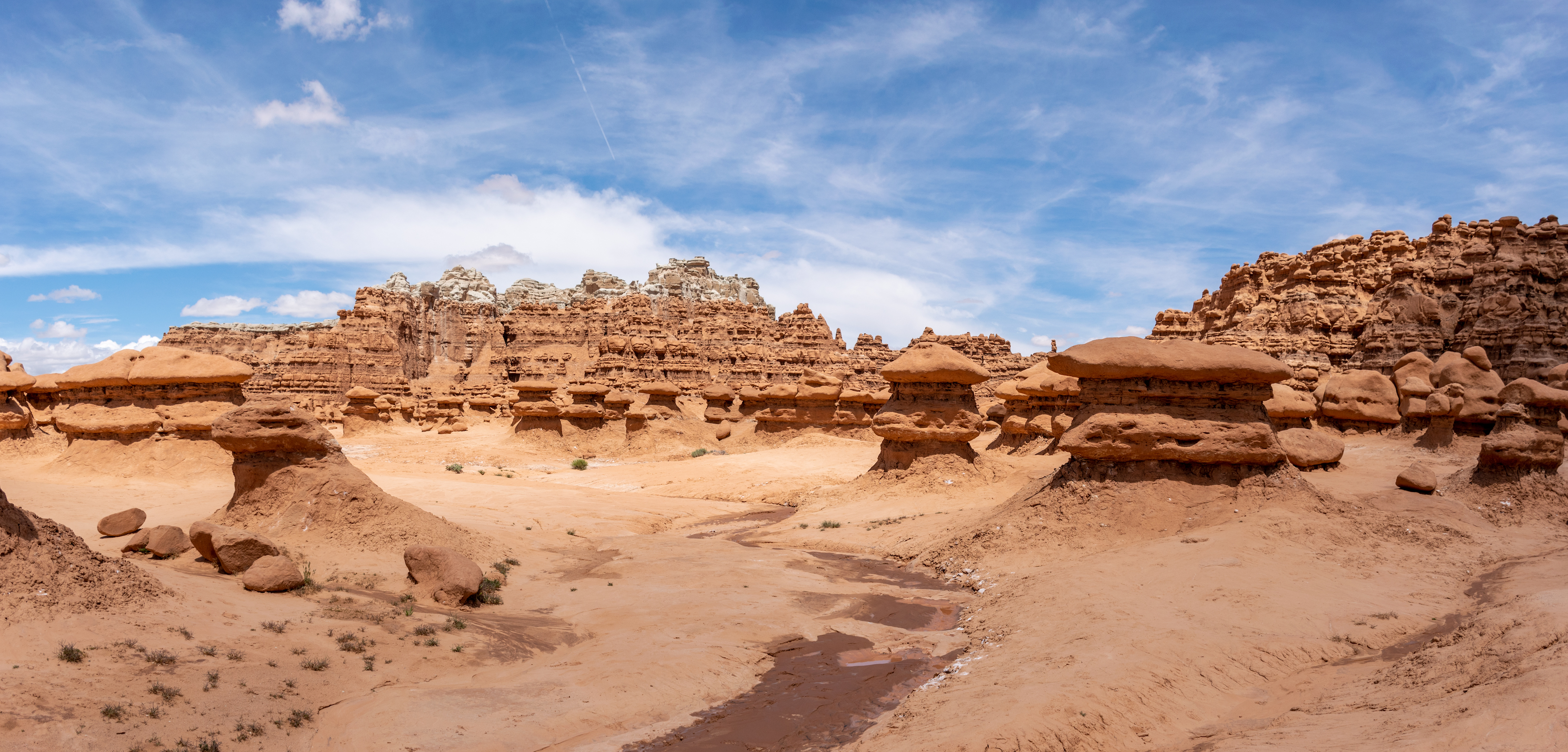
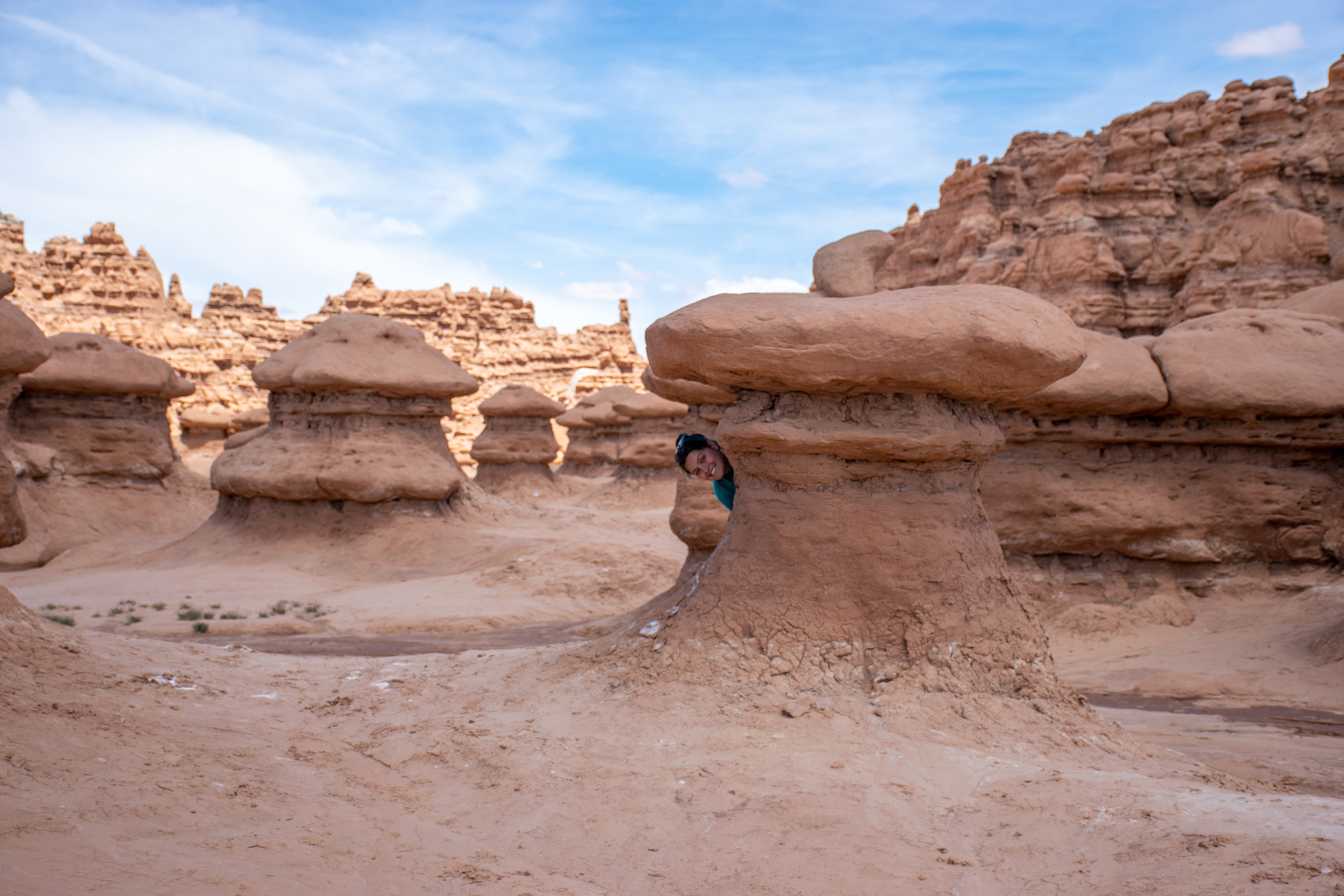
After another hour or so of driving and the best cookie dough shake I’ve ever had at a truck stop somewhere in southern Utah, we finally arrived at Goblin Valley. Goblin Valley, or as I would call it, Mushroom Valley, is a small valley that was underwater millions(-ish) of years ago. As the water receded it eroded the silt and shale into goblin-like (think mushroom-like) statues. The area was discovered in the twenties by a local, and after awhile Goblin Valley gained some fame within Utah and the government decided to protect the area because of how uniquely epic it is. Goblin Valley was established as a State Park and tourists such as ourselves flocked to the middle of nowhere to enhance our instagram feeds.

On our way out, Aaron skidded to a stop and we ran into the visitor center to pick up our postcard from a sixteen year old who thought my coin sorter was the coolest thing in the world (she isn’t wrong).
Back on the road we headed out to our final stop of the evening: Fremont State Park and tepee accommodations. Disregarding Google’s instructions, Aaron turned left rather than right because he wanted to cut through the park rather than go around and we ended up on a gravel road that wound through the beautiful canyons and desert.
After a couple hours we made it to the park where we pulled into the visitor center 15 minutes before they closed and forty five minutes after their posted closing time (I assume they were in the process of switching from winter to summer hours or something). The Fremont Indian State park was created after thousands of artifacts were discovered while the government was creating the I-70 freeway that runs directly through the park and on top of said ruins.
The ranger inside apologized profusely that she had already closed down much of the place and that we’d have to pay in card if we wanted to buy anything. We laughed it off telling her no problem and she gave us a lay of the land including a short hiking trail just outside the visitor center that had lots of petroglyphs and the location of the major sites along the driving tour. We then quickly scoured the little store for our postcard and found nothing until we were about to leave when I noticed a rack of postcards in a shadowy corner of the store. After looking over the rack twice, I finally found the one we were looking for and we happily returned to the register with our find.
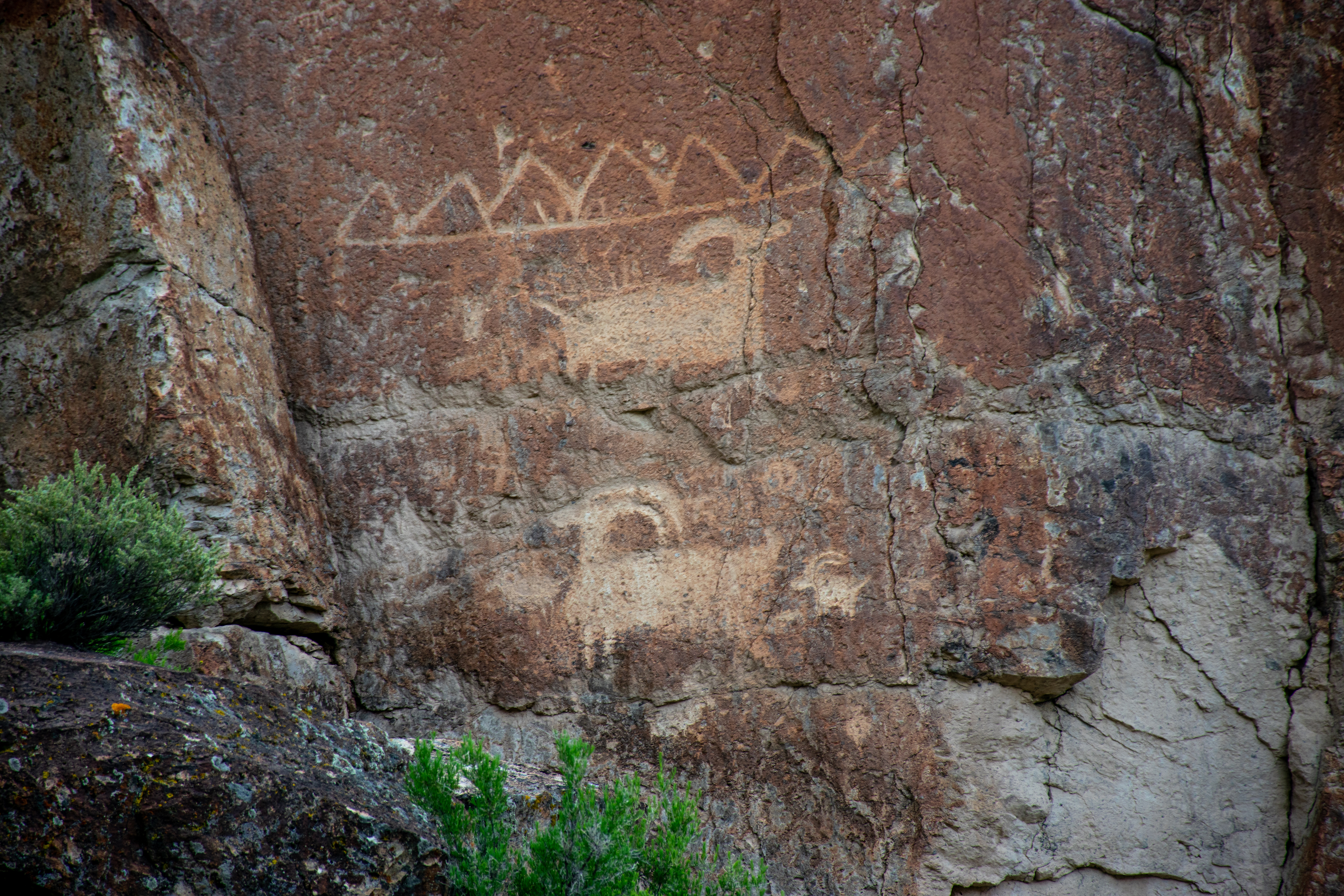
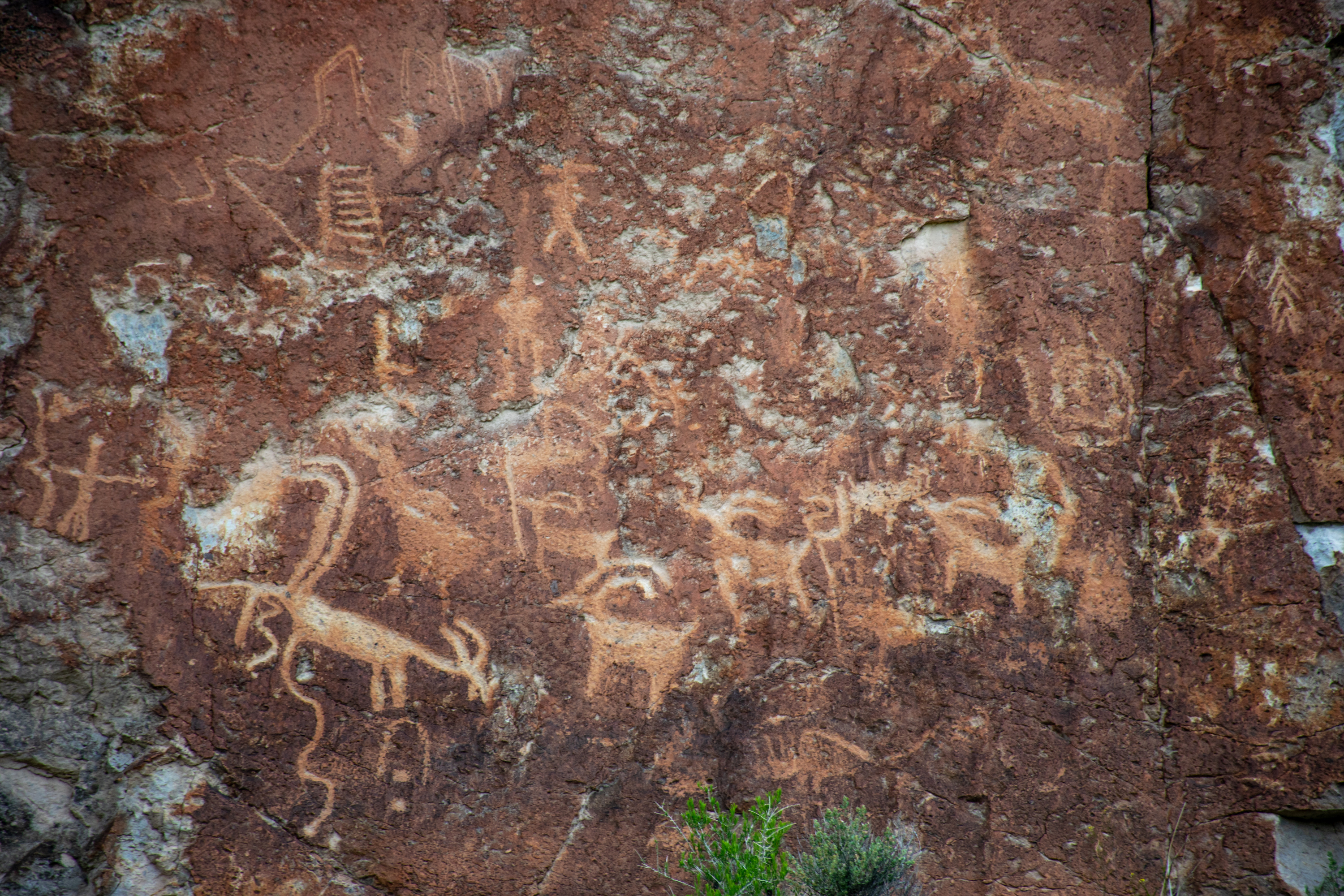
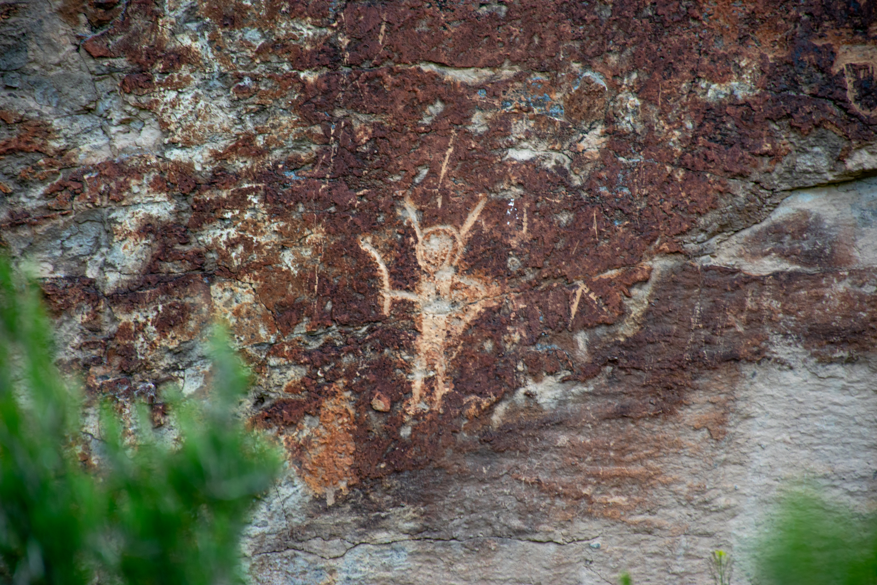
Leaving the visitor center we headed out to the walking trail around back and admired the petroglyphs from the nice paved sidewalk. After a fashion, the paved sidewalk led to a rocky climb into a canyon where we found more petroglyphs lining the canyon walls. Climbing up the canyon we found more than we bargained for both in terms of the difficulty of the walk and the number of petroglyphs that lined the walk.
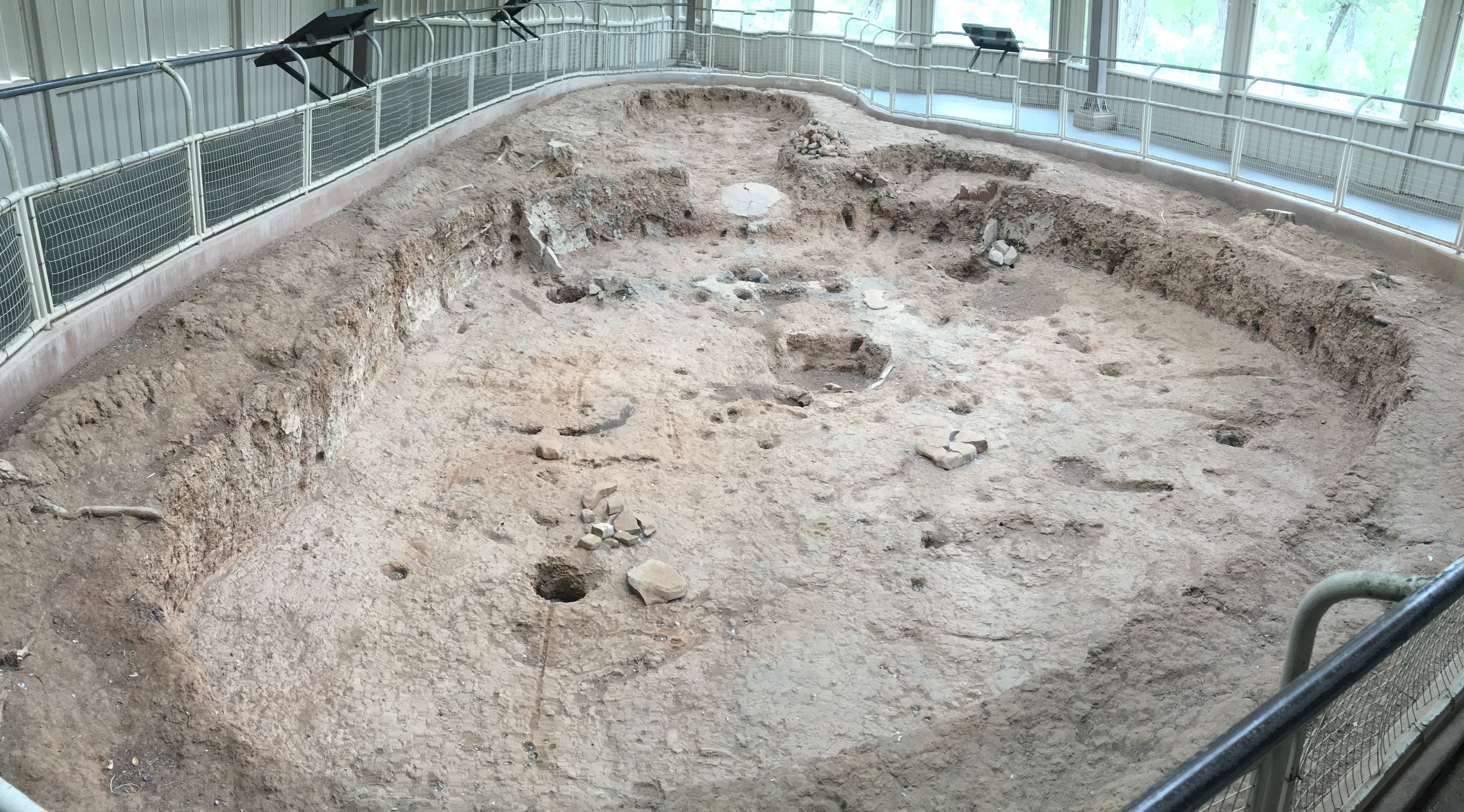
Returning to the visitor center we admired the re-created pit house they had next to the educational area before driving out to Newspaper Rock.
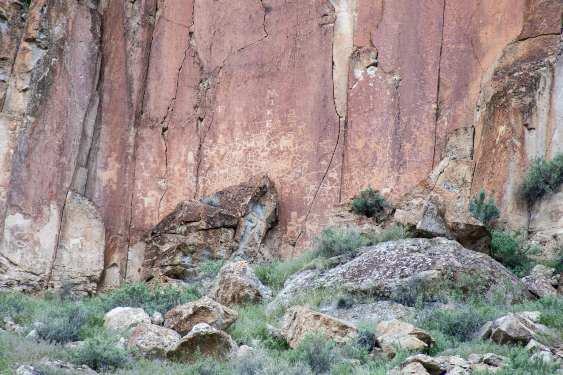
Newspaper Rock’s claim to fame was its “Over one thousand rock drawings viewable from the road” but in reality the cliff drawings are so far away that we learned far more about marmots than petroglyphs at that stop. However, one cool aspect of Newspaper Rock was that the drawings were made over a long period of time so some drawings were from the early Fremont Indians (who had contact with the Ancestral Puebloans and traded with them) and others were from the 1800s by a Paiute elder who had travelled quite a bit by train and had added his drawings of trains and colonial style houses to the wall.
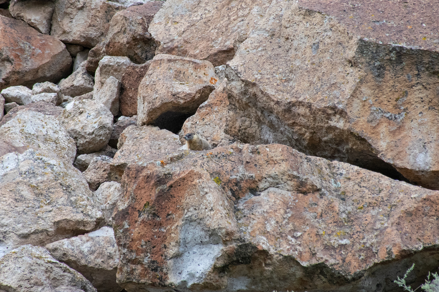
The marmots at Newspaper Rock were a sight to see and caused a lot of debate between Aaron and I as I said they looked kind of like squirrels, but he said they were too big, so I said maybe groundhogs? And he said no that can’t be it, so finally I googled groundhogs in Fremont Indian State Park and google quickly told me that what I was seeing was a Yellow Bellied Marmot, which I then became very excited because I’ve never seen a Yellow Bellied Marmot. Aaron then told me that the animal in the “Allen” talking animals video was a Marmot which I couldn’t believe because I was convinced it was a prairie dog, so then I googled that and google told me that the animal was, in fact, a marmot. The excitement was short lived as I googled “marmots” to find out that they were the same as “woodchucks” which I grew up knowing about. I even did a whole report on wood chucks in third grade, and I never once was told that they were the same as marmots. This interesting fact led to discussion between Aaron and I about growing up in California vs. Minnesota, because he had always grown up learning about marmots, and hadn’t ever heard of woodchucks, outside of the woodchuck rhyme. Whereas I had grown up knowing that wood chucks and ground hogs were the same things, but who had ever heard of a marmot outside of cartoon characters calling each other yellow bellied marmots? Further research on Wikipedia reveals that ground hogs and yellow bellied marmots are both within the genus marmota so they aren’t exactly the same but essentially they’re all types of marmot….Wikipedia is also able to clarify why we grew up with different names for these small Ginny-like (read: pig-like) animals. Yellowbellied marmots make their home specifically in the Western US and Southwestern Canada (AKA California), whereas woodchucks/groundhogs are found in the North Central/Eastern part of the US (AKA Minnesota) and most of Canada (except for Southwestern Canada).
With my hunger on the edge of becoming hanger, we headed to our campsite (about five minutes away) and I set up our tent inside the teepee to protect from the inevitable rain that was dogging us this entire trip until Aaron finished making food. We finished out the evening discussing school and traveling and tomorrow’s adventures until it was dark enough to justify going to bed and we’d used up all of our firewood.
Waking up on Thursday morning at our usual early hour, we couldn’t help but get ready at a reasonable pace, leave camp too early, and arrive at the Great Basin National Park with three hours to spare before our cave tour started. We thought getting there early might be nice if we felt like exploring the park, unfortunately the park didn’t really feel like being explored. The peak had a few nice hikes that looked to pass right by glacier lakes so we started driving up the road to have a short hike before the cave tour. We made it all the way up to 9000 feet (out of 9886) before the road was closed and we were left staring at turkeys through binoculars at the lookout area. I told Aaron that watching two male turkeys with all of their feathers out and listening to them gobble would be much more interesting if I didn’t see the same sight back home often enough that “Turkey Crossing” signs really should be installed on our road. We nonetheless enjoyed the lookout and headed back to the visitor center to make ourselves lunch.

Despite all of our attempts to waste time, we still had an hour before our tour started. We settled outside of the little cafe and watched the lightning and listened to the thunder. I went inside to get myself a hot chocolate to help stay warm and was given the world’s coldest hot chocolate. Moments later, Aaron decided he wanted coffee and returned with the world’s hottest coffee. I used it to warm up my hands and he used the remains of my hot chocolate (which really were cold at this point) to cool it down a little. I guess in the end we all got what we wanted? Finally, with thirteen minutes to spare we walked back into the Visitor Center and told them we were there for the one o’clock tour.
The ranger behind the table sprang into action and said she’d need to check us in very quickly, but that Aaron would need to be present. He walked in right then and she gave us the run down which was: no backpacks, yes lights, no flash for the first 100 feet or so because there are bats in residence; and if we’ve visited a cave/lava tubes in the last 13 years, and if so, did we wear anything in those caves that we are currently wearing? Who remembers cave visits from that long ago?! Well we were both guilty of wearing the same shoes in the last caves so we were told that we would need to sanitize our shoes (they don’t want cross contamination of mold in the caves because there’s a particular cave mold that kills bats, and we like bats, it’s not our first time having to do the shoe sanitation thing, but it was the first time that it was as simple as put your shoes in this bin of lysol for five minutes). So she walked us over to a bin on the floor, had us take off our shoes, and then we put them in the bin for five minutes. As I watched the clock she assured us that the ranger knew we were waiting for our shoes and that she wouldn’t leave without us. As a safety precaution, they also gave us the cave orientation just in case we missed it while our group was all outside (don’t touch anything, watch your head, don’t flash the first 100 feet).
With two minutes to spare before our tour started, our shoes were done being sanitized in the bin and I pulled them out. Aaron shoved his feet in his shoes and raced outside to drop my purse in the van and fetch a headlamp so we could see stuff in the cave. He made it back just as I started lacing up my second hiking boots (dang they take forever to lace up!). We rejoined our group just in time to miss out hearing the history lecture and instead hear the safety orientation. Again. Watch your head, hold the handrails, don’t touch anything, don’t flash the first 100 feet. I took the time during the safety orientation to see who else was joining us on this tour and was surprised to see a service dog was going to see the caves.
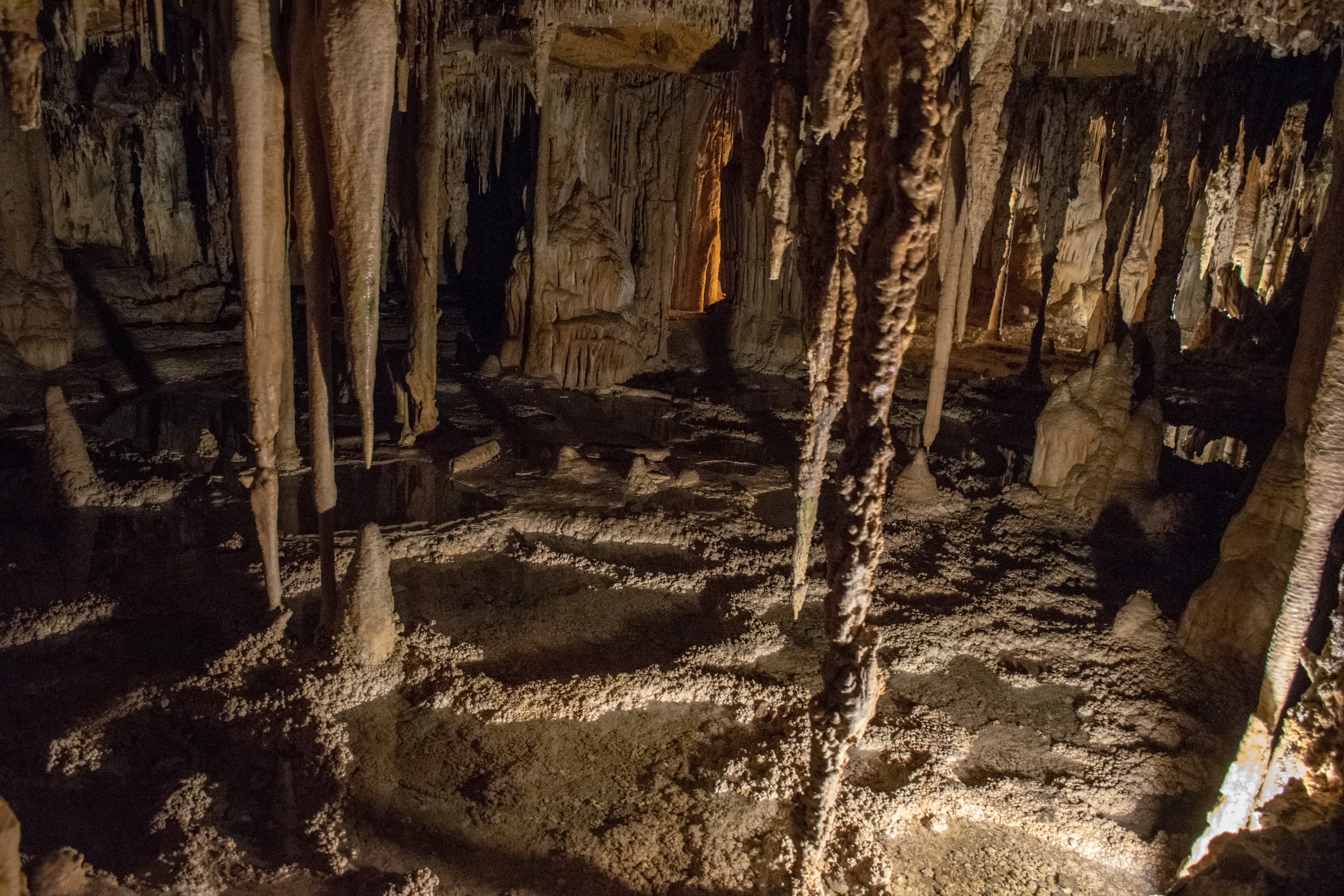
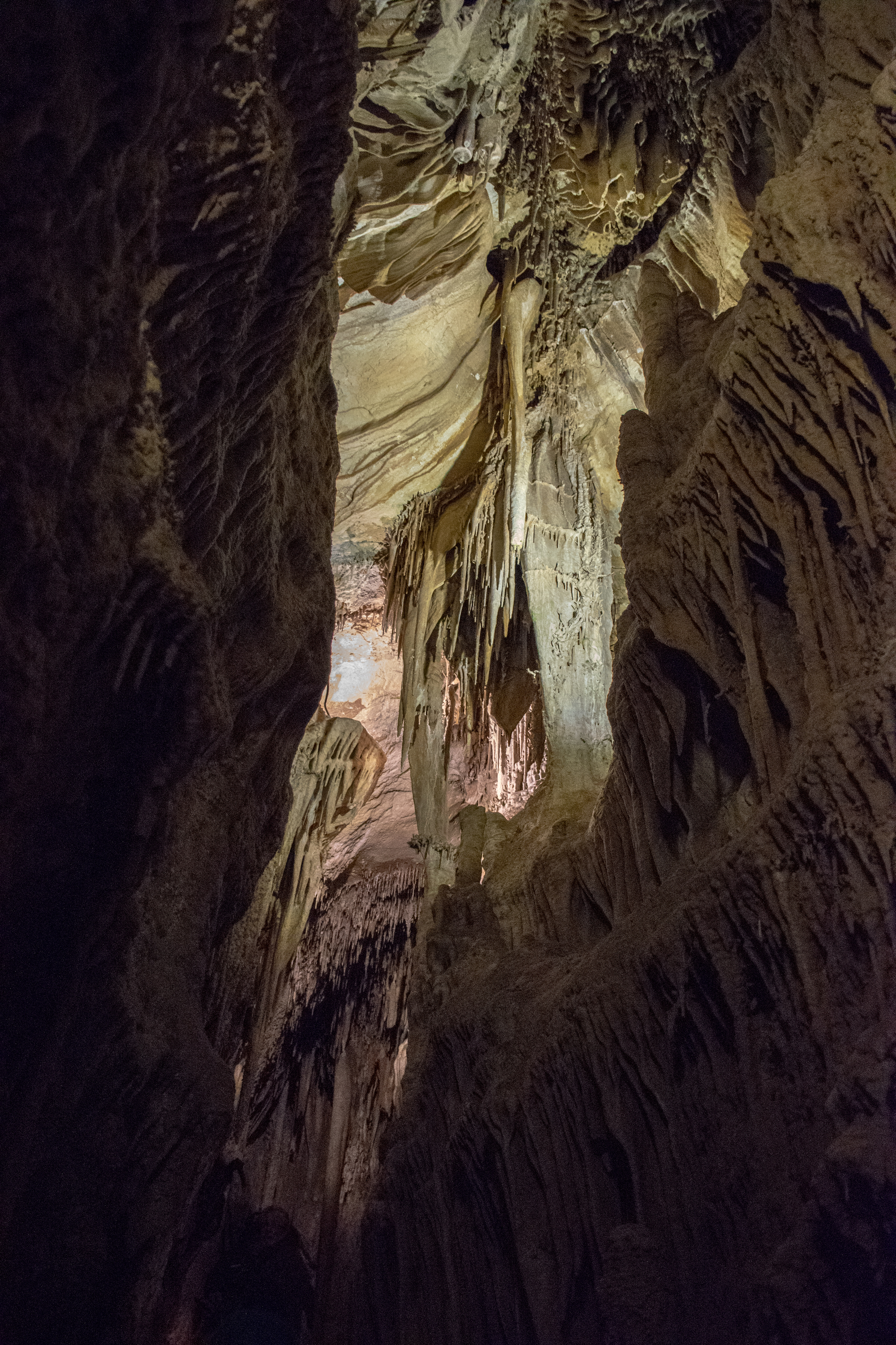
Heading down into the cave we were all very quiet and nobody used flash as we passed the natural (vertical) entrance to the cave where the bats lived. When we arrived at the first section, we all looked around in awe. It was a very impressive cave. Our tour guide began telling us about the history and I found myself standing right in front of her. As Aaron clicked away next to me (taking a million photos in the low light), I found myself getting bombarded by water droplets from above. Our tour guide assured us that the water was “cave kisses” and then started teaching about stalagmites and stalactites. She also wanted us to experience the natural lighting in the cave so she dimmed all of the electric lights, and she had us turn off any cellphone or watch lights we had on, and then she turned off her little lantern. And in the darkness and the silence that we all experienced, a very, very, unhappy service dog voiced its concern that not only were we deep underground, but it couldn’t see. Apparently its service dog training didn’t include any excursions into dark caves.
We headed deeper into the cave enjoying all of it’s many structures and I used my light to see some of the less well lit parts of the caves including all of the shiny brown crystals that showed through wherever there were broken stalactites. While most of the group immensely enjoyed the tour, our Labrador companion made sure we all knew that it did not like being underground, it definitely did not like corrugated iron steps that we occasionally had to climb, and it really really didn’t like when we had to go through the darker corners.

Finishing our visit to the caves, we emerged to find that the rain had stopped. Our phones were once again happy to inform us that tonight’s campsite had a storm predicted over it from 5pm – 7pm and that the whole area had an active flood warning in place and that it had already experienced some flooding. Once again, we decided to go see what the campsite looked like, and if necessary we could always spend the night in Reno, or, we could just drive home.
Turns out the storm won and we spent the night in Reno.
