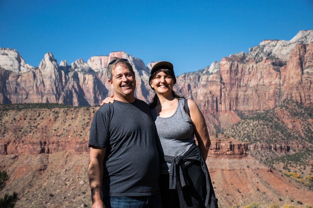
My parents have been telling me that I absolutely have to go visit Zion National Park ever since they visited a few years ago. So this year for my birthday, we decided that it was high time that we actually went. Our trip took place over Veteran’s Day Weekend which provided us with an emptyish park, freezing cold water, and the opportunity to stay at the lodge. The name for the area coined by the native Americans was Mukuntuweap and, if Wikipedia is to be believed, the name was changed when it became a national park in order to increase its attraction as a tourist place. The concern at the time was that Native American names would diminish the worth of the place. Seems high time to me that the Parks Department goes ahead and switches the name back to Mukuntuweap National Park.
We started our trip to Zion National Park by waking up at three in the morning driving to the airport, flying to Las Vegas, driving to St. George, stopping for lunch, and then driving the rest of the way to Springdale.
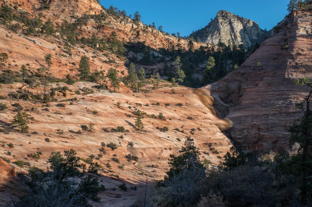
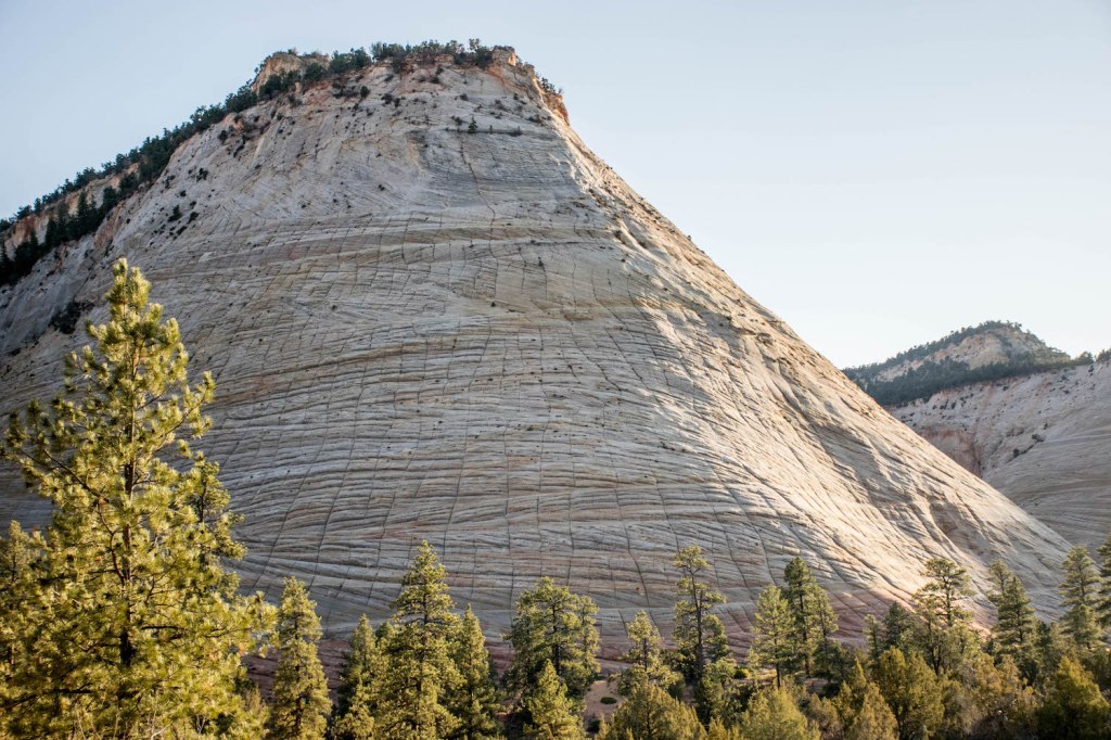
We had previously researched options for completing the famous Narrows hike and had decided to rent dry pants, neoprene socks, canyoneering boots, and walking sticks from the Zion Adventure Company located in Springdale. Our first stop was in their shop to pick up our gear. As we tried everything on and substituted one size for another and added on a second layer of neoprene socks for those of us (aka me and mom) who were sensitive to the cold. Fully equipped and ready to go, we hopped back into the car, flashed our parks pass at the entrance and drove into Zion National Park. Because we were arriving late in the afternoon, my parents suggested that we drive along the scenic route on the east side of the park to enjoy the views while we had some extra time. There were some small hikes in the that section of the park, but we were all tired enough that just admiring the view was enough.


We were as excited as everyone else to find bighorn sheep grazing along the side of the road and I hopped out to frantically take pictures of them before they inevitably ran away.
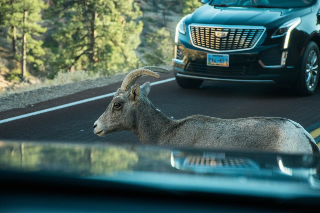
They didn’t run away. Over the next few days we would learn that the sheep could be seen along that stretch of road almost every day of the year, so while they were super cute and fun to see, they were not really the rare sighting that I had first thought.
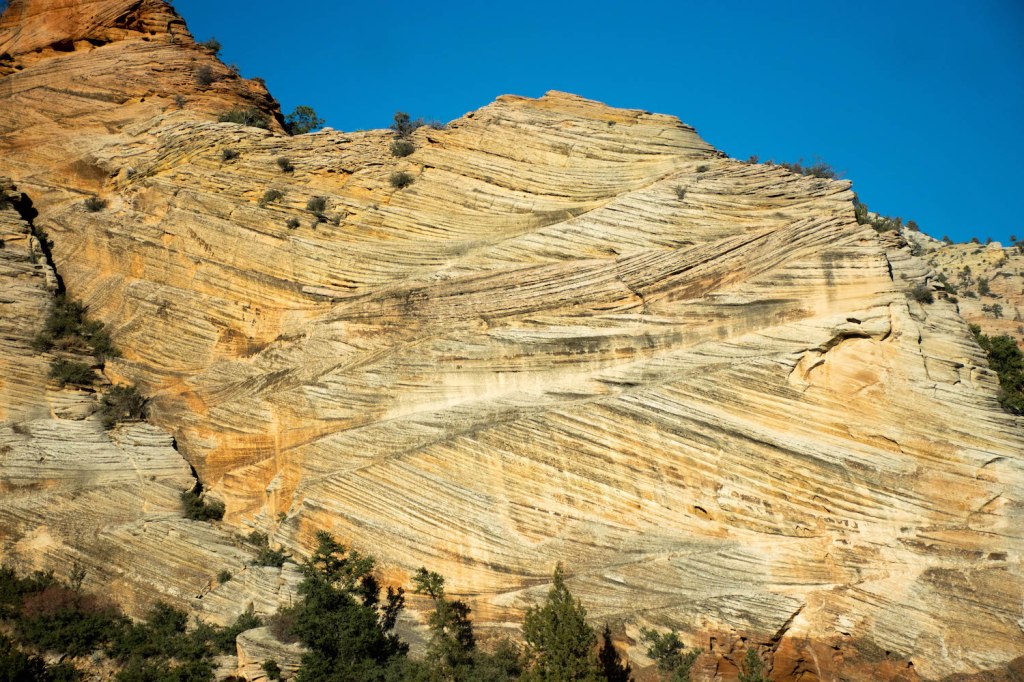
We also stopped by checkerboard mesa to admire the natural checkerboard formed in its sides by erosion in perfect perpendicular lines.
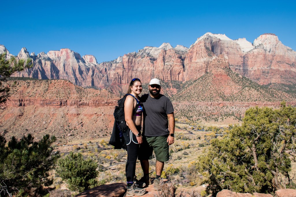
With our tour of the scenic drive complete, we finally drove to the Zion Lodge, our accommodations for the next few nights. Being located in the Zion Lodge meant that we spent each night in the park and woke up with the first shuttle of the day just outside our door and the tall peaks of the parks surrounded us. While usually impossible to get a reservation, because we were visiting over Veteran’s Day Weekend, we had managed to squeeze in for a few nights.
Because the staff at Zion Adventure Company had communicated to us how busy they really were and how big of a help it would be if we brought the suits back a little earlier, we decided to go ahead and complete the Narrows hike on our first day in the park, rather than saving it for last on the second day. Planning to take advantage of the closeness of the shuttle stop, and hoping to make it to the end of the hike, we all woke up at 6:00am, wandered into the breakfast room when it opened at 6:30 and were out at the bus stop by 7:10. The first shuttle arrived at 7:20 chock full of tourists, many of them wearing similar dry pants and canyoneering boots as us. With some dismay, we watched as the group who had arrived at the bus stop before us squeezed themselves into the already full busses before deciding to wait the ten minutes for the next shuttle.
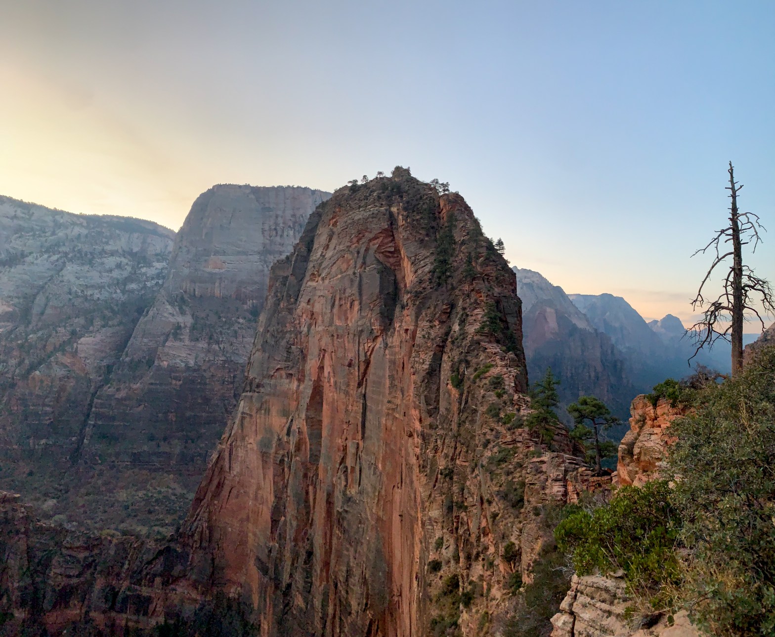
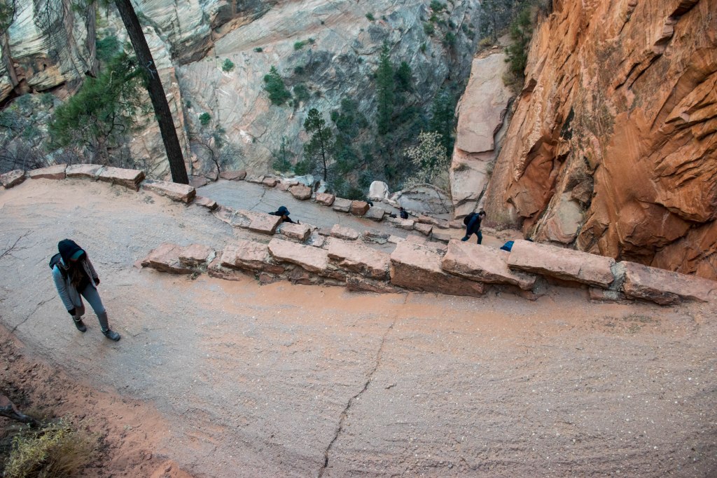
The second shuttle arrived with all of the seats taken, but enough standing room for all of us to hop on. When the shuttle arrived at Stop 6 (the starting point for Angel’s Landing) half the shuttle emptied as the non-dry pants-wearing tourists headed for the 2,117 foot climb to the top of Angel’s Landing. The shuttle continued on to the next stops and Aaron and I contemplated the number of hikers headed up Angel’s Landing. We too wanted to complete Angel’s Landing but had been hoping to do it without being surrounded by so many people, the last half mile of the hike was said to be incredibly dangerous and we didn’t like the idea of attempting it with cross-traffic. But more on that later.
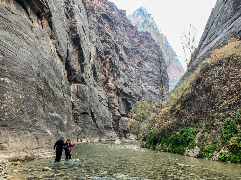
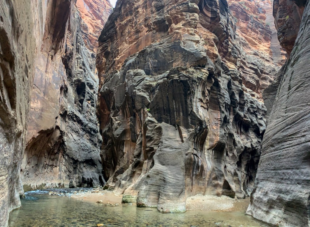
Having finally arrived at Stop 9, we joined all of the other bundled up tourists on the bus and made one more bathroom break before heading towards the Narrows. Before reaching the beginning of the river, there’s a nice 1 mile stroll on pavement that runs along the river. Reaching the end of that, we were finally at the Narrows, with bated breaths, we all very cautiously began to walk in the river, hoping that that our dry pants, canyoneering boots, and neoprene socks would be able to successfully fend off the cold 31 degree water that we were walking in.
And they worked perfectly! (For the most part). The boots gripped the rocks as though there was no water, the socks kept my feet nice and warm, and the dry pants meant that no water every touched my calves.

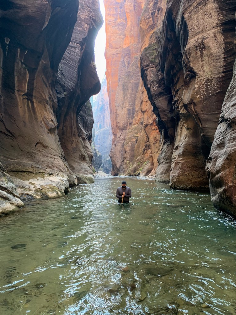
Waist deep in freezing water but still dry thanks to our rented gear 
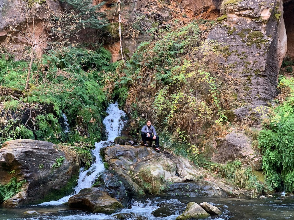
Fork in the road, left leads to Big Springs, right leads to a different small waterfall 
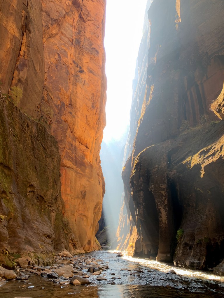
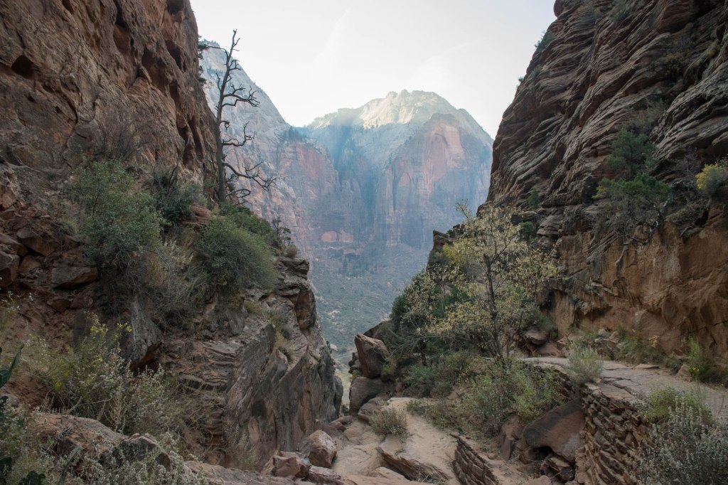
There was a wildfire burning north of us creating a smoky sight in the canyon 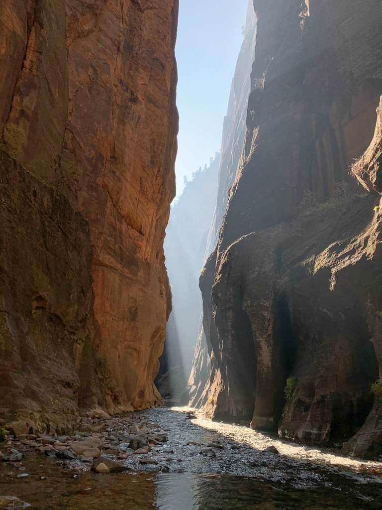
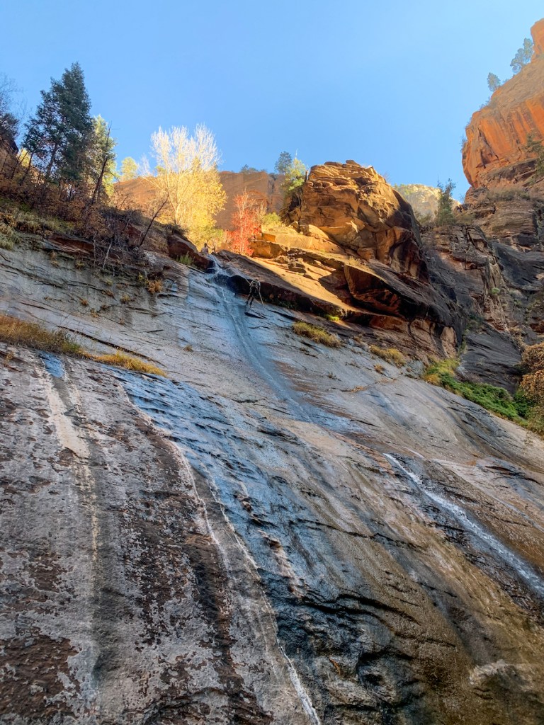
Climbers rappelling down the waterfall

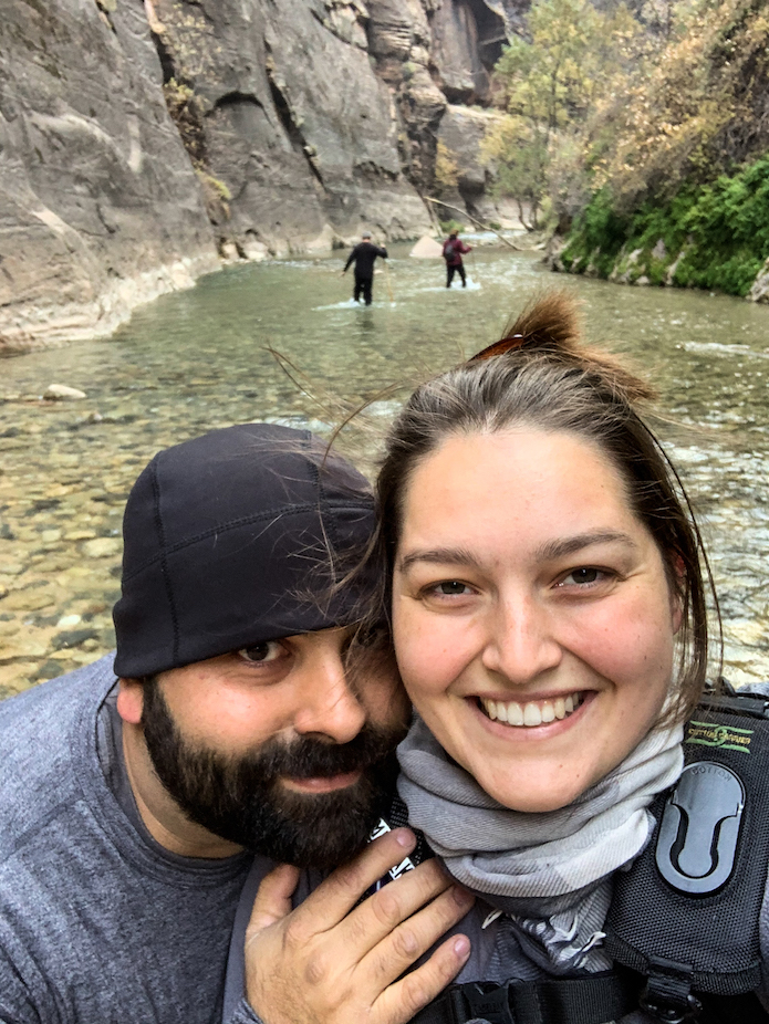
After three hours of hiking, we had made it to two rocks that stood side by side, and had been marked on a map my mom had been looking at. She declared herself to have reached her goal and my dad agreed that he was ready to turn around. Some hikers had told Aaron and I that the end was near and we were prepared to continue walking. Just past the two rocks, however, we found ourselves faced with an incredibly deep stretch of water. Hikers with full body suits were walking through the center of it, having no qualms about being in 31 degree water up to their chest. Our pants only stopped at our belly buttons and we didn’t want to risk getting wet. So we watched the other hikers and peered through the perfectly clear water trying to judge the depth. Seeing hikers on the other side with only dry pants, we realized that there had to be a path, so Aaron began hugging the edge and tiptoeing over the gap. After witnessing his success, I followed on tiptoes and our journey continued.

What hikers had said was only 20 minutes away, turned out to be an area wit ha rock fall that made the path appear to end. In reality, there was a path up and over the rocks and Aaron and I continued onwards for another hour and fifty minutes before we reached Big Springs. This part of the hike was filled with far more greenery and we each slipped and fell a couple times as the rocks were now coated with algae and fatigue was setting in.

At last, we made it to Big Springs and I climbed onto the spring in a victory celebration. Our GPS tracking app declared us to have walked five miles in four hours and fifty minutes. Worried that we were now looking at a 5 hour hike back to the hotel, and with dinner reservations at 6:15pm, Aaron and I began the trek back.

It turns out going down stream is much easier than going upstream, it also turns out that the part after where we left my parents was MUCH harder than the downstream section of the Narrows (including Wall Street and below). Once we made it back to Wall Street, we were practically jogging in some sections. Our boots once again gripping the rocks flawlessly, we made excellent time and were back at the Lodge within three hours. My parents, having arrived two hours before us, we already changed and enjoying the slow internet in the lobby.
We exchanged stories on our return trips after we had parted and then Aaron and I returned to our rooms to change out of our gear and return it to Zion Adventure Company. Having returned from the hike early, and being starving, and already being in town, we canceled our dinner reservations at the Lodge and got dinner in town.
In order to truly take advantage of the Lodge for the Angel’s Landing hike, Aaron and I Knew that we would have to start the hike before the first shuttle arrive to the base of it at 7:15am. Wanting to make sure that we were all the way up and back out of the dangerous section before the shuttle arrived, we knew we’d have to start the hike before it was light out. Wanting to build in some extra time we agreed to wake up at 5:00am and leave as soon as we were ready.
So the next morning we were walking down the road towards Stop 6 at 5:30 in the morning with the flashlight on our phone guiding us. It was quite fun to look up and see the outline of the rocks looming over us and breaking up the starry skies above us. A car passed us on the way and we realized that getting up as early as did was a good idea. While cars aren’t actually allowed back in the canyon unless they’re folks visiting the lodge, clearly this person didn’t know about that rule. We started the hike up in the freezing air and quickly began to warm up as the trail veered upward. The Angel’s Landing hike is a 3 mile (one way) hike with a 2,117 foot elevation gain. There are two sets of switchbacks and, as I mentioned, a treacherous climb for the last half mile. So in reality, most of the elevation gain occurs over about 2 miles. It was the second steepest hike that Aaron and I have ever done, the first steepest being the climb to the top of Yosemite Falls.
Climbing switchbacks has never been my forte so while we were the first to begin the trail, we were passed by one person about a mile from the end making us the second group to arrive at Angel’s Landing that morning.

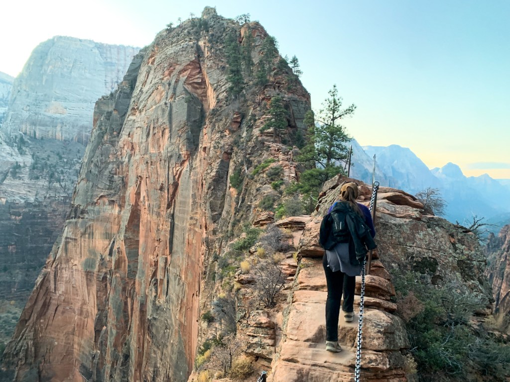
Upon reaching the “landing pad” before beginning the treacherous climb, we were greeted by some restrooms and a sign telling us that 9 people had fallen from this hike and died since 2008 and if we weren’t careful we could be next. We read the sign and then headed towards the chains that would be both our aids in this climb and the only trail markers for the final half mile hike.

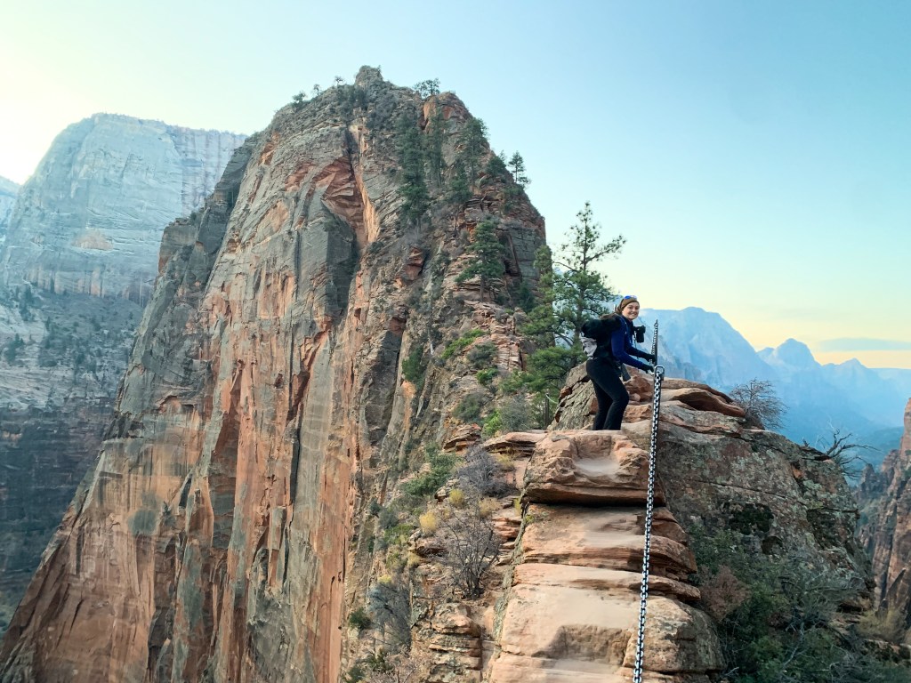


Upon reaching the top we greeted once again the person who had passed us on the way up and two photographers who we could only assume had spent the night up there. Due to our early start, the sun had not risen above the mountains even at the top of Angel’s Landing while we were up there. I found the heights incredibly daunting and it took me about 15 minutes and observing everyone else’s fearlessness before I could shake my own fear of falling from Angel’s Landing.

Me deciding that I’m probably safest if I stay seated 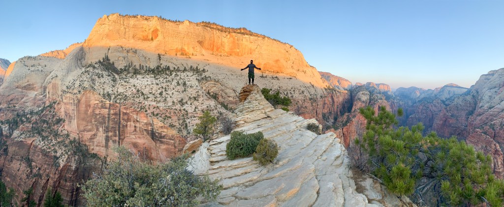
Aaron deliberately climbing to the absolute highest point 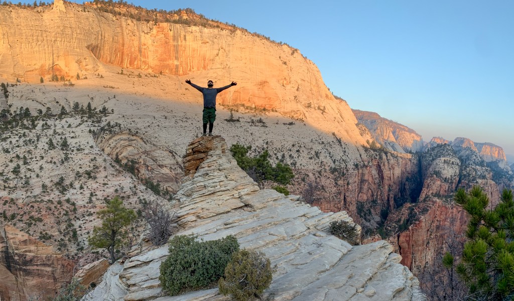
Aaron enjoying it with no obvious fear of heights affecting him 
The top of Angel’s Landing 
Me attempting to get over my fear of heights 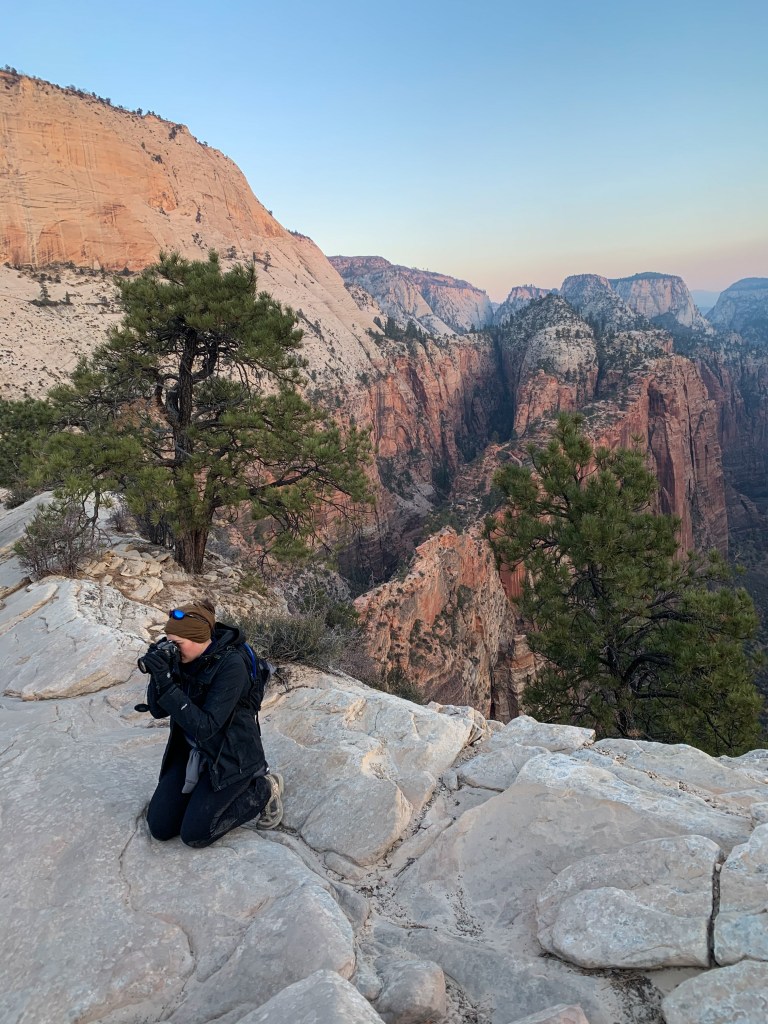
Not succeeding at getting over my fear of heights 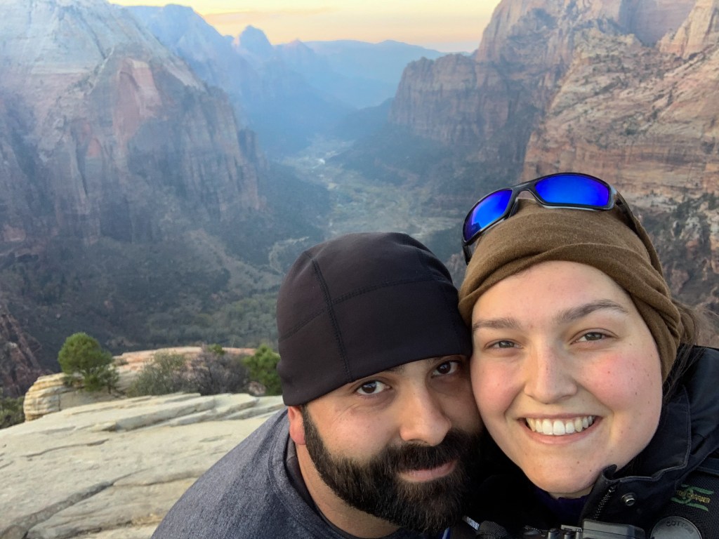
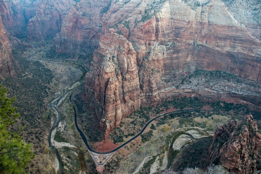
Big Bend Road 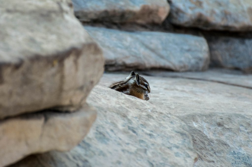
Chipmunk friend at the top
While we were at the top we watched as the first shuttle dropped off the first set of Angel’s Landing hikers at the bus stop and realized that it wouldn’t be too long before those hikers were going to create dangerous cross-traffic for us. We began our descent down, having had our fill of the view from the top and the chipmunks who inhabited the area. Climbing down was far easier than climbing up, perhaps due to the fact that now we were climbing down and any falling would occur facing forward, where I might have a better chance of catching myself. No matter the cause, we climbed back to the “landing pad” in about half an hour. As we entered the sandy area, we saw the most intrepid hikers from the first shuttle were beginning to arrive there and were just about ready to begin the hike. High fiving ourselves for our excellent timing, we happily headed down Angel’s Landing. The problem with being the first people to make it down the trail, means that for every single hiker on their way up, we were the first people they saw. We were stopped often with questions of “Wow up and back already?” “Is it worth it?” or “How far are we?” We kept our patience as we repeatedly answered the same questions while imagining the looks on my parents’ faces when we returned early and dreaming of the breakfast that was just out of reach.
We made it back to the Lodge at 9am, a whole half an hour earlier than we had told my parents we would meet them. They joked that we must have decided not to attempt Angel’s Landing and as we headed to breakfast, I shared our photos from the top with them.
The next hike of the day was the Watchman Hike, a 3 mile hike with a 400-ish foot elevation change that my parents had said was a reasonably easy hike. Over-dressed as I was, I eventually way overheated and stripped down to my sports bra, once we were at the top we hung out in some shade and I cooled down so much I had to add some layers back on.


We returned from Watchman with one more hike on the schedule for the day, but unable to bear my many layers any longer, we stopped by the hotel room and I changed into a much more reasonable tee-shirt and shorts for our third hike of the day. The Emerald Pools hike is a very popular and pretty easy hike. We were planning on going to all three pools — lower, middle, and upper. Our plans were foiled once we arrived at the lower pools when we discovered that a rockfall had destroyed the path to the middle and upper pools and we could only admire the lower pools.
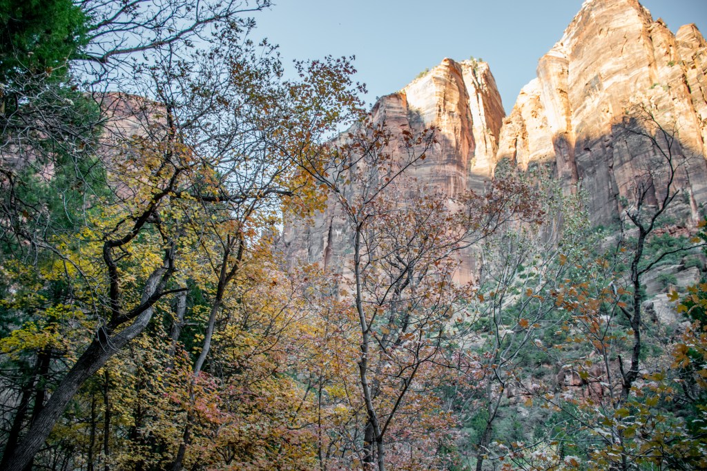
Fall colors on the way to Emerald Pools 
Hiking to Emerald Pools 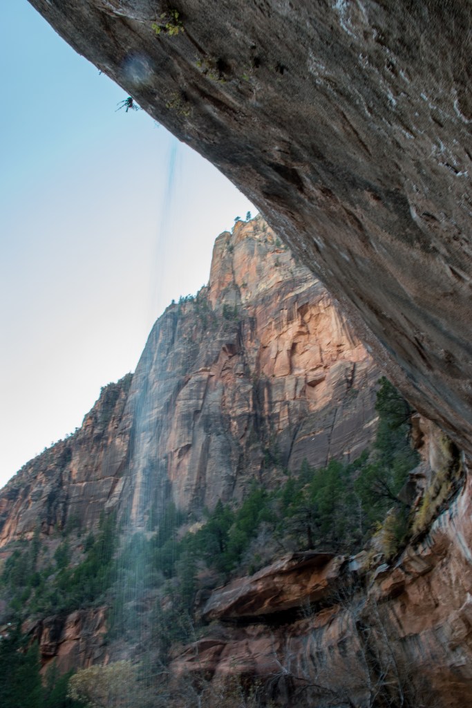
Waterfall into Lower Emerald Pools 
Overhang dumping water into Emerald Pools
We returned to the beginning of the trail to look for the sign that had said we’d need to take a detour and found that the detour required taking the bus to the next shuttle stop and then, most likely, required another two hour hike. Exhausted as we were, we decided to be content with having seen the lower Emerald pools. We returned to our rooms and collapsed in exhaustion where I finally let myself take a nap. My phone told me that my day included walking 13.8 miles, 30,843 steps, and that I’d had an elevated heart rate for 237 minutes – almost 4 hours. The Narrows hike had been just a mile and a half shorter than the adventures of Sunday, but was far less exhausting with only 40 minutes in the day with an elevated heart rate.
And with that, we packed our bags ready for the morning, enjoyed our final evening at the lodge and celebrated the days’ shenanigans with a fantastic chocolate cookie sundae.
